Lighthouses of the United States: Western Washington

The United States of America is a federal union of 50 states and a capital district. The west coast state of Washington was originally part of the Oregon Country, the area west of the Continental Divide between latitudes 42° and 54°40' North. In the London Convention of 1818 the U.S. and Britain agreed to joint occupation of this territory. The Oregon Treaty of 1846 confirmed British occupation of Vancouver Island and the rest of what became British Columbia; it also set the boundary between the U.S. and British territory at latitude 49° between the Rocky Mountains and the Strait of Georgia. This treaty left the status of the San Juan Islands in doubt, leading to an 1859 military standoff known in Washington as the Pig War although no shots were fired. The dispute continued until 1872 when arbitration by Germany's Kaiser Wilhelm I established the international boundary in Haro Strait, placing the San Juan Islands in the United States. In 1853 Washington became an organized territory separate from Oregon and in 1889 it was admitted to the union as the 42nd state.

An important feature of Washington's geography is Puget Sound, a network of fjords, strewn with islands, penetrating 100 miles (160 km) southward into the state and leading to the harbors of Seattle and Tacoma. Puget Sound is connected through Admiralty Inlet to the Strait of Juan de Fuca, which separates northwestern Washington from Canada's Vancouver Island. In recent years geographers have defined the Salish Sea to include Puget Sound and the Straits of Georgia and Juan de Fuca.

This page describes lighthouses of the Columbia River, Pacific Coast, and Strait of Juan de Fuca. There's a separate page for Puget Sound and San Juan Islands.

Preservation efforts in Washington have been strong for many years and the United States Lighthouse Society has its headquarters at the Point No Point Lighthouse in Hansville.

Navigational aids in the United States are operated by the U.S. Coast Guard, but ownership (and sometimes operation) of historic lighthouses has been transferred to local authorities and preservation organizations in many cases. Aids to navigation in Washington are maintained by Coast Guard District 13, based in Seattle. Aids to Navigation Teams are based at Astoria, Oregon, for the southern and central section of the Pacific coast and the lower 150 mi (250 km) of the Columbia river, at Kennewick for the rest of the Columbia River and Snake River, and at Seattle for the northern section of the Pacific coast, the Strait of Juan de Fuca, Puget Sound, and the San Juan Islands.

ARLHS numbers are from the ARLHS World List of Lights. Admiralty numbers are from Volume G of the Admiralty List of Lights & Fog Signals. For a few lights close to the Canadian border CCG numbers are from the Pacific Coast volume of the List of Lights, Buoys, and Fog Signals of Fisheries and Oceans Canada and U.S. NGA numbers are from Publication 111. USCG numbers are from volume 6 of the U.S. Coast Guard List of Lights.

General Sources
Washington Lighthouses
From Kraig Anderson of LighthouseFriends.com, photos and accounts of the state's lighthouses.
Online List of Lights - U.S. West Coast
Photos by various photographers posted by Alexander Trabas; many of the Washington photos are by Michael Boucher.
Washington Lighthouses
An informative web site supporting the restoration efforts at all of the state's lighthouses.
Lighthouses in Washington (state)
Photos by various photographers available from Wikimedia.
World of Lighthouses - Northwest Coast of U.S.
Photos by various photographers available from Lightphotos.net.
Washington, United States Lighthouses
Aerial photos posted by Marinas.com.
Leuchttürme USA auf historischen Postkarten
Historic postcard images posted by Klaus Huelse.
U.S. Coast Guard Navigation Center: Light Lists
The USCG Light List can be downloaded in pdf format.
NOAA Nautical Charts
Official nautical charts for the coast can be viewed online.
Navionics Charts
Navigation chart for Washington.


North Head Light, Ilwaco, January 2024
Instagram photo by Masayo Kaneko

Columbia River Lighthouses (see also Oregon)

The Columbia River follows the western 2/3 of the border between the states of Washington and Oregon. The river is navigable for 469 miles to Kennewick and Richland; navigation then continues along the Snake River to Lewiston, Idaho. The listing here is east to west (downstream).

Benton County Lighthouse
Clover Island (Kennewick)
2010. Active; focal plane about 70 ft (21 m); white flash every 4 s. 62 ft (19 m) round concrete tower with lantern and gallery. Kevin Cole's photo is at right, Gary Paulsen has a photo, Rachel Meyer has a 2021 closeup, and Google has a 2023 street view and a satellite view. Clover Island is in the Columbia River between Kennewick and Pasco; it is accessible by a causeway from North Washington Street in Kennewick. The lighthouse was built as part of a $1.12 million project to develop the island as a park. Construction began in September 2009 and was completed in May 2010. Located at the west (upstream) end of the island. Site open, tower closed. . USCG 6-13053.

Clark County Lighthouse
* St. Helens Range Rear
Date unknown. Active; focal plane 58 ft (19 m); white light, 3 s on, 3 s off, visible only along and near the range line. 54 ft (16.5 m) square cylindrical skeletal tower; the tower carries a rectangular daymark painted red with a black vertical stripe. Google has a satellite view and a distant river view. This range guides vessels upstream north of St. Helens, Oregon. Located off Dike Road on the east side of the river opposite St. Helens. Site open, tower closed. Admiralty G4686.1; USCG 6-11035.

Cowlitz County Lighthouses
Martin Island Range Rear
Date unknown. Active; focal plane 54 ft (16.5 m); white light, 3 s on, 3 s off, visible only along and near the range line. 54 ft (16.5 m) square cylindrical skeletal tower mounted on a platform supported by piles; the tower carries a rectangular daymark painted red with a black vertical stripe. No photo available but Google has a satellite view. This range guides vessels downstream north of St. Helens, Oregon. Located off the southern end of Martin Island. Accessible only by boat. Site open, tower closed. Admiralty G4684.1; USCG 6-10990.
Bybee Ledge Channel Range Rear
Date unknown. Active; focal plane 50 ft (15 m); white light, 3 s on, 3 s off, visible only along and near the range line. 50 ft (15 m) square cylindrical skeletal tower mounted on a platform supported by piles; the tower carries a rectangular daymark painted red with a black vertical stripe. Google has a street view and a satellite view. This range guides vessels upstream south of Kalama. Located in the mouth of Martin Slough. Accessible only by boat, but visible from the southbound lanes of the I-5 expressway. Site open, tower closed. Admiralty G4682.81; USCG 6-10955.
Clover Island Light
Clover Island Light, Kennewick, February 2011
Flickr photo copyright Kevin Cole; used by permission
Cottonwood Island Upper Range Rear
Date unknown. Active; focal plane 52 ft (16 m); white light, 3 s on, 3 s off, visible only along and near the range line. 52 ft (16 m) square cylindrical skeletal tower; the tower carries a rectangular daymark painted red with a black vertical stripe. No photo available but Google has a satellite view. This range guides vessels downstream on the approach to Longview. Located on Cottonwood Island about 2.5 mi (4 km) southeast of Longview. Accessible only by boat. Site open, tower closed. Admiralty G4674.1; USCG 6-10880.
Cottonwood Island Lower Range Rear
Date unknown. Active; focal plane 63 ft (19 m); white light, 3 s on, 3 s off, visible only along and near the range line. 59 ft (18 m) square cylindrical skeletal tower; the tower carries a rectangular daymark painted red with a black vertical stripe. No photo available but Google has a satellite view. This range guides vessels upstream (eastward) past Longview. Located on Cottonwood Island just off the north bank of the river about 1.5 mi (2.5 km) southeast of Longview. Accessible only by boat. Site open, tower closed. Admiralty G4671.51; USCG 6-10825.
Stella Range Rear
Date unknown. Active; focal plane 59 ft (18 m); green light, 3 s on, 3 s off, visible only along and near the range line. 59 ft (18 m) square cylindrical skeletal tower mounted on a platform supported by piles; the tower carries a rectangular daymark painted red with a black vertical stripe. Google has a street view (a portion is seen at right) and a satellite view. This range guides vessels downstream (westward). Located just off the north bank of the river about 10 mi (16 km) northwest of Longview. Accessible only by boat, but easily seen from the riverbank highway (WA 4). Site open, tower closed. Admiralty G4651.1; USCG 6-10665.

Wahkiakum County Lighthouses
Skamokawa/Puget Island Range Rear
Date unknown. Active; focal plane 48 ft (15 m); white light, 3 s on, 3 s off, visible only along and near the range line. 48 ft (15 m) square cylindrical skeletal tower mounted on a platform supported by piles; the tower carries rectangular daymarks painted red with a black vertical stripe. No photo available but Google has a satellite view. This tower carries lights for the upstream Skamokawa Range and the downstream Puget Island Range. Located in Pete Anders Slough, just off the river about 2 mi (3.2 km) northwest of Cathlamet. Accessible only by boat. Site open, tower closed. Site manager: Julia Butler Hansen National Wildlife Refuge. Skamokawa Range Rear: Admiralty G4618.41; USCG 6-10360. Puget Island Range: Admiralty G4618.41; USCG 6-10390.
Harrington Point Range Rear
Date unknown. Active; focal plane 61 ft (19 m); white light, 3 s on, 3 s off, visible only along and near the range line. 61 ft (19 m) square cylindrical skeletal tower mounted on a platform supported by piles; the tower carries a rectangular daymark painted red with a black vertical stripe. The light can be seen near the left edge of a river view by Ozzie Cisneros and Google has a satellite view. This range guides vessels upstream past Rice Island. Located off the north bank of the river about 9 mi (15 km) northeast of Astoria, Oregon. Accessible only by boat. Site open, tower closed. Admiralty G4606.1; USCG 6-10180.

Stella Range Rear Light, Cowlitz County, October 2012
Google Maps street view

Pacific Coast Lighthouses

Pacific County Lighthouses
* Cape Disappointment
1856 (Francis Kelly and Francis Gibbons). Active; focal plane 220 ft (67 m); flashes every 15 s, alternating red and white. 53 ft (16 m) stone tower attached to oil house; 4th order Barbier & Bernard Fresnel lens (1898). The original 1st order Fresnel lens (transferred to North Head in 1898) is on display nearby at the Lewis and Clark Interpretive Center. Lighthouse painted with horizontal black and white bands, lantern black. Keeper's house and fog signal building demolished. The original fog bell is on display outside the Columbia County Courthouse in St. Helens, Oregon. A photo is at right, Trabas has a photo by Selector Jonathon Photography, Kyle Drexel has a 2022 photo, a 2008 closeup is available, Sue Olson has a fine view, Wikimedia has numerous photos, Marinas.com has aerial photos, Darius Nabors has a 2019 street view, and Google has a satellite view. This is Washington's oldest lighthouse. In October 2006 Washington State Parks announced plans to acquire the lighthouse from the Coast Guard and open it to the public, but nothing came of this initiative. By 2022 the lighthouse was obviously in poor condition and the Keepers of the North Head Lighthouse began contacts with the Coast Guard about restoration needs. Removal of asbestos and lead paint must be the first goal. Located on a high bluff overlooking the mouth of the Columbia River, adjacent to the Cape Disappointment State Park. Accessible by hiking trail (1.5 miles (2.5 km) round trip) from the end of WA 100 south of Ilwaco. Site open, tower closed. Owner/site manager: U.S. Coast Guard. . ARLHS USA-112; Admiralty G4532; USCG 6-0695.
* [Columbia River Entrance Range Front]
Date unknown. Active; focal plane 196 ft (60 m continuous red light. Approx. 25 ft (7.5 m) square cylindrical skeletal tower carrying a rectangular daymark painted white with a black vertical stripe. Trabas has Jim Smith's photo, Dean Phillips has a photo, Alex Nally has a closeup street view, and Google has a satellite view. This range guides vessels in the dangerous entrance to the Columbia River, which is notorious for the interaction of the river's outflow with the tides and Pacific surf. Sailors rate this as the most difficult entrance to any U.S. harbor. Located a few feet east of the Cape Disappointment Lighthouse. Site open, tower closed. Admiralty G4534; USCG 6-9895.
Columbia River Entrance Range Rear
Date unknown. Active; focal plane 260 ft (79 m); continuous green light. Approx. 50 ft (15 m) square cylindrical skeletal tower carrying a rectangular daymark painted white with a black vertical stripe. No photo available but Google has a satellite view. Located on a steep bluff above the Cape Disappointment Coast Guard Station. Site status unknown. Admiralty G4534.1; USCG 6-9900.
Cape Disappointment Light
Cape Disappointment Light, Ilwaco, December 2011
Wikimedia Creative Commons photo by Another Believer
* North Head
1898. Active; focal plane 194 ft (59 m); two white flashes every 30 s, flashes separated by 7.5 s. 65 ft (20 m) brick tower with plaster overlay, attached to workroom; VRB-25 aerobeacon (1999). The original 1st order Fresnel lens (transferred from Cape Disappointment) is on display nearby at the Lewis and Clark Interpretive Center, and the 4th order Fresnel lens used from 1935 to the 1950s is on display at the Columbia River Maritime Museum in Astoria, Oregon. Lighthouse painted white, lantern roof black (formerly red). The brick principal keeper's house and half of the duplex assistant keeper's house are available for overnight rental or special events such as weddings; the other half of the assistant keepers's house is a ranger residence. Masayo Kaneko's 2024 photo appears at the top of this page, Wikimedia has numerous photos, Trabas has a photo by Selector Jonathon Photography, a 2021 photo is available, the Coast Guard has a historic photo, Marinas.com has aerial photos, Simon Little has a street view, and Google has a satellite view. In May 2011 the tower was closed to tours due to a rusted beam supporting the stairway; it reopened in 2012. Ownership of the light station was transferred to Washington State Parks in November 2012. The state and a preservation group, Keepers of the North Head Lighthouse , are working to repair and restore the lighthouse. The lantern was restored in spring 2015; its roof, red for many years, was repainted the original black. Also in 2015, $1.3 million was appropriated for the second phase of restoration, including repairs to the masonry and the foundation. This work began in 2016 and continued in several phases through 2018-19. The lighthouse reopened in August 2019. Located on a rocky headland at the end of North Head Lighthouse Road, off WA 100 about 2 miles (3 km) southwest of Ilwaco and 1.5 miles (2.5 km) north of the mouth of the Columbia River. Site open (free), tower open daily during the summer months through September. Owner/site manager: Washington State Parks (Cape Disappointment State Park). . ARLHS USA-553; Admiralty G4718; USCG 6-0700.
Willapa River Range B Rear
Date unknown. Active; focal plane 56 ft (17 m); white light, 3 s on, 3 s off. 56 ft (17 m) square cylindricaal skeletal tower carrying a rectangular daymark colored red with a black vertical stripe. No closeup photo available but Google has a satellite view. The light is just barely visible in a very distant street view from the US 101 highway. The range guides small craft in the Willapa River, one of the streams feeding the large but mostly shallow Willapa Bay estuary. Located in the river's Kellogg Slough. Accessible only by boat. Siet open, tower closed. Admiralty G4723.66; USCG 6-15285.

Grays Harbor County Lighthouses
Grays Harbor is an estuarine bay, the flooded lower valley of the Chehalis River, about 45 mi (72 km) north of the mouth of the Columbia River.
*** Grays Harbor (Westport)
1898. Active; focal plane 123 ft (37.5 m); flashes every 15 s, alternating red and white. 107 ft (32.5 m) octagonal brick tower with lantern and gallery; FA-251 lens (1992) mounted on the balcony. The original Henry LePaute 3rd order clamshell rotating Fresnel lens is still in the lantern. Light tower painted white; lantern, gallery and watch room gray; lantern roof red. The keeper's house has been demolished, but two oil houses survive. Krystal Hamlin's photo is at right, Trabas has a photo by Boucher, Wikimedia has photos, Ken Root has a 2021 closeup, the Coast Guard has a 1925 photo, Marinas.com has good aerial photos, and Google has a street view and a satellite view. This is Washington's tallest lighthouse. In 1999 the tower was closed to the public due to dangers from lead paint and the mercury formerly used in the lens mechanism. After a cleanup the lighthouse was reopened in 2001. In 2003-04 the Coast Guard spent $220,000 to renovate and repair the tower. On August 24, 2004, ownership of the tower was transferred to the Westport-South Beach Historical Society under NHLPA. The society had a 5-year plan to restore the lighthouse and lens. In 2015 the Coast Guard gave permission for the Fresnel lens to be relit on special occasions, although the lens is now fixed so that it shines only north and south, parallel to the coast. The first relighting was held on 30 June 2015. The light station is adjacent to Westport Light State Park. Located off WA 105 on the south side of the Grays Harbor entrance in Westport. Site open; museum open Thursday through Monday year round; tower open to tours daily in June through August and Thursday through Monday in February through May and September through late November. Owner: Westport-South Beach Historical Society. Owner/site manager: Westport-South Beach Historical Society (Grays Harbor Lighthouse ). ARLHS USA-342; Admiralty G4726; USCG 6-0720.
* Point Chehalis (Range Rear) (Siren Tower)
Date unknown. Active; focal plane 66 ft (20 m); red light, 3 s on, 3 s off, visible only along the range line. 62 ft (19 m) square cylindrical skeletal tower mounted on a square platform supported by piles. The tower carries a rectangular daymark, red with a black vertical stripe. Fog siren (2 s blast every 15 s). Trabas has Boucher's photo and Google has a street view and a satellite view. This is the second range for vessels entering Grays Harbor. The front light is on a shorter tower offshore. Located on the beach on the south side of the harbor entrance in Westport, off the end of Harms Street. Site open, tower closed. Admiralty G4728.1; USCG 6-15590.
South Reach Range A Rear
Date unknown. Active; focal plane 61 ft (19 m); red light, 3 s on, 3 s off, visible only along the range line. 61 ft (19 m) square cylindrical skeletal tower mounted on a square platform supported by piles. The tower carries a rectangular daymark, red with a black vertical stripe. No photo available but Google has a satellite view. Located off the south shore of Gray's Harbor near Markham. Accessible only by boat. Site open, tower closed. Admiralty G4732.1; USCG 6-15615.

Grays Harbor Light, Westport, May 2014
Flickr Creative Commons photo by Krystal Hamlin
North Channel Range F Rear
Date unknown. Active; focal plane 53 ft (16 m); white light, 3 s on, 3 s off, visible only along the range line. 53 ft (16 m) square cylindrical skeletal tower mounted on a square platform supported by piles. The tower carries a rectangular daymark, red with a black vertical stripe. Oliver Hoopes has a very distant street view and Google has a satellite view. Located just off the Bowerman Airport runway about 3.5 mi (6 km) west of Hoquiam, on the east side of the bay. Accessible only by boat. Site open, tower closed. Admiralty G4734.4; USCG 6-15790.
* Grays Harbor Bar Range Rear (2)
2018 (station establishment date unknown). Active; focal plane 71 ft (22 m); red light, 3 s on, 3 s off, visible only along the range line. 62 ft (19 m) square cylindrical skeletal tower carrying a rectangular daymark, red with a black vertical stripe. No current photo available but Google has a satellite view. Formerly onshore, this light was relocated to an offshore location nearby. Google has a 2013 street view and a satellite view showing the former location. This is the approach (first) range for vessels entering Grays Harbor. Located on the north side of the inlet in Ocean Shores, behind the Ocean Shores Sewage Plant. Site open, tower closed. Admiralty G4727.1; USCG 6-15545.

Western Jefferson County Lighthouse
Destruction Island
1891. Inactive since 2008. 94 ft (28.5 m) stone tower with lantern and gallery, attached to a small storage building; solar-powered VRB-25 aerobeacon mounted on a mast on top of the lantern. The original 1st order Fresnel lens is on display at the Westport Maritime Museum in Westport. Lighthouse painted white, lantern and gallery black, lantern roof red. The keeper's house has been demolished, but the 1-story concrete fog signal building (now used to temporarily house maintenance crews), two oil houses, and other buildings survive. NOAA C-MAN automatic weather station. Doug Zimmer's photo is at right, a 2022 view from the sea is available, the Coast Guard has a 1978 photo, and Google has a satellite view. In February 2006 the Coast Guard proposed to deactivate this light and despite some protests the light was extinguished in April 2008. Endangered: the abandoned lighthouse is certain to deteriorate in the region's stormy weather. It is now on the Lighthouse Digest Doomsday List. Destruction Island is a rocky 30 acre (12 ha) island about 3.5 mi (6 km) off the coast. Located at the highest point of the island. Visible from US 101 at Ruby Beach about 5 miles (8 km) north of Kalaloch. Accessible only by boat in very dangerous seas. Site and tower closed. Owner U.S. Coast Guard. Site manager: Quillayute Needles National Wildlife Refuge. . ARLHS USA-225; ex-Admiralty G4746; ex-USCG 6-0735.

Destruction Island Light, October 2011
Flickr public domain photo by Doug Zimmer
for U.S. Fish and Wildlife Service

Strait of Juan de Fuca Lighthouses

The Strait of Juan de Fuca separates the U.S. state of Washington from the southern end of Vancouver Island in Canada. The strait is about 150 km (90 mi) long and generally about 30 km (19 mi) wide. It carries heavy ship traffic bound to and from the Seattle and Vancouver areas.

Clallam County Lighthouses
James Island
Date unknown. Active; focal plane 150 ft (45.5 m); white flash every 6 s. Described by USCG as a "white house," this appears to be a light mounted atop a former fog signal building. No photo available but Google has a satellite view. James Island is a small island off the entrance to the Quillayute River at La Push. The island is part of the Quileute Indian Reservation and is closed except to members of the tribe. We need information about this light! Located atop a cliff on the south side of the island. Site and tower closed. Admiralty G4750; USCG 6-0745 (=16080).
[Swiftsure Bank Lightfloat]
Date unknown (lightship station established 1909). Active; focal plane about 10 m (33 ft); yellow flash every 2.5 s. Approx. 10 m (33 ft) square skeletal tower painted yellow on a small round lightfloat. A photo is available and Bing has a satellite view. This light marks the western end of the traffic separation scheme for ships entering or leaving the Strait of Juan de Fuca. The lightfloat is close to the historic position of the Swiftsure lightship station on the south side of the Swiftsure Bank shoal. The Lightship Sailors Association has the history of this station, served from 1909 to 1930 by Lightship 93 and from 1930 to 1961 by Lightship 113. Neither ship survives. Lightship 83, exhibited as the Swiftsure at Seattle (see the Puget Sound and San Juan Islands page) was never assigned permanently to this station although it appeared here several times as the Relief. Located about 13 miles (20 km) west of the Cape Flattery lighthouse. Accessible only by boat. Site open. CCG P-0180.8; USCG 6-0750 (=16130).
Cape Flattery (Tatoosh Island) (1)
1857. Inactive since 2009. 65 ft (20 m) brick tower with lantern and gallery, rising through the center of a 1-1/2 story sandstone keeper's house; VRB-25 aerobeacon (1996). Lighthouse painted white, lantern and watch room black; keeper's house roof is bright red. 1-story fog signal building also preserved. Continuously operating fog horn (2 blasts every 60 s). NOAA C-MAN automatic weather station. Aaron Davis's photo is at right, a 2007 photo is available, Trabas has Boucher's distant view, Miah Greene has a 2018 drone view, Wikimedia has a 2013 photo, Dustin Price has a distant view, Marinas.com has aerial photos, and Google has a satellite view. The Coast Guard has a 1914 photo of the station. This historic tower marks the extreme northwestern corner of the original 48 states. Few U.S. lighthouses are as inaccessible. The Coast Guard repaired the buildings in 1999, installing new windows and replacing rotten wood throughout the structures, and the lighthouse was reported in "fair" condition. In September 2009 Coast Guard crews were removing equipment from the station in preparation for turning the structures over to the Makah Nation. The active light (focal plane 165 ft (50 m); two white flashes every 20 s) was moved to a 35 ft (11 m) skeletal tower. In 2017 the light station was named a National Treasure by the National Trust for Historic Preservation. Located on Tatoosh Island about 1 mile (1.5 km) off the mainland. Accessible only by boat in very dangerous seas. The light station can be seen from Cape Flattery, which is accessible by rugged roads and a hiking trail (1.5 miles (2.5 km) round trip); Prashant Kumar has a view of the light station from the observation platform at the end of the trail. Hikers must purchase a recreation permit from the Makah Nation in order to park at the trailhead. Site and tower closed; landing on the island requires a written permit from the tribal government. Owner/site manager: Makah Nation. . ARLHS USA-117.
#Cape Flattery (2)
2009. Removed. This was a 30 ft (9 m) square cylindrical skeletal tower. Aaron Davis's photo at right and Miah Greene's 2018 drone view show that the tower has been removed. The light (two white flashes every 20 s) is now listed as being on a 9 ft (2.75 m) skeletal tower. The former focal plane of 112 ft (34 m) is still listed but the actual focal plane must be much less. The light is in front of the gray building in the drone view. Site and tower closed; landing on the island requires a written permit from the tribal government. Active light: Admiralty G4756; NGA 13816; CCG P-0181; USCG 6-0760 (=16145).
Waadah Island (2)
1930s (station establishment date unknown). Active; focal plane 63 ft (19 m); white flash every 4 s. Approx. 5.5 m (18 ft) square white concrete tower carrying a diamond-shaped red and white daymark. Trabas has Capt. Peter Mosselberger's view from the sea, a distant view is available, and Google has an indistinct satellite view. Waadah Island is a 40 acre (16 ha) island in the entrance to Neah Bay, about 7 mi (11 km) east of Cape Flattery. The area is popular with scuba divers. According to the National Geodetic Survey, the light was present in 1940 and there was an earlier light before 1930. Located at the northwestern point of the island. Accessible only by boat. Site open, tower closed. Owner/site manager: U.S. Coast Guard. Admiralty G4762; USCG 6-16155.

Cape Flattery Light, Tatoosh Island, October 2023
Google Maps photo by Aaron Davis
[Slip Point]
1905. Inactive since the late 1990s. The historic fog signal building (1905) and light tower (1916) were demolished in 1951. A skeletal light tower (1951) was replaced about 2000 by a lightbuoy (green flash every 4 s, USCG 6-16185). The original 2-story wood keeper's house, seen in a Google street view and satellite view, survives and houses offices of the Coast Guard and the Clallam County Sheriff's department. There is local interest in restoring the building and perhaps rebuilding the 1916 lighthouse, which was destroyed by a landslide in 1940. In 2001 Congress passed legislation transferring 23.6 acres (9.6 ha) of the light station property to the county for inclusion in Clallam Bay Spit County Park. Located at Slip Point on the east side of Clallam Bay, overlooking the Strait of Juan de Fuca. Site open. Owner/site manager: Clallam County. ARLHS USA-762; ex-Admiralty G4764.
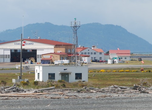
Ediz Hook (3)
1946 (station established 1865). Active; focal plane 50 ft (15 m); three flashes every 10 s, a green flash followed by two white flashes. 50 ft (15 m) square skeletal tower. Jim Smith's photo is at right and Google has a satellite view. Note: Wikimedia's photo of "Ediz Hook Light" does not show the light; it shows only the Coast Guard communications towers. The tower is on the grounds of the U.S. Coast Guard's Air Station Port Angeles. Located at the tip of Ediz Hook, the sand spit protecting Port Angeles Harbor. Site and tower closed but the light can be seen easily from Black Ball ferries crossing the strait between Port Angeles and Victoria, British Columbia, Canada. Owner/site manager: U.S. Coast Guard. Admiralty G4768; NGA 13768; CCG P-0190; USCG 6-16280.
[Ediz Hook (2)]
1908 (station established 1865). Inactive since 1946. The lighthouse was an octagonal cylindrical wood tower attached to a 1-1/2 story wood keeper's house. The keeper's house, with the light tower removed, was relocated in 1946 and is in use as a private residence. Google has a street view and a satellite view. The Coast Guard has a historic photo showing both the 1865 and 1908 lighthouses and Wikimedia also has historic photos. The house is located at Fourth and Albert Streets in Port Angeles, adjacent to Webster Park. Site closed, but the house can be viewed from the street. Site manager: private. ARLHS USA-266.
Ediz Hook Light
Ediz Hook Light, Port Angeles, May 2010
photo copyright Jim Smith; used by permission
** New Dungeness
1857. Active (privately maintained); focal plane 67 ft (20 m); white flash every 5 s. 63 ft (19 m; lowered from 100 ft (30.5 m) in 1927) stucco-clad brick tower with lantern and gallery, rising from a 1-story assistant keeper's house; VRB-25 aerobeacon (1998). Buildings painted white with red roofs. 1-1/2 story frame principal keeper's house (1905). The lantern was relocated from the Admiralty Head Light in 1927. The 4th order Fresnel lens installed in 1927 is now on display at the Coast Guard Museum Northwest in Seattle. Brick fog signal building (1927). Vem Fell has the 2022 photo seen at right, Anderson has a great page for the lighthouse, a 2008 closeup photo is available, Trabas has Boucher's view from the sea, Jeremy Krause has a 2021 view of the station, the Coast Guard has a historic photo taken in the 1950s as well as an 1898 photo taken before the tower was reduced in height, Marinas.com has aerial photos, Max Thornburg has a 2016 street view from the beach, and Google has a satellite view. A historic and remarkably well preserved light station. The keeper's houses provide housing for volunteer caretakers, who must be members of the preservation association. Lighthouse Digest has Jeremy D'Entremont's March 2005 feature marking the tenth anniversary of the preservation efforts. In July 1999 a quick-thinking volunteer used lawn sprinklers to deflect a bursh fire that burned around all sides of the station. In early 2006 the Coast Guard announced plans to deactivate the lighthouse and move the light to a small structure at the end of the spit. Preservationists protested this announcement, and the New Dungeness Light Station Association negotiated an agreement with the Coast Guard to keep the light in the tower under the Association's maintenance. The 250 pound vent ball atop the tower was replaced in December 2011 and in 2015 the lighthouse was repainted by volunteers. Located 1/2 mile (800 m) from the end of a 6 mile (10 km) long sand spit extending into the Strait of Juan de Fuca north of Dungeness. The spit is the major part of the Dungeness National Wildlife Refuge (entry fee). Accessible by boat (docking reservations required in advance) or by hiking the spit (11 miles (18 km) round trip). Site and tower open. Site manager: New Dungeness Light Station Association . ARLHS USA-538; Admiralty G4772; CCG P-0217; NGA 13764; USCG 6-16335.

New Dungeness Light, Dungeness, July 2022
Google Maps photo by Vem Fell

Information available on lost lighthouses:

Notable faux lighthouses:

Adjoining pages: North: Southern British Columbia | East: Puget Sound and San Juan Islands | South: Oregon

Return to the Lighthouse Directory index | Ratings key

Posted 2001. Checked and revised January 17, 2024. Lighthouses: 25. Site copyright 2024 Russ Rowlett and the University of North Carolina at Chapel Hill.