- A relatively flat island by Cape Verde standards, São
Vicente (St. Vincent) lies about 15 km (9 mi) southeast of Santo Antão across
the São Vicente Channel. The island has a population of about 75,000
and has several resorts.
Ilhéu dos Pássaros (Farol Don Luís,
Porto Grande) (2) - Date unknown (station established 1882). Active; focal plane 86
m (282 ft); three white flashes every 12 s. 5 m (16 ft) hexagonal
equipment room with a small lantern. Tower painted white, lantern
red. This lighthouse is perched atop a conical rock; the keepers
house, which is also a signal station, is halfway down the slope,
with a remarkable stairway connecting it to the light. Thomas Hackl's 2021 photo is
at right, IMP has a photo, a distant view
is available, Trabas has Erich Hartmann's 2018 photo, a postage
stamp (third stamp in line) has a closeup view of the lighthouse,
and Google has a satellite view. Huelse has a historic postcard
view of the original light, which was 12 m (39 ft) tall;
it's not known whether the existing tower is the stump of the
original or if it is a shorter replacement. Carrette found that the lighthouse has been restored recently. Located in the entrance
to Porto Grande, the harbor of Mindelo, on the northwest side
of Ilha de São
Vicente. Accessible only by boat. Site and tower closed. ARLHS CAP-010;
PT-2024; Admiralty D2942; NGA 24100.
- [Cabnave (Mindelo Breakwater)]
- Date unknown. Active; focal plane 8 m (26 ft); red flash every 2 s. 4 m (13 ft) light atop a square platform resting on a small square masonry tower. Trabas has Douglas Cameron's 2015 view from the sea and Bing has a very distant satellite view. Located on a breakwater on the east side of the entrance to Mindelo. Site status unknown. Admiralty D2943; NGA 24104.
- *** Ponta Machado (Dona
Amélia, São Pedro)
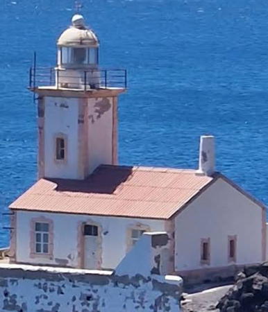
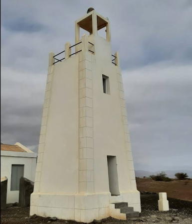
- 1894. Active; focal plane 56 m (184 ft); white flash every 5 s.
14 m (46 ft) square cylindrical stucco-clad masonry tower with lantern and gallery rising
from the front of a 1-story keeper's house. Lighthouse painted white with gold trim. A 2025 photo is at the top of this page,Roman Skorynin has a 2023 photo, Harm Carrette contriabuted a 2019 photo, IMP has a photo, Trabas has a 1980 distant view by Capt. Theo Hinrichs, Wikimedia has another view, the lighthouse has also appeared on a postage
stamp, and Google has a satellite view. Huelse has a historic postcard
view showing the lighthouse with the original lantern. The lighthouse was repainted in 2006. In 2018 it was completely restored and a new lantern was installed. Located
at the western point of Ilha de São Vicente, marking the
entrance to the channel between São Vicente and Santo
Antão.
Accessible from São Pedro by a hiking trail notched into the
cliffs. Site open, and Fünfzig found the tower to be open
during his 2004 visit. ARLHS CAP-002; PT-2020; Admiralty D2946;
NGA 24096.
Ilha de Santo Antão Lighthouses- Santo
Antão ("Saint Anthony") is the northwesternmost island of the group. Much of the
island is quite rugged. The principal towns are Ponta do Sol on the north
coast, which has an airport, and Porto Novo on the south coast, which has
a ferry terminal.
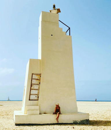
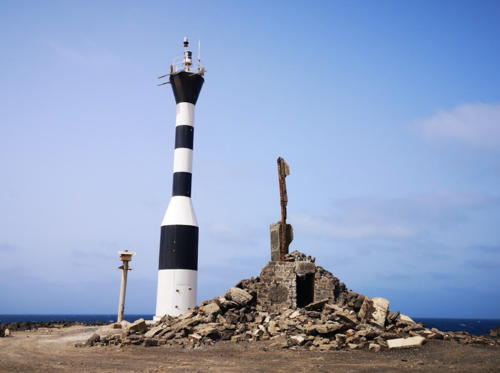
* Ponta do Sol - Date unknown. Active; focal plane 15 m (49 ft); white flash every 4 s.
10 m (33 ft) round barbell-shaped tower painted with black and white horizontal bands. Harm Carrette's 2019 photo is at right, IMP has a photo, and Google has an indistinct satellite view. Located on the waterfront at Ponta do Sol, at the northern tip
of the island. Site open, tower closed. PT-2004; Admiralty D2952; NGA 24088.
- Ponta de Tumbo (Fontes Pereira de Melo) (1)
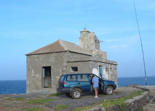
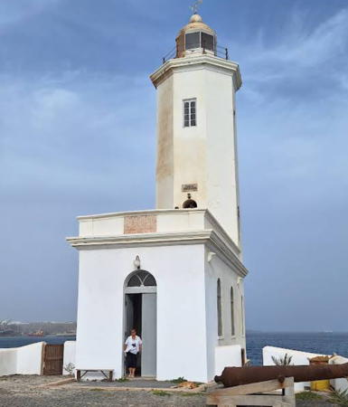
- 1886. Reactivated; focal plane 162 m (531 ft); four white flashes every 20 s. 16 m (52 ft) octagonal stucco-clad masonry
tower with lantern and gallery. The adjacent 1-story rubblestone
keeper's house has collapsed in ruins. Lighthouse originally painted white.
Maxim Konovalov's 2025 photo is below right, Diogo Botelho has a 2020 photo, Harm Carrette contributed a 2019 photo, IMP has a photo, a distant photo is available, Wikimedia has a very distant view, the lighthouse also appears on a postage
stamp, and Google has a satellite
view. The lighthouse was gravely endangered, as seen in Bergtor Roald Opsett's 2013 closeup photo. His photo also shows a then-active active light on a small concrete pyramid in front of the historic tower. The light station was completely restored sometime around 2017 and the light is back in the original tower. Huelse has a historic postcard
view (misidentified on the card as São Pedro Light on São
Vicente). Located at the northeastern point of Santo Antão, about
10 km (6 mi) southeast of Pombas. Site status unknown. ARLHS CAP-004;
PT-2008; Admiralty D2950; NGA 24080.
- Ponta de Mangrade (3)
- Around 2020. Active; focal plane 112 m (367 ft); two white flashes
every 10 s. Approx. 80 m (33 ft) round barbell-shaped tower painted with black and white horizontal bands. This light replaced a 3 m (10 ft) round cylindrical white concrete tower with lantern.
The original light here was mounted on a keeper's house
and the modern light appears to be within the foundation ruins of this house. IMP has a photo and Google has a satellite view. This is the westernmost light of the islands, and thus
the westernmost of all African lighthouses; it stands in longitude 25°21.8'
W. Located at the western point of Ilha de Santo Antão. Site status
unknown; the area is quite remote. PT-2013; Admiralty D2954; NGA 24092.
Information available on lost lighthouses:
Notable faux lighthouses:
|
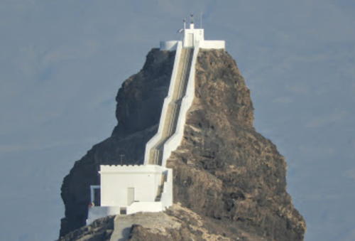
Don Luís Light, Ilhéu dos Pássaros, January 2021
Google Maps photo by Thomas Hackl

Ponta do Sol Light, Santo Antão, February 2019
contributed photo copyright Harm Carrette; used by permission.
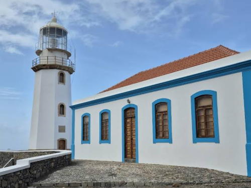
Ponta de Tumbo Light, Santo Antão, April 2025
Google Maps photo by Maxim Konovalov.
|
