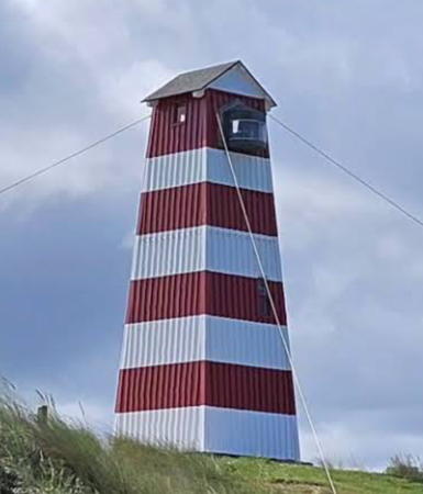
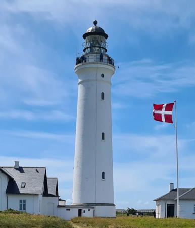
Lighthouses of Denmark: West Coast

The Kingdom of Denmark (Danmark in Danish), located at the mouth of the Baltic Sea, includes the north-pointing peninsula of Jylland (Jutland) in the west and a large number of islands to the east. The capital, Copenhagen, is on the island of Sjælland (Zealand). Other major Danish islands include Fyn (Funen) between Sjælland and Jylland, Lolland and Falster south of Sjælland and Bornholm farther east in the Baltic. The Skagerrak is a sound separating Jylland from Norway to the northwest, while the Kattegat separates Jylland from Sweden to the northeast.

This page covers lighthouses on the west coast of Jylland and on the Limfjord waterway that crosses the northern part of the peninsula. The southern part of this coast faces the North Sea and the northern part faces Norway across the Skagerrak.

Denmark is divided into five regions (regioner) and subdivided into 98 municipalities (kommuner). The regions of Nordjylland (North Jutland) and Midtjylland (Central Jutland) are almost entirely on Jylland but include some smaller islands, while the region of Syddanmark (South Denmark) includes southern Jylland and Fyn with several smaller islands.

The Danish word for a lighthouse is fyr or fyrtårn. The front light of a range is the forfyr and the rear light is the bagfyr. Næs is a cape, odde a narrow promontory or isthmus, ø is an island, bugt is a bay, rev is a reef, fjord is an inlet, and havn is a harbor.

Danish aids to navigation are maintained by the Danish Maritime Authority (Søfartsstyrelsen).

ARLHS numbers are from the ARLHS World List of Lights. DFL numbers are from the Dansk Fyrliste. Admiralty numbers are from volume B of the Admiralty List of Lights & Fog Signals. U.S. NGA List numbers are from Publication 114.

General Sources
Danske Fyrtårne
A comprehensive site on Danish lighthouses by Ole Henrik Lemvigh, with many photos; the text is entirely in Danish.
Online List of Lights - Denmark - West Coast and Skagerrak
Photos by various photographers posted by Alexander Trabas. Many photos for this area are Eckhard Meyer.
Leuchttürme.net - Dänemark
A fine web site by Malte Werning with excellent photos. Text in German.
Leuchtturmseiten von Anke und Jens - Denmark
Photos of more than 100 Danish lighthouses with notes in English.
Dänische Leuchttürme
Photos of more than 280 Danish lighthouses posted by Klaus Huelse.
Leuchttürme in Dänemark
Photos of more than 160 Danish lighthouses by Andreas Köhler.
Denmark Lighthouses
Aerial photos posted by Marinas.com.
Lighthouses in Denmark
Photos by various photographers available from Wikimedia.
World of Lighthouses - Denmark
Photos by various photographers available from Lightphotos.net.
Dänische Leuchttürme auf historischen Postkarten
Historic postcard views posted by Klaus Huelse.
Danske Fyrskibe
Comprehensive information on Danish lightships (in Danish) posted by the group managing the Horns-Rev.
Dansk Fyrliste 2022
Official Danish light list (in .pdf format); the list also includes lights of Greenland and Faroes.
OpenSeaMap
Navigational chart information for Denmark.
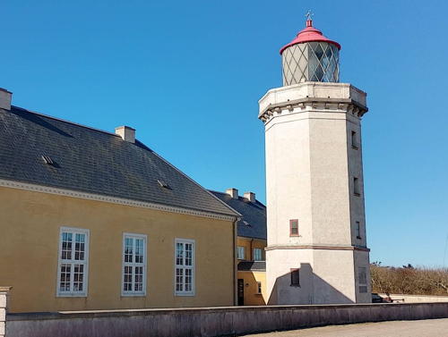

Hanstholm Light, Thisted, April 2025
Google Maps photo by Erling Højerslev
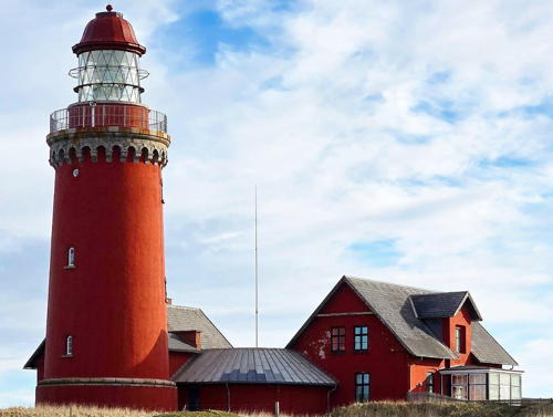

Bovbjerg Light, Lemvig, March 2025
Instagram photo by Bovbjerg Fyr
Syddanmark (Southern Denmark) Region West Coast Lighthouses

The Syddanmark (Southern Denmark) Region includes southern Jylland and the major islands of Fyn and Langeland as well as numerous smaller islands. Additional lighthouses of the Syddanmark region are listed on the Southeast Jylland and Fyn and Langeland pages.

Esbjerg Lighthouses
Esbjerg, a city of about 72,000 residents, is Denmark's only important North Sea port. Not a historic city, it was founded in 1868 after Denmark lost its former ports on the lower Elbe River to Prussia (and then Germany).

*
Esbjerg Trafikhavn Sydmole (South Mole) (2)
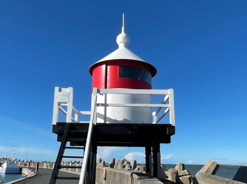
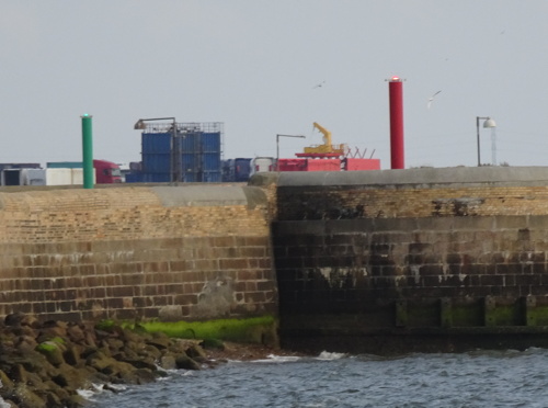
2014 (station established 1889). Active; focal plane 8 m (26 ft); continuous green light. 5 m (17 ft) round post painted green. Trabas has Meyer's photo, Heather Craven's photo of the new mole lights is at right, and Google has a 2019 street view across the harbor and a satellite view. This was previously a round green cast iron tower with a domed lantern, seen in the Anke/Jens photo (July 2005) and in Huelse's photo. The Trafikhavn (Commercial Harbor) is one of several small basins in the harbor facilities at Esbjerg. Located at the end of the Trafikhavn South Mole; apparently accessible by walking the mole. Site open, tower closed. DFL-0075; Admiralty B1796; NGA 10792.
* Esbjerg Trafikhavn Nordmole (North Mole) (2)
2014 (station established 1889). Active; focal plane 8 m (26 ft); continuous red light. 5 m (17 ft) round post painted red. Trabas has Meyer's photo, Heather Craven's photo of the new mole lights is at right, and Google has a 2019 street view across the harbor and a satellite view. This was previously a round cast iron tower with a domed lantern, seen in Huelse's photo, and Huelse also has a postcard view of a former mole lighthouse. Site open, tower closed. Located at the end of the Trafikhavn North Mole; apparently accessible by walking the mole. DFL-0074; Admiralty B1794; NGA 10788.
* Esbjerg
1923. Active; focal plane 6 m (20 ft); white, red or green light, depending on direction, 2 s on, 2 s off, 6 s on, 2 s off. 5 m (17 ft) wood building; the light is shown through a square window. Lighthouse painted white with one red horizontal band. Trabas has Meyer's photo, Huelse also has a good photo, Lemvigh has a page for the light, Köhler has a photo, and Google has a satellite view. This tiny directional lighthouse guides ships approaching Esbjerg through the narrow channel between the mainland and the island of Fanø. Located at the end of the broad mole separating the Trafikhavn and the Fiskerihavn. Site open, tower closed. ARLHS DEN-202; DFL-0060; Admiralty B1792; ex-NGA 10784.

Trafikhavn Mole Lights, Esbjerg, August 2018
photo copyright Heather Craven; used by permission
* [Esbjerg Konsumfiskerihavn Ostmole (East Mole)]
1889. Active; focal plane 8 m (26 ft); green flash every 3 s. 3 m (10 ft) square skeletal tower with lantern and enclosed upper portion, painted green. Trabas has a closeup photo by Meyer, Köhler also has a photo, and Google has a street view and a satellite view. In August 2018 Heather Craven and Ian Yarde found these mole lights to be in poor condition. Located on the east mole of the harbor basin just to the north of the Esbjerg light. Accessible by walking the mole. Site open, tower closed. DFL-0071; Admiralty B1788; NGA 10780.
* [Esbjerg Konsumfiskerihavn Vestmole (West Mole)]
1889. Active; focal plane 8 m (26 ft); red flash every 3 s. 3 m (10 ft) square skeletal tower with lantern and enclosed upper portion, painted red. Trabas has a closeup photo by Meyer, Köhler also has a photo, Jørgen Breer Laursen has a street view, and Google has a satellite view. Located on the west mole of the harbor basin just to the north of the Esbjerg light. Accessible by walking the mole. Site open, tower closed. DFL-0070; Admiralty B1786; NGA 10776.
* Strandby
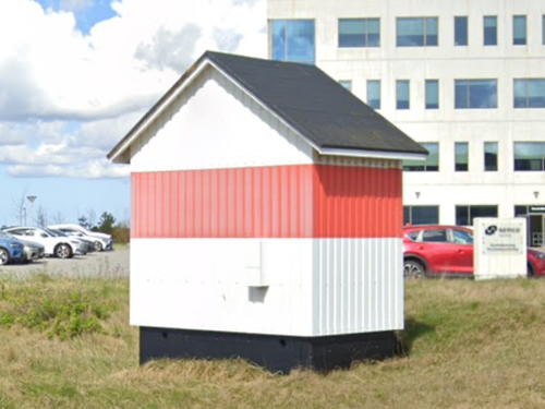
1893. Active; focal plane 6 m (20 ft); white, red or green light, depending on direction, occulting once every 5 s. 5 m (17 ft) wood building; the light is shown through a square window. Lighthouse painted white with one red horizontal band. Trabas has Meyer's closeup, Huelse also has a good photo, Werning has a photo of the light in action, and Google has the 2024 street view seen at right and a satellite view. This light guides ships approaching Esbjerg from the North Sea. Located on the Doggerkaj, a broad mole at the northwestern corner of Esbjerg harbor. Site open, tower closed. ARLHS DEN-203; DFL-0048; Admiralty B1782; NGA 10760.


Strandby Light, Esbjerg, April 2024
Google Maps street view

Sæddingstrand Syd Bagfyr (South Range Rear) (2)
1947 (station established 1873). Active; focal plane 25 m (82 ft); continuous green light. 17 m (56 ft) triangular skeletal tower with a square enclosed lantern room, mounted atop a robust square concrete tower. Lantern painted gray. Trabas has Meyer's closeup photo, a 2023 closeup is available, and Google has a satellite view. The tower is left over from World War II, although we aren't sure of its original function. The front light is on a short skeletal tower. Located in the Strandskoven, a wooded park about 1 km (0.6 mi) northeast of the harbor area in Esbjerg. Site status unknown. ARLHS DEN-118; DFL-0034a; Admiralty B1778.1; NGA 10748.
**** Motorfyrskib 1 Horns Rev
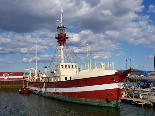
1913. Inactive as a lightship since 1980; decommissioned 1988. 33.6 m (110 ft) wood lightship; the light was displayed from a round lantern on a mast amidships. Hull painted red with a white horizontal band and a vertical white stripe (the pattern of the Danish flag). A photo is at right, another nice photo is available, Huelse also has a photo, Jørgen Breer Laursen has a 2021 street view, and Bing has a satellite view. Built at Faaborg, the ship spent its entire career on the Vyl and Horns Rev stations west of Esbjerg in the North Sea. (Horns Rev is now the site of a large windfarm.) In 1989 the Defense Ministry donated the ship to a foundation formed in Esbjerg for its preservation. After some refurbishment the ship opened as a museum vessel later in 1989. This is one of the best preserved lightships in Denmark, or anywhere. Moored in a new small craft basin at the north end of Esbjerg harbor. Site open, ship open for tours Monday through Friday, May through September. ARLHS DEN-233.

Motorfyrskib 1 Horns Rev, Esbjerg, May 2020
Wikimedia Creative Commons photo by Hjart
* Sæddingstrand Forfyr (Range Front) (2?)
Date unknown (station established 1873). Inactive since 2006. 7 m (23 ft) 1-1/2 story wood keeper's house, painted red with white trim. The light was shown through a plate glass window on the lower story. In 2006 the active light (focal plane 14 m (46 ft); white light, 1 s on, 1 s off) was moved to a 3 m (10 ft) round metal tower with lantern. The original lens is on display at the Fiskeri- og Søfartsmuseet, Esbjerg's maritime museum. The house is clearly used as a residence. Huelse has a photo of the house from a different angle, Köhler also has a photo, and Google has a street view from the rear of the building and a satellite view. Trabas has Lemvigh's photo of the new light (focal plane 14 m (46 ft),; white light, 1 s on, 1 s off). Seen in Google's satellite view, it was activated in November 2006. The Sæddingstrand lights define the intial approach range for Esbjerg. Located on the Fyrvej, just off the Sædding Strandvej (beach road) in Sædding, a beach town just northwest of Esbjerg. Site and tower closed, but the house can be viewed from the street. ARLHS DEN-114. Active light: DFL-0032c; Admiralty B1772; NGA 10720.
* Sæddingstrand Mellumfyr (Range Middle)
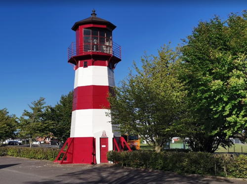
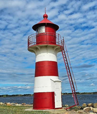
1873. Active; focal plane 27 m (89 ft); white light, 2 s on, 2 s off. 14 m (46 ft) octagonal cast iron tower with lantern and gallery. Tower painted with red and white horizontal bands; lantern painted red. Jeppe Hjorth's 2019 photo is at right, Mona Svendsen has a 2024 photo, Trabas has a closeup photo, Huelse also has a good photo and a historic postcard view, Köhler has a photo, and Google has a street view and a satellite view. This was the rear light of the range until 1953. The lighthouse was repainted in 2018. Located in a parking lot on the eastern leg of the Fyrparken, off the Tarphagevej in Sædding. Site open, tower closed. ARLHS DEN-115; DFL-0032b; Admiralty B1772.1; NGA 10724.
 

Sæddingstrand Range Middle Light, Esbjerg, May 2019
Google Maps photo by Jeppe Hjorth
 
* Sæddingstrand Bagfyr (Range Rear)
1953. Active; focal plane 37 m (121 ft); continuous white light. 22 m (72 ft) triangular skeletal tower with a round gallery. Tower painted red. Trabas has Meyer's photo, Köhler has a photo, and Google has a street view and a satellite view. Located on the Nordre Fovrfeldvej at the Sprogøvej in Sædding. Site open, tower closed. ARLHS DEN-116; DFL-0032a; Admiralty B1772.2; NGA 10728.
* Sæddingstrand Nord Forfyr (North Range Front) (2)
1983 (station established 1947. Active; focal plane 17 m (56 ft); continuous red light. 6.5 m (21 ft) rectangular skeletal tower painted white. Trabas has Meyer's photo and Google has a street view and a satellite view. Located on the beachfront at the foot of the Femhøjevej in Sædding. Site open, tower closed. ARLHS DEN-112; DFL-0036b; Admiralty B1779; NGA 10752.
* Sæddingstrand Nord Bagfyr (North Range Rear)
1947. Active; focal plane 28 m (92 ft); continuous red light. 11 m (36 ft) triangular cylindrical concrete tower with lantern and gallery. There are vertical panels of wood on each face, so the lighthouse appears with brown and white vertical stripes. Trabas has Meyer's photo, Köhler has a photo, and Google has a street view and a satellite view. This very modern tower, designed by the architect Frank Holmelin, is located on the western leg of the Fyrparken, off the Sædding Ringvej (ring road) in Sædding. Site open, tower closed. ARLHS DEN-113; DFL-0036a; Admiralty B1779.1; NGA 10756.

Varde Lighthouse
**** Blåvandshuk (Blåvand) (2)
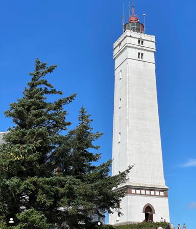
1900 (station established 1888). Active; focal plane 55 m (180 ft); three white flashes every 20 s. 39 m (128 ft) square concrete tower with lantern and gallery; original 2nd order Fresnel lens. Lighthouse painted white with gray trim; lantern painted red. A 2023 photo is at right, Trabas has Meyer's closeup, Lemvigh's page has photos, Ingo Bos has a nice photo of a rainbow behind the lighthouse, Wikimedia has photos, Steffen Andersen has a 2021 photo, Huelse has a historic postcard photo, and Google has a 2024 street view and a satellite view. In 2021 the Admiralty renumbered the light as the rear light of a range; the front light is on a skeletal mast. The cape of Blåvandshuk is the westernmost point of Denmark. Located at the point of the cape, at the end of the Fyrvej (Lighthouse Road) in Blåvand-Oksby. Site open; tower open daily late March through mid November and during the Christmas holidays; otherwise Thursday through Sunday; it may be closed in bad weather. Site manager: Vardemuseerne (Blåvandshuk Fyr) . ARLHS DEN-002; DFL-0150; Admiralty B1849.1 (ex-B1848); NGA 10716.

Blåvandshuk Light, Varde, August 2023
Instagram photo by herrschm1dt

Midtjylland (Central Jylland) Region West Coast and Limfjord Lighthouses

East coast lighthouses of the Midtjylland (Central Jylland) region are listed on the Northeast Jylland page. Most of the Midtjylland lighthouses listed on this page are on the south side of the Limfjord waterway. The Limfjord is not a fjord in the Norwegian sense. It is a network of broad sounds and narrow channels that extends all the way across the northern end of Jylland (Jutland), connecting the North Sea at Thyborøn to the Kattegat at Hals. Until it was pierced by a storm in 1825 a narrow isthmus called the Agger Tange connected the northern part of Jylland to the rest of the peninsula. The present Thyborøn Channel through the Agger Tange was opened by another storm in 1862. From Thyborøn, the waterway extends southeast to a narrow strait at Oddesund, then northeast to another strait at Sallingsund, then east through the city of Ålborg to the Kattegat. (Lighthouses on the Kattegat at the eastern end of the waterway are listed on the Northeast Jylland page.)

Ringkøbing-Skjern Lighthouse
**** Lyngvig (Nørre Lynvig, Holmlands Klit)
1906. Active; focal plane 53 m (174 ft); white flash every 5 s. 38 m (125 ft) round concrete tower with lantern and gallery. Lighthouse painted white; lantern painted red. A 2023 photo is at right, Wikimedia has additional photos, Trabas has Arno Siering's excellent photo, Huelse has both a photo and a historic postcard view, Lemvigh has a page for the lighthouse, a 2021 photo is available, and Google has a street view and a satellite view. All photos show how the lighthouse stands atop a 17 m (56 ft) dune. The lighthouse is built on a barrier spit enclosing the Ringkjøping Fjord, a large, shallow sound connected to the sea by a narrow inlet. Located at the end of the Holmsland Klitvej in Nørre Lyngvig. Site open; tower open daily year round except for the Christmas and New Year holidays. Site manager: Ringkøbing-Skjern Museum (Lyngvig Fyr ). ARLHS DEN-024; DFL-0215; Admiralty B1868; NGA 10872.

Lemvig Lighthouses
**** Bovbjerg
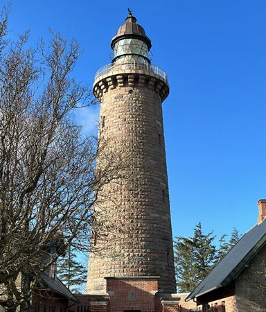
1877. Active; focal plane 62 m (203 ft); two long (2.5 s) white flashes every 15 s. 26 m (85 ft) round brick tower with stone trim, lantern and gallery, attached to a pair of 1-1/2 story brick keeper's houses; one of the houses is renovated as a café. The original 1st order Fresnel lens remains in use. The lighthouse is unpainted red brick with gray stone trim; lantern painted dark red to match the brick. A 2025 photo is at the top of this page, Lemvigh has a page for the lighthouse, Anke and Jens have a page with photos, Alberto Fulcheri has a 2019 photo, Derek Meier has an excellent September 2006 photo, Trabas has Meyer's photo, Wikimedia has photos, Marinas.com has aerial photos, Huelse has a postcard view postmarked 1907, Martin Hansen has a 2022 street view, and Google has a satellite view. Not the tallest Danish lighthouse, but this is one of the country's most handsome and most popular. Located on the Fyrvej south of Ferring. Site open; tower open in the afternoon daily in July and August and daily except Mondays February through June and September through December. Site manager; Bovbjerg Fyr . ARLHS DEN-003; DFL-0250; ; Admiralty B1886; NGA 10908.
* Thyborøn Anduvning (Thyborøn Approach)
Date unknown. Active; focal plane 24 m (79 ft); three white flashes every 10 s. 17 m (56 ft) square skeletal mast with lantern and gallery. The lantern is red. Trabas has Meyer's photo, Mette Krebs has a street view from the nearby beach, and Google has a satellite view. Located on a dune on the south side of the entrance to the Limfjord. Site open, tower closed. DFL-0260; Admiralty B1890; NGA 10912.

Lyngvig Light, Ringkjøping-Skjern, August 2023
Instagram photo by Lyngvig Fyr
* Thyborøn Tange
1911. Active; focal plane 6 m (20 ft); white, red or green light, depending on direction, occulting twice every 12 s. 6 m (20 ft) round cast iron lantern with a square wood gallery, mounted on four wood piles. Lantern and gallery painted white with a red horizontal band, piles brown. Björn Dangeleit has the 2022 closeup photo seen at right, Huelse has a fine photo, Trabas also has a good photo, Anas Kasmo has a street view, and Google has a satellite view. This was formerly the front light of a range; the rear light was deactivated in 1988 and has since been relocated to Kongsdal Havn, near Mariager (see the Northeast Jylland page). Located at an elbow bend on the Havregade (breakwater) sheltering the harbor of Thyborøn, on the south side of the inlet leading to the Limfjord. Accessible by walking the breakwater. Site open, tower closed. . ARLHS DEN-189; DFL-0408; Admiralty B1900; NGA 10932.
* Toftum
1904. Active; white, red or green light, depending on direction, 2 s on, 2 s off. 4 m (13 ft) wood building; the light is shown through a square window. Lighthouse painted white with one red horizontal band. Huelse has a photo, Trabas also has a photo, and Google has a satellite view. Standing at the eastern end of the west basin of the Limfjord, this directional light guides ships down the length of the basin. Located on a golf course near the town of Toftum Bjerge, about 2 km (1.2 mi) southwest of the Oddesund bridge. Site open, tower closed. Site manager: Struer-Golfklub. ARLHS DEN-076; DFL-0455; Admiralty B1946.
* Oddesundbroen
1904. Active; focal plane 13 m (43 ft); white, red or green light, depending on direction, 1 s on, 1 s off. Light mounted atop the drawbridge control building of the Oddesund Bridge (highway 11). Trabas has a closeup photo and Google has a 2023 street view and a satellite view. Located near the north end of the bridge. Site open, tower closed. DFL-0460; Admiralty B1948.

Thyborøn Tange Light, Thyborøn, September 2022
Google Maps photo by Björn Dangeleit

Struer Lighthouses
* Grisetåodde
1909. Active; focal plane 8 m (26 ft); white, red or green light, depending on direction, occulting once every 5 s. 8 m (26 ft) round cast iron tower with lantern and gallery, painted with red and white horizontal bands. André R. Mastel's 2023 photo is at right, Werning has a page with a good photo, Lemvigh also has a page for the lighthouse, Thomas Peter has a 2022 photo, Charles Joynt has a 2009 photo, Trabas has Arno Siering's excellent photo, Erik Meldgaard Sørensen has a 2020 sunrise photo, Marinas.com has aerial photos, and Google has a satellite view as well as a distant 2023 street view taken from the nearby Oddesund Bridge. Anke and Jens found the light freshly repainted in June 2005, and Heather Craven and Ian Yarde found it being repainted again in 2018. Located on a spit of land marking the east entrance to the Oddesund strait in Oddesund Syd. Site open, tower closed. . ARLHS DEN-075; DFL-0470; Admiralty B1954.

Skive Lighthouses
* Langerodde
1911. Active; focal plane 9 m (30 ft); white, red or green light, depending on direction, 2 s on, 2 s off. 4 m (13 ft) wood building; the light is shown through a square window. Lighthouse painted white with one red horizontal band. Trabas has a closeup photo and Google has a satellite view. This is a directional light guiding ships northeastward from Oddesund to Sallingsund. Located on the south side of the fjord roughly 4 km (2.5 mi) southwest of Sallingsund, near Vile. Site open, tower closed. ARLHS DEN-078; DFL-0510; Admiralty B1976.
* Glyngøre
1911. Active; focal plane 10 m (33 ft); white, red or green light, depending on direction, occulting once every 5 s. 10 m (33 ft) round cast iron tower with lantern and gallery, painted with red and white horizontal bands; a sibling of the Grisetåodde lighthouse. Lemvigh has a page for the lighthouse, Trabas has a good photo, Eugenio Ferrandi has a closeup, Jørgen Pedersen has a street view, and Google has a satellite view. Located at a marina on the tip of a promontory on the east side of the fjord north of Sallingssund. Site open, tower closed. . ARLHS DEN-077; DFL-0515; Admiralty B1980.
* Vodstrup
1911. Active; focal plane 16 m (52 ft); red or green light, depending on direction, 2 s on, 2 s off. 4 m (13 ft) wood building; the light is shown through a square window. Lighthouse painted white with one red horizontal band. Trabas has a closeup photo and Google has a street view and a satellite view. This directional light guides westbound ships toward Sallingsund. Located at the end of the Fyrvej in Morsø, on the eastern side of the island of Mors. Site open, tower closed. ARLHS DEN-066; DFL-0542; Admiralty B2006.

Grisetåodde Light, Struer, September 2023
Instagram photo by André R. Mastel
* Fur (2)
2007 (station established 1911). Active; focal plane 13 m (43 ft); white, red or green light, depending on direction, occulting once every 5 s. 6 m (20 ft) triangular metal tower. Trabas has a photo of the new light, Malene Marie Reesbøll has a 2021 photo, and Google has a satellite view. The first lighthouse was a 4 m (13 ft) wood building; the light was shown through a square window. Huelse has a good 2007 photo. The old lighthouse was removed because it was endangered by beach erosion. Located on the northwestern side of Fur, an island in the Limfjord on the south side of the waterway. The island is accessible by ferry from the mainland near Selde. Site open. ARLHS DEN-073; DFL-0548; Admiralty B2010.

Nordjylland (North Jylland) Region Limfjord and Northwest Coast Lighthouses

Vesthimmerland Lighthouse
* Løgstør Grunde Forfyr
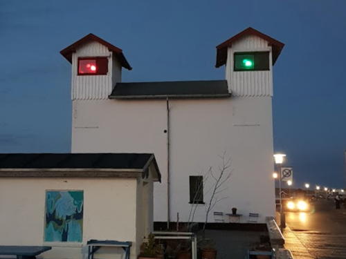
1908. Active; focal plane 9 m (30 ft); red or green light, depending on direction, 2 s on, 2 s off. 9 m (30 ft) rectangular building with two square lantern houses, one at each end. Building painted white. Lemvigh has a page with photos, Trabas has a photo, a 2024 photo is available, Huelse has a historic postcard view, and Google has a street view and a satellite view. In this very unusual lighthouse the lantern at the north end carries the red light and the one at the south end carries the green; Diana Toftbjerg has the 2021 photo of the lights in action seen at right. The range guides eastbound ships approaching the narrow Aggersund channel of the Limfjord leading to Ålborg. Located on the south side of the fjord on the Havnevej in Løgstør. Site open, tower closed. . ARLHS DEN-079; DFL-0630b (south tower) and 0630c (north tower); Admiralty B2050.
* Løgstør Grunde Bagfyr
Date unknown. Active; focal plane 38 m (125 ft); white light, 2 s n, 2 s off. 15 m (49 ft) square cylindrical skeletal tower carrying a large red slatted daymark. Trabas has a photo and Google has a satellite view and a distant street view. Located on the Tranvej in eastern Løgstør. Site open, tower closed. DFL-0630a; Admiralty B2050.1.

Morsø Lighthouses
* Sillerslev Forfyr (Range Front)
1911. Active; focal plane 10 m (33 ft); white light, 1 s on, 1 s off. 3 m (10 ft) wood building; the light is shown through a square window. Lighthouse painted white with one red horizontal band. Lemvigh has a page with a photo, Trabas has a closeup photo, and Google has a satellite view. This range guides ships heading northeast from the Oddesund area. Located on the waterfront of Sønderby, about 1.2 km (3/4 mi) southwest of Sillerslev on the south side of the island of Mors. Site open, tower closed. ARLHS DEN-064; DFL-0500b; Admiralty B1970.
* Sillerslev Bagfyr (Range Rear)
1911. Active; focal plane 28 m (92 ft); white light, 2 s on, 2 s off. 13 m (43 ft) square pyramidal wood tower with lantern room and gallery; the light is shown through a square window in the lantern room. Trabas has a closeup photo, Lemvigh has a page with a photo, Ham Sirl has a 2020 photo, and Google has a street view and a satellite view. Located on the Gammel Færgevej on the east side of Sillerslev. Site open, tower closed. ARLHS DEN-065; DFL-0500a; Admiralty B1970.1.

Løgstør Grunde Forfyr, Vesthimmerland, September 2021
Google Maps photo by Diana Toftbjerg

Thisted Lighthouses
#Agger-Tange Forfyr (Range Front) (1) (?)
1988. Replaced around 2022 and since removed. 5 m (16 ft) round cast iron lantern, painted red. Huelse has a closeup and Arvid Fimreite has a 2020 photo, but Google's satellite view confirms that the lighthiuse was removed. The range guides ships entering the Thyborøn Kanal, the inlet leading to the Limfjord. The rear light is 800 m (1/2 mi) east on a skeletal mast. Located just behind the beach on the north side of the inlet. Trabas has Meyer's closeup photo of a new light (focal plane 8 m (26 ft); white, red or green light, depending on direction, 2 s on, 2 s off) on a short skeletal tower. Apparently accessible by a hike of about 1.2 km (3/4 mile) across the sand from the Tangevej. Site open, tower closed. ARLHS DEN-190. Active light: DFL-0401b; Admiralty B1894; NGA 10916.
**** Lodbjerg
1884. Active; focal plane 48 m (157 ft); two white flashes every 20 s. 35 m (115 ft) round granite tower with lantern and gallery. The lighthouse is unpainted stone; lantern dome is weathered gray metallic. Two 1-1/2 story keeper's houses and other light station buildings; there is a resident caretaker. Helle Kehlet's 2023 photo is at right, Trabas has a closeup photo by Arno Siering, the Nature Agency has a page for the lighthouse, Huelse also has a good closeup plus a historic postcard view, Anke/Jens have a view from the gallery, Marinas.com has aerial photos, Klaus Friese has a street view from the gallery, and Google has a satellite view. The lighthouse is located about 1 km (0.6 mi) from the beach in a maritime forest preserve, the Lodbjerg Klitplantage. In 1999 the deteriorated lantern dome was replaced by an authentic replica. Located on the Lodbjergvej about 8 km (5 mi) by road north of Agger. Site open, tower open daily year round. Site manager: Naturstyrelsen (Nature Agency) (Lodbjerg Fyr). . ARLHS DEN-022; DFL-0264; Admiralty B2070; NGA 10944.
* [Stenbjerg (Fog Signal)]
Date unknown. Active fog siren; two 5-s blasts every 30 s. 1-story building. Trabas has Werner Seiler's photo, Barne Peters has a beach view, and Google has a satellite view. Located at a national park station in Stenbjerg. Site open, building closed. Admiralty B2071.
* Vorupør Forfyr
1894. Active; focal plane 20 m (66 ft); red light, 2 s on, 2 s off. 4 m (13 ft) wood building; the light is shown through a small rectangular window. Lighthouse painted with red and white horizontal bands. Huelse has a closeup, Köhler has a 2015 photo, Trabas has Meyer's photo, Jørgen Pedersen has a street view, and Google has a satellite view. This light was replaced by a temporary light during construction in the area in 2019-21; Jacob Diernæs Søndergaard's July 2021 distant view shows the temporary light closer to the water with contruction work ongoing on the dune. It appears the light is back now at its original location; it is barely visible at the right edge of Eckhard Senczek's October 2022 view. Located on the dunes at Nørre Vorupør. Site open, tower closed. ARLHS DEN-063; ; DFL-0269b; Admiralty B2072; NGA 10948.

Lodbjerg Light, Agger, October 2023
Instagram photo by Helle Kehlet
* Vorupør Bagfyr
1894. Active; focal plane 30 m (98 ft); red light, 2 s on, 2 s off. 9 m (30 ft) square wood tower, painted with red and white horizontal bands. The light was originally shown through a window, but a semicircular lantern has now been attached to the windowframe, and an external ladder has been added to provide access to the modern lantern. A. Lindhorst's 2023 photo is at right, Lemvigh has a page for the lighthouse, Trabas has a good photo by Arno Siering, Wikimedia has a photo, Köhler has a photo, Marinas.com has aerial photos, Jørgen Pedersen has a sunrise street view, and Google has a satellite view. Thee lighthouse was repainted in 2023. The Vorupør lights apparently have been moved several times to track changes in the entrance channel. Located 80 m (260 ft) southeast of the front light in Nørre Vorupør. Site open, tower closed. ARLHS DEN-187; DFL-0269a; Admiralty B2072.1; NGA 10952.
**** Hanstholm
1843 (substantially rebuilt in 1889). Active; focal plane 65 m (213 ft); three white flashes every 20 s. 23 m (75 ft) octagonal cylindrical stone tower with lantern and gallery, attached by a covered passageway to a 2-1/2 story masonry keeper's house. 1st order Fresnel lens (1889) in use. Lighthouse painted white; lantern roof painted red. Erling Højerslev's 2025 photo appears at the top of this page, Lemvigh has a page for the lighthouse, Ralf Buthmann has a 2022 photo, Anke and Jens also have a page with photos, Trabas has a closeup by Pauline and Wim de Kleine, Wikimedia has photos, Werning has a good photo, Marinas.com has aerial photos, Huelse has a historic postcard view, and Google has a street view and a satellite view. Hanstholm Fyr is one of Denmark's most important lights since it marks the southern entrance to the Skagerrak, the broad strait separating Denmark and Norway and leading to the Baltic Sea. The lighthouse had to be built twice because a mixup in the specifications left the first tower inadequate to support the lens. The tower was raised in height in 1889 when the present first-order lantern was installed. In 1979 the light station was sold to Hanstholm Kommune (now part of Thisted Kommune) and the Viborg Regional Authority, although the Maritime Authority reserves the right of access to the tower and stations a resident caretaker on the property. The buildings are part of a museum of regional history. The keeper's house includes four apartments available for overnight accommodations. All the light station buildings were under restoration in 2014 but the station reopened in 2015. Located on the Tårnvej in Hanstholm, about 400 m (1/4 mi) southeast of the waterfront. Site open, museum and tower open daily year round. Owner: Thisted Kommune; site manager: Det Nordatlantiske Fyr i Hanstholm. . ARLHS DEN-013; DFL-0280; Admiralty B2084; NGA 10968.

Vorupør Bagfyr, Thisted, August 2023
Google Maps photo by A. Lindhorst

Hjørring Lighthouses
** Rudbjerg (Rubjerg) Knude
1900. Inactive since 1968. 23 m (85 ft) square cylindical masonry tower with lantern and gallery. Lighthouse painted white, lantern red. Several 1-1/2 story keeper's houses hve collapsed in ruins. Werning has a page for the lighthouse, Lemvigh also has a page with photos, Wikimedia has numerous photos, a 2020 photo is available, Adrian Mossakowski has a street view, Google has a satellite view, and Huelse has a historic postcard view of the lighthouse in operation. This lighthouse was abandoned when high sand dunes began encroaching on the station. The dunes have now migrated over the station covering the buildings except for the tower. Clearly the lighthouse and all the other structures were endangered by continuing erosion and the rise in sea level. A September 2007 photo and Karsten Köhler's June 2008 photo show the lighthouse still in dunes but looming over the beach. Happily, in October 2019 the tower was moved on rails 70 m (230 ft) back from the edge of the dune. The site is now managed by the Vendsyssel Historiske Museum, which has exhibits on the lighthouse and the natural history of the area. Located on the beach about halfway between Nørre Rudbjerg and Lønstrup. Accessible by a road from the Rudbjergvej. Site open, the tower stands open at all times. Site manager: Vendsyssel Historiske Museum. . ARLHS DEN-036.
**** Hirtshals
1863. Active; focal plane 57 m (187 ft); continuous white light with a more intense flash every 30 s. 35 m (115 ft) round tile-covered brick tower, attached by covered passageways to two 1-1/2 story brick keeper's houses. Lighthouse is white; lantern roof is weathered metallic. A 2023 photo is at right, Lemvigh's page for the lighthouse has photos, Anke and Jens also have a page with photos, Trabas has a photo, Wikimedia has many additional photos, Sonny Christensen has a 2021 photo, Huelse also has a good photo and a historic postcard view, Werning has a page for the lighthouse, Michael Riis Allesøe has a street view, Marinas.com has an aerial view, and Google has a satellite view. A café in one of the keeper's houses is open in the warmer months; also an apartment in the assistant keeper's house is available for overnight accommodations. The lighthouse was restored during the summer of 2005. Hirtshals, at the northern end of Jylland, is the southern terminal for ferries crossing the Skagerrak to Oslo, Kristiansand, and Larvik, Norway, and also to the Faroes and Iceland. Located just off the Kystvej in Hirtshals, about 1 km (0.6 mi) southwest of the harbor. Site open; tower open daily year round. Site manager: Hirtshals Fyr. . ARLHS DEN-017; DFL-0310; Admiralty B2106; NGA 11008.

Information available on lost lighthouses

  • Skallingen (1903-1909 and 1913-?), tip of the Skallingen Peninsula near Esbjerg. The original brick lighthouse was lost to beach erosion in only 6 years. A skeletal tower replaced it in 1913 and it's not clear when that tower was removed.

Hirtshals Light, Hjørring, April 2023
Instagram photo by zweite_heimat_danmark

Notable faux lighthouses:

Adjoining pages: East: Northeast Jylland | South: North Frisia

Return to the Lighthouse Directory index | Ratings key

Posted December 16, 2006. Checked and revised April 19, 2025. Lighthouses: 32, lightships: 2. Site copyright 2025 Russ Rowlett and the University of North Carolina at Chapel Hill.