Lighthouses of the Faroes

The Faroes (or Faroe Islands, or Føroya in the islands' Norse language) comprise an archipelago of 18 islands in the North Atlantic Ocean very roughly equidistant from Norway, Scotland, and Iceland. Settled by the Norse in the 7th century, the Faroes have a population of about 55,000. Although they are part of the Kingdom of Denmark the islands are self-governing in practically all respects. In fact the Faroes declined to join the European Union when Denmark did so.

During World War II the islands were occupied by British troops to keep them out of German control. British engineers built the only airport in the archipelago on the island of Vágar. Today the national airline Atlantic Airways offers regular flights to the islands from London, Copenhagen, Oslo, Stockholm and several other locations in northwestern Europe. Bridges and tunnels have been built connecting the major islands except Sandoy and Suðeroy, which are accessible by ferry.

The word for a lighthouse in Faroese is viti, the same word as in Icelandic; oy is an island, nes is a cape or headland, vík is a bay, sund is a strait, and havn is a harbor. Like Icelandic Faroese includes the old Norse letter "eth" (Ð and ð), pronounced with the softer form of the th sound.

Aids to navigation in the islands are maintained by the Danish Maritime Authority (Søfartsstyrelsen).

ARLHS numbers are from the ARLHS World List of Lights. DFL numbers are from the Dansk Fyrliste. Admiralty numbers are from volume L of the Admiralty List of Lights & Fog Signals. U.S. NGA List numbers are from Publication 115.

General Sources
Dänische Leuchttürme/Feuerschiffe
Photos of Danish lighthouses posted by Klaus Huelse; a section on the Faroes is near the bottom of the page.
Online List of Lights - Faroe Islands
Photos by various photographers posted by Alexander Trabas.
Lighthouses of the Faroe Islands
A restricted photo group on Flickr.com with more than 360 photos of Faroese lighthouses.
Lighthouses in the Faroe Islands
Photos by various photographers available from Wikimedia.
World of Lighthouses - Faroe Islands
Photos by various photographers available from Lightphotos.net.
Map of the Faroe Islands
Provided by Wikipedia.
Dansk Fyrliste 2022
Official Danish light list (in .pdf format); the list includes lights of Greenland and Faroes.
OpenSeaMap
Navigational chart information for the Faroes.
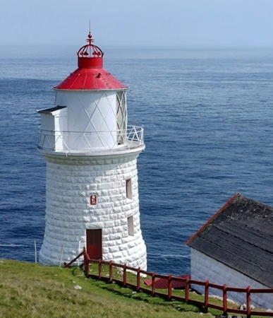
Nólsoy
Light, Nólsoy, June 2023
Google Maps photo by Bitta
Fugloy Lighthouses
Fugloy ("bird island") is a small island at the northeastern end of the Faeroes; the population in 2020 was 38.

Fugloy (Eystfelli)
Date unknown. Active; focal plane 445 m (1460 ft); two long white flashes every 20 s. 8 m (26 ft) square cylindrical skeletal tower. Jógvan Horn has a photo, Google has a street view, and Bing has a satellite view. Located atop a vertical cliff roughly 425 m (1400 ft) high at the northeastern tip of Fugloy. Site open if you can get to it, tower closed. ARLHS FAR-002; DFL-6775; Admiralty L4439; NGA 17980.
Bispen (Stapi)
1994. Active; focal plane 32 m (105 ft); white flash every 3 s. 3.5 m (12 ft) round cylindrical concrete tower with gallery; the light is shown from a tripod atop the tower. Tower painted white with a red horizontal band. Trabas has Kees Aalbersberg's closeup photo, Huelse also has a closeup photo, Gert Norðoy has a photo and a more distant view, and Bing has a very fuzzy satellite view. This lighthouse is perched on a ledge of a vertical cliff it is accessed by a series of ladders bolted to the bare rock. Located on an islet off the northeastern end of Fugloy. Accessible only by boat. Site and tower closed. ARLHS FAR-004; DFL-6780; Admiralty L4440; NGA 17984.

Borðoy Lighthouses
Borðoy is the largest island in the northeastern Faroes with a population of about 6300; it includes Klaksvík, the second largest town in the islands.

* Klaksvík Range Rear
Date unknown. Active; focal plane 20 m (66 ft); green light, 2 s on, 2 s off. 19 m (62 ft) triangular skeletal tower. Trabas has Kees Aalbersberg's photo and Google has a street view and an indistinct satellite view. The front light is on a 14 m (46 ft) skeletal mast. Located on a short pier in the Klaksvík port. Site open, tower closed. DFL-6750a; Admiralty L4434.1; NGA 17992.
* Havannasund Range Rear
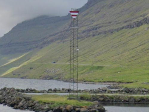
Date unknown. Active; focal plane 15 m (49 ft); continuous red light. 13 m (43 ft) triangular skeletal tower carrying a triangular daymark colored white with two red horizontal bars. Google has a street view and an indistinct satellite view. Borðoy is joined to the neighboring island of Kunoy by a short causeway across the narrow strait of the Hvannasund. Located on a short jetty just north of the causeway. Site open, tower closed. DFL-6756a; Admiralty L4437.1.

Kalsoy Lighthouses
Kalsoy is a long, narrow, and rather rugged island lying to the northeast of Eysturoy. It has a population of about 75 and is administered as part of the Borðoy municipality.

Kalsoy (Kalsø)
1893. Active; focal plane 12 m (39 ft); white, red or green light depending on direction, 2 s on, 2 s off. 7 m (23 ft) round cylindrical cast iron tower with lantern and gallery, painted white with one red horizontal band. 1-story equipment building. Eileen Sandá has a photo, Huelse has a view from the sea, another view from the sea is available, Trabas has a distant view by Kees Aalbersberg, and Google has a satellite view. Located at the southern end of Kalsoy; the site does not appear to be readily accessible. Site and tower closed. ARLHS FAR-015; DFL-6740; Admiralty L4428; NGA 17972.
Kallur (Kadlur)
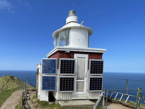
1927. Active; focal plane 240 m (787 ft); white light, 3 s on, 12 s off. 4.5 m (15 ft) square wood equipment room with a round lantern and 4th order (?) Fresnel lens. Lighthouse painted white with one red horizontal band. A photo is at right, Felix van de Gein has a good closeup photo, Petr Tichý also has a closeup, Huelse has a photo, Alessio Mesiano has a spectacular panoramic view, Trabas has Kees Aalbersberg's photo, and Google has a distant satellite view. Located high on a promontory northwest of Trøllanes, at the northwestern end of Kalsoy. Accessible by a challenging hike of about 1.6 km (1 mi) from Trøllanes (bring lighting for several unlit tunnels on the trail). Site open, tower closed. ARLHS FAR-014; DFL-6790; Admiralty L4430; NGA 17976.
Kallur Light
Kallur Light, Kalsoy, May 2010
Flickr photo copyright Ivan (m0rus); used by permission

Eysturoy Lighthouses
Eysturoy is the second largest and second most populous of the islands, having a population of nearly 12,000. It is separated from Stremoy, the largest island, by the narrow Sundini strait crossed by a bridge; In December 2020 a new undersea tunnel provided a shorter route between the two islands.
* Leirvik (Lervik, Lervig)
1914. Active; focal plane 21 m (69 ft); flash every 3 s, white, red or green depending on direction. 4 m (13 ft) round lantern mounted on a concrete pad. Lantern painted white with one red horizontal band. Huelse has a photo, Jones Damm has a 2020 closeup, and Google has a street view and a satellite view. Located on a bluff at the east edge of Leirvik, a town on the east shore of Eysturoy. Site open, tower closed. ARLHS FAR-018; DFL-6700; Admiralty L4415; NGA 17956.
Mjóvanes (2)
Date unknown. Active; focal plane 31 m (102 ft); two flashes every 15 s, white, red or green depending on direction. 7.5 m (25 ft) round cylindrical fiberglass (?) tower with lantern, painted white with one red horizontal band. Huelse has a photo, a distant view from the sea is available, Trabas has Kees Aalbersberg's foggy view from the sea, and Google has a satellite view. In 2005 NGA described this light as a "wooden tripod with railings," so the present lighthouse is probably new. Located on a sharp promontory at the eastern tip of Eysturoy. Site status unknown. ARLHS FAR-019; DFL-6690; Admiralty L4410; NGA 17952.
* Toftir (Tofte)
1893. Active; focal plane 13 m (43 ft); white, red or green light depending on direction, occulting once every 5 s. 7 m (23 ft) round cylindrical cast iron tower with lantern and gallery, painted white with one red horizontal band. Huelse's photo is also seen at right, a 2015 photo is available, and Google has a satellite view and a distant street view. Toftir is a fishing port near the southern end of Eysturoy. Located on a promontory south of the entrance to Toftir harbor, about 5 km (3 mi) north of Tórshavn. Site open, tower closed. ARLHS FAR-030; DFL-6670; Admiralty L4406; NGA 17944.
* Strendur (Straender)
1909. Inactive since 2014. 5 m (17 ft) round cylindrical cast iron tower with lantern and gallery, painted white with one red horizontal band. Huelse has a photo, Google has a closeup street view, and Bing has a satellite view. Located on a bluff above the harbor of Strendur, also on Eysturoy but facing Toftir across a 600 m (660 yd) wide fjord. Site open, tower closed. ARLHS FAR-028; ex-DFL-6680; ex-Admiralty L4408; ex-NGA 17948.
Toftir Light
Toftir Light, Eysturoy
photo copyright Klaus Huelse; used by permission

Nólsoy Lighthouses
Nólsoy is a small island south of Eysturoy and off the southern tip of Stremoy. The island has a population of about 250 and is accessible by ferry from Tórshavn. It is administered as part of the Torshavn municipality.

*
Nólsoy (Nolsø)
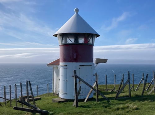
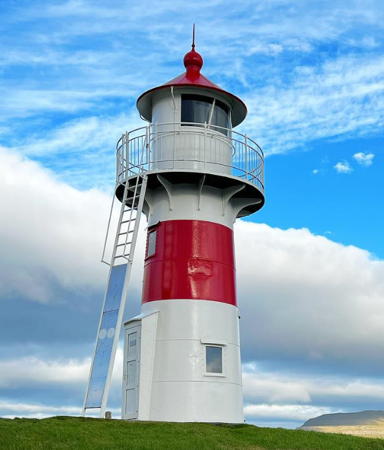
1893. Active; focal plane 72 m (236 ft); one long (2.5 s) white flash every 20 s. 14 m (46 ft) round stone tower with lantern and gallery; 1st order Fresnel lens in use. Lighthouse painted white; lantern dome painted red. 1-story stone keeper's cottage. A 2023 photo is at the top of this page, Jean Tiede has a 2021 photo, another photo is available, Nigil Homer has a good 2007 photo, Huelse has a photo, Trabas has Rainer Arndt's view of the station, the lighthouse appears on a 1985 postage stamp, and Bing has a satellite view. All the recent photos show the lantern topped by a Danish crown, but this feature is missing from the postage stamp image. It may be that the crown is a historically accurate finial, added during a recent restoration. This is the landfall light for Tórshavn, the capital and chief port of the Faroes. The lighthouse is sometimes called Borðan, which creates confusion with the next entry. Located on Øknastangi, the southeastern point of the island of Nólsoy, about 7 km (4.5 mi) east southeast of Tórshavn. Site open, tower closed. ARLHS FAR-023; DFL-6610; Admiralty L4388; NGA 17920.
* Borðan (Borin)
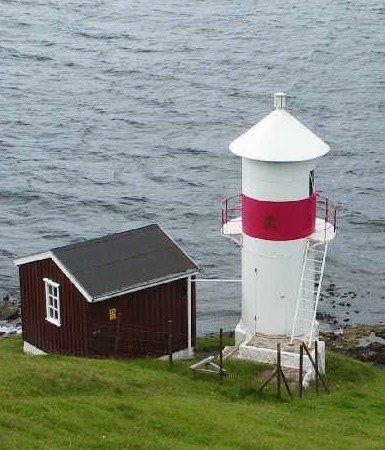
1900. Active; focal plane 39 m (128 ft); white, red or green light depending on direction, 1 s on, 1 s off. 5.5 m (18 ft) round metal lantern, painted white with one red horizontal band. Wonho Kim's 2022 photo is at right, Huelse has a photo, Jean Tiede has a 2021 photo, another excellent closeup is available, Trabas has Rainer Arndt's photo, and Google has a distant satellite view. Located on the southernmost point of Nólsoy, about 800 m (1/2 mi) west of the Nólsoy lighthouse. Site open, tower closed. ARLHS FAR-005; DFL-6615; Admiralty L4390; NGA 17924.
 

Borðan Light, Nólsoy, September 2022
Google Maps photo by Wonho Kim

Streymoy Lighthouses
Streymoy is the largest and most populous island of the Faroes, with a population of 24,276 in 2018. Tórshavn, the national capital, is located on the southeast coast of the island.

Hoyvíkshólmur
Date unknown. Active; focal plane 13 m (43 ft); flash every 5 s, white or green depending on direction. 4 m (13 ft) round lantern painted white with a red horizontal band. Trabas has Kees Aalbersberg's photo and Bing has a satellite view. Located on a small island at the north end of the Tórshavn harbor. Accessible only by boat. Site status unknown. ARLHS FAR-013; DFL-6650; Admiralty L4394; NGA 17928.
* Skansin (Skansen, Tórshavn)
1888. Active; focal plane 25 m (82 ft); white, red or green light depending on direction, occulting once every 5 s. 12 m (39 ft) round cast iron tower with lantern and gallery. Lighthouse painted white with one red horizontal band; the lantern dome is also painted red. Lena Klanderud's photo is at right, Trabas has a closeup by Rainer Arndt, a good 2012 photo is available, Arne List has a nice photo, Gert Norðoy has a closeup, D.A. Scott has a 2008 closeup, Huelse has a photo, Jan Egil Kristiansen has a photo of the lighthouse in action, Federico Debetto has a closeup street view, and Google has a satellite view. The lighthouse stands on a corner of the Skansin fort, built in 1580 to protect the harbor of Tórshavn from pirate raids. Every ship arriving in the Faroes passes this light, making it the best known Faroese lighthouse. Located on a promontory on the east side of Tórshavn harbor, on the island of Streymoy. Site open, tower closed. . ARLHS FAR-029; DFL-6630; Admiralty L4396; NGA 17932.
* Velbestaður (Velbestað)
1974. Active; focal plane not listed by NGA; two flashes every 10 s, white, red or green depending on direction. 4 m round (fiberglass?) lantern, painted red. Trabas has Helmut Seger's photo, Huelse has a photo, and Google has a distant sea view, and Google has a satellite view. Located on a bluff southeast of Velbestaður and about 4 km (2.5 mi) southwest of Tórshavn. A coastal road passes close to the light. Site open, tower closed. ARLHS FAR-033; DFL-6880; Admiralty L4450; NGA 18008.
Leynar (Lejnum)
Date unknown. Active; focal plane 34 m (111 ft); white, red or green light depending on direction, with two long (2 s) occultations every 12 s. 5 m (17 ft) round (fiberglass?) lantern, painted white with one red horizontal band. Huelse has a photo and Google has a distant street view and a satellite view. This lighthouse marks the southern entrance to the channel separating the west side of Stremoy from the neighboring island of Vágar. Located on a promontory about 1.5 km (1 mi) southeast of Leynar. There is a coastal road, but it is not clear if there is access to the light from the road. Site status unknown. ARLHS FAR-017; DFL-6875; Admiralty L4448; NGA 18004.

Skansin Light, Tórshavn, May 2018
Instagram photo
by Lena Klanderud

Vágar Lighthouses
Vágar, located off the west coast of Streymoy, is the third largest of the islands and the location of the only airport. The population was 3271 in 2018. An undersea tunnel 4940 m (3.1 mi) long connects Vágar to Streymoy and the other central islands of the country.
* Múlin (Múlen)
Date unknown. Active; focal plane 33 m (108 ft); flash every 3 s, white, red or green depending on direction. 5 m (18 ft) round cylindrical tower with lantern and gallery, painted white with one red horizontal band. A good photo is available, Trabas has Kees Aalbersberg's photo, Jamen Percy has a 2010 photo, Katrin Svabo Bech has a distant view, Federico Debetto has an aerial view, and Google has a satellite view. This lighthouse marks the entrance to the Sørvágsfjørd, which leads to the fishing port of Sørvágur on the southwest coast of Vágar. Located on a bluff on the south side of the fjord about 4 km (2.5 mi) west of Sørvágur. Site open, tower closed. ARLHS FAR-020; DFL-6900; Admiralty L4455; NGA 18012.
Slættanes
Date unknown. Active; focal plane 63 m (207 ft); flash every 5 s, white, red or green depending on direction. 5 m (17 ft) round lantern, painted red, on a concrete base. Jan Egil Kristiansen has a 2011 photo and Google has a satellite view. Located on the northern tip of Vágar. Site open, tower closed. ARLHS FAR-026; DFL-6850; Admiralty L4454; NGA 18024.
Gáshólmur (Gasholm)
Date unknown. Active; focal plane 32 m (105 ft); two white flashes every 5 s. Approx. 5 m (17 ft) round tower, upper half red and lower half white. Trabas a Kees Aalbersberg's distant view, a distant aerial view is available, and Google has a satellite view. This light marks the narrow passage between Vágar and Mykines. Located atop a cliff at the western tip of Gáshólm, a small island off the west side of Vágar. Site status unknown. ARLHS FAR-011; DFL-6910; Admiralty L4454.6; NGA 18032.

Mykines Lighthouse
* Mykines (Myggenaes)
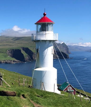
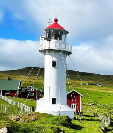
1909. Active; focal plane 125 m (410 ft); three white flashes every 20 s. 14 m (46 ft) round cylindrical cast iron tower with lantern and gallery, painted white; lantern roof painted red. 2nd order (?) Fresnel lens in use. Guy wires have been added to support the lighthouse against the constant winds. A photo is at right, Huelse has a closeup photo, Nigel Homer also has a great closeup, Trabas has Kees Aalbersberg's photo, Eduardo Jurado has a street view, and Google has a satellite view. Mykines is the westernmost of the Faroes. There is a very small village on the island but by 2012 the population had dwindled to 10. Boat transportation can be arranged from Sørvágur. Located on the heights above the westernmost tip of the island and the country, accessible by a short hike from the village of Mykines. Site open, tower closed. . ARLHS FAR-021; DFL-6890; Admiralty L4460; NGA 18036.

Mykines
Light, Mykines, August 2019
Instagram photo by smyrilline

Suðeroy Lighthouses
Suðuroy ("South Island") is in fact the southernmost of the Faroe Islands. The island is about 30 km (19 mi) long with a deeply indented coastline. The population was 4601 in 2018. Daily ferry service links the island to Tórshavn.

Stóra Dímun (Store Dimon) (2)
2000 (station establishment date unknown). Active; focal plane 115 m (377 ft); white flash every 5 s. 5 m (17 ft) round lantern on a concrete foundation. Lantern painted white with one red horizontal band. Marita Gulklett has a closeup, Huelse also has a closeup, Trabas has Bjørn Poulsen's photo, another photo is available, and Bing has a satellite view. This light replaced a 2.5 m (8 ft) square tower. Eileen Sandá has a photo showing the spectacular clifftop location of this lighthouse. Located at the southwest point of Stóra Dímun, a small island about 8 km (5 mi) northeast of the northern point of Suðeroy. Site open, tower closed. ARLHS FAR-027; DFL-6580; Admiralty L4368; NGA 17908.
Hvalba (Kvalbø)
Date unknown. Active; focal plane 16 m (52 ft); white, red or green light, depending on direction, occulting once every 5 s. 4 m (13 ft) rectangular corrugated metal building; the lights are shown through a broad window. The building is painted white with one red horizontal band. Randi Hjelm Debes has a photo and Google has a street view and a satellite view. Located at the head of a long fjord at Hvalba, near the northern tip of Suðeroy. Accessible by road. Site open, tower closed. ARLHS FAR-016; DFL-6550; Admiralty L4361; NGA 17904.
* Galgitangi (Galgetange) Forfyr (Range Front)
1893. Active; focal plane 14 m (46 ft); white, red or green light depending on direction, 1 s on, 1 s off. 3 m (10 ft) rectangular corrugated metal building; the lights are shown through a broad window. The building is painted white with one red horizontal band. Huelse has a photo and Google has an indistinct satellite view. The range guides ships into the Trongisvágsfjødur, leading to the fishing port of Trongisvágur. Located on the south side of the fjord about 5 km (3 mi) southeast of Trongisvágur. Site open, tower closed. ARLHS FAR-009; DFL-6535b; Admiralty L4358; NGA 17880.
* Galgitangi (Galgetange) Bagfyr (Range Rear)
1893. Active; focal plane 22 m (72 ft); white light, 2 s on, 2 s off. 8 m (30 ft) round cylindrical (cast iron?) tower with lantern, painted with red and white horizontal bands. Eileen Sandá has a closeup photo, Huelse also has a photo, Jan Egil Kristiansen has a view from the sea, and Google has a street view and a satellite view. Located 258 m (846 ft) west northwest of the front light. Site open, tower closed. ARLHS FAR-010; DFL-6535a; Admiralty L4358.1; NGA 17884.
* Porkerisnes (Porkere Næs)
Date unknown. Active; focal plane 24 m (79 ft); three flashes every 15 s, white, red or green depending on direction. 5.5 m (18 ft) round cylindrical fiberglass tower with lantern, painted white with one red horizontal band. Erik Christensen has a closeup photo, Trabas has Kees Aalbersberg's photo, and Google has a satellite view. Located on a promontory on the north side of the Vágsfjord, which leads to the port of Vágur, about 1.5 km (1 mi) east of the village of Porkeri. Site open, tower closed. ARLHS FAR-024; DFL-6525; Admiralty L4354; NGA 17876.
* Akraberg
1909. Active; focal plane 94 m (308 ft); two long (2 s) flashes every 20 s, white, red or green depending on direction. 14 m (46 ft) round cylindrical (cast iron?) tower with lantern and gallery, painted white; lantern roof painted red. Guy wires have been added to support the lighthouse against the constant winds. Fog horn (one blast every 60 s). Giovani Lupi's 2023 photo at right shows the lighthouse freshly repainted, Gamer Ivanov has a 2021 photo, Huelse has a photo, Trabas has Kees Aalbersberg's view from the sea, Vesna Lokar has a photo, and Google has a distant satellite view. Located at the southern tip of Suðeroy, the southernmost of the Faroes. Site open, tower closed. . ARLHS FAR-001; DFL-6500; Admiralty L4342; NGA 17852.

Akraberg
Light, Suðeroy, July 2023
Instagram photo by Giovani Lupi

Information available on lost lighthouses:

Notable faux lighthouses:

Adjoining pages: East: Shetland Islands | West: East and South Iceland

Return to the Lighthouse Directory index | Ratings key

Posted October 24, 2006. Checked and revised April 17, 2024. Lighthouses: 26. Site copyright 2024 Russ Rowlett and the University of North Carolina at Chapel Hill.