Lighthouses of Haiti

The Republic of Haiti (République d'Haïti in French) occupies the western 3/8 of the island of Hispaniola with the Dominican Republic occupying the rest of the island. One of the islands of the Greater Antilles, Hispaniola is east of Jamaica, southeast of Cuba, and west of Puerto Rico. A former French colony, Haiti revolted against French rule and won its independence in 1804. Sadly, it is one of the world's poorest nations and for many years it has been torn by insurrection and unrest. Its historic lighthouses were built in the late 1800s or during a U.S. military occupation between 1915 and 1934. Some of those that survive are abandoned and deteriorating, like the Point Picolet lighthouse shown below.

It is difficult to obtain accurate reports from Haiti and tourism there is quite limited. As a result little is known about some of these lighthouses, their condition, whether they are in operation, or even whether they still exist. Any information would be welcome. Thanks to Michel Forand, who contributed much of the historical information on this page from older light lists.

On 12 January 2010 Haiti's capital Port-au-Prince was essentially destroyed by a devastating earthquake. Recovery from this disaster has been very slow.

French and a Creole dialect are official languages in Haiti. The French word for a lighthouse is phare, île is an island, cap is a cape, pointe is a promontory or point of land, roche is a rock, récife is a reef, baie is a bay, estuaire is an estuary or inlet, détroit is a strait, rivière is a river, and havre is a harbor.

Aids to navigation in Haiti are maintained by the Service Maritime et de Navigation d'Haïti (SEMANAH).

ARLHS numbers are from the ARLHS World List of Lights. Admiralty numbers are from volume J of the Admiralty List of Lights & Fog Signals. U.S. NGA List numbers are from Publication 110.

General sources
Online List of Lights - Haiti
Photos posted by Alexander Trabas; the Haiti photos are by Captains Theo Hinrichs ("Capt. Theo") or Peter Mosselberger ("Capt. Peter").
World of Lighthouses- Haiti
Photos by various photographers available from Lightphotos.net. Currently all the Haiti photos were contributed by Capt. Peter.
Leuchttürme Mittelamerikas und der Karibik auf historischen Postkarten
Historic postcard views posted by Klaus Huelse.
GPSNavigationCharts
Navigation chart for Haiti.
Navionics Charts
Navigation chart for Haiti.


Pointe du Lamentin Light
Pointe du Lamentin Light, Carrefour, February 2013
photo copyright Capt. Peter Mosselberger; used by permission

Sud-Est (Southeast) Department Lighthouse
Cap Jacmel (?)
Date unknown. Inactive but listed with focal plane 39 m (128 ft); white flash every 6 s. 6 m (20 ft) skeletal tower painted white with a red lantern. No photo available. Bing's satellite view of the cape may show a ruined light station. The light tower is not seen. Located on a prominent cape about 10 km (6 mi) south of Jacmel. Site status unknown. Admiralty J5368; NGA 14156.

Sud (South) Department Lighthouses
Île Vache (Île-à-Vaches) (?)
Date unknown (station established 1922). Reported destroyed but listed with six quick white flashes followed by one long white flash every 15 s. Described by NGA only as a "white square tower." No photo available. Google satellite views formerly suggested a tower perhaps 15 m (49 ft) tall; the current satellite view shows some structure remaining in the beach. The original lighthouse had a focal plane height of 10 m (33 ft). The Admiralty reported the lighthouse as destroyed in a November 2016 Notice to Mariners but has retained its listing of the light. Whatever remains is likely to succumb to beach erosion. Île-à-Vache ("Cow Island") is an island about 13 km (8 mi) long lying off Haiti's southwestern peninsula. The island has several resorts, among the few in Haiti. Located at the eastern tip of the island. Site status unknown. Admiralty J5370; NGA 14158.
Pointe Gravois (2)
1960s(?) (station established 1925). Inactive. White steel tower with a red lantern, according to Lighthouse Digest. No photo available but Google's satellite view shows that a tower survives at this station. Located at the southwestern tip of the Gravois peninsula in far southwestern Haiti. Accessible only by boat. Site status unknown. ARLHS-007.

Grand'Anse Department Lighthouses
Cap Dame Marie (2)
Date unknown. Active; focal plane 37.5 m (123 ft); white light, 2.5 s on, 2.5 s off. NGA describes a 5 m (17 ft) skeletal tower on a white concrete base. However, Trabas has Capt. Peter's photo (also seen at right) of a 15 m (49 ft) round concrete tower with lantern and gallery, painted white; lantern painted red. An aerial view is available and Google has a satellite view. Located at the end of the Tiburon Peninsula, the long southwestern peninsula of Haiti. Site status unknown. Admiralty J5376; NGA 14160.

Cap Dame Marie Light, Gulf of Gonâve
photo copyright Capt. Peter Mosselberger; used by permission
Grande Cayemite (Grande Île des Cayemites) (2?)
Date unknown (station established 1925). Inactive but listed with focal plane 16.5 m (54 ft); very quick-flashing white light. 13 m (43 ft) square skeletal tower with gallery and a small lantern. Lighthouse painted white, lantern red. No photo available but Google has a satellite view of the station. The original lighthouse was described similarly but had a focal plane height of only 13 m (43 ft). The Admiralty reported the lighthouse as destroyed in a November 2016 Notice to Mariners but the satellite view suggests that something remains of this tower. Grand Cayemite is an elliptical island, about 13 by 5 km (8 by 3 mi) in dimensions, lying in the Gulf of Gonâve off the north coast of the Tiburon Peninsula. Located at the northern tip of the island. Accessible only by boat. Site status unknown. Admiralty J5380; NGA 14164.

Ouest (West) Department (Gulf of Gonâve) Lighthouses
The Gulf of Gonâve is the large gulf indenting the west coat of Haiti. The capital, Port-au-Prince, is at the head of the gulf. The Île de la Gonâve is a large island in the center of the gulf; the island is 60 km (37 mi) long and 15 km (9 mi) wide; it has a population of nearly 90,000.

Banc de Rochelois (Les Pirogues)
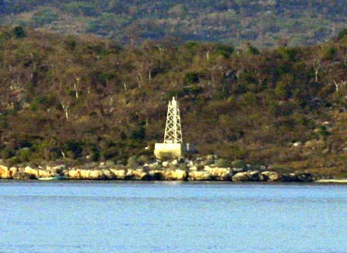
Date unknown. Active; focal plane 9 m (30 ft); one short and one long white flash every 10 s. 9 m (30 ft) square skeletal tower painted white with a black horizontal band. Trabas has a photo by Capt. Peter (also seen at right) and Bing has a fuzzy satellite view. Located on a dangerous reef in the center of the Canal de la Gonâve (Gonâve Channel), between the Île de la Gonâve and Haiti's southwestern Tiburon Peninsula. Accessible only by boat. Admiralty J5386; NGA 14172.

Banc de Rochelois Light, Gulf of Gonâve
photo copyright Capt. Peter Mosselberger; used by permission
Pointe Ouest (Île de la Gonâve) (2)
Date unknown (station established 1925). Active(?); focal plane 85 m (279 ft); four white flashes every 15 s. Approx. 12 m (39 ft) square skeletal tower with gallery. Entire lighthouse painted white. No photo available but Bing has a satellite view. An earlier lighthouse had a focal plane of 16 m (52 ft). This lighthouse warns ships approaching the Île de la Gonâve. The island is 60 km (37 mi) long and 15 km (9 mi) wide. Located on the western point of Île de la Gonâve. Accessible only by boat. Site status unknown. Admiralty J5382; NGA 14168.
Pointe Fantasque
Date unknown. Active; focal plane 15 m (50 ft); six quick white flashes and one long white flash every 15 s. Approx. 20 m (66 ft) square skeletal tower with gallery and a small lantern. Entire lighthouse painted white. Trabas has Capt. Hinrichs's view from the sea (also seen at right) and Google has a satellite view. Located on the southeastern point of Île de la Gonâve. Site status unknown. Accessible only by boat. Admiralty J5384; NGA 14184.
* Pointe du Lamentin
Date unknown (station established 1864(?)). Active; focal plane 32 m (106 ft); white flash every 3 s. 29 m (95 ft) quadrupod cast iron tower with lantern, gallery, and central cylinder, painted white; lantern dome painted green. A photo by Capt. Peter is at the top of the page, Glinca Pierre-Louis has a 2021 photo, Jonas Laurince has a more distant view from the sea, and Google has a satellite view. This is a historic lighthouse of architectural significance. The lighthouse sustained some damage during the quake, but the damage has been repaired, and the lighthouse looks great in a 2019 photo by Yves Bruno Dany Jean. Located on a peninsula jutting into the Baie de Port-au-Prince at Carrefour, about 5 km (3 mi) west of the city. Carrefour is a very poor neighborhood and casual travel there may not be advisable, but the lighthouse should be visible from ships arriving in Port-au-Prince. Site status unknown. ARLHS HAI-001; Admiralty J5390; NGA 14192.
#Port-au-Prince Range Front
Date unknown (station established 1917). Destroyed by the earthquake of 12 January 2010. Approx. 25 m (82 ft) cathedral tower with the light mounted near the top. The cathedral was white; the dome of the tower was gold. The light was attached to the cupola atop the north tower of the Cathédrale de Port-au-Prince. A pre-quake photo of the cathedral is available and Andre Paultre's 2017 photo and Google's most recent satellite view show the devastation caused by the quake. Located in downtown Port-au-Prince. Site open, tower closed. ARLHS HAI-008; ex-Admiralty J5396; ex-NGA 14196.
Pointe Fantasque Light
Pointe Fantasque Light, Île de la Gonâve, February 2013
photo copyright Capt. Theo Hinrichs; used by permission
Lafiteau Range Rear
Date unknown. Active; focal plane about 25 m (82 ft); continuous red light. Light mounted on a tower rising from a large industrial building. Trabas has Capt. Hinrich's 2013 photo. This building collapsed in the earthquake but Google's satellite view shows that it has been rebuilt. The front light is somewhere on the skeletal structure on the pier at left in the photo. Lafiteau is a town about 15 km (9 mi) north of Port-au-Prince. Located near the pier in Lafiteau. Site status unknown. Admiralty J5399.1; NGA 14216.
Les Arcadins
1882. Active (?); focal plane 12.5 m (41 ft); two white flashes every 5 s. 9 m (30 ft) cylindrical cast iron tower with lantern and gallery. Lighthouse painted white; lantern dome is black. Franck Cottel's photo is at right, R.M. Ramirez has a good photo, Trabas has a distant view by Capt. Hinrichs, and Google has a satellite view. The Admiralty reported the light to be out of service in 2016. This lighthouse is a typical 19th century French tourelle, one of many installed all around the world. The three small islands known as the Arcadins are hazards in the Canal de Saint-Marc (St. Mark Channel), which separates the mainland from the Île de Gonâve, about 30 km (19 mi) northwest of Port-au-Prince. Located on the Île du Phare, the central and largest of the three islands. Accessible only by boat. Site open, tower closed. ARLHS HAI-006; Admiralty J5402; NGA 14220.

Artibonite Department (Gonaïves Area) Lighthouses
Pointe de Saint-Marc
1924. Active(?); focal plane 29 m (95 ft); nine quick white flashes every 15 s. Approx. 12 m (39 ft) skeletal tower, painted white. No photo available but Google has a satellite view of the station. This light marks the entrance to the Canal de Saint-Marc (St. Mark Channel). Located on the point, about 20 km (13 mi) southwest of Saint-Marc. Site status unknown. Admiralty J5404; NGA 14224.

Les Arcadins Light, Gulf of Gonâve, July 2018
Google Maps photo by Franck Cottel
Pointe Lapierre (Gonaïves)
1928. Active(?); focal plane 97 m (318 ft); seven very quick white flashes followed by one long white flash every 10 s. White square stone tower, according to NGA. No photo available but Google has a satellite view sof the station. Located on a steep headland on the north side of the entrance to the Baie de Gonaïves, about 15 km (9 mi) west of the city of Gonaïves. Site status unknown. Admiralty J5406; NGA 14228.

Nord-Ouest (Northwest) Department Lighthouses
Cap du Mole St. Nicolas (3?)
Date unknown (station established 1922). Active (?); focal plane unknown; white light occulting once every 3 s. NGA lists a "white tower" without specifying either the height or the focal plane. Google has a satellite view of a short tower at the listed location. Trabas has a photo by Capt. Peter of a tall communications tower; either the light has moved or the Captain made a rare mistake. The 1948 Admiralty list listed a 4 m (14 ft) "white house, red lantern" with a focal plane height of 46.5 m (153 ft). Located on the extreme northwestern tip of the island facing the Windward Passage. Site status unknown. ARLHS HAI-002; Admiralty J5408; NGA 14230.
Île de la Tortue Pointe Ouest (3?)
Date unknown (2014?) (station established 1924). Active (?); focal plane 23.5 m (77 ft); very quick-flashing white light. 14 m (46 ft) round tower with lantern and gallery painted with red and white horizontal bands. Trabas has Capt. Peter's photo (also seen at right), Pierre Idjory has a 2023 aerial view, and Google has a satellite view. The original light was described as a 9 m (30 ft) "white house" and the second was a 14 m (46 ft) white skeletal tower on a triangular base. The Île de al Tortue, also known by its Spanish name Tortuga (Turtle Island), is a substantial island off the north coast of Haiti. It was a well-known base for pirates during the heyday of Caribbean piracy, roughly 1630-1680. Located at the western tip of the island. Accessible only by boat. Site status unknown, probably open. ARLHS HAI-005; Admiralty J5412; NGA 14234.
Île de la Tortue (Pointe de l'Est) (2)
2014. Active (?); focal plane 23.5 m (77 ft); two white flashes every 6 s. 14 m (46 ft) round tower painted with red and white horizontal bands. Trabas has Capt. Peter's photo, Pierre Idjory has a 2023 aerial view, and Google has a satellite view of the station. NGA describes a skeletal tower on a triangular base. Idolaire Sainvil has a 2013 photo of the lighthouse still under construction, its lantern not yet installed. Located on the eastern tip of the Île de la Tortue. Accessible only by boat. Site status unknown, probably open. Admiralty J5414; NGA 14232.

Point Ouest Light, Île de la Tortue
photo copyright Capt. Peter Mosselberger; used by permission

Nord-Est (Northeast) Department Lighthouses
Pointe Picolet (Cap-Haïtien) (1)
1895. Inactive. Approx. 22 m (72 ft) cast iron quadrupod tower with lantern, gallery, and enclosed watch room. Dejan Andjelic's photo of the abandoned and rusting lighthouse is at right. Stefan Krasowski has a 2012 photo, Venzo Van has a distant view from the sea, and Google has a satellite view. Gravely endangered. Prefabricated in France, this lighthouse is (or was) a remarkable architectural monument. The active lighthouse at Ruhnu, Estonia, is the only other known surviving quadrupod tower. Located on a promontory sheltering the harbor of Cap-Haïtien, on the north coast of Haiti. Accessible only by boat. Site open; Roswell climbed part way up the tower but found it too dangerous to continue. ARLHS HAI-004.
Pointe Picolet (Cap-Haïtien) (2)
Date unknown. Active; focal plane unknown; white flash every 4 s. Approx. 10 m (33 ft) square cylindrical white concrete tower. Trabas has Capt. Peter's photo, Venzo Van has a distant view from the sea (also showing the older Picolet lighthouse lower on the slope), Karl Arthur has a distant 2022 drone view, and Google has a satellite view. This light was dropped by the Admiralty in 2013 but apparently it was reactivated by 2020. According to NGA it is a powerful light with a range of 55 km (35 mi). Located high above the historic lighthouse. Accessible only by boat. Site status unknown. Admiralty J5410; NGA 14231.

Information available on lost (or at least inactive) lighthouses:

  • Port-au-Prince (1888-?). The lighthouse was on Fort Islet in Port-au-Prince harbor. Google's satellite view of the islet shows that this tower does not survive. ARLHS HAI-003.

Notable faux lighthouses:


Pointe Picolet Light, Cap-Haïtien, October 2017
Google Maps photo by Dejan Andjelic

Adjoining pages: North: Turks and Caicos Islands | East: Dominican Republic | West: Jamaica | Northwest: Eastern Cuba

Return to the Lighthouse Directory index | Ratings key

Posted January 4, 2007. Checked and revised December 16, 2023. Lighthouses: 19. Site copyright 2023 Russ Rowlett and the University of North Carolina at Chapel Hill.