Lighthouses of South Korea: Gunsan Area

For most of its history Korea was an independent kingdom, or at least an autonomous kingdom under Chinese influence. This came to an end in 1910 when Japan annexed all of Korea. At the end of World War II in 1945 the 38° parallel was established as the dividing line between U.S. and Soviet zones of occupation, and in 1948 separate civil administrations were established in the two halves of the country. The Korean War (1950-53) ended in a draw with the armistice line falling close to the prewar 38° line. The Republic of Korea (ROK), commonly called South Korea (Daehan Minguk in Korean), occupies the Korean peninsula south of the armistice line.

South Korea is divided into nine provinces and eight province-level cities; the provinces are subdivided into counties and cities. This page covers lighthouses of Gunsan City in Jeollabuk Province and the adjoining Seocheon County in Chungcheongnam (Chungnam) province. These two jurisdictions surround the important harbor of Gunsan, located on South Korea's southwest coast facing west on the Yellow Sea (usually called the West Sea in Korea).

In 2000 South Korea adopted a Revised Romanization System to replace systems formerly used in the West. In the Revised System, the word for a lighthouse is deungdae (등대); dan (formerly tan) is a cape, seom (som) or do (to) is an island, am or amseog is a rock, man is a bay, and hang is a harbor. Some place names, including Gunsan (formerly Kunsan), may be more familiar to Westerners in the spellings of older systems.

Navigational aids in the ROK are regulated by the Ministry of Oceans and Fisheries (MOF). The lights in Gunsan are maintained by the Gunsan Regional Office of Oceans and Fisheries.

ARLHS numbers are from the ARLHS World List of Lights. KR numbers, where available, are from the Korean light list. Admiralty numbers are from volume M of the Admiralty List of Lights & Fog Signals. U.S. NGA List numbers are from Publication 112.

General Sources
Online List of Lights - Korea
Photos by various photographers posted by Alexander Trabas.
Navigational Beacon Management Office
Information from the Gunsan Oceans and Fisheries Office.
Navionics Charts
Navigation chart for western South Korea.
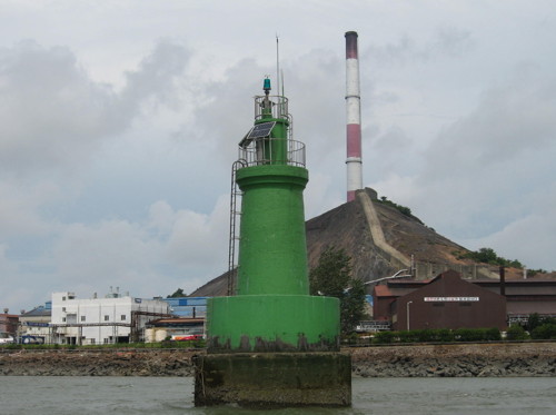
Jeonmangsan Light
Jeonmangsan Light, Janghang
Gunsan Oceans and Fisheries Administration photo
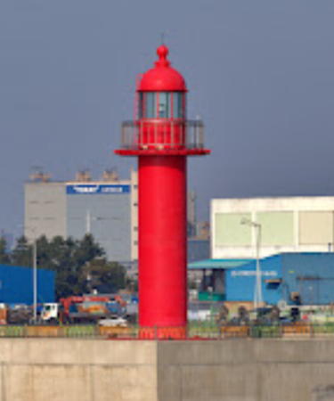
Gunsan (Kunsan) City Lighthouses

Gunsan is a seaport of about 2.8 million residents. (Although the official English spelling is now Gunsan, the name of the seaport is often spelled Kunsan online.) The city is a heavy industrial zone and also the site of a U.S. Air Force base.
* Bieungdo Hang East Breakwater (2)
2008. Active; focal plane 14 m (46 ft); red flash every 5 s. 12 m (39 ft) round concrete tower with three ribs, lantern and gallery. Entire lighthouse is red. A 2018 view from the sea is available, Jeon Nam-gyu has a 2021 photo, Dong-Hyung Han has a 2013 photo of the East and West Breakwater Lights in action, and Google has a satellite view. The breakwater was extended in 2019-20 and the lighthouse was relocated to the new pierhead. Located at the end of the east breakwater of a small boat harbor at Bieungdo, at the northern end of the Saemangeum Seawall. Accessible by walking the pier. Site open, tower closed. KR-3170.1; Admiralty M4192.52; NGA 17756.6.
* #Bieungdo Hang West Breakwater (2)
2008. Replaced. This was a 12 m (39 ft) round concrete tower with three ribs, lantern and gallery. Entire lighthouse was white. A photo is at right and Dong-Hyung Han has a 2013 photo of the East and West Breakwater Lights in action. The breakwater was shortened in 2019-20 and the lighthouse was replaced by a 7 m (23 ft) steel post (focal plane 14 m (46 ft); green flash every 5 s) as seen in Lee Jong-sik's 2022 photo. Google has a satellite view. Located at the end of the east breakwater of a new small boat harbor at Bieungdo. Accessible by walking the pier. Site open, tower closed. Active light: KR-3170.2; Admiralty M4192.51; NGA 17756.7.
* Bieungdo Hang South Breakwater
2019 or 2020. Active; focal plane 14 m (46 ft); three green flashes every 7 s. 12 m (39 ft) round concrete tower with lantern and gallery. Entire lighthouse is white. Seo Min-goo has a 2021 photo, Lee Jong-sik has a distant 2022 photo and Google has a satellite view. Located at the end of the south (outer) breakwater of a new small boat harbor at Bieungdo. Accessible by walking the pier. Site open, tower closed. KR-3170.3; Admiralty M4192.501.
#Bieungdo
Date unknown. Inactive since 2012 at least and demolished in 2013-14. This was a 13 m (43 ft) round cylindrical concrete tower with lantern and gallery, painted white. A 2012 photo and a 2013 photo are available but Google's satellite view confirms the removal of the lighthouse. The lighthouse stood in front of the very tall harbor control tower seen in the satellite view. This light formerly marked the south side of the entrance to Gunsan harbor, but the shallows east of Bieungdo have recently been filled for industrial development. The outer breakwater light has replaced the Bieungdo lighthouse as the entrance light for the harbor. Located on what was a small island (now connected to the mainland). Site status unknown (industrial area). ex-Admiralty M4193; ex-NGA 17764.

Bieungdo West Breakwater Light (now lost), Gunsan, June 2013
U.S. Air Force photo
Gunsan Sinhang South Breakwater
2010. Active; focal plane 20 m (66 ft); red flash every 6 s. 19 m (62 ft) round cylindrical concrete tower with lantern and gallery, mounted on a round concrete base. Entire lighthouse is red. Karla Velasco's photo is at right, another photo is available, a nighttime photo shows this light and the next one both floodlit, and Google has a satellite view. Located at the end of the breakwater on the south side of the entrance to Gunsan. Site status unknown. KR-3170.10; Admiralty M4193.2; NGA 17758.1.
Gunsan Outer Breakwater South End
Date unknown. Active; focal plane 21 m (69 ft); green flash every 6 s. 20 m (66 ft) round cylindrical concrete tower with lantern and gallery, painted white. A closeup photo is available, a nighttime photo shows this light and the previous one both floodlit, and Bing has a satellite view. This light marks the north side of the entrance into Gunsan (Kunsan). Located at the southwestern end of the detached breakwater that protects Gunsan harbor from northwesterly winds. Accessible only by boat. Site and tower closed. KR-3170.6; Admiralty M4193.3; NGA 17757.
Gunsan Outer Breakwater North End
Date unknown. Active; focal plane 21 m (69 ft); yellow flash every 6 s. 20 m (66 ft) round cylindrical concrete tower with lantern and gallery, painted yellow. A closeup photo is available and Google has a satellite view. Located at the northeastern end of the detached breakwater. Accessible only by boat. Site and tower closed. KR-3170.7; Admiralty M4193.35; NGA 17757.1.
Myeongam Westward
Date unknown. Active; focal plane 19 m (62 ft); two white flashes every 10 s. 25 m (82 ft) round concrete tower with gallery, painted black with a red horizontal band. The gallery is reached by a stairway spiralling around the tower. No photo available but Bing has a satellite view. Located on a shoal in the entrance to Gunsan, inside the outer breakwater. Accessible only by boat. Site and tower closed. KR-3170.8; Admiralty M4193.38; NGA 17758.5.
Gunsan Hang South Breakwater Light
Gunsan Sinhang South Breakwater Light, Gunsan, July 2010
Flickr photo copyright Karla Velasco; used by permission
Myeongam Breakwater
Date unknown. Active; focal plane 16 m (52 ft); nine quick white flashes every 15 s. 18 m (59 ft) round concrete tower with double gallery, painted yellow with a black horizontal band. No photo available but Google has a satellite view. The lighthouse was formerly green but it has been converted to a "west cardinal" light to guide smaller vessels entering from the north. Located on a reef at the end of the north breakwater of Gunsan harbor. Accessible only by boat. Site open, tower closed. KR-3170.9; Admiralty M4193.5.
Gunsan Hang Wharf No. 7 (No. A)
Date unknown. Active; focal plane 13 m (43 ft); four yellow flashes every 8 s. 8 m (26 ft) round yellow fiberglass tower. No photo available but Google has a satellite view. Located on the westernmost wharf on the south side of Gunsan harbor. Site and tower closed. KR-3186.1; Admiralty M4193.6; NGA 17761.
Gunsan Daewoo Breakwater Southwest End
2021 or 2022. Active; focal plane about 16 m (52 ft); yellow light, pattern unknown. Approx. 12 m (38 ft) round concrete tower. No photo available but Google has a satellite view. Located on the southwest end of a detached breakwater about 1.6 km (1 mi) east of the Wharf No. 7 light. Site and tower closed. Admiralty M4193.7.
Gunsan Daewoo Breakwater Northeast End
2021 or 2022. Active; focal plane about 16 m (52 ft); yellow light, pattern unknown. Approx. 12 m (38 ft) round concrete tower. No photo available but Google has a satellite view. Located on the northeast end of the detached breakwater about 1.6 km (1 mi) east of the Wharf No. 7 light. Site and tower closed. Admiralty M4193.75.
Gunsan Hang Eulho (Gunsan Hang Ulho)
Date unknown. Active; focal plane 14 m (46 ft); red flash every 4 s. 15 m (49 ft) round concrete tower with lantern and gallery. Entire lighthouse is red. No photo available but Google has a satellite view. This light marks the end of a submerged reef on the south side of the fairway in Gunsan harbor. Located about 400 m (1/4 mi) off the quays on the south side of the harbor. Accessible only by boat. Site open, tower closed. KR-3189; Admiralty M4196; NGA 17772.
Gunsan Jangsando (Changsando)
Date unknown. Active; focal plane 17 m (56 ft); red flash every 5 s. 14 m (46 ft) hexagonal concrete tower, centered on a square 1-story base. Entire lighthouse is red. No photo available but Google has a satellite view. Located at the entrance to one of the basins of Gunsan harbor. Site status unknown (industrial area). KR-3196; Admiralty M4197; NGA 17780.
Gunsan Jangsando Outer
2021. Active; focal plane 13 m (43 ft); nine quick white flashes every 15 s. 13 m (43 ft) round concrete tower painted yellow with a black horizontal band. No photo available but Google has a satellite view. The Admiralty lists this light as "Outer Port," confusing since it is in the inner harbor of Gunsan. Located on a shoal on the east side of the entrance to one of the basins of Gunsan harbor. Accessible only by boat. Site status unknown. KR-3196.1; Admiralty M4197.5.
Byeongho (Pyongho) (2)
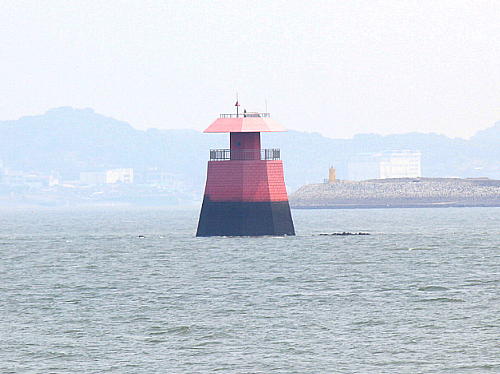
Date unknown. Active; focal plane 11 m (36 ft); two red flashes every 6 s. 11 m (36 ft) octagonal concrete tower on a robust octagonal pyramidal pier. Lighthouse is red with a black base. An MOF photo is at right, Joo Hwan Lee has a distant street view from shore, and Google has a satellite view. This lighthouse replaced a round tower. Located on a shoal on the south side of the Gunsan harbor channel. Accessible only by boat. Site status unknown. KR-3200; Admiralty M4198; NGA 17788.
Geumrando
2021. Active; focal plane 9 m (30 ft); quick-flashing white light. 9 m (30 ft) round concrete tower, upper half painted black and lower half yellow. No photo available but Google has a satellite view. The light guides ships into a narrow channel on the south side of Geumrando, a long island currently under development. Located on a shoal off the west end of Geumrando. Accessible only by boat. Site status unknown. KR-3207.1; Admiralty M4198.3.

Byeongho Light, Gunsan
Gunsan Oceans and Fisheries Administration photo
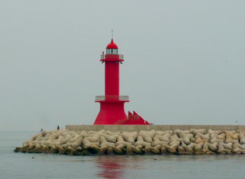
Haemangdong
Date unknown. Active; focal plane 10 m (33 ft); twp green flashes every 6 s. Approx. 6 m (20 ft) round white concrete tower. No photo available but Google has a satellite view. Located on a pier in the Haemang neighborhood on the channel south of Geumrando. KR-3207.5; Admiralty M4201; NGA 17795.
Gunsan Groyne North Head
Date unknown. Active; focal plane 31 m (102 ft); red flash every 4 s. 20 m (66 ft) square pyramidal red concrete tower, built with a strong slant to the west. Yun Sik Hwang has a distant view from the Dongbaek Bridge over the harbor and Google has a satellite view and a street view from the top of the tower. Located at the northeastern tip of Geumrando, an island on the south side of Gunsan harbor. Accessible only by boat, but there is a good view from the Gunsan Bridge. Site status unknown. KR-3207; Admiralty M4202; NGA 17796.
Minya Am
Date unknown. Active; focal plane 13 m (43 ft); two white flashes every 10 s. 11 m (36 ft) round concrete tower, painted black with one red horizontal band. No photo available but Google has a satellite view. Located on a rocky reef near the south bank of the Geum River in western Gunsan. Accessible only by boat. Site open, tower closed. KR-3208; Admiralty M4204; NGA 17800.

Seocheon County Lighthouses

Janghang Town Lighthouses
Janghang is a town of about 12,000 residents facing the seaport of Gunsan across the Geum River estuary.

Jeonmangsan (Chonmang San)
2002. Active; focal plane 11 m (36 ft); green flash every 4 s. 13 m (43 ft) round cylindrical concrete tower mounted on a round concrete pier. Entire lighthouse is green. A photo is at the top of this page and Bing has a satellite view. Located just off the Janghang waterfront on the north side of Gunsan harbor. Accessible only by boat, but there must be good views from shore. Site open, tower closed. Admiralty M4199; NGA 17792.
Janghang Hang South Breakwater
2016. Active; focal plane 13 m (43 ft); red flash every 5 s. 12 m (39 ft) round concrete tower with three ribs, lantern and gallery. Entire lighthouse is red. A photo is available, Choi Sang-deok has a photo showing both lighthouses, and Google has a satellite view. Located on the south breakwater of Janghang. May be accessible by walking the pier. Site status unknown. KR-3218; Admiralty M4198.91; NGA 17789.7.
Janghang Hang North Breakwater
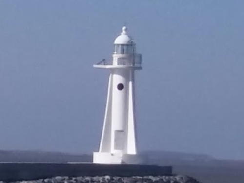
2016. Active; focal plane 13 m (43 ft); green flash every 5 s. 12 m (39 ft) round concrete tower with three ribs, lantern and gallery. Entire lighthouse is white. Choi Sang-deok has a photo showing both lighthouses (the photo at right comes from his image) and Google has a satellite view. Located on the north breakwater of Janghang. May be accessible by walking the pier. Site status unknown. KR-3217; Admiralty M4198.92; NGA 17789.6.

North Breakwater Light, Janghang, February 2017
Google Maps photo by Choi Sang-deok

Seo Township Lighthouses
These lighthouses are all in the village of Maryang, which occupies a peninsula projecting into the Yellow (West) Sea far enough to reach water deep enough for navigation.
* Biin Hang North Breakwater
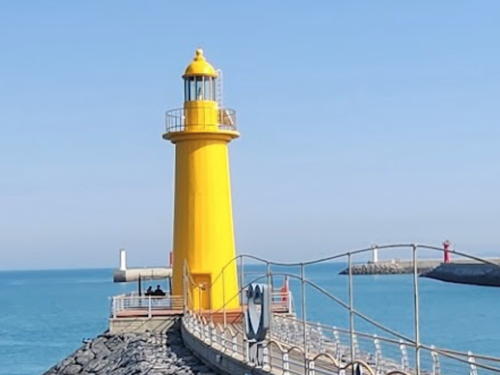
2011. Active; focal plane 13 m (43 ft); two yellow flashes every 6 s. 10 m (33 ft) round concrete tower with lantern and gallery, painted yellow. A 2023 photo is at right, the light is seen in Cho Sun Young's photo and at the right of another photo showing the west breakwater light, and Google has a satellite view. Located at the end of the new north breakwater at Biin, a small port at the end of a sand spit just north of the mouth of the Geum River. Accessible by walking the pier. Site open, tower closed. KR-3235.5; Admiralty M4187.61.
Biin Hang West Breakwater
2007. Active; focal plane 13 m (43 ft); red flash every 5 s. 10 m (33 ft) round concrete tower, painted red. Cho Sun Young has a 2018 photo and Google has a satellite view. Located at the south end of the detached west breakwater at Biin. Accessible only by boat. Site open, tower closed. KR-3229.1; Admiralty M4187.52; NGA 17809.
* Biin Hang East Breakwater
2007. Active; focal plane 14 m (46 ft); green flash every 5 s. 10 m (33 ft) round concrete tower, painted white. Cho Sun Young has a 2018 photo also showing the west breakwater light, and Google has a satellite view. Located at the end of the east (really south) breakwater at Biin. Accessible by walking the pier. Site open, tower closed. KR-3229.2; Admiralty M4187.53; NGA 17810.
Biin Hang Detached Breakwater North End
2011. Active; focal plane 13 m (43 ft); green flash every 6 s. 10 m (33 ft) round cylindrical concrete tower. Entire lighthouse is white. The lighthouse is on the left in a photo and a similar photo and Google has a satellite view. Located the north end of a short detached breakwater protecting the south entrance to the harbor. Accessible only by boat. Site open, tower closed. KR-3235.3; Admiralty M4187.63.

North (Breakwater Lights, Biin, May 2023
Google Maps photo by solhyang-gi
Biin Hang Detached Breakwater South End
2011. Active; focal plane 13 m (43 ft); red flash every 6 s. 10 m (33 ft) round cylindrical concrete tower. Entire lighthouse is red. The lighthouse is on the right in a photo and a similar photo and Google has a satellite view. Located the south end of a short detached breakwater protecting the south entrance to the harbor. Accessible only by boat. Site open, tower closed. KR-3235.4; Admiralty M4187.65.
Biin Hang Approach
2014. Active; focal plane 18 m (59 ft); six quick white flashes and one long white flash every 15 s. 22 m (72 ft) round cylindrical concrete tower painted yellow with one black horizontal band. No photo available but Google has a satellite view. Located about 2 km (1.3 mi) west of Biin harbor. Accessible only by boat. Site open, tower closed. KR-3235.6; Admiralty M4187.48.
Gwangam
2002. Active; focal plane 13 m (43 ft); red flash every 5 s. 15 m (49 ft) round cylindrical concrete tower centered on a round concrete pier. Entire lighthouse is red. No photo available but Google has an indistinct satellite view. Located on a skerry about 1 km (0.6 mi) northwest of Hongwon harbor. Accessible only by boat. Site open, tower closed. KR-3232.1; Admiralty M4189.9; NGA 17803.
* Hongwon Hang West Breakwater
Date unknown. Active; focal plane 18 m (59 ft); two red flashes every 6 s. 11 m (36 ft) round concrete tower, painted red. A closeup photo is available and Google has a satellite view. NGA misspells the name of this light as Hangwon. Located at the end of the west (main) breakwater at Hongwon, a small port 4 km (2.5 mi) north of Biin. Probably accessible by walking the pier. Site open, tower closed. KR-3232; Admiralty M4189.31; NGA 17825.7.
* Hongwon Hang East Breakwater
Date unknown. Active; focal plane 13 m (43 ft); two green flashes every 6 s. 11 m (36 ft) round concrete tower, painted white. Seungbum Lee has a 2021 photo, a distant view of this light and the Marina light (next entry) is available and Google has a satellite view. Located at the original end of the east breakwater at Hongwon. Accessible by walking the pier. Site open, tower closed. KR-3231; Admiralty M4189.3; NGA 17825.5.
* Hongwon Marina
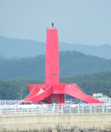
2010. Active; focal plane 17 m (56 ft); red flash every 6 s. 15 m (49 ft) semielliptical concrete tower, the lower portion surrounded by an observation deck accessed by three sweeping stairways. Entire lighthouse is red. A photo is at right, Choi Kwiho has a photo, a distant view is available, and Google has a satellite view. Located at the end of a new breakwater attached to the former end of the Hongwon East Breakwater. Accessible by walking the pier. Site open, tower closed. KR-3231.1; Admiralty M4189.32; NGA 17825.6.
Hongwon Marina Light
Hongwon Marina Light, August 2011
photo copyright kwangsik; used by permission

Information available on lost lighthouses:

Notable faux lighthouses:

Adjoining pages: North: Boryeong Area | West: Okdo Islands | South: Gochang and Buan Counties

Return to the Lighthouse Directory index | Ratings key

Posted January 9, 2008. Checked and revised May 13 2023. Lighthouses: 33. Site copyright 2023 Russ Rowlett and the University of North Carolina at Chapel Hill.