The Republic of the Marshall Islands is located in the central Pacific Ocean near the Equator and the International Date Line. The country includes 29 atolls and five isolated islands arranged in two roughly parallel groups, the Ratak (sunrise) and Ralik (sunset) chains. The capital is at Majuro, an atoll in the central part of the Ratak chain. The population is roughly 60,000, nearly half living at Majuro.
The islands were controlled by Spain until the Spanish-American War of 1898. Following that war Spain transferred the islands to Germany. Japan seized the islands from Germany in 1915, during World War I, and moved quickly to make several of them naval bases. The U.S. took the islands from Japan in very hard fighting during World War II.
After the war the U.S. administered the islands as part of the Trust Territory of the Pacific Islands. The country became self governing in 1979 and independent in 1986. The new country signed a Compact of Free Association with the United States. Under the Compact the United States provides economic and financial aid and defends the RMI's territorial integrity. In return, the RMI provides the Untied States with unlimited and exclusive access to its land and waterways for strategic purposes.
Navigational aids in the Marshall Islands are maintained by Republic of the Marshall Islands Port Authority (RMIPA).
ARLHS numbers are from the ARLHS World List of Lights. Admiralty numbers are from volume M of the Admiralty List of Lights & Fog Signals. U.S. NGA List numbers are from Publication 111.
- General Sources
- Online List of Lights - Marshall Islands
- Photos by various photographers posted by Alexander Trabas.
- Google Maps
- Satellite view of the islands.

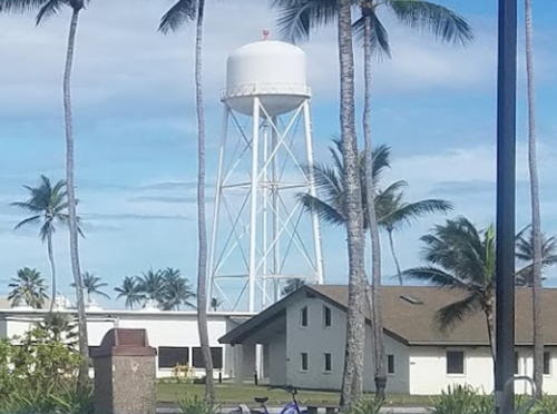
Kwajalein Light, Kwajalein, June 2019
Google Maps photo by Scott Masingill