The Republic of Perú occupies the central west coast of South America, between Chile on the south and Ecuador on the north. It has a lengthy coastline (about 2400 km or 1500 mi) on the Pacific Ocean. The coast is guarded by a large number of lighthouses, mostly concrete towers of relatively modern design. There is also navigation on Lake Titicaca in the southeastern corner of the country and on the upper Amazon River in the northeastern corner.
Information about whether many of these light stations are accessible to the public has been hard to find; special thanks are due to José Balta Varillas for his reports from some of the lighthouses and to Martin Berendsen Leigh and Alessandro Catenazzi for information on several light stations. Tourism is not well developed on the Peruvian coast except for a few sites favored by surfers. A large part of the coast is not accessible by road. Callao, near Lima, is a major seaport, but most of the other ports are quite small.
Some of Perú's lighthouses are located in natural protected areas. A permit from the natural areas protection agency Sernanp is required to visit these lights. Sometimes, these areas are islands under the management of AgroRural, a public corporation that mines the guano deposits produced by seabirds nesting on the islands.
Perú is divided into 25 regions (regiones) plus the Department of Lima for the national capital area. This page includes lighthouses of Perú from the Chilean border northward through the metropolitan Lima area.
The Spanish word for a lighthouse is faro; isla is an island, cabo is a cape, punta is a promontory or point of land, péñon is a rock, arrecife is a reef, bahía is a bay, ría is an estuary or inlet, estrecho is a strait, río is a river, and puerto is a port or harbor. Also, the Spanish word canal means a natural channel, not an artificial canal.
Lighthouses in Perú are owned by the navy (Marina de Guerra del Perú) and managed by the navy's Dirección de Hidrografía y Navegación (DHN) through its Departamento de Señalización Nautica. DHN also manages the lights on the Amazon and on Lake Titicaca.
ARLHS numbers are from the ARLHS World List of Lights. DHN numbers are from DHN's Lista de Faros y Señales Nauticas; Admiralty numbers are from volume G of the Admiralty List of Lights & Fog Signals. U.S. NGA numbers are from Publication 111.
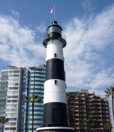
La Marina Light, Miraflores, June 2013
Wikimedia Creative Commons photo by
Mira4espina78y
