Lighthouses of Sweden: Lake Vänern

The Kingdom of Sweden (Sverige in Swedish) is the largest country of northern Europe, occupying the entire west coast of the Baltic Sea. Along with its lengthy coast Sweden has a distinguished lighthouse history and a good record of preserving its historic lights. The Swedish Lighthouse Society (Svenska Fyrsällskapet) works actively for the preservation of the lighthouses.

Lake Vänern, in southern Sweden, is Europe's third largest lake (after Russia's Lakes Ladoga and Onega). Lake Vänern and its smaller neighbor Lake Vättern are linked by canals of an inland waterway that connects Göteborg on the Kattegat to Mem on the Baltic Sea. With a surface about 44 m (144 ft) above sea level, Lake Vänern is connected to the Kattegat by the Göta Alv river and the Trollhätte Canal and to the Baltic (via Lake Vättern) by the Göta Canal.

The listing on this page is counterclockwise around the lake starting at Kristinehamn at the northeast corner.

The Swedish word for a lighthouse is fyr. The front light of a range is the nedrefyr (lower light) and the rear light is the övrefyr (upper light). Ö is an island, holme is an islet, skär is a skerry (a tiny island or rocky reef), sund is a strait (often between an island and the mainland), vik is a bay, hav is a sea, udde is a headland, and hamn is a harbor.

Aids to navigation in Sweden are maintained by the Swedish Maritime Administration (Sjöfartsverket).

ARLHS numbers are from the ARLHS World List of Lights; SV numbers are from the Sjöfarsverket light list (Svenska Fyrlista) as reported by the Swedish Lighthouse Society. Former Admiralty numbers are from volume C of the Admiralty List of Lights & Fog Signals (the Admiralty decided in 2014 to drop these lights from its listings). The lighthouses of the lake are not included on the NGA List.

Special thanks to Alexander Trabas. He formerly had a page for the lake's lighthouses in his invaluable Online List of Lights. Because the Admiralty no longer lists the lights that page has been removed, but he has continued to make the individual photos available.

General Sources
Swedish Lighthouse Society (Svenska Fyrsällskapet, SFA)
The Society is active in promoting the preservation of Swedish lighthouses.
Venerns Seglationsstyrelse
Information on Lake Vänern lighthouses posted on the SFA website.
Mariestads Fyrsällskap
Web site of the Mariestad Lighthouse Society, with information of the lights of that harbor.
Leuchttürme und Leuchtfeuer in Schweden - Svenska Fyrar
A large collection of photos and data posted by Erich Hartmann; text in German.
World of Lighthouses - Sweden
Photos by various photographers available from Lightphotos.net.
Schwedische Leuchttürme auf historischen Postkarten
Historic postcard views posted by Klaus Huelse.
Navionics Charts
Navigation chart information for Lake Vänern.


Söököjan Light, Hammarö
SFA Creative Commons photo from the Hammarö Skärgårdsmuseum
North Coast (Värmland County) Lighthouses

Kristinehamn Area Lighthouses
Kristinehamn is a town of about 18,000 residents at the northeastern corner of the lake.
Lakholmen (2)
1911 (station established 1870). Active; focal plane 16 m (52 ft); four flashes every 12 s, white, red or green depending on direction. 13 m (43 ft) square cylindrical tower with lantern and gallery, attached to a 1-story keeper's cottage. Lighthouse painted white; house painted red with white trim. Ingela Eriksson has a photo, Pär Ericsson has a winter photo, and Google has a satellite view. Located about 2.5 km (1.5 mi) west of Brattsand. Accessible only by boat. Site status unknown. . SV-9739; ex-Admiralty C6714.
* Strandudde Nedre
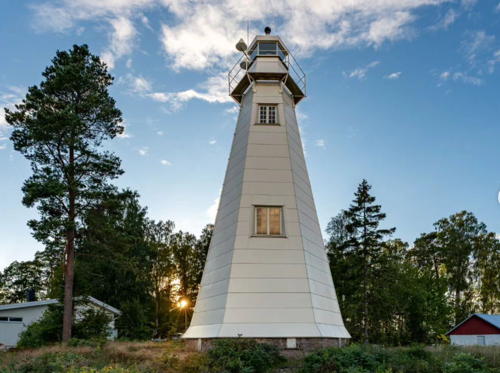
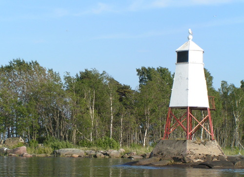
1940. Active; focal plane 9 m (30 ft); white light, 0.75 s on, 0.75 s off. Approx. 8 m (26 ft) square cylindrical wood tower, painted white. The light is shown through a square window. SFA has a page for the range lights, Trabas has a photo, Tomas Hermann has a 2020 photo, Mats Karlsson has a 2021 photo showing both range lights, Huelse has a historic postcard view, and Google has a satellite view. Located in a small park on the east side of the entrance to Kristinehamn, at the northeast corner of the lake. Site open, tower closed. SV-9752; ex-Admiralty C6715.
* Strandudde Övre (2)
1940 (station established 1866). Active; focal plane 20 m (66 ft); white light, 0.75 s on, 0.75 s off. 11 m (36 ft) square cylindrical wood tower attached to one end of a 1-story wood keeper's house. The light is shown from a small platform perched atop the tower. Tower painted white, house red with white trim. Google's 2022 street view is at right, SFA has a page for the range lights, Karin Masannek has a 2023 photo, Trabas has a photo, Mats Karlsson has a 2021 photo showing both range lights, and Google has a satellite view. Located about 175 m (190 yd) northeast of the front light. Site open, tower closed. SV-9752.01; ex-Admiralty C6715.001.

Strandudde Övre Light, Kristinehamn, July 2022
Google Maps street view

Hammarö Area Lighthouses
Hammarö is a town of about 16,000 at the north end of the lake.

Söököjan (2)
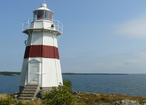
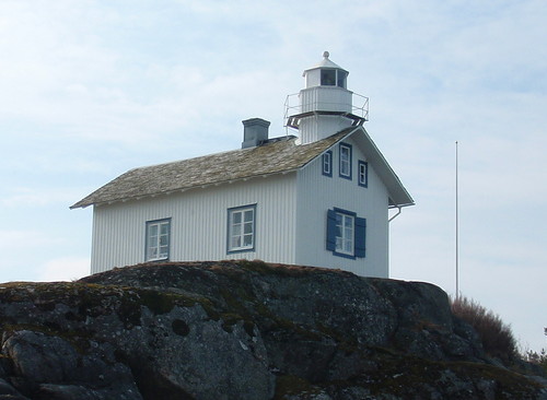
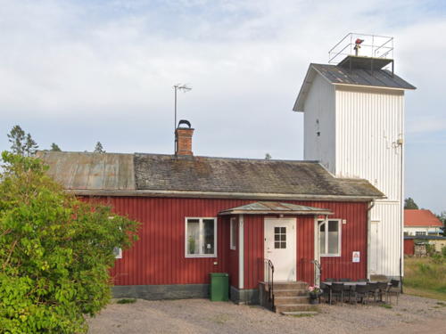
1866 (station established 1860). Active; focal plane 15 m (49 ft); four long (2 s) flashes every 30 s, white, red or green depending on direction. 15 m (49 ft) octagonal cylindrical tower with lantern and gallery, rising from one end of a 1-1/2 story wood keeper's house. Tower painted white, house red. Leif Elsby's photo is at the top of this page,Veronica Nellebo has a 2021 photo, a nice view from the lake is available, Trabas also has a distant view, and Google has a satellite view. The original light was a small lantern fixed to the gable of the house. Located on an island in the northeastern corner of the lake, about 3 km (2 mi) east of Rud. Accessible only by boat. Site status unknown. ARLHS SWE-360; SV-9680; ex-Admiralty C6712.711.
* Mårrholmen
1895. Active; focal plane 11 m (36 ft); flash every 3 s, white, red or green depending on direction. 7 m (23 ft) round tower with lantern, painted white. Trabas has a photo and Google has a satellite view. Mårrholmen is an inhabited island in the entrance to the harbor of Karlstad. Located at the northeastern end of the island. Site status unknown. SV-9697; ex-Admiralty C6713.28.
* Hammarö Skage
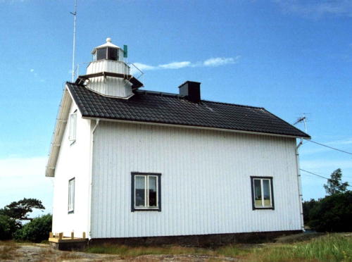
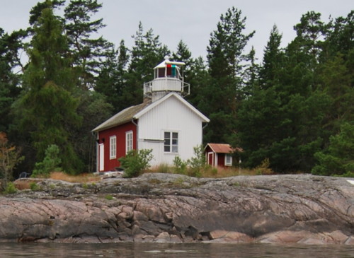
1872. Inactive since 1932. 8 m (26 ft) octagonal cylindrical tower with lantern and gallery, rising from one end of a 1-1/2 story wood keeper's house. Tower and lake side of the house painted white as a continuing daymark; the rest of the house is painted red. Pascal Ebel has the 2020 photo seen at right, SFA has a page for the lighthouse, Dennis Lind has a 2017 photo, Anders Bostrom has a 2008 aerial photo, Daniel Frost has a photo, another good photo is available, Huelse has a historic postcard view, and Google has a satellite view. This lighthouse was built on the same plan as the Söököjan lighthouse (see above). After deactivation the lighthouse was acquired by a private lighthouse society. Located at the tip of a peninsula projecting southward into the lake, about 6 km (3.5 mi) southeast of Hammarö. Site open, building closed except for guests of the society. Owner/site manager: Föreningen Fyrtornet. . ARLHS SWE-175; ex-SV-9703.
Skoghall (3)
1935 (?) (station established 1804). Active; focal plane 17 m (56 ft); two long flashes every 15 s, white, red or green depending on direction. 15 m (49 ft) octagonal wood tower with lantern and gallery, painted white. SFA has a page for the lighthouse, Trabas has a photo, Huelse has a historic postcard view, and Google has a satellite view. The original light, the first light built on the lake, was replaced in 1855. Located within a paper mill on the tip of a peninsula at the entrance to the harbor of Skoghall, on the west side of Hammarö. Site and tower closed. Site manager: Stora Enso. ARLHS SWE-348; SV-9662; ex-Admiralty C6711.
Risnäsudde (2)
1935 (?) (station established 1867). Active; focal plane 9 m (30 ft); three flashes every 9 s, white, red or green depending on direction. 9 m (30 ft) round cylindrical concrete tower with lantern and gallery, painted white. SFA has a page for the lighthouse, Trabas has a photo, Andreas Köhler has a 2017 photo, and Google has a satellite view. Located on a point of land on the west side of the entrance to the arm of the lake leading to Grums, about 5 km (3 mi) south southeast of the town. Site open, tower closed. ARLHS SWE-322; SV-9615; ex-Admiralty C6798.5.

Hammarö Skage Light, Hammarö, August 2020
Google Maps photo by Pascal Ebel

Säffle (Värmlandsnäs) Area Lighthouses
Värmlandsnäs is a peninsula projecting into the northwestern section of Lake Vänern.
* Stavik (Staviken, Stavikens)
1860. Active; focal plane 15 m (49 ft); white flash every 5 s. 13.5 m (44 ft) hexagonal wood-shingled tower with lantern and gallery, painted white. A 2018 photo is at right, Hartmann has a page for the light, SFA also has a page, Trabas also has a closeup, a 2022 photo is available, Huelse has a historic postcard view showing the small keeper's cottage, and Google has a satellite view. This light station has been occupied by the same family since its establishment. After the last keeper retired from the house in 1973, the family rented the property as a summer home. In 2003 the current generation, Anna-Lena and Gunno Quist, purchased the station and completely restored the lighthouse. The new wood siding replaced concrete tiles that had covered the tower since the 1950s. The Sjöfartsverket continues to operate the light. In 2007 the family offered the station for rent for vacationers. Located on a point of land on the west side of the lake near the base of the Värmlandsnäs peninsula, about 7 km (4.5 mi) east of Värmlandsbro; accessible by a gravel road (4WD recommended). Site open, tower closed. Owner/site manager: Stavikens Fyr . ARLHS SWE-367; SV-9611; ex-Admiralty C6798.
Måkskär (2)
date unknown (station established 1935). Inactive since 2013. 7.5 m (25 ft) round stone tower, painted red. SFA has a page for the lighthouse and Google has a satellite view. This lighthouse replaced a skeletal tower. Located on a reef 2.5 km (1.5 mi) east northeast of the Stora Klubben lighthouse (next entry). Accessible only by boat. Site open, tower closed. SV-9459; ex-Admiralty C0415.55.
Stora Klubben (3)
1935 (station established 1853). Active; focal plane 16 m (52 ft); flash every 5 s, white, red or green depending on direction. 4.5 m (15 ft) octagonal wood lighthouse with lantern, painted white. SFA has a page for the lighthouse and Google has a satellite view. This light was relocated from Bastungen, near Vänersborg, in 1935. Located on an small island just off the southern tip of the Värmlandsnäs peninsula about 6 km (3.5 mi) north of the Stångudden lighthouse. Accessible only by boat. Site open, tower closed. ARLHS SWE-372; SV-9392; ex-Admiralty C0415.37.
Gunnarsholmen Nedre (2?)
1960 (station established 1854). Active; focal plane 8 m (26 ft); white light, 2 s on, 2 s off. 4 m (13 ft) octagonal pyramidal wood tower, painted white; the light is now displayed from the peak of the roof. SFA has Esjörn Hillberg's photo and Google has a satellite view. The previous light was relocated to Åmal in 1960 (see below). Located on an small island off the southwestern side of the Värmlandsnäs peninsula about 5 km (3 mi) northwest of the Stångudden lighthouse. Accessible only by boat. Site open, tower closed. SV-9377; ex-Admiralty C0415.35.

Staviken Light, Värmlandsnäs, March 2018
Instagram photo by gizzezfikaochsurdeg
Gunnarsholmen Övre (2)
1878 (station established 1852). Active; focal plane 12 m (39 ft); quick-flashing light, white or red depending on direction. Approx. 9 m (30 ft) light tower with lantern and gallery, attached to a 1-1/2 story keeper's house. Entire lighthouse painted white. SFA has a page for the lighthouse and Google has a satellite view. Located about 100 m (330 ft) northeast of the front light. Accessible only by boat. Site open, tower closed. ARLHS SWE-164; SV-9377.01; ex-Admiralty C0415.351.
** Duseudde (Säffle)
1867. Active; focal plane 19 m (62 ft); three flashes every 10 s, white, red or green depending on direction. Approx. 9 m (30 ft) square lantern room mounted at the gable of a 1-1/2 story wood keeper's house. The house is painted red, but the lake side is painted white as a daymark. A 2023 photo is at right, SFA has a page for the lighthouse, Svend Ole Kvilesjø has a photo, Pontus Rååd has a 2016 closeup, Trabas has a good closeup, Wikimedia has a photo of the station, and Google has a satellite view. The lighthouse has been expanded to house a restaurant, part of a large and popular campground. Located on a point of land about 5 km (3 mi) southwest of Säffle, on the north coast of an embayment called the Dalbosjön. Site open, tower closed. Site manager: Duse Udde Camping (Fyren Restaurant & Café) . ARLHS SWE-118; SV-9291; ex-Admiralty C0415.253.

Djurö Lighthouse
Djurö (2)
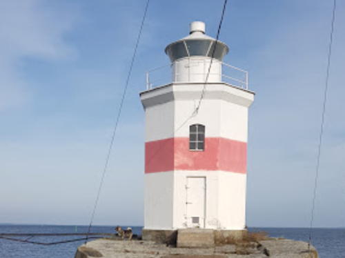
1912 (station established 1874). Active; focal plane 18 m (59 ft); two flashes every 10 s, white or red depending on direction. 13 m (43 ft) octagonal cylindrical stone tower with lantern and gallery. Lighthouse painted white with two narrow red horizontal bands. Bo Björk has a 2021 closeup photo and Google has a satellite view. The original light was a lantern mounted on the keeper's house. Djurö, an island near the center of the lake, has been a national park since 1991. Located at the northeastern point of the island. The island is accessible only by boat; a hiking trail leads to the lighthouse. Site open, tower closed. Site manager: Djurö National Park. ARLHS SWE-115; SV-9463; ex-Admiralty C0415.555.

Lurö Area Lighthouses
** Trädgårdsholmen (relocated to Lurö)
1863. Inactive. Octagonal lantern room mounted on a gable of a 1-1/2 story wood keeper's house. Lighthouse painted red with white trim. Google has a satellite view. This lighthouse was deactivated in 1915 and relocated to Ekenäs in the 1930s. It was relocated a second time to Lurö in the early 1990s; in 1995-96 it was rebuilt, with additional rooms and a new faux lantern, as part of a resort development. The house is available for overnight accommodations. Located on the west side of Lurö, about 2 km (1.25 mi) northwest of the active Stångudden lighthouse. Accessible only by boat. Site open, lighthouse open to paying guests. Owner/site manager: Lurö Gästhärbärge och Krog. ARLHS SWE-395.

Duseudde Light, Säffle, August 2023
Google Maps photo by Luigi DiL.
Stångudden (Lurö) (2)
1905 (station established 1864). Active; focal plane 15 m (49 ft); white, red or green light, depending on direction, occulting once every 10 s. 8 m (26 ft) round light tower with lantern and gallery, mounted atop the gable of a 1-1/2 story wood keeper's house. Entire lighthouse painted white. Esbjörn Hillberg's photo, seen at right, is from SFA's page for the lighthouse, Stefan Viklund has a photo, Magnus Barkelund has a street view, and Google has a satellite view. The area is a nature reserve. Located on the southeast side of Lurö off the southern tip of the Värmlandsnäs peninsula and about 8 km (5 mi) northeast of the Pålgrunden lighthouse. Accessible only by boat. Site open, tower closed. ARLHS SWE-366; SV-9446; ex-Admiralty C0415.49.
 
Lilla Bratten
1906. Active; focal plane 13 m (43 ft); two flashes every 6 s, white, red or green depending on direction. 6 m (20 ft) octagonal pyramidal wood tower with lantern and gallery, painted white. SFA has a page for the lighthouse, Martin Sandmark has a 2021 photo, and Google has a satellite view. Located on an small island off the northeastern side of Lurö. Accessible only by boat. Site open, tower closed. SV-9452; ex-Admiralty C0415.52.
Lurö Röskär
1915. Active; focal plane 9 m (30 ft); two flashes every 6 s, white, red or green depending on direction. 8 m (26 ft) round concrete tower with lantern and gallery; the light is now displayed from a short mast atop the lantern. Lighthouse painted white. SFA has a page for the lighthouse, Stefan Viklund has a photo, and Google has a satellite view. Located on a skerry about 7 km (4.5 mi) south of the tip of the Värmlandsnäs peninsula. Accessible only by boat. Site open, tower closed. SV-9449; ex-Admiralty C0415.5.

Stångudden Light, Lurö, September 2014
SFA Creative Commons photo by Esbjörn Hillberg
 

South Coast (Västra Götaland County) Lighthouses

Åmål and Mellerud Area Lighthouses
* Åmål (Mål) (3) Nedre
Date unknown (station established 1891). Active; focal plane 5 m (17 ft); continuous red light. 5 m (17 ft) octagonal pyramidal wood tower with lantern. Lighthouse painted white; lantern roof is gray metallic. SFA has a page for the lighthouse, Trabas has a photo, another photo is available, and Google has a satellite view. This was originally the Gunnarsholmen Nedre light; it was relocated to Åmal in 1960. The rear light is on a post. Located on the north side of the marina entrance in Åmål. Site open, tower closed. SV-9284; ex-Admiralty C0415.24.
Fogden (4)
1935 (station established 1851). Active; focal plane 22 m (72 ft); flash every 5 s, white, red or green depending on direction. 8 m (26 ft) octagonal pyramidal tower with lantern and gallery, painted white with one narrow red horizontal band. A photo is at right, Hartmann has a page for the light, Trabas has a photo, Andreas Köhler has a closeup photo, a distant view is available, and Google has a satellite view. Huelse has a historic postcard view of the third lighthouse, built in 1908 with a light tower attached to the keeper's house. The second lighthouse (1869) had a lantern on the roof of the keeper's house. Located on a small island in the entrance to Åmål. Accessible only by boat. Site open, tower closed. . ARLHS SWE-140; SV-9280; ex-Admiralty C0415.22.
Långö Yttre Nedre (2)
1936 (station established 1886). Active; focal plane 5 m (17 ft); red light, 2 s on, 2 s off. 5 m (17 ft) square wood shed standing on a square stone pedestal; the light is shown through a window. Lighthouse painted white. Trabas has a photo and Google has a satellite view. Located on the western shore of the lake near Köpmannebro. Site status unknown. SV-9247; ex-Admiralty C0415.196.

Fogdens Fyr
Fogden Light, August 2007
photo copyright zdeno84; permission requested

Långö Yttre Övre (2)
1936 (station established 1886). Active; focal plane 12 m (39 ft); quick-flashing red light. 5 m (17 ft) square wood shed standing with gallery standing on a square skeletal tower; the light is shown through a window. Lighthouse painted white. Trabas has a photo and Bing has an indistinct satellite view. Located 86 m (282 ft) west of the front light. Site status unknown. SV-9247.01; ex-Admiralty C0415.197.
Megrundet (2)
1919 (lightship station established 1881). Active; focal plane 12 m (39 ft); two white flashes every 20 s. 13 m (43 ft) round concrete tower with lantern and gallery. Tower painted white; lantern painted red. A photo is available and Bing has an indistinct satellite view. This lighthouse replaced a lightship station established in 1881. The firm of Stenungsunds Hamntjänst AB recently refurbished the light. Located on a rocky reef in the middle of the Dalbosjön basin of the lake, about 16 km (10 mi) east of Mellerud. Accessible only by boat. Site open, tower closed. ARLHS SWE-279; SV-9234; ex-Admiralty C0415.187.
* Hjortens Udde
1852 (Nils Gustaf von Heidenstam). Active; focal plane 17 m (56 ft); flash every 5 s, white, red or green depending on direction. 15 m (49 ft) hexagonal cast iron tower, covered with wood siding, with lantern and gallery. Entire lighthouse painted white. S. Brandt's photo is at right, SFA has a page for the lighthouse, Leif Guldbrandsen has a closeup photo, Trabas also has a closeup, Wolfgang Graf has a 2022 photo, Huelse has a historic postcard view, and Google has a satellite view. This is one of the oldest lighthouses designed by Heidenstam. It remains in service, although the offshore Hjortgrundet Fyr (SV-9226) may be more important for navigation now. The Sjöfartsverket repaired the tower in 2007-08. Located on a prominent cape on the west side of the lake about 12 km (7.5 mi) east southeast of Mellerud. Site open, tower closed. . ARLHS SWE-192; SV-9224; ex-Admiralty C0415.18.


Hjortens Udde Light, Mellerud, August 2023
Instagram photo by S. Brandt


Vänersborg Area Lighthouses
Vänersborg is a town of about 25,000 residents located at the southwest end of the lake near the outflow of the Göta Älv River.
* Gälleudde (1)
1864. Inactive since 1906. 1-1/2 story wood keeper's house, painted red with white trim. Leif Guldbrandsen has a photo. The light, originally mounted on the gable of the house, was moved to a free-standing tower in 1906. The keeper's house continued in service and is still occupied by a resident keeper. Huelse's historic postcard view shows the new tower and the gallery of the former light tower attached to the gable. The station is located on a promontory on the west side of the lake about 9 km (5.5 mi) northwest of the Trollhätte Canal at Vänersborg. Site and tower closed, but the lighthouse can be seen from nearby or from the lake.
Gälleudde (2)
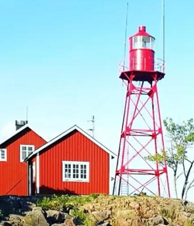
1906 (station established 1864). Inactive since 2009. 15.5 m (51 ft) square cast iron skeletal tower with lantern and gallery. Entire lighthouse painted red. Maria Sörqvist's photo is at right, SFA has a page for the lighthouse, Trabas has a good photo, Leif Guldbrandsen has a 2013 photo, and Google has a satellite view. Endangered. In 2007 the Sjöfartsverket announced its intention to demolish the lighthouse and replace it with a modern tower. There were immediate protests, and the provincial government of Västra Götaland refused to grant a building permit for the new tower. As of late 2008 the case was in the courts. In March 2009 the Sjöfartsverket announced that the light had been moved to a mast outside the lighthouse. When Andreas Köhler visited in June 2017 he found the historic light still standing. Rikard Jacobsson's 2022 photo shows the light freshly painted and in good condition. The station is located on a promontory on the west side of the lake about 9 km (5.5 mi) northwest of the Trollhätte Canal at Vänersborg. Site open. . ARLHS SWE-143.
Gälleudde (4)
2009. Active; focal plane about 20 m (66 ft); two long flashes every 12 s, white, red or green depending on direction. Approx. 19 m (62 ft) square skeletal tower. Stefan Viklund has a photo. Site open, tower closed. SV-9221; ex-Admiralty C0415.15.
* [Bastungen (2)]
1873 (station established 1807). Inactive since 1935. 3-story wood keeper's house. The wood is stained a dark brown. SFA has a page for the lighthouse, Hartmann also has a page with a photo, a 2019 photo is available, and Google has a satellite view. The light was shown from an octagonal tower in front of the house but that tower was demolished when the light was deactivated. The light guided vessels as they left the Trollhätte Canal at Vänersborg. The house has been purchased by the town of Vänersborg. Located on the west coast of the lake about 1 km (0.6 mi) north of the canal exit. Site open, tower closed. Owner/site manager: Town of Vänersborg. ARLHS SWE-434.

1906 Gälleudde Light (now lost), Sörbo, August 2021
Instagram photo by Maria Sörqvist

Kållandsö Area Lighthouses
Naven
1856. Active; focal plane 15 m (49 ft); white light, 2 s on, 8 s off. 8 m (26 ft) round light tower with lantern and gallery, mounted atop the gable of a 1-1/2 story wood keeper's house. Entire lighthouse painted white. Robert Lidberg's photo is at right, Petr Stránský has a view from the lake, Huelse has a historic postcard view, and Google has a satellite view. A small vippfyr (bucket light) was in use here in 1830. Located on a small island off the northwest side of Kållandsö, a large island barely separated from the mainland, about 15 km (9 mi) north northwest of Lidköping. Site status unknown. ARLHS SWE-287; SV-9406; ex-Admiralty C0415.45.
Norra Klasgrundet
1909. Inactive since 2008. 8 m (26 ft) round concrete tower with lantern and gallery. Lantern painted red. Hans Bleeker has a distant view (halfway down the page) and Google has an indistinct satellite view. Located on a shoal about 6 km (3.5 mi) west of Spiken, off the north coast of Kållandsö. Accessible only by boat. Site open, tower closed. ex-SV-9421; ex-Admiralty C0415.46.
Pålgrunden
1958 (rebuilt 1978). Active; focal plane about 9 m (30 ft); two long flashes every 12 s, white, red or green depending on direction. 9 m (30 ft) round cylindrical tower with lantern and gallery, painted with red and white horizontal bands. Google has a distant satellite view. This lighthouse marks the narrowest passage of the lake, north of the island of Kållandsö and south of the Värmlandsnäs peninsula. The tower had to be rebuilt after it was cracked by ice in 1978. Located about 4 km (2.5 mi) north of Granvik. Accessible only by boat. Site open, tower closed. ARLHS SWE-310; SV-9426; ex-Admiralty C0415.465.
Navens Fyr
Naven Light, Kållandsö, April 2009
ex-Flickr photo copyright Robert Lidberg; used by permission

Lidköping Area Lighthouses
Lidköping is a town of about 30,000 residents located on a bay on the southeast side of lake. The town calls itself "Lidköping by Vänern" and works to increase tourism on the lake.

*
Lidköping (3)
1911 (station established 1852). Active; focal plane 11 m (36 ft); three flashes every 9 s, white, red or green depending on direction. 8 m (26 ft) octagonal cylindrical stone tower with lantern and gallery. Lighthouse painted white with one red horizontal band. Fredrik Thempo's photo is at right, Trabas has a good photo, Andreas Köhler has a closeup, Huelse has a historic postcard view, Anders Olofsson has a street view, and Google has a satellite view. The first Lidköping lighthouse, a small wood tower, was relocated to Hällekis (next entry) in 1871. The second was also a wood building, with a lantern on the roof. Located at the end of the east jetty of Lidköping. Accessible by walking the pier. Site open, tower closed. ARLHS SWE-237; SV-9590; ex-Admiralty C6797.85.
Hällekis
1852 (relocated here in 1871). Inactive since 1968. 4.5 m (15 ft) octagonal pyramidal wood tower with lantern and gallery. Lighthouse painted white; lantern roof is black. Sebastian Kirsch has a closeup photo, Jolanta Gauricikaite has a 2018 photo, Andreas Köhler has a photo, Gianluca Groppo has a 2022 view, and Google has a satellite view. This is the original Lidköping lighthouse (previous entry), relocated to this location in 1871. Located at the end of a mole at Hällekis, a small port about 16 km (10 mi) northeast of Lidköping. Site status unknown, but there should be good views of the lighthouse from shore. . ex-SV-9583; ex-Admiralty C7814.

Lidköping Light, Lidköping, October 2018
Google Maps photo by Fredrik Thempo

Mariestad Area Lighthouses
Mariestad is a town of about 17,000 residents on the east shore of the lake.
Gullsjö Nedre
1902. Inactive since 1950. 9 m (30 ft) hexagonal pyramidal wood tower with lantern and gallery, painted white. Google has a satellite view. The lighthouse was restored by its owners, Nils and Sibylla Gustavsson. Both range lights were sold in 1953; it's not known what became of the other one. Located on a headland about 15 km (9 mi) west of Mariestad. Accessible only by boat. Site and tower closed. ex-SV-1811 (older numbering).
Viknäsudde
1902. Inactive since 1950 but maintained as a daybeacon. 6 m (20 ft) hexagonal skeletal tower with enclosed upper portion and lantern. Lighthouse painted white, skeletal legs red. A photo is at right, SFA has a page for the lighthouse, and Google has an indistinct satellite view. A boater has a small photo and comments (almost halfway down the page) "Tyvärr är den släckt" (unfortunately it is inactive). The lighthouse was heavily damaged by a storm in April 2015 but it was restored during the summer. Located off the end of a long peninsula, marking a narrow passage between the mainland and the island of Onsö about 8 km (5 mi) west of Mariestad. Accessible only by boat. Site open, tower closed. ex-SV-1813 (older numbering).
* [Mariestad (replica)]
Date unknown. Inactive. Approx. 15 m (49 ft) hexagonal skeletal tower with lantern and gallery. Tower painted red, lantern white. Google has a street view and a satellite view. This lighthouse is a replica of the three lighthouses built in the Mariestad area in 1904: Snuggen, Nolhagen Nedre, and Snappudden Övre. Located in the middle of the Göteborgsrondellen, a traffic roundabout in Mariestad at the intersection of Göteborgsvägen and Marieforsleden. The lighthouse was restored in 2015. Site open, tower closed. Owner: City of Mariestad.

Viknäsudde Light, Mariestad, June 2006
ex-Panoramio photo copyright Mika Siitonen; used by permission
* Mariestad Inre Nedre (Inner Range Front) (2)
1927 (station established 1904). Inactive. 4 m (13 ft) hexagonal lantern, painted white. A post behind the lantern carries the current rear light of the range (focal plane 5 m (17 ft), quick-flashing red light; ex-Admiralty C6797.721), as seen in Trabas's photo. A distant view is available, Huelse has a historic postcard view, and Google has a satellite view. Located on an elbow of the west breakwater of Mariestad. Probably accessible by walking the pier. Site open, tower closed. ARLHS SWE-273; ex-SV-9558; ex-Admiralty C6797.72.
* Mariestad Inre Övre (Inner Range Rear) (2)
1927 (station established 1904). Inactive. 8 m (26 ft) hexagonal skeletal tower, upper 2/3 enclosed, painted white. Google has a street view and a satellite view. Located 600 m (655 ft) south of the front light. Site open, tower closed. ex-SV-9558.01; ex-Admiralty C6797.721.
* Snuggen (Övre)
Date unknown (station established 1904). Active; focal plane 24 m (79 ft); white light occulting once every 5 s. 16 m (52 ft) hexagonal pyramidal sketetal tower with lantern and gallery; there is also a 1-story equipment shelter in the base of the tower. Tower painted red, lantern and gallery white, equipment shelter red with white trim. The Mariestad Lighthouse Society has a page for the lighthouse, SFA has a page, Trabas has a photo, Google has a street view (a portion is seen at right) and the tower is centered in a Google satellite view. This light is the rear light of a range with the Snappudden Nedre light as the front light. The lighthouse was restored in 2013. Located just off the lakeshore road on the north side of Mariestad. Site open, tower closed. . ARLHS SWE-359; SV-9528; ex-Admiralty C6797.7.
* Nolhagen Nedre
Date unknown (station established 1904). Active; focal plane 16 m (52 ft); white, red or green light, depending on direction, occulting once every 5 s. 13 m (43 ft) hexagonal pyramidal sketetal tower with lantern and gallery; there is also a 1-story equipment shelter in the base of the tower. Tower painted red, lantern and gallery white, equipment shelter red with white trim. Trabas has a photo, SFA has a page for the range lights, Andreas Köhler has a photo, Google has a street view, and the tower is centered in a Google satellite view. The rear light is in a very small tower. The lighthouse was restored in 2014. Located beside the lakeshore road about 2 km (1.2 mi) northeast of Mariestad. Site open, tower closed. SV-9549; ex-Admiralty C6797.77.

Snuggen Light, Mariestad, August 2023
Google Maps street view
Snappudden Nedre
1904. Active; focal plane 5 m (17 ft); white light, 2 s on, 2 s off. Approx. 6 m (20 ft) octagonal tower with lantern, mounted on a stone pier. Lighthouse painted white. SFA has a page for the range lights, Hartmann has a page, Trabas has a photo, and Google has a satellite view. This light is off the northeastern end of a skerry about 1.5 km (0.9 mi) southwest of the rear light. The lighthouse was restored in 2011. Accessible only by boat. Site open, tower closed. SV-9545; ex-Admiralty C6797.699.
Snappudden Övre
1904. Active; focal plane 14 m (46 ft); quick-flashing white light. 15 m (49 ft) hexagonal pyramidal sketetal tower with lantern and gallery; there is also a 1-story equipment shelter in the base of the tower. Tower painted red, lantern and gallery white, equipment shelter red with white trim. The Mariestad Lighthouse Society has a page for the range lights, SFA has a page for the range lights, Trabas has a photo, and the tower pokes out of dense forest in Google's satellite view of the listed location. The lighthouse was restored in 2015. Located on the lakeshore about 4 km (2.5 mi) northeast of Mariestad. Site open, although this is private property; tower closed. SV-9545.01; ex-Admiralty C6797.698.

Brommö Lighthouses
* Borhallsudde
1866. Active; focal plane 11 m (36 ft); four flashes every 12 s, white, red or green depending on direction. 8 m (26 ft) lantern and gallery mounted at the gable end of a 1-1/2 story wood keeper's house. Lantern painted white; the house is white on the end facing the lake and red with white trim on the other sides. Mika Siitonen's photo is at right, Huelse has a historic postcard view, and Google has a satellite view. The front light is on a post in the lake. Located at the northeast corner of the island of Brommö. Accessible by road. Site open, tower closed. ARLHS SWE-103; SV-9470; ex-Admiralty C0415.571.
* Brommösund Nedre (2)
1939 (station established 1865). Active; focal plane 7 m (23 ft); quick-flashing red light. 4 m (13 ft) octagonal wood tower with lantern, painted white. SFA has a page for the lighthouse, Trabas has a photo, Bert Kaufmann has a distant view, and Google has a satellite view. The rear light is on a short skeletal tower. Located on the north side of the harbor entrance at Brommösund, near the ferry terminal. Site open, tower closed. SV-9473; ex-Admiralty C0415.588.
Smörhättan
1855. Active; focal plane 16 m (52 ft); white, red or green light, depending on direction, occulting twice every 12 s. 14 m (46 ft) octagonal wood tower with lantern and gallery, painted white. SFA has a page for the lighthouse, Bertil Jonsson has a 2021 photo, David Thyberg has a 2011 photo, Trabas has a view from the lake, and Google has a satellite view. This lighthouse, a subling of the Hjortens Udde lighthouse (see photo above), was restored in 2008. Located at the southern tip of Brommö. Accessible by road. Site status unknown. ARLHS SWE-354; SV-9476; ex-Admiralty C0415.59.

Borhallsudde Light, Brommö, July 2009
ex-Panoramio photo copyright Mika Siitonen; used by permission

Fågelö Area Lighthouses
Bornäsudde
1904. Active; focal plane 8 m (26 ft); three flashes every 10 s, white, red or green depending on direction. 7 m (23 ft) hexagonal skeletal tower with enclosed upper section, lantern and gallery, painted white. SFA has a page for the lighthouse, Trabas has a distant view, and Google has a satellite view. Located on the northeast coast of Fågelö about 2.5 km (1.5 mi) north of Sundören and 6 km (4 mi) southwest of Sjötorp. May be accessible only by boat. Site status unknown. SV-9523; ex-Admiralty C6797.65.
Marpilen
1956. Active; focal plane 7 m (23 ft); quick-flashing white light. 7 m (23 ft) round cast iron lantern mounted on a concrete pier. Lantern painted red. Bing has a distant satellite view. This light guides vessels around the northern end of the island of Fågelö toward the Göta Canal entrance at Sjötorp. Located on a shoal about 10 km (6 mi) northwest of Sjötorp. Accessible only by boat. Site open, tower closed. SV-9488; ex-Admiralty C6797.05.
Fällholmen Nedre
1865. Active; focal plane 11 m (36 ft); three flashes every 15 s, white, red or green depending on direction. 7 m (23 ft) octagonal wood tower with lantern and gallery, rising from a 1-story equipment building. Lighthouse painted white. SFA has a photo and Google has a satellite view. Located on a small island about 5 km (3 mi) northwest of Sjötorp. Accessible only by boat. Site and tower closed (private property). SV-9480; ex-Admiralty C6797.
Fällholmen Övre (2)
1918 (station established 1865). Inactive since 1954. Approx. 8 m (26 ft) octagonal lantern mounted on a square wood tower attached to a 1-story keeper's cottage. Lighthouse painted white. Esbjörn Hillberg's photo is at right and Google has a satellite view. The house was sold and is in use as summer residence. Located about 200 m (650 ft) northeast of the front light. Accessible only by boat.

Fällholmen Övre Light, Fågelö, November 2017
SFA Creative Commons photo by Esbjörn Hillberg

Sjötorp Lighthouses
Sjötorp is a small village at the western entrance to the Göta Canal.
Harnäsudde Nedre (1)
1865. Inactive. Small lantern attached to a corner of a 1-story keeper's cottage. Building painted red with white trim. SFA has a photo by Esbjörn Hillberg on its page for the range lights. Site status unknown.
Harnäsudde Nedre (2)
1903 (station established 1865). Active; focal plane 6 m (20 ft); white light, 2 s on, 2 s off. 4 m (13 ft) octagonal pyramidal wood tower with lantern and gallery. Lighthouse painted white. SFA has a page for the range lights, Trabas has a good photo, Carl-Gustaf Jansson has a 2022 closeup, and Google has a satellite view. Located on a promontory about 1.5 km (1 mi) west of Sjötorp. Site status unknown. SV-9511; ex-Admiralty C6797.4.
Harnäsudde Övre
1890. Active; focal plane 13 m (43 ft); quick-flashing white light. 11 m (36 ft) octagonal pyramidal wood tower with lantern and gallery. Lighthouse painted white. SFA has a page for the range lights, Trabas has a closeup photo, Carl-Gustaf Jansson has a 2022 closeup, and Google has a satellite view. Located on a promontory about 1.5 km (1 mi) west of Sjötorp. Accessible by a long gravel road (4WD recommended). Site open, tower closed. SV-9511.01; ex-Admiralty C6797.401.
* Sjötorp Övre
1911 (?) (station established 1865). Active; focal plane 5 m (17 ft); flash every 3 s, white, red or green depending on direction. 5 m (17 ft) square pyramidal wood tower with lantern, painted white. Ove Rønne has the 2023 photo seen at right, Jane Skagern has a photo, SFA has a page for the range lights, Trabas has a good photo, Andreas Köhler has an excellent 2017 photo, Anders Sandblad has a street view, and Google has a satellite view. The range guides vessels approaching the western entrance to the Göta Canal. The front light is at the end of the town's breakwater. Located on the north side of the Göta Canal entrance in Sjötorp. Site open, tower closed. ARLHS SWE-441; SV-9517.01; ex-Admiralty C6797.501.

Otterbäcken Lighthouses
* Otterbäcken Nedre (1)
1896. Inactive. 6 m (20 ft) octagonal pyramidal wood tower with lantern. Lighthouse painted white, lantern roof red. SFA's page has a photo and Google has a fuzzy satellite view. Located on the south side of the entrance to the small boat harbor of Otterbäcken, a town on the northeastern shore of the lake. Site open, tower closed.

Sjötorps Övrefyr, Sjötorp, May 2023
Google Maps photo by Ove Rønne
Otterbäcken Nedre (2)
1917 (?) (station established 1896). Active; focal plane 3 m (10 ft); red light, 2 s on, 2 s off. 4 m (13 ft) 1-story wood shed; the light is shown through a square window. The front of the building is painted red and the rest of the building white. Trabas has a photo but the small range lights are not seen in Google's satellite view. Located in Otterbäcken, exact location unknown. Site status unknown. SV-9498; ex-Admiralty C6797.3.
Otterbäcken Övre (2?)
1917 (?) (station established 1896). Active; focal plane 7 m (23 ft); quick-flashing red light. 8 m (26 ft) 1-story wood shed mounted on wood piles; the light is shown through a square window. The front of the building is painted red and the rest of the building white. Trabas has a photo. Located in Otterbäcken, exact location unknown, a short distance behind the front light. Site status unknown. SV-9498.01; ex-Admiralty C6797.301.
Fårbetsudden Övre
Date unknown (station established 1896). Active; focal plane 10 m (33 ft); quick-flashing white light. 4 m (13 ft) square wood shed; the light is shown through a square window. Lighthouse painted white with a red roof. SFA has a page for the range lights, Trabas has a photo and Bing has a fuzzy satellite view. The front light is housed in an even smaller shed at the edge of the lake. Located on a point of land about 800 m (1/2 mi) northwest of Otterbäcken. Site and tower closed. SV-9496.01; ex-Admiralty C6797.151.

Information available on lost lighthouses:

Notable faux lighthouses:

Adjoining pages: East: Lake Vättern | Southeast: Lake Vättern | Southwest: Göteborg Area

Return to the Lighthouse Directory index | Ratings key

Posted September 3, 2007. Listings expanded January 2, 2009. Checked and revised February 21, 2024. Lighthouses: 56. Site copyright 2024 Russ Rowlett and the University of North Carolina at Chapel Hill.