|
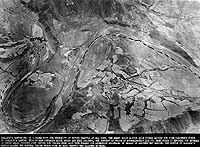
Photo #: 80-G-437274 "Carlson's Canyon" Bridge Attacks, March-April 1951 Photograph "Carlson's Canyon # 13", showing the bypass route established by the enemy following the destruction of the railway bridge in left center. The bypass, represented by dotted lines, was necessary to avoid the bridge and tunnels, which could be easily closed by air strikes. Though it included several small bridges, the bypass was not so easily knocked out and was more readily repaired. Task Force 77 carrier planes were therefore diverted southward in search of another vital "choke point". Text below the image provides additional information. The "Carlson's Canyon" bridge was located on the rail line south of Kilchu, in northeastern Korea. Official U.S. Navy Photograph, now in the collections of the National Archives. Online Image: 139KB; 740 x 570 pixels Reproductions of this image may also be available through the National Archives photographic reproduction system. |
 |
Click on the small photograph to prompt a larger view of the same image.
If you want higher resolution reproductions than this digital image, see: "How to Obtain Photographic Reproductions."
15 November 1999