Photo #: NH 59278
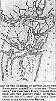
"Map of the Environs of Savannah, on the South ..."
Engraving published in "Harper's Weekly", Volume 7,
January-June 1863, page 164.
The map shows the position of the Confederate Privateer Rattlesnake
(ex-CSS Nashville, 1861-1862), the Ogeechee River, Beulah
Battery and "the present Field of Operations of the 'Passaic'
and other Ironclads under Commodore Dupont".
U.S. Naval Historical Center Photograph.
Online Image: 141KB; 410 x 765 pixels |
 |