|
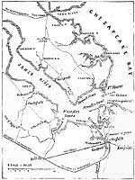
Photo #: NH 73737 "Hampton Roads area of Virginia" Map published in "Frank Leslie's Illustrated Newspaper", 1861. U.S. Naval Historical Center Photograph. Online Image: 173KB; 675 x 925 pixels |
 |
Click on the small photograph to prompt a larger view of the same image.
If you want higher resolution reproductions than this digital image, see: "How to Obtain Photographic Reproductions."
24 October 2003