Photo #: NH 97748
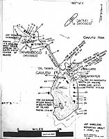
Tanambogo, Gavutu and Gaomi Islands, near Tulagi
Chart prepared for use during the invasion of the Guadalcanal
and Tulagi area. It is dated 21 July 1942, about two weeks before
the landings.
Key to the numbered features on this chart:
1. Store Hut
2. & 3. Army Huts
4. Bomb Store Hut
5. 2nd Fuel Store
6. Rails (wooden)
7. Fuel oil stores
8. Kitchen
9. Wash House
10. Wharf, depth 15'
11. Repair for riggers and a few stores
12. Officers mess and late headquarters for VNTG RAAF wireless
13. Golf course
14. Ratings quarters
15. Engine house
16. Power House
17. Cable (no- connection)
18. Gaomi Island (Dead Mans Island)
19. Causeway
20. Bridge 20' length
21. Gunpit
22. Elevated concrete span
23. & 24. Stores
25. Boat shed
26. Bollard
27. Wire fence
28. Break water
29. Swimming pool
30. Gunpit
31. Levers Bros. Office
32. Bachelor's quarters
33. Accountants house
34. Gunpit
35. & 36. Wireless tripod masts
37. & 38. Small square entrenchments
39. Wharf not in use
40. Water catchment
41. The unused house
42. Latrines
43. Native quarters
44. (left blank on original list)
45. Chinese quarters
46. Store
The original photograph came from Rear Admiral Samuel Eliot Morison's
World War II history project working files.
U.S. Naval Historical Center Photograph.
Online Image: 104KB; 580 x 765 pixels |
 |