Photo #: NH 97763
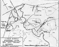
Lunga Point area, Guadalcanal Island, Solomon Islands
Annotated chart prepared for planning purposes shortly before
the area was captured by U.S. Marines on 7-8 August 1942. It
is based on aerial photographs taken on 31 July 1942.
The airfield then being constructed by the Japanese, which after
changing hands became Henderson Field, is in the right center.
The original print came from the illustrations package for Rear
Admiral Samuel Eliot Morison "History of United States Naval
Operations in World War II", volume IV (originally published
opposite page 278).
U.S. Naval Historical Center Photograph.
Online Image: 116KB; 740 x 615 pixels |
 |