Photo #: NH 104135
Iwo Jima Operation, February-March 1945
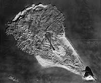
"Relief Map of Iwo Jima --- U.S. Navy carrier pilots were
briefed for their strikes against Iwo Jima through the use of
detailed relief maps such as this one". Quoted from the
original photo caption, filed 6 April 1945.
Mount Suribachi, at the island's southern end, is in the lower
right.
The original photograph came from Rear Admiral Samuel Eliot Morison's
World War II history project working files. It was provided to
Morison by E.J. Long.
Official U.S. Navy Photograph, from the collections of the
Naval Historical Center.
Online Image: 133KB; 740 x 630 pixels |
 |