Lighthouses of the French Southern and Antarctic Lands

The French Southern and Antarctic Lands (Terres Australes et Antarctiques Françaises, or TAAF) includes a widely scattered collection of islands in the South Indian Ocean. When it was established in 1955 TAAF consisted of several French-controlled islands in the sub-Antarctic, including the Îles Kerguélen, Amsterdam, St.-Paul, and the Îles Crozet. Collectively these territories are called the Îles Australes ("southern islands"). None of these islands have any permanent population but France maintains military or scientific stations on them.

In January 2005 the TAAF office also assumed the administration of several small tropical islands in the waters surrounding the former French colony of Madagascar. These islands, known collectively as the Îles Éparses ("scattered islands"), were previously administered as dependencies of Madagascar and then (after Madagascar became independent) as dependencies of Réunion. All of these islands are wildlife sanctuaries closed to visitors except by special permit.

TAAF is administered from an office in Réunion.

The French word for a lighthouse, phare, is often reserved for the larger coastal lighthouses; a smaller light or harbor light is called a feu (literally "fire," but here meaning "light"). The front light of a range (alignement) is the feu antérieur and the rear light is the feu postérieur. In French île is an island, cap is a cape, pointe is a promontory or point of land, roche is a rock, récife is a reef, baie is a bay, estuaire is an estuary or inlet, détroit is a strait, rivière is a river, and havre is a harbor.

Aids to navigation on these remote islands are operated and maintained by DEAL Réunion, the transportation ministry of Réunion.

ARLHS numbers are from the ARLHS World List of Lights. Admiralty numbers are from volume D of the Admiralty List of Lights & Fog Signals for the Îles Éparses and Îles Crozet and from Volume Q for the Îles Kerguelen and Île Amsterdam; U.S. NGA List numbers are from Publication 112.

General Sources
Terres Australes et Antarctiques Françaises
TAAF's colorful website describes its various territoriesa dn activities.
French Southern and Antarctic Lands
Wikipedia's article has a useful map locating the various territories.
Phares d'Océanie
Photos posted by Alain Guyomard and Robert Carceller.
Online List of Lights
Photos by various photographers posted by Alexander Trabas. There are separate pages for Île Europa, Île Juan de Nova, Île Tromelin, Îles Crozet, Îles Kerguelen, and Île Amsterdam.


Île Juan de Nova Light
DEAL Réunion photo (no longer online)

Îles Éparses Lighthouses
Île Europa
1994. Active; focal plane 21 m (69 ft); white flash every 5 s. 18 m (59 ft) steel post; the upper portion of the tower has a white daymark. No photo available but Google has a satellite view. Largest of the Îles Éparses at about 30 sq km (12 sq mi), the roughly circular island of Europa is near the center of the Mozambique Channel between southern Madagascar and southern Mozambique. Annexed by France in 1897, it has an automatic weather station and a small French military detachment. The island is claimed by Madagascar. Located on the north coast of Île Europa. Site and tower closed. ARLHS JUN-001; Admiralty D7026.5; NGA 32598.
Île Juan de Nova (2)
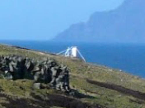
2001 (station established 1966). Active; focal plane 37 m (121 ft); three white flashes, in a 2+1 pattern, every 15 s. 27 m (89 ft) square cylindrical skeletal tower with lantern, gallery, and enclosed watch room, mounted on a 2-story square concrete base. Tower is white; lantern, gallery, and watch room painted black. The newer tower is shown at the top of this page. Sea-Seek.com has a photo and Google has a satellite view. Lighthouse Digest has a photo of the 1966 lighthouse, which had a very similar design but had become dangerously rusted. Juan de Nova is about 6 km (3.75 mi) long and aligned east to west; it is near the center of the Mozambique Channel off the central west coast of Madagascar. It is named for its discoverer, a Galician captain who found it in 1501 on his way to India. Like Europa, the island was annexed by France in 1897, is claimed by Madagascar, and has an automatic weather station and a small French military detachment. Located at the west end of the island, about 145 km (90 mi) west of north central Madagascar. Site and tower closed. ARLHS JUN-002; Admiralty D7033; NGA 32624.
Île Tromelin (2)
Date unknown (1970s?) (station established 1950s). Active; focal plane 15 m (49 ft); white flash every 4 s. 11 m (36 ft) 2-story weather station building; the light is mounted on a short mast on the roof. The weather station is staffed. A photo appears at right and Google has a satellite view of the station. Tromelin is a very small island very far at sea, 450 km (280 mi) east of northern Madagascar in the Indian Ocean. The island is claimed by Mauritius and in 2010 France and Mauritius agreed to manage the island jointly. Site and tower closed. ARLHS TRO-001; Admiralty D7073; NGA 32884.

Light atop weather station, Île Tromelin, September 2002
ex-Panoramio photo by Ralf174978 posted by Lightphotos.net

Îles Crozet Lighthouses

The Crozet Islands are located in the sub-Antarctic about 3000 km (1875 mi) south of Réunion. There is no permanent population and no airport but since 1963 France has maintained a permanent scientific station, on one of the islands, the Île de la Possession, typically staffed by 18-30 scientists and support personnel. France claimed the islands based on their discovery by a French expediation in 1772.

Port Alfred Faure (Pointe Seince) Range Front
Date unknown. Active; focal plane unknown; continuous green light. Approx. 6 m (20 ft) concrete tower, front face painted with black and white vertical stripes. The light is visible at the far left of a photo of the harbor; a portion of this photo is seen at right. The light is barely visible in Google's satellite view. NGA has confused these lights and has an incorrect Admiralty number for this light. Located on the cape on the north side of the harbor of the station, on the north side of Île de la Possession, the largest of the islands. Site open, tower closed. Admiralty D7119.4; NGA 33072.
Port Alfred Faure (Pointe Seince) Range Rear
Date unknown. Active; focal plane unknown; continuous green light. Approx. 6 m (20 ft) concrete tower, front face painted with black and white vertical stripes. No photo available and the light is barely visible in Google's satellite view. Located 70 m (230 ft) west northwest of the front light. Site open, tower closed. Admiralty D7119.41.
Pointe Lieutard Range Lights
Date unknown. Active; focal plane unknown; continuous red lights. Approx. 8 m (26 ft) concrete towers, front face painted with black and white vertical stripes. No photo available and the small lights are hard to spot in Google's satellite view. The rear light is 46 m (150 ft) west northwest of the front light. Located on the cape on the south side of the harbor of the station, on the north side of Île de la Possession, the largest of the islands. Site open, tower closed. Admiralty D7119.5 (front) and D7119.51 (rear); NGA 33076.
 

Port Alfred Faure Range Front Light, Îles Crozet, October 2012
Google Maps photo by TheFranek2
 

Îles Kerguelen Lighthouses

The Kerguelen Islands are located in the sub-Antarctic about 3300 km (2100 mi) south of Réunion. There is no permanent population and no airport but since 1950 France has maintained a permanent scientific station, typically staffed by 50-100 scientists and support personnel, on La Grande Terre, the prncipal island of the group. Like the Îles Crozet the Îles Kerguelen were claimed by France following their exploration by a French expediation in 1772.

Port aux Français Range Front
Date unknown. Active; focal plane 8 m (26 ft); quick-flashing green light. 6 m (20 ft) concrete tower. Lighthouse painted white with a red vertical stripe. Guyomard and Carceller have a view of the range from the sea by Alain Chasseignaux and Google has a satellite view. Located on a promontory on the north side of the harbor, across from the settlement of Port-aux-Français. Site open, tower closed. Admiralty Q0821; NGA 33120.
Port aux Français Range Rear
Date unknown. Active; focal plane 20 m (66 ft); quick-flashing green light. 6 m (20 ft) concrete tower. Lighthouse painted white with a red vertical stripe. Guyomard and Carceller have a view of the range from the sea by Alain Chasseignaux and Google has a satellite view. Located east of the settlement of Port-aux-Français, 700 m (0.44 mi) northeast of the front light. Site open, tower closed. Admiralty Q0821.1; NGA 33124.
Baie du Morbihan Range Front
Date unknown. Active; focal plane 5 m (17 ft); quick-flashing white light. 4 m (13 ft) concrete equipment shelter with the light on a short post on top. Building painted white with a black upward-pointing arrow. No photo available but Google has a satellite view. Located on a promontory on the north side of the bay, about 10 km (6 mi) west of Port-aux-Français. Site open, tower closed. Admiralty Q0820.4; NGA 33100.
Baie du Morbihan Range Rear
Date unknown. Active; focal plane 5 m (17 ft); quick-flashing white light. 4 m (13 ft) concrete equipment shelter with the light on a short post on top. Building painted white with a black downward-pointing arrow. No photo available but Google has a satellite view. Located on a promontory on the north side of the bay, about 10 km (6 mi) west of Port-aux-Français. Site open, tower closed. Admiralty Q0820.41; NGA 33104.
Pointe Molloy
Date unknown. Active; focal plane 15 m (49 ft); red flash every 2.5 s. 4 m (13 ft) concrete equipment shelter with the light on a short post on top. Building painted white. A photo is at right and Google has a satellite view. Located on a promontory on the northwest side of the bay, about 18 km (11 mi) west of the scientific station at Port-aux-Français. Site open, tower closed. Admiralty Q0820; NGA 33096.

Pointe Molloy Light, Îles Kerguelen, August 2007
Google Maps photo by Eric le Breton

Île Amsterdam Lighthouses

Île Amsterdam is a volcanic island in the south central Indian Ocean, about 3200 km (1990 mi) east southeast of Madagascar and the same distance north of Antarctica and west of Australia. It is accompanied by a second, smaller island, Île Saint-Paul, 90 km (56 mi) to the south. There is no permanent population and no airport but since 1949 France has maintained a permanent scientific station, typically staffed by about 30 scientists and support personnel, on the north coast of the island.

Mouillage du Gonio Range Front
Date unknown. Active; focal plane unknown; quick-flashing green light. Approx. 6 m (20 ft) concrete tower, described by NGA as a "black and white checkered beacon." The light is barely visible at upper right in Nodir Tursun-Zade's photo and Google has a satellite view. There is no sheltered harbor at the island, so the range lights point ships to the locations of more or less safe anchorages (mouillages). Located about 800 m (1/2 mi) west of the scientific station of Martin-de-Viviès. Site open, tower closed. Admiralty Q0822.4; NGA 33088.
Mouillage du Gonio Range Rear
Date unknown. Active; focal plane unknown; quick-flashing green light. Approx. 6 m (20 ft) concrete tower, described by NGA as a "black and white checkered beacon." No photo available but Google has a satellite view. Located 224 m (735 ft) southwest of the front light. Site open, tower closed. Admiralty Q0822.41; NGA 33092.
Mouillage du Ribault Range Front
Date unknown. Active; focal plane unknown; quick-flashing green light. Approx. 6 m (20 ft) concrete tower, described by NGA as a "red and white checkered beacon." No photo available but Google has a satellite view. Located about 800 m (1/2 mi) southeast of the scientific station of Martin-de-Viviès. Site open, tower closed. Admiralty Q0822; NGA 33080.
Mouillage du Ribault Range Rear
Date unknown. Active; focal plane unknown; quick-flashing green light. Approx. 6 m (20 ft) concrete tower, described by NGA as a "red and white checkered beacon." No photo available but Google has a satellite view. This light stands just east of a volcanic cone, the Cratères Dumas. Located 390 m (1280 ft) southwest of the front light. Site open, tower closed. Admiralty Q0822.1; NGA 33084.
 

Information available on lost lighthouses:

Notable faux lighthouses:

Return to the Lighthouse Directory index | Ratings key

Posted October 30, 2005. Checked and revised April 15, 2024. Lighthouses: 16. Site copyright 2024 Russ Rowlett and the University of North Carolina at Chapel Hill.