Lighthouses of the United Kingdom: North Wales

The United Kingdom (officially the United Kingdom of Great Britain and Northern Ireland) includes England, Scotland, Wales, and Northern Ireland. Wales (Cymru in Welsh) occupies a mountainous peninsula to the west of England, surrounded by water on three sides, the Bristol Channel to the south, the Celtic Sea to the southwest and the Irish Sea to the west and north. A country with a distinct Celtic heritage and language, Wales was conquered by England in the 13th century and formally annexed to England in the 16th century. Since 1301 the title Prince of Wales has been held traditionally by the heir to the English and later British throne.

Most of the coastline of Wales is rugged, scenic, and hazardous to navigation. The lighthouses of the country are clustered in the north, guarding the approaches to the Mersey estuary and the port of Liverpool, and in the south, guarding the approaches to the Severn. estuary and the ports of Cardiff and Bristol. The largest number of lighthouses can be found at the northwestern corner on the Isle of Anglesey and at the southwestern corner in Pembrokeshire.This page is for lighthouses of North Wales, and there is another page for South and West Wales.

Historically divided into 13 counties, Wales is now divided into 22 council areas, known as principal areas, some styled as counties and some as county boroughs. Sir is the Welsh word for county, corresponding to the English shire.

The Welsh language Cymraeg is spoken commonly in many parts of Wales, especially the north and west. The Welsh word for a lighthouse is goleudy; ynys is an island, trywn is a cape, pen is a headland, culfor is a strait, aber is an estuary, afon is a river, and porthladd is a port.

The major coastal lighthouses are maintained by Trinity House, the English lighthouse administration. Several, including South Stack, St. Ann's Head, and Nash Point, are among the best known and most visited British lighthouses. Harbor lights are under the control of local port authorities.

ARLHS numbers are from the ARLHS World List of Lights. Admiralty numbers are from Volume A of the Admiralty List of Lights & Fog Signals. U.S. NGA numbers are from Publication 114.

General Sources
Trinity House
Chartered by Henry VIII in 1514, Trinity House has built and operated lighthouses in Britain for nearly 500 years.
Lighthouses of South Wales and North Wales
Photos and information from the Lighthouse Accomodations website.
Online List of Lights - Wales - Bristol Channel, Celtic Sea, and Irish Sea
Photos by various photographers posted by Alexander Trabas.
Lighthouses in Wales
Photos by various photographers available from Wikimedia.
World of Lighthouses - Wales
Photos by various photographers available from Lightphotos.net.
United Kingdom Lighthouses
Aerial photos posted by Marinas.com.
Association of Lighthouse Keepers
Founded by serving and retired keepers, this lighthouse association is open to everyone.
Britische Leuchttürme auf historischen Postkarten
Historic postcard images posted by Klaus Huelse.
GPSNauticalCharts
Navigational chart for Wales.


Trwyn Du (Penmon Point) Light, Penmon, June 2023
Google Maps photo by David Cumbley

Gwynedd (Caernarfonshire) Lighthouses
The County of Gwynedd, also known historically as Caernarfonshire, occupies the northwestern mainland of Wales, including the northern portion of the Cardigan Bay coast and the Llŷn Peninsula. The north of the county faces Anglesey across the narrow Menai Strait. The county's population is about 120,000.

St. Tudwal's (Ynys Tudwal)
1877. Active; focal plane 46 m (151 ft); flash every 15 s, white or red depending on direction. 11 m (35 ft) round cylindrical masonry tower with lantern and gallery, painted white. Trabas has a 2006 photo, a closeup photo and a drone view are available, Lighthouse Accommodations has a page for the lighthouse, David Medcalf has a very distant view, and Google has a view from the sea and a satellite view. The 1-story keeper's house was sold as a private residence in 1935; the entire island on which the lighthouse stands is now owned.by TV personality Bear Grylls. Trinity House refurbished the lighthouse in 2021 and installed an LED optic. Located on St. Tudwal's Island West, at the western entrance to Tremadoc Bay about 5 km (3 mi) southeast of Abersoch. Accessible only by boat. Site and tower closed. Operator: Trinity House. Site manager: private. ARLHS WAL-028; Admiralty A5238; NGA 5552.
Bardsey (Ynys Enlli)
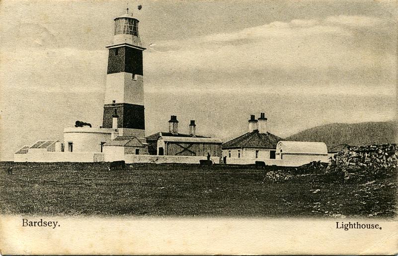
1821 (Daniel Alexander and Joseph Nelson). Active; focal plane 39 m (129 ft); red flash every 10 s. 30 m (98 ft) square masonry tower with lantern and gallery, painted with red and white horizontal bands. Three 1-story keeper's houses and other buildings. Maria Whitehead's 2020 photo is at right, Lighthouse Accommodations has a page for the lighthouse, Alan Fryer has a closeup photo, David Medcalf has a photo, a distant view of the site is available, Trabas has Ian Wright's 2006 view from the sea, Mimi Chan has a 2021 photo, Huelse has a historic postcard view, David Murcutt has a 2017 street view, and Google has a satellite view. The lighthouse marks the northern entrance to Cardigan Bay. Bardsey Island, 3 km (2 mi) off the end of the Llŷn (Lleyn) Peninsula, is a national nature reserve accessible by passenger ferry from Porth Meudwy; several cottages on the island are available for overnight accommodations. In 2014 Trinity House replaced the 2nd order Fresnel lens (1856) with LED lighting and changed the color of the light from white to red in an effort to spare birds who crash into the lighthouse in migration. The disassembled lens was flown by helicopter to the mainland, where it has been reassembled for display at the National Trust's Porth y Swnt Visitor Centre. Located at Pen Diban, the southern end of the island. Accessible by hiking trail, but day trippers must walk the 3 km (2 mi) length of the island to reach the light station. Site open, tower closed. Operator: Trinity House. Site manager: Bardsey Island Trust. (Ymddiriedolaeth Ynys Enlli). . ARLHS WAL-001; Admiralty A5234; NGA 5548.

Bardsey Light, Bardsey Island, September 2020
Instagram photo by Maria Whitehead
Irish Lightship Penguin
1910. Decommissioned 1966. 30.5 m (100 ft) steel lightship converted to a 3-masted schooner. Hull painted black, superstructure white. Wikimedia has several photos. After being decommissioned in 1966, the ship was sold and used as a youth sea training vessel named the Hallowe'en. In 1982 it was sold, converted to a schooner, and renamed the Arctic Penguin. In 1995 it was moored at Inverary, Scotland, as a maritime museum. Dave Forbes has a photo and Google has a 2011 street view of the ship in Scotland. After being for sale for £180,000 for several years, it was sold on Christmas Eve 2015 to Viscount Christopher Wright of Warmingham, Cheshire. In March 2017 the ship sailed under its own power to Barrow-in-Furness for repairs and refitting as a private vessel. In 2018 the ship was at Carmet Marine in Bromborough, upstream from Birkenhead on the River Mersey opposite Liverpool. Since 2020-21 it has been moored at Caernarfon during the winter; Hefin Owen had a March 2024 photo (no longer online). Site status unknown. Owner/site manager: Viscount Shipping Lines.

Southern and Western Isle of Anglesey (Ynys Môn) Lighthouses
The Isle of Anglesey is an island county about 25 km (15 mi) in diameter just off the northwest corner of the Welsh mainland. The island is separated from the mainland by the very narrow Menai Strait. The population of the island is about 70,000; it is a principal area governed by a county council.

* Llanddwyn Island (2) (Twr Bach, Ynys Llanddwyn)
Early 1800s daybeacon, first lit in 1975. Active; focal plane 12 m (39 ft); flash every 2.5 s, white or red depending on direction. 5 m (17 ft) round conical stone tower, painted white. Trabas has a fine 2007 closeup by Ian Wright, another closeup photo is available, Tom Haley has a 2022 photo, Wikimedia has distant views, and Google has a street view and a satellite view. A directional light was placed on this daybeacon in 1975 when the 1845 Twr Mawr lighthouse was deactivated. Located at the southern tip of the peninsula. Site open, tower closed. Operator: unknown. Site manager: Newborough National Nature Reserve and Forest. . ARLHS WAL-046; Admiralty A5210; NGA 5528.

Twr Mawr Light, Llanddwyn Island, May 2023
Google Maps photo by Alex Serg
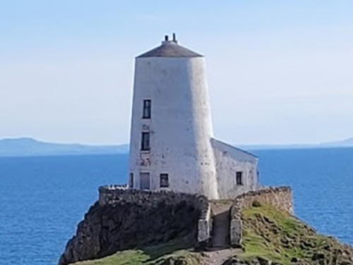
* Llanddwyn Island (1) (Twr Mawr)
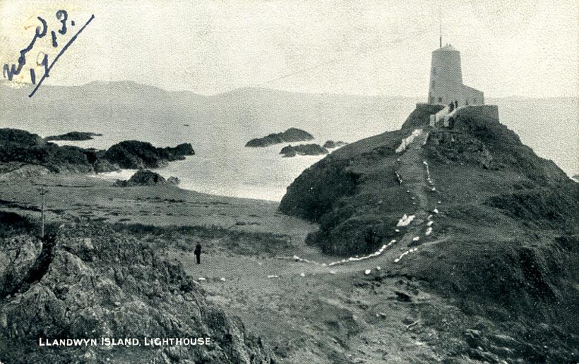
1845. Inactive since 1975 but charted as a daybeacon. 11 m (36 ft) round old-style stone tower attached to a keeper's house; photos appear to show abandoned lights atop the tower. Lighthouse painted white. A 2023 photo by Alex Serg is above right, Philip Higgins has a fine photo, Wikimedia has photos, Huelse has a historic postcard view, and Google has a street view and a satellite view. The nearby pilot house is a museum of local maritime history. In 2004 the lighthouse was repainted with its lower half red for its appearance in the movie Half Light starring Demi Moore. Llanddwyn Island--actually a peninsula except at the highest tides--is on the south shore of Anglesey about 5 km (3 mi) west of the southern entrance to Menai Strait. Site of the ruined church of St. Dwynwen and now part of a national nature reserve, the island is accessible by popular hiking trails. Located at the southern tip of the peninsula, a short distance west of the active beacon. Site open, tower closed. Owner: Anglesey government (?). Site manager: Newborough National Nature Reserve and Forest. . ARLHS WAL-057; ex-Admiralty A5210.1.
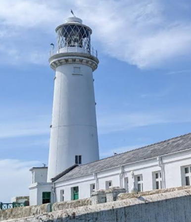
**** South Stack (Ynys Lawd)
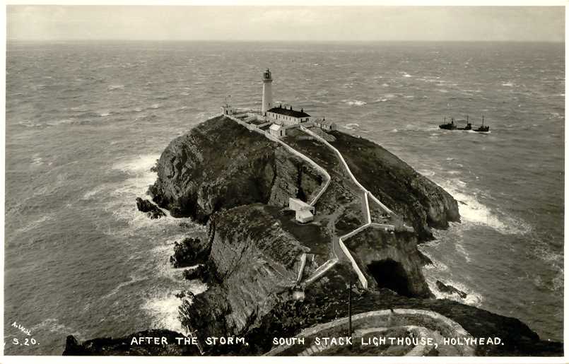
1809 (Daniel Alexander). Active; focal plane 60 m (197 ft); quick white flash every 10 s. 28 m (92 ft) round stone tower with lantern and gallery, attached to 1-story keeper's quarters and service building. Entire structure painted white. Rotating 1st order Fresnel lens. Fog horn (one 3 s blast every 30 s). Stephen Coope's 2023 photo is at right, John Slade has a 2022 photo , Trabas has a 2019 photo by Eckhard Meyer, Brian Mottershead also has a good photo, Wikimedia has many photos, Lighthouse Accommodations has a page for the lighthouse, Marinas.com has aerial photos, Huelse has a historic postcard view, and Google has a street view and a satellite view. The station includes a Trinity House Visitor Centre. South Stack is a steep-sided island off the western tip of Anglesey. The island is separated from the mainland by a narrow channel crossed by a footbridge since 1828; the present bridge, built in 1997, is the third. Visitors cross the footbridge after descending 400 steps from the parking area and they must climb those steps on their return. Despite the strenuous climb this is a well-visited lighthouse, one of the best known in Britain. However, in early 2017 the Anglesey Council announced it would stop supporting the Visitor Centre as a cost saving measure. After some negotiation Trinity House licensed a new management group, South Stack Ynys Lawd Ltd., and tours resumed in July. Located about 5 km (3 mi) west of Holyhead. Site open, visitor center open and tower open to guided tours daily early April through October and on weekends in March and November (admission fee). Operator: Trinity House. Site manager: South Stack Ynys Lawd. . ARLHS WAL-025; Admiralty A5204; NGA 5520.

South Stack Light, Holyhead,May 2023
Google Maps photo by Stephen Coope
* [North Stack Fog Signal (2)]
1895 (station established 1780). Inactive since 1986. 1-story fog-signal building. The station includes a 1-story keeper's house now used as a private residence. The station was originally equipped with two cannons; the 1861 1-story stone magazine of the cannons survives. The surviving fog-signal building housed a fog siren used until it was discontinued in 1986. The cannons were tossed in the sea; one has been salvaged and is on display at Holyhead Breakwater Country Park (photos are available, halfway down the page). Google has a street view and a satellite view of the station. Accessible by a pleasant hike from the car park of the Country Park. Site open. ex-Admiralty A5202.
* Holyhead (Caergybi) Breakwater
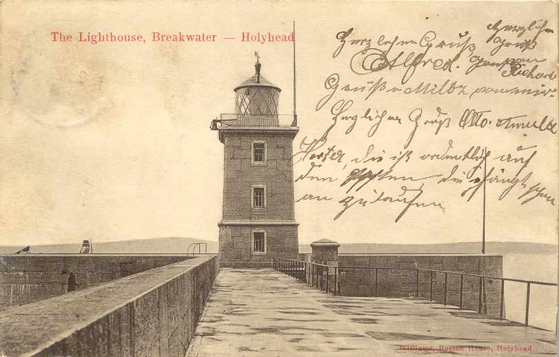
1873. Active (privately maintained); focal plane 21 m (70 ft); three green flashes every 10 s. 19 m (63 ft) square stone tower with lantern and gallery, painted white with a single broad black horizontal band. A 2025 photo is at right, a 2023 photo is available, Aliyah Patrycja Nawrocka has a 2022 photo, Trabas has a 2006 photo, Eric Jones has a 2008 closeup, Terry Robinson has a 2013 photo, Huelse has a historic postcard view, Uy Hoang has a street view, and Google has a satellite view. Colin Chant's August 2006 photo shows restoration work on the lantern in progress. Located at the end of the long Holyhead Breakwater, the longest in the U.K. at 3 km (9875 ft). Accessible in good weather by walking the breakwater. There's a good views from ferries between Holyhead and Dublin, Ireland. Site open, train transportation available daily in the summer season and on weekends the rest of the year, tower closed. Operator: Stena Line (Holyhead Harbor). . ARLHS WAL-011; Admiralty A5174; NGA 5476.
Holyhead (Caergybi) Mail Pier (Admiralty Pier, Salt Island) (3)
1821 (John Rennie). Inactive for many years. 15 m (49 ft) round old-style stone tower with lantern and gallery. The Lighthouse Digest photo by John Mobbs shows two signal lights, one above the other, on a mast mounted on the gallery, but in a September 2005 email James Doutch reported that these lights have been removed. Dave Leaton has a photo, Stephen Elwyn Roddick has a photo, C.W. Bash has a photo taken from the harbor, and Google has a satellite view and a street view across the harbor. This is one of a pair of lighthouses designed by John Rennie to guide packet boats sailing beween Holyhead and Howth Harbour, near Dublin (see Eastern Ireland for the twin lighthouse). This historic lighthouse, one of the oldest in Wales, does not get the attention it deserves. It is believed that there were two earlier lights at this location, but details of the history are not available. Located at the end of the pier at Salt Island (Ynys Halen) marking the north side of the entrance to the Old Harbour in downtown Holyhead. There's a good views from ferries between Holyhead and Dublin, Ireland. Accessible by walking the pier. Site and tower closed (restricted harbor area). Owner/site manager: Stena Line (Holyhead Harbor). ARLHS WAL-053.

Holyhead Breakwater Light, Holyhead, January 2025
Instagram photo by mummy_mash

Northern Isle of Anglesey (Ynys Môn) Lighthouses
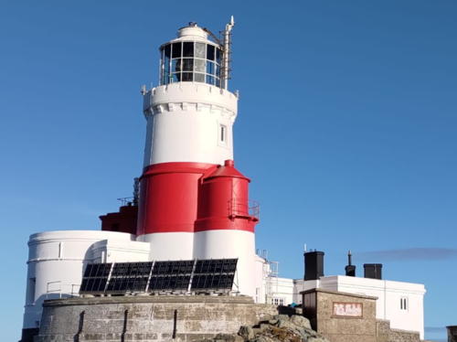
The Skerries (Ynys Y Moelrhoniaid)
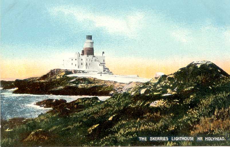
1717 (William Trench). Active; focal plane 36 m (119 ft); two white flashes every 10 s, day and night; also a continuous red light shown over the Coal Rock reef (see next entry). 23 m (75 ft) round cylindrical stone tower with lantern and gallery, attached to a 2-story keeper's house. Tower painted white with a single broad red horizontal band; the red band is continued around the top of the keeper's house so that from a distance a red stripe appears around the whole complex. Ray Clayton's 2023 photo is at right, Lighthouse Accommodations has a page for the lighthouse, Lighthouse Digest has a photo by Tony Denton, Stephen Roddick has a good photo, C.W. Bash has a photo, Peter Godfrey has a closeup, Trabas has Arno Siering's distant 2013 view, Huelse has a historic postcard view, and Google has a satellite view. Privately built; in fact, this was the last private lighthouse in Britain when it was finally bought by Trinity House in 1841. This light station marks the extreme northwestern tip of Wales, making it one of the most important lights of the Irish Sea. In 2004 Trinity House restored the keeper's house and received an award for the historic preservation. Located on a small rocky island about 3 km (2 mi) northwest of Carmel Head, Anglesey. Accessible only by boat in dangerous seas. Distantly visible from Carmel Head, which can be reached by hiking the Anglesey Coastal Path. Site and tower closed. Operator: Trinity House. . ARLHS WAL-030; Admiralty A5168; NGA 5472.
* [Carmel Head Beacons]
1860s. Daybeacons, never lit. Two 9 m (30 ft) triangular stone beacons. The seaward side of the beacons was previously painted white, although very little paint remains. Ian Warburton has a view from the sea, Lighthouse Accommodations has a page for the beacons, and Google has a satellite view. These beacons line up with a conical stone beacon on the islet of West Mouse; the line points to Coal Rock, a dangerous reef lying beyond West Mouse. Located at the eastern point of Carmel Head, southeast of the Skerries lighthouse (next entry). Site open.

The Skerries Light, Llanfairynghornwy, Jaanuary 2023
Google Maps photo by Ray Clayton
* Amlwch Old Harbour (2)
1853 (station established 1817). Inactive. Approx. 11 m (36 ft) square stone tower attached to a 1-story stone building; square lantern room with slate roof. Llion Hughes has a good 2006 photo, Robin Drayton has a photo, and Google has a 2024 street view and a satellite view. Located at the end of the short pier enclosing the old harbor at Amlwch Port in northwestern Anglesey. Site open, tower closed. Owner/site manager: Isle of Anglesey Council. ARLHS WAL-055.
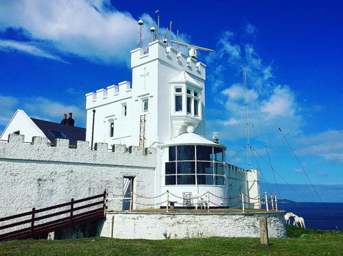
* Point Lynas (2)
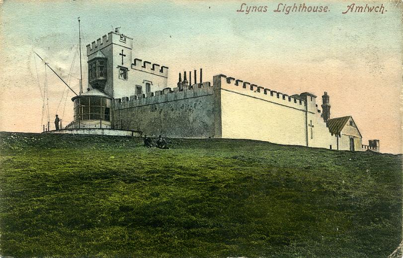
1835 (Jesse Hartley; station established 1779). Active; focal plane 39 m (128 ft); white light, 8 s on, 2 s off. Lantern, at ground level, attached to the front of an 11 m (36 ft) square cylindrical castellated stone tower; the tower, keeper's house, and other structures are enclosed by a high stone wall. In this unusual design, the tower has an observation window above the lantern. 1st order Fresnel lens in use. Fog horn (blast every 45 s). A 2021 photo is at right, Lighthouse Accommodations has a page for the lighthouse, Trabas has a 2006 closeup, Steve Fareham has a 2007 photo, a 2020 photo is available, Huelse has a historic postcard view, Joseph Mearman has a street view, and Google has a satellite view. The original lighthouse was 300 m to the south. Like Great Orme, the light station was built by the Mersey Docks and Harbour Board and transferred to Trinity House in 1973. In 2000 Trinity House sold the station to Robin and Iona Beckmann, who spent the next decade restoring the buildings. In 2010 the Beckmanns placed the property for sale for £1.5 million; in 2014 it was still for sale with the price reduced to £1.375 million. Apparently it did sell and the new owners have renovated several keeper's cottages for overnight accommodation. Located on Point Lynas, about 1 km (0.6 mi) north of Llaneilian. Probably accessible by road; if not, it's a short walk from parking in Llaneilian. Site and tower closed (private property), but the lighthouse can be seen from nearby. Operator: Trinity House. Owner/site manager: Point Lynas Lighthouse . ARLHS WAL-019; Admiralty A5160; NGA 5464.

Point Lynas Light, Llaneilian, October 2021
Instagram photo by love_a_lighthouse
* Trwyn Du (Penmon Point)
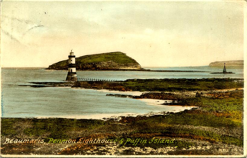
1838 (James Walker). Active; focal plane 19 m (63 ft); white flash every 5 s. 29 m (62 ft) round cylindrical castellated stone tower with lantern and gallery, painted with black and white horizontal bands; the lantern is white. The historic 178 kg (392 lb) fog bell remains in place but it was replaced by a foghorn in 2019. David Cumbley's 2023 photo is at the top of this page, Lighthouse Digest has a photo by Tony Denton, Trabas has Ian Wright's 2006 closeup, Jeff Buck has a photo, there's a 2008 photo showing waves breaking against the tower, Lighthouse Accommodations has a page for the lighthouse, Wikimedia has many photos, Marinas.com has aerial photos, Huelse has a historic postcard view, Matt Vickery has a street view, and Google has a satellite view. The lighthouse stands at the northeastern corner of the Isle of Anglesey marking the northern entrance to Menai Strait, which separates the island from the Welsh mainland. In 1996 Trinity House renovated the lighthouse by converting it to solar power and installing a mechanism to operate the fog bell. A foghorn was installed (to the dismay of neighbors) when this mechanism became unreliable in 2019. In 2022 one of the two privately-owned onshore keeper's houses was for sale for £1.7 million. Located just off the point of Trwyn Penmon about 1200 m (3/4 mi) northeast of Penmon. It is possible to walk to the lighthouse at low tide, although the rough shingle beaches are rather difficult walking. Also visible from cruises out of Beaumaris. Site open, tower closed. Operator: Trinity House. . ARLHS WAL-031; Admiralty A5140; NGA 5420.

Great Orme Head (Llandudno) Light, Llandudno, May 2022
Google Maps photo by Alan Jones

Conwy Lighthouse
The County Borough of Conwy faces north on the Irish Sea east of the Isle of Anglesey. It has a population of about 120,000.

**
Great Orme Head (Llandudno)
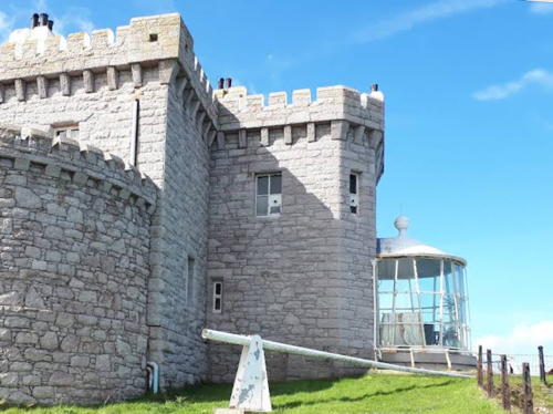
1862 (G. Lyster). Inactive since 1985. 11 m (37 ft) lantern attached to a 2-story castellated keeper's house. The original 1st order Fresnel lens is on display nearby at the Great Orme Summit Complex. A 2022 photo by Alan Jones is above right, Bert Kos has a closeup photo, Lighthouse Accommodations has a page for the lighthouse, Anna Nowak has a view from above, Les Johnson has a 2022 closeup, Eric Jones has a 2008 photo from the rear of the building, and Google has a satellite view and a distant street view. The Great Orme is a huge limestone promontory jutting into the Irish Sea north of Llandudno. This remarkable lighthouse is perched high on a vertical cliff at the northern end of the promontory. Built by the Mersey Docks and Harbour Board, it was transferred to Trinity House in 1973 and deactivated 12 years later. It then became a bed and breakfast inn; the lantern room is now a sitting room with a spectacular view of the sea. Located on Marine Drive (a toll road) about 5 km (3 mi) northwest of Llandudno. Site open, tower open to paying guests. Owner/site manager: The Lighthouse - Llandudno . ARLHS WAL-008; ex-Admiralty A5134.

Flintshire (Sir y Fflint) Lighthouse
Flintshire is a small county in the northeastern corner of Wales. Much of the county faces eastward on the marshy estuary of the River Dee. The county's population is about 160,000.

* Point of Ayr (Talacre)
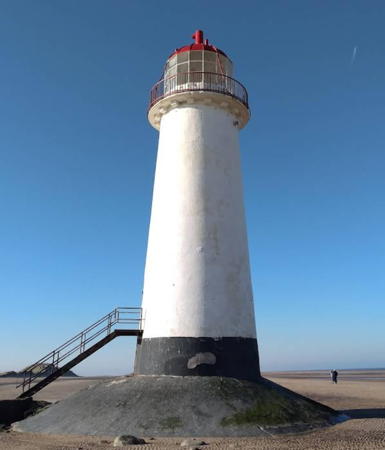
1776. Inactive since 1883. 18 m (58 ft) round brick tower with lantern and gallery, painted white; lantern painted black, lantern dome red. Petereurwen Owen's 2023 photo is at right, another good photo is available, Eugene Everson has a 2008 photo, Grzegorz Wieczorek has a 2018 closeup, Kenny Gresty has a street view from the beach, and Google has a satellite view. Built to mark the entrance to the Dee estuary, the lighthouse was replaced by a lightship in 1883. Though long abandoned, this lighthouse was maintained in fair condition by its owner, James McAllister, who bought it at auction in 1983. In November 2011 McAllister offered the lighthouse for sale for £100,000. It sold sometime in 2012-13. The new owners found the tower to be in poor condition and have been working steadily to patch leaks and restore the masonry. They capped off their work by repainting the tower in 2022, and it looks great in the photo at right. The lighthouse is surrounded by water at high tide but it can be reached easily across a broad, flat beach when the tide is low. The surrounding land is a nature preserve, the Gronant and Talacre Dunes SSSI. Located on the beach about 1 km (0.6 mi) west of Point of Ayre. Accessible by walking about 800 m (0.5 mi) from Talacre, a short distance off the A548 coastal highway. Site open, tower closed. Owner/site manager: private. . ARLHS WAL-018.

Point of Ayr Light, Talacre, February 2023
Google Maps photo by Petereurwen Owen

Information available on lost lighthouses:

Notable faux lighthouses:

Adjoining pages: North: Isle of Man | Northeast: Northwestern England | South: South and Wesy Wales

Return to the Lighthouse Directory index | Ratings key

Posted November 15, 2004. Checked and revised June 7, 2025. Lighthouses: 13, lightships: 1. Site copyright 2025 Russ Rowlett and the University of North Carolina at Chapel Hill.