- * [Scott's
Head (2?)]
- Date unknown. Active; focal plane unlisted; quick-flashing white
light. Approx. 5 m (17 ft) square post. Lightphotos.net has a 2013 closeup of the post, Marc Crandall has a closeup street view, Trabas has a distant view by
Capt. Theo Hinrichs, and Google has a distant satellite
view. Scott's
Head is actually a tombolo: a small island attached to the southern tip of
Dominica by a gravel bar; Wikimedia has a view across the bar. Located atop the promontory; accessible by
a trail crossing the bar from the nearby village also called Scott's
Head. Site open, tower closed. Owner/site manager: unknown.
Admiralty J5770; NGA 14929.
- Roseau
- Date unknown. Active; focal plane unlisted; red light, pattern unknown. Approx. 30 m (98 ft) triangular skeletal communications tower painted in with red and white horizontal bands. Trabas has Capt. Peter Mosselberger's photo and Google has an indistinct satellite view. Located on heights northeast of Roseau, the national capital. Site status unknown. Admiralty J5760.
- Barroui (Salisbury)
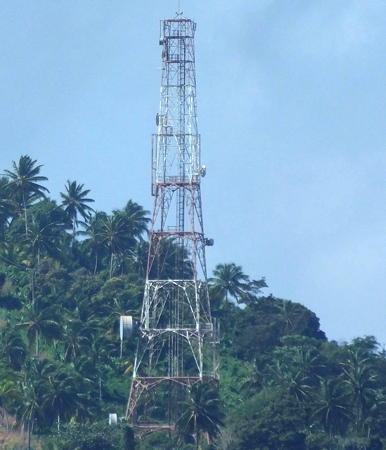
- Date unknown. Active; focal plane unlisted; two continuous red lights, one above the other. Approx. 30 m (98 ft) square skeletal communications tower. Trabas has a photo by
Capt. Peter Mosselberger (also seen at the top of this page) but the tower has not been found in Bing's satellite view. Located at Barroui (Baroui) on the northwestern coast of Dominica just north of Salisbury. Site status unknown. Owner/site manager: unknown.
Admiralty J5760.4; NGA 14926.
- Barbers Block (Morne Espagnol)
- Date unknown. Active; focal plane unlisted; continuous lights, one red and one green, arranged vertically. 12 m (39 ft) square skeletal communications tower painted in with red and white horizontal bands. Trabas has Capt. Peter Mosselberger's photo and Bing has an indistinct satellite view. Located on a high ridge near the northwestern tip of the island. Site status unknown. Owner/site manager: unknown.
Admiralty J5760.8; NGA 14925.
- Saint Cyr
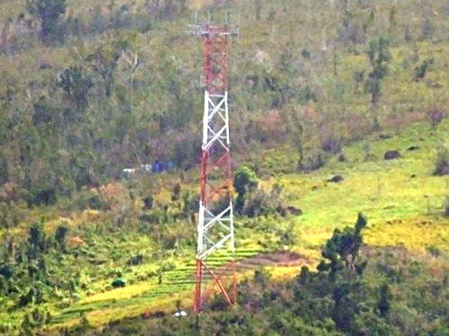
- Date unknown. Active; focal plane unlisted; red light, pattern unknown. Approx. 30 m (98 ft) square skeletal communications tower painted in with red and white horizontal bands. Trabas has Capt. Peter Mosselberger's photo (also seen at right), Lightphotos.net has the same photo, and Google has an indistinct satellite view. This light is seen by ships arriving from the Atlantic. Located in Saint Cyr, a village on slopes in the central east coast of the island. Site open, tower closed. Owner/site manager: unknown.
Admiralty J5762.
|
 Saint Cyr Light, Saint Cyr, February 2017
photo copyright Capt. Peter Mosselberger; used by permission |

