Lighthouses of Indonesia: Northwestern Papua

The Republic of Indonesia has been independent since 1945, after having been the Dutch East Indies for more than 350 years. It is a huge country, stretching along both sides of the Equator for more than 46 degrees of longitude (roughly 5100 km or 3200 miles). Comprised of some 17,000 islands (more than 6000 inhabited islands), it has hundreds of major aids to navigation.

Indonesia is divided into 38 provinces (provinsi) and the provinces are subdivided into county units called regencies (kabupaten). The lighthouses on this page are in Indonesian Papua (western New Guinea). In 1828 the Dutch extended their claim to the western half of New Guinea, the world's second-largest island, but they established no major settlements until nearly 1900. When Indonesia became independent in 1949 Papua was excluded and remained under Dutch control. Following strong Indonesian effrots to claim control an agreement in 1962 provided for a transitional period under United Nations administration. In 1969 an asembly of elder leaders decided to join Indonesia. However an independence movement called the Free Papua Movement (OPM) continues and a varying degree of unrest has persisted to the preent day.

This page describes lighthouses on the north coasts of West Papua Province and Southwest Papua Province. These provinces include the oddly-shaped Doberai or Bird's Head (Vogelkop) Peninsula at the northwestern corner of New Guinea. These coasts face northwest on the Halmahera Sea and north on the Philippine Sea. Lighthouses of the south coasts of both provinces are described on the Western Papua South Coast page.

More than 700 languages are spoken in Indonesia. The official national language, Indonesian (Bahasa Indonesia), was standardized from a form of Malay that served as a lingua franca across the archipelago. In Indonesian a lighthouse is a mercusuar or a menara suar. Tanjung is a cape, ujung is a headland or point of land, bukit is a hill, sungai is a river, kuala or muara is an estuary or river mouth, pulau is an island, karang is a reef, batu is a rock, laut is a sea, selat is a strait, teluk is a bay, pelabuhan is a harbor, and labuhan is a port. It's also worth knowing that the word for an island is nusa in Balinese and gili in the Sasak language spoken on Lombok and in western Sumbawa.

Aids to navigation in Indonesia are operated and maintained by the Directorate of Marine Navigation within the Directorate General of Sea Transportation

ARLHS numbers are from the ARLHS World List of Lights. Admiralty numbers are from volumes F and Q of the Admiralty List of Lights & Fog Signals. U.S. NGA List numbers are from Publications 111 and 112.

General Sources
World of Lighthouses - Indonesia
Photos by various photographers available from Lightphotos.net.
Online List of Lights - Indonesia - Papua - Vol Q and Vol. F
Photos by various photographers posted by Alexander Trabas. Volume Q includes light south of the Equatir and Volume F has lights north of the Equator.

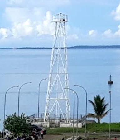
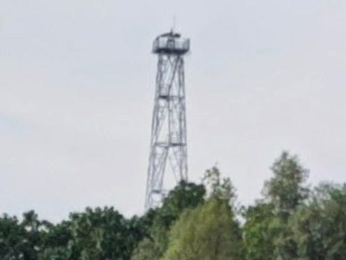
Manokwari Light, Manokwari, June 2021
Google Maps photo by fotobagus manokwari

Southwest Papua Province North Coast Lighthouses

 
Sorong Regency: Southern Sele Strait Lighthouses
The narrow Sele Strait separates the mainland of Papua from Pulau Sulawati to the west. Sorong is a city of about 300,000 people located at the tip of the Doberai (Bird's Head) Peninsula and on the east side of the strait near its northern end; its broad harbor, sheltered by Pulau Sulawati, makes it one of the best ports of West Papua.

Kamoomyel Range Rear
Date unknown. Active; focal plane 14 m (46 ft); green flash every 5 s. 14 m (46 ft) skeletal tower mounted on a platform supported by piles. No photo available but Google has a satellite view. This is the rear light for a long southbound range in the Sele Strait. Located in the strait about 50 km (30 mi) south southwest of Sorong. Accessible only by boat. Admiralty Q3381.1; NGA 26004.
 
Pulau Segarau
Date unknown. Active; focal plane about 16 m (52 ft); green light, pattern unknown. Approx. 16 m (52 ft) square green skeletal tower mounted on a platform supported by piles. No photo available but Bing has a satellite view. Located on a shoal on the east side of the southern Sele Strait. Accessible only by boat. Admiralty Q3380.3.
Pulau Balbili (2)
Date unknown. Active; focal plane about 16 m (52 ft); two white flashes every 12.5 s. Approx. 16 m (52 ft) square skeletal tower painted white and mounted on a platform supported by piles. No photo available but Bing has a satellite view. NGA lists a 5 m (16 ft) tower at this location. Located just off the northeast point of Pulau Balbili, on the west side of Sele Strait. Accessible only by boat. Site open, tower closed. Admiralty Q3379; NGA 25992.
Pulau Majener
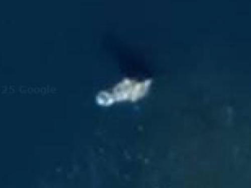
Date unknown. Active; focal plane about 16 m (52 ft); green light, pattern unknown. Approx. 16 m (52 ft) square green skeletal tower mounted on a platform supported by piles. No photo available but Google has the satellite view at right. Located on a shoal on the east side of the Sele Strait south of Pulau Yawya. Accessible only by boat. Admiralty Q3378.77.
Pulau Kabra East
Date unknown. Active; focal plane about 16 m (52 ft); green light, pattern unknown. Approx. 16 m (52 ft) square green skeletal tower mounted on a platform supported by piles. No photo available but Bing has a satellite view. Located on a shoal in the center of the Sele Strait east of Pulau Kabra. Accessible only by boat. Admiralty Q3378.75.
Pulau Kabra North
Date unknown. Active; focal plane about 16 m (52 ft); red light, pattern unknown. Approx. 16 m (52 ft) square red skeletal tower mounted on a platform supported by piles. No photo available but Bing has a satellite view. Located on the west side of the Sele Strait northeast of Pulau Kabra. Accessible only by boat. Admiralty Q3378.73.
 

Pulau Majener Light, Sele Strait
Google Maps street view
 
Pulau Garma Kecil
Date unknown. Active; focal plane about 16 m (52 ft); red light, pattern unknown. Approx. 16 m (52 ft) square red skeletal tower mounted on a platform supported by piles. No photo available but Google has a satellite view. Located in the Sele Strait just south of Pulau Yawya and about 4 km (2.5 mi) southwest of the Arar Terminal. Accessible only by boat. Admiralty Q3378.7.
Pulau Selebus
Date unknown. Active; focal plane about 16 m (52 ft); green light, pattern unknown. Approx. 16 m (52 ft) square green skeletal tower mounted on a platform supported by piles. No photo available but Google has a satellite view. Located about 1.6 km (1 mi) southwest of the Arar Terminal. Accessible only by boat. Admiralty Q3378.6.
Arar Terminal
2009. Active; focal plane 22 m (72 ft); white flash every 3 s. 22 m (72 ft) triangular skeletal tower, painted white. No photo available but Google has a satellite view. Located just offshore at a liquid natural gas terminal about 25 km (15 mi) south of Sorong harbor. Site and tower closed. Admiralty Q3378.5.
Pelabuhan Arar
Date unknown. Active; focal plane about 23 m (75 ft); white light, pattern unknown. Approx. 20 m (66 ft) square white skeletal tower. Andi Afwan has the 2018 photo at right, a panoramic photo is available, and Google has a satellite view.Located at the Semen Gresik terminal at Arar. Site and tower closed. Admiralty Q3378.52.
Arar Approach South
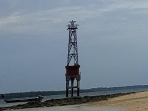
Date unknown. Active; focal plane about 16 m (52 ft); green light, pattern unknown. Approx. 16 m (52 ft) square green skeletal tower mounted on a platform supported by piles. Tidja Famy has a photo (lighthouse in foreground), the tower is at upper left in the photo at right, and Google has a satellite view. Located about 600 m (3/8 mi) off the Arar waterfront. Accessible only by boat. Admiralty Q3378.495.
Arar Approach North
Date unknown. Active; focal plane about 16 m (52 ft); red light, pattern unknown. Approx. 16 m (52 ft) square red skeletal tower mounted on a platform supported by piles. Tidja Famy has a photo (lighthouse in background) and Google has a satellite view. Located about 600 m (3/8 mi) north northwest of the South light. Accessible only by boat. Admiralty Q3378.49.

Pelabuhan Arar Light, Sorong, January 2018
Google Maps photo by Andi Afwan
Pulau Yarusir (Pulau Pasir)
Date unknown. Active; focal plane about 16 m (52 ft); red light, pattern unknown. Approx. 16 m (52 ft) square red skeletal tower mounted on a platform supported by piles. Muhammad Fathurohim's 2020 photo is at right, Catherine Kudheta has a 2024 photo, and Google has a satellite view. Between this light and the next one listed ships are guided through a narrow passage by several smaller lights. Located at the south end of a shoal off a small island opposite the Arar Terminal. Accessible only by boat. Admiralty Q3378.489.
Pulau Sisi West
Date unknown. Active; focal plane about 16 m (52 ft); green light, pattern unknown. Approx. 16 m (52 ft) square green skeletal tower mounted on a platform supported by piles. No photo available but Bing has a satellite view. Located on a shoal in the center of the Sele Strait about 20 km (13 mi) southwest of Sorong. Accessible only by boat. Admiralty Q3378.1.
Pulau Yawya
Date unknown. Active; focal plane about 16 m (52 ft); green light, pattern unknown. Approx. 16 m (52 ft) square green skeletal tower mounted on a platform supported by piles. No photo available but Google has a satellite view. Located off the northeast side of Pulau Yawya, a large island opposite the Arar Terminal, on the east side of the Sele Strait. Accessible only by boat. Admiralty Q3378.485.
Pulau Arar
Date unknown. Active; focal plane about 16 m (52 ft); red light, pattern unknown. Approx. 16 m (52 ft) square red skeletal tower mounted on a platform supported by piles. No photo available but Google has a satellite view. Located at the south end of a shoal area about 1.6 km (1 mi) northwest of the Arar Terminal. Accessible only by boat. Admiralty Q3378.45.

Pulau Yarusir Light, Sorong, March 2020
Google Maps photo by Muhammad Fathurohim
Pulau Vandu
Date unknown. Active; focal plane about 12 m (39 ft); green flash every 5 s. Approx. 12 m (39 ft) square green skeletal tower mounted on a platform supported by piles. No photo available but Google has a satellite view. Located on a shoal on the east side of the Sele Strait channel about 10 km (6 mi) southwest of Sorong. Accessible only by boat. Admiralty Q3370.
Pulau Nanah (?)
Date unknown. Active(?); focal plane about 12 m (39 ft); red flash every 5 s. Approx. 12 m (39 ft) square red skeletal tower mounted on a platform supported by piles. No photo available and the light is currently missing from Google's satellite view. Located on a shoal on the west side of the Sele Strait channel about 10 km (6 mi) southwest of Sorong. Accessible only by boat. Admiralty Q3371.

Sorong Regency and City: Sorong Harbor and Northern Sele Strait Lighthouses
* Pulau Doom
Date unknown. Active; focal plane about 12 m (39 ft); green light, pattern unknown. Approx. 12 m (39 ft) round green tower on a platform supported by piles. A 2023 street view is available and Google has a satellite view. Located beside the pier of Pulau Doom, a small but densely inhabited island across the harbor southwest of Sorong. Accessible only by boat but easily seen from shore. Site open, tower closed. Admiralty Q3374; NGA 25964.
Pulau Dofior (2)
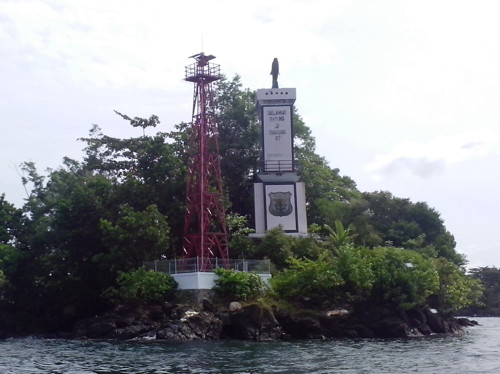
Date unknown. Active; focal plane about 16 m (52 ft); red flash every 2 s. Approx. 14 m (46 ft) square skeletal tower with gallery, painted red. Richard Monny's photo is at right, Rochmadi Hendro Cahyono has a good view from the sea, and Google has a satellite view. A tall monument stands behind the lighthouse. This light replaced a much smaller light seen in Ryan Sanjaya's 2008 photo. NGA misspells the name of the islet as Dopior. Located on an islet in the entrance to Sorong harbor. Accessible only by boat. Site open, tower closed. Admiralty Q3366; NGA 25968.
Karang Dua
Date unknown. Active; focal plane 7 m (23 ft); two white flashes every 10 s. 7 m (23 ft) beacon, probably a fiberglass tower. No photo available but Google has a satellite view. Located on a shoal about 800 m (1/2 mi) off the Sorong waterfront. Accessible only by boat. Site open, tower closed. Admiralty Q3368.5; NGA 25984.
Pulau Dofior Light
Pulau Dofior Light, Sorong, March 2014
ex-Panoramio photo copyright Richard Monny; used by permission
* Sorong Jetty Head (Pelabuhan Perikanan)
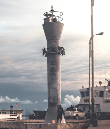
Date unknown. Active; focal plane about 15 m (49 ft); white light, pattern unknown. Approx. 13 m (43 ft) round barbell-shaped white concrete tower. Tri Firmansyah has the 2018 photo also seen at right, a 2019 distant view is available, and Google has a satellite view. Located at the marina jetty in Sorong. Site open, tower closed. Admiralty Q3366.5.
* Sorong Port Common Front
Date unknown. Active; focal plane about 15 m (49 ft); white light, pattern unknown. Approx. 15 m (49 ft) square white skeletal tower standing on a concrete base. Davit Nainggolan has a 2018 photo and Google has a satellite view. Located offshore in a harbor basin east of the Sorong marina. Accessible only by boat but easily seen from shore. Site open, tower closed. Admiralty Q3368; NGA 25972.
* Sorong Port South Entrance Range Rear
Date unknown. Active; focal plane 24 m (79 ft); white light, 2 s on, 2 s off. Approx. 16 m (52 ft) square white skeletal tower. No photo available but Google has an indistinct satellite view. NGA lists a 16 ft tower but this must be an error. Located in a residential area 841 m (1/2 mi) northeast of the common front light. Site probably open, tower closed. Admiralty Q3367.9; NGA 25980.
* Sorong Port North Entrance Range Rear
Date unknown. Active; focal plane 60 m (197 ft); white light, 2 s on, 2 s off. Approx. 16 m (52 ft) square white skeletal tower. No photo available but Google has an indistinct satellite view. NGA lists a 16 ft tower but this must be an error. Located in a residential area 1.9 km (1.2 mi) east southeast of the common front light. Site probably open, tower closed. Admiralty Q3368.1; NGA 25976.
Pulau Tsiof
Date unknown. Active; focal plane 11 m (36 ft); three white flashes every 15 s. 10 m (33 ft) square white skeletal tower. No photo available but Google has a satellite view. The tower appears taller than its listed height. Located at the western tip of Pulau Tsiof about 6 km (4 mi) west of Sorong harbor. Accessible only by boat. Site open, tower closed. Admiralty Q3372; NGA 25988.
Pulau Ram West
Date unknown. Active; focal plane about 16 m (52 ft); red light, pattern unknown. Approx. 16 m (52 ft) tower, almost certainly a square red skeletal tower, on a platform supported by piles. No photo available and Bing has only a fuzzy satellite view of the reef. This is an important light marking the northern entrance to the Sele Strait and Sorong. Located about 2.5 km (1.5 mi) west of Pulau Buaya (Pulau Ram). Accessible only by boat. Site open, tower closed. Admiralty Q3373.4.

Jetty Head Light, Sorong, September 2018
Google Maps photo by Tri Firmansyah
Pulau Buaya (Pulau Ram)
Date unknown. Active; focal plane 86 m (282 ft); four white flashes every 25 s. 20 m (66 ft) square white skeletal tower. No photo available but Google has a satellite view. The light guides vessels entering the Sele Strait from the north. Located on the western tip of the island, about 10 km (6 mi) northwest of Sorong. Accessible only by boat. Site status unknown. Admiralty Q3373.3; NGA 25956.

Tambrouw Regency Lighthouses
* Sausapor
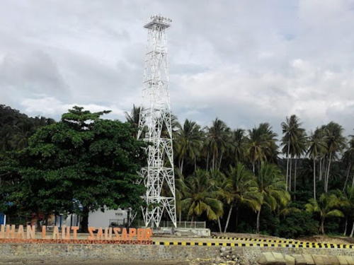
2015 (?). Active; focal plane 34 m (112 ft); white flash every 10 s. 30 m (98 ft) square skeletal tower painted white. Suprandoko Sutrisno has the photo at right, Bram Mambrasar has a closeup, a 2020 view from the sea is available, and Bing has a satellite view. Located at the base of the pier at Sausapor, the seat of Tambrouw Regency, a small town on the "brow" of the Bird's Head peninsula. Site open, tower closed. Admiralty Q3375.
Mios Su (Amsterdam Island) (2?)
Date unknown. Active; focal plane 17 m (56 ft) (?); white flash every 3 s. 16.5 m (54 ft) (?) square iron skeletal tower, painted white. The lighthouse is in the left distance in a 2023 aerial view and Google has a satellite view. This light marks the eastern entrance to the Dampier Strait, which separates the Doberai Peninsula of Papua from the island of Waigeo. In the satellite view the tower appears to be much taller than its listed height. Located on the western tip of a small island off the "eyebrow" of the Bird's Head. Accessible only by boat. Site status unknown. ARLHS IDO-170; Admiralty Q3376; NGA 26024.
 

Sausapur Light, Sausapur, May 2016
Google Maps photo by Suprandoko Sutrisno
 

West Papua Province North Coast Lighthouses

Manokwari Regency Lighthouses
Manokwari is the capital of West Papua Province; it has a metropolitan population of more than 250,000. The city has a fine natural harbor and has become an important port.

Tanjung Saukorem (Saoekorem)
Date unknown. Active; focal plane 32 m (105 ft); two white flashes every 10 s. 30 m (98 ft) iron skeletal tower, painted white. No photo available but Google has a satellite view of the station. Located on a low promontory on the top of the Bird's Head, about 125 km (75 mi) north northwest of Manokwari. Site status unknown. ARLHS IDO-269; Admiralty Q3376.5; NGA 26028.
Tanjung Memori (Tanjung Bakaro)
Date unknown. Active; focal plane about 33 m (108 ft); three white flashes every 15 s. Approx. 30 m (98 ft) square skeletal tower painted white. Ronald Marthen has a 2020 photo, a drone view is available, and Google has a satellite view. Tanjung Memori is a promontory sheltering the harbor of Manokwari, the capital of West Papua province. Located at the tip of the cape, about 8 km (5 mi) east of Manokwari. Accessible by road. Site status unknown. Admiralty Q3389; NGA 26032.
Karang Butsiuri
Date unknown. Active; focal plane 11 m (36 ft); red flash every 5 s. 11 m (36 ft) square red skeletal tower on a platform supported by piles. Dmitry Telnov has a distant view, Faisal Rauf also has a distant view (lighthouse right of center), a distant drone view is available, and Google has a satellite view. Located on a shoal in the entrance to Teluk Manokwari. Accessible only by boat. Site open, tower closed. Admiralty Q3391; NGA 26036.
Manokwari Range Front (2)
Date unknown. Inactive. Approx. 17 m (56 ft) square white skeletal tower. A 2021 drone view is available, Google has a street view and a drone view showing both Manokwari lighthouses, and Bing has a satellite view. NGA lists a much shorter tower. Located on the waterfront of Manokwari. Site status unknown. ex-Admiralty Q3390; NGA 26040.
* Manokwari (Range Rear) (2)
Date unknown. Active; focal plane about 25 m (82 ft); white light, 1 s on, 1 s off. Approx. 22 m (72 ft) square white skeletal tower. A portion of a 2021 drone view is at the top of this page, and Google has a satellite view and a drone view showing both Manokwari lighthouses. NGA lists a much shorter tower. The range has been discontinued and the Admiralty has dropped its listing of the front light. Located about 250 m (820 ft) northwest of the harbor area in Manokwari. Site open, tower closed. Admiralty Q3390.1; NGA 26048.
* Manokwari Perikanan Pelabuhan (Fishery Harbor)
Date unknown. Active; focal plane about 15 m (49 ft); white light, pattern unknown. Approx. 12 m (39 ft) square white skeletal tower. A 2023 photo and an aerial view are available, the tower is seen in the first few seconds of Bastian Noriwari's video taken from the sea, and the light is centered beside the blue-roofed building in Google's satellite view. Located at the fishery port on the west side of the Manokwari harbor. Site open, tower closed. Admiralty Q3391.3

Tanjung Memori Light, Manokwari, October 2020
Google Maps photo by Ronald Marthen
Pertamina Manokwari
Date unknown. Active; focal plane about 17 m (56 ft); white light, pattern unknown. 6 m (20 ft) square pyramidal skeletal tower, three sides covered with white siding. Laode Rasyid has a 2023 photo and Google has a street view and an indistinct satellite view. Located at the Pertamina oil terminal in Manokwari. Site and tower closed but the light is seen from the street. Admiralty Q3390.6.

Manokwari Selatan (South Manokwari) Regency Lighthouse
Tanjung Oransbari
Date unknown. Active; focal plane 50 m (164 ft); white light occulting once every 4 s. 20 m (66 ft) square skeletal tower painted white. No photo available but Google has a satellite view. Located on a promontory at the back of the Bird's Head, marking the west side of the entrance to the Cenderawasih Gulf. Site status unknown. Admiralty Q3395.1; NGA 26080.
* Pelabuhan Gaya Baru
Date unknown. Active; focal plane about 12 m (39 ft); white light, pattern unknown. Approx. 10 m (33 ft) round white barbell-shaped tower. Aida Krisna's photo is at right and Google has a satellite view. Located at a small boat harbor in central Manokwari Selatan. Site open, tower closed. Not listed by the Admiralty.

Teluk Wondama (Wondama Bay) Regency Lighthouses
Tanjung Yanimerai
Date unknown. Active; focal plane 24 m (79 ft); yellow flash every 4 s. 24 m (79 ft) yellow tower, probably skeletal. No photo available but Bing's indistinct satellite view may show the light. Located at the northern tip of Pulau Yanimaerai, a small island off the end of the much larger Pulau Rumberpon, which shelters Teluk Rumberpon. Site status unknown. Admiralty Q3395.15; NGA 26081.

Pelabuhan Gaya Baru Light, Manokwari Selatan, March 2017
Google Maps photo by Aida Krisna
Pulau Matas
Date unknown. Active; focal plane 14 m (46 ft); yellow flash every 4 s. 14 m (46 ft) yellow tower, probably skeletal, on a platform supported by piles. No photo available and the light is not shown in Bing's satellite view of the listed location. Located off the west side of the Pulau Matas atoll, about 65 km (40 mi) east of Pulau Rumberpon. Accessible only by boat. Admiralty Q3395.35; NGA 26106.5.
Tanjung Wandoswaar (Mios Waar)
Date unknown. Active; focal plane 15 m (49 ft); yellow flash every 4 s. 15 m (49 ft) yellow tower, probably skeletal, on a platform supported by piles. Google has a satellite view of a settlement at the listed location, but the description of the light implies it is offshore, not shown by the satellite view. Located near the northern end of Mios Waar, a large forested island southeast of Pulau Rumberpon. Accessible only by boat. Admiralty Q3395.2; NGA 26082.
Teluk Wasior (Wandamen, Wandammen) (2)
Date unknown. Active; focal plane 13 m (43 ft); white light, 2 s on, 8 s off. Approx. 12 m (39 ft) square skeletal tower with gallery painted white. Jefry Echletus has the 2020 street view at right and Google has a satellite view. Located near the port area in Wasior, a ferry terminal on the east side of Wondama Bay. Site status unknown. Admiralty Q3395.55; NGA 26107.7.
Pulau Yop
Date unknown. Active; focal plane 14 m (46 ft); white flash every 5 s. Approx. 12 m (39 ft) green tower, probably fiberglass. No photo available but Google has an indistinct satellite view. Located on the eastern tip of Yop, an island on the west side of Wondama Bay. Accessible only by boat. Admiralty Q3395.5; NGA 26107.5.

Teluk Wasior Light, Wasior, September 2020
Google Maps photo by Jefry Echletus

Information available on lost lighthouses:

Notable faux lighthouses:

Adjoining pages: East: Northern Papua | South: Southwest Papua | West: Central Maluku | Northwest: North Maluku

Return to the Lighthouse Directory index | Ratings key

Posted December 31, 2008. Checked and revised February 11, 2025. Lighthouses: 46. Site copyright 2025 Russ Rowlett and the University of North Carolina at Chapel Hill.