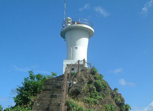
Lighthouses of Japan: Ōsumi and Amami Islands

The Ōsumi and Amami islands, together with neighboring groups of smaller islands, form the northern half of the Nansei (or Ryūkyū) Islands (Nansei-shotō or "southwest islands" in Japanese), an archipelago extending southwestward from Kyūshū towards Taiwan. Administratively, these islands are part of Kagoshima Prefecture, the southernmost prefecture of Kyūshū.

Historically the Ryūkyū Islands were a more-or-less independent kingdom paying tribute as needed to either China or Japan or both. Japan annexed the islands in 1879 over Chinese protests; U.S. President Ulysses Grant, called in as arbitrator, ruled in favor of Japan. At the end of World War II in 1945, the Ryūkyū Islands from the Tokara group southward came under U.S. control. The U.S. returned the Tokaras to Japan in 1952 and the Amami Islands in 1953; Japan then attached these islands to Kagoshima Prefecture. Okinawa and the islands farther south remained under U.S. control as the Trust Territory of the Ryūkyū Islands. In 1972, the U.S. ceded sovereignty over all of the Ryūkyūs back to Japan, and the southern islands then became Okinawa Prefecture.

In Japanese, the word for a lighthouse is tōdai or toudai (灯台). The words saki and misaki are for capes and headlands, shima (also spelled sima or jima) is an island, wan is a bay, andis a harbor. Lighthouses in Japan are operated and maintained by the Japanese Coast Guard's Maritime Safety Agency. Lighthouses in the Ōsumi islands are maintained by the Coast Guard office at Kagoshima City, Kyūshū. Those in the Amami islands are maintained by the office at Amami City.

ARLHS numbers are from the ARLHS World List of Lights. JCG numbers are the Japanese Coast Guard's light list numbers. Admiralty numbers are from volume M of the Admiralty List of Lights & Fog Signals. U.S. NGA List numbers are from Publication 112.

General Sources
Lighthouses in Japan - Kagoshima
A comprehensive site, although almost entirely in Japanese.
Kiso's Lighthouses
This site has many excellent photos of Japanese lighthouses.
Amami District Lighthouses
Photos posted by the Amami Coast Guard Station. There is additional pages of photos for Amami Ōshima and for the other islands of the district.
Region Ten Lighthouses
Information and photos posted by the Tenth Coast Guard Region office, which is responsible for Kagoshima Prefecture.
Lighthouses in Kagoshima Prefecture
Photos by various photographers available from Wikimedia.
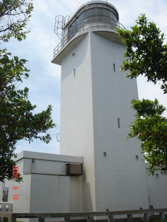
Kashika Saki Light
Kashika Saki Light, Nishioomote, August 2005
Japanese Coast Guard photo

Ōsumi Islands Lighthouses

Mishima Islands Lighthouses
Note: The Mishima Islands are small islands lying roughly in a west-to-east line northwest of the other Ōsumi Islands. Administratively, Mishima is a village under the direct administration of Kagoshima City on the mainland of Kyūshū.
Kusagaki Shima
Date unknown. Active; focal plane 140 m (459 ft); two white flashes every 20 s. 14 m (46 ft) round cylindrical concrete tower with lantern and gallery, attached to an L-shaped 1-story concrete keeper's house. Entire lighthouse is white. The Coast Guard has the photo at right and also an aerial photo, but Bing has only a distant satellite view of the area. The light station has been converted to solar power and has the largest solar array of any Japanese lighthouse. Located atop an isolated and uninhabited island about 50 km (30 mi) west of Kuro Shima and 80 km (50 mi) southwest of Kyūshū. Accessible only by helicopter. Site and tower closed. ARLHS JPN-312; JCG-6901; Admiralty M4802; NGA 12988.
* Kuro Shima (Satsuma Kuroshima)
Date unknown. Active; focal plane 239 m (784 ft); flash every 5 s, alternately white and green. 11 m (36 ft) square cylindrical concrete tower with lantern and gallery. Entire lighthouse is white. A photo is available (fourth photo on the page), and Kiso has a photo (1/4 the way down the page), but Google has only a distant satellite view of the area. Kuroshima is the westernmost of three inhabited islands of the Mishima group. The island has a permanent population of a little over 200; a ferry from Kagoshima city calls there two or three times per week. Located on heights at the eastern tip of the island. Site open, tower closed. JCG-6901.5; Admiralty M4804; NGA 12990.
* Iō Shima (Iōjima, Satsuma Ioshima)
1972. Active; focal plane 147 m (482 ft); white flash every 4 s. 13 m (43 ft) round concrete tower with gallery. Entire lighthouse is white. Kiso has a photo (1/4 the way down the page), and a 2012 closeup is available, but Google has only a distant satellite view of the area. In Japanese, Iō Shima has the same name as Iwo Jima, the site of the famous World War II battle. A ferry from Kagoshima city serves the island two or three times per week. Located on heights above the village of Iōjima at the western end of the island. Site open, tower closed. JCG-6902; Admiralty M4787; NGA 12992.
Kusagaki Shima Light
Kusagaki Shima Light, Mishima Islands
Japanese Coast Guard photo (no longer online)
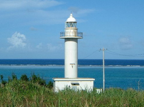
Nishinoomote City (Northern Tanegashima) Lighthouses
Note: Tanegashima, the northernmost of the major Nansei Islands, is about 58 km (36 mi) long but only about 10 km (6 mi) wide. The Portuguese adventurer Mindes Pinto arrived here in 1543, but the island is best known today as the site of the Tanegashima Space Center, where Japan's satellites are launched. Tanegashima is accessible by air and by high-speed ferry from Kagoshima.
* Sumiyoshi (Sumiyosi) Misaki
1956. Active; focal plane 23 m (75 ft); white flash every 5 s. 10 m (33 ft) square cylindrical concrete tower rising from a square 1-story concrete equipment room. Entire lighthouse is white. A 2012 closeup photo is available, Tom Yam Muu has a photo, Kiso has a photo (1/4 the way down the page), and Bing has a distant satellite view. Located on a promontory on the central west coast of Tanegashima. Site open, tower closed. JCG-6909; Admiralty M4794; NGA 13020.
Mageshima
Date unknown. Active; focal plane 14 m (46 ft); white flash every 3 s. 12 m (39 ft) round tapered white concrete tower attached to a small equipment shelter. The Coast Guard has a photo, another photo is available, and Google has a satellite view. Mageshima is a small island about 13 km (8 mi) west of Nishinoomote. The U.S. has proposed to use the island for practice landings by carrier-based pilots, moving that function from Okinawa; this is the subject of controversy in Japan. Located on the northern tip of the island. Site status unknown. ARLHS JPN-2573; JCG-6903; NGA 12996.
Nishinoomote (Nisinoomote)
1998. Active; focal plane 18 m (59 ft); two red flashes every 6 s. 15 m (49 ft) round cylindrical tower with lantern. The lighthouse is built in the form of Japanese H-2 rocket, with two strap-on booster tubes on the sides. Entire lighthouse painted red. A photo appears at right, a view from the harbor is available, and Google has a satellite view. Located at the north end of the detached outer breakwater of Nishinoomote, marking the entrance to the harbor. Accessible only by boat, but there is an excellent view from ferries arriving from Kagoshima. Site and tower closed. ARLHS JPN-2578; JCG-6904.1; Admiralty M4798.8; NGA 13002.
* Nishinoomote Sinko West Breakwater
1964. Active; focal plane 13 m (43 ft); green light, 2 s on, 2 s off. 9.5 m (31 ft) concrete post attached to a square 1-story concrete equipment room. Entire lighthouse is white. A photo and a more distant view (this light is at the left) are available, and Google has a satellite view. Located at the end of the breakwater in Nishinoomote harbor; the area north of the lighthouse has been reclaimed and developed as a park. Accessible by walking the pier. Site open, tower closed. ARLHS JPN-2581; JCG-6908; Admiralty M4798.4; NGA 13012.
Nishinoomote Sunosaki (Sonosaki) Breakwater
1964. Active; focal plane 13 m (43 ft); continuous green light with a more intense flash every 6 s. 9.5 m (31 ft) concrete post attached to a square 1-story concrete equipment room. Entire lighthouse is white. This light is at the right in a view of the harbor, and Google has a satellite view. Located at the end of a detached breakwater in Nishinoomote harbor. Accessible only by boat. Site open, tower closed. ARLHS JPN-2579; JCG-6905; Admiralty M4796; NGA 13004.
Nishinoomote Light
Nishinoomote Light, Nishinoomote, September 2006
Flickr Creative Commons photo by Dorothy (catandgirl)
* Kashika (Kasika) Saki
1963. Active; focal plane 69 m (226 ft); red flash every 15 s. 13 m (43 ft) square cylindrical concrete tower with concrete equipment room and gallery, rising from a 1-story concrete equipment building. Entire lighthouse is white. A photo is at the top of this page, Arashi Sanjyuurou has a closeup photo, a 2012 photo is available, Kiso has a photo (4th lighthouse on the page), and Bing has a distant satellite view of the area. Located on the northern tip of Tanegashima. Site open, tower closed. ARLHS JPN-773; JCG-6904; Admiralty M4799; NGA 13000.
* Shiojiura (Syoziura) Kō
Date unknown. Active (?); focal plane 11 m (36 ft); continuous green light with a more intense flash every 6 s. 8.5 m (28 ft) post attached to a square 1-story concrete equipment shelter. A distant view is available, and Google has a satellite view. There is a report that this light was deactivated in November 2013. Located at the end of the south breakwater of Shiojiura harbor on the northeastern coast of Tanegashima. Accessible by walking the pier. Site open, tower closed. ARLHS JPN-2588; JCG-6915; Admiralty M4800; NGA 13044.

Minamitane Town (Southern Tanegashima) Lighthouses
Kumano Kō Directional
Date unknown. Active; focal plane 28 m (95 ft); continuous white, red green light depending on direction. 7 m (23 ft) square white concrete tower. A distant view is available, and Google has a satellite view. Located on a rocky pinnacle about 800 m (1/2 mi) southwest of Kumano harbor. Site status unknown. JCG-6914; Admiralty M4800.6; NGA 13040.
Otake Saki (Tanegashima)
1951. Active; focal plane 106 m (348 ft); two white flashes every 20 s. 18 m (59 ft) round concrete tower with lantern and gallery, rising from a semicircular 1-story concrete keeper's cottage. Entire lighthouse is white. Bill Ingalls's photo is at right, Kato's Lighthouse Blog has a page for the lighthouse, a 2010 photo is available, Kiso has a photo (1/4 the way down the page), and Google has a street view and a satellite view. This is the oldest and most powerful lighthouse on the island, with a range of 48 km (30 mi). There are launch support facilities adjacent to the lighthouse, including a tall skeletal tower and a building that probably houses radar or cameras. Located on a steep bluff in Minamitane on the southeastern coast of Tanegashima. Site probably closed; it is accessible by road but the area is probably not open to the public. ARLHS JPN-625; JCG-6912; Admiralty M4792; NGA 13032.
Shimana Saki
1968. Active; focal plane 17 m (56 ft); white light, 2 s on, 2 s off. 11.5 m (38 ft) concrete post rising from a square 1-story concrete equipment room. Entire lighthouse is white. The Coast Guard has a page with a photo, and Google has a satellite view. This lighthouse marks the north entrance to the strait between Tanegashima and Yakushima. Located on a promontory in Minamitane on the southwest coast of Tanegashima. Site status unknown. ARLHS JPN-561(=2586); JCG-6911; Admiralty M4793; NGA 13028.
Shimana Kō West Breakwater
Date unknown. Active; focal plane 16 m (52 ft); two red flashes every 6 s. 10 m (33 ft) concrete post attached to a square 1-story concrete equipment room. Entire lighthouse is red. Google has a satellite view and a very distant street view across the harbor. Located at the northeast end of the detached west breakwater of Shimana, a small port in the lee of Shimana Saki. Accessible only by boat. Site open, tower closed. ARLHS JPN-2585; JCG-6910; Admiralty M4793.5; NGA 13024.
Otake Saki Light
Otake Saki (Tanegashima) Light, Minamitane, February 2014
U.S. NASA public domain photo by Bill Ingalls

Yakushima Lighthouses
Note: Yakushima is a roughly circular island about 15 km (9 mi) in diameter, separated from Tanegashima by the 16 km (10 mi) wide Yakushima Strait. The mountains of Yakushima have the highest rainfall in Japan and are cloaked with a unique forest recognized as a World Heritage Site. The island has a population of about 15,000 and is accessible by air or ferry from Kagoshima.
* Nagota Misaki (Yakushima)
1897. Active; focal plane 72 m (236 ft); white flash every 15 s. 20 m (66 ft) round brick tower with lantern and gallery, rising from a semicircular 1-story keeper's cottage. Entire lighthouse painted white. The Coast Guard has a page for the lighthouse; one of its photos is at right. A good 2007 photo is also available, Tadahiro Okuda has a closeup, and Arashi Sanjyuurou has a more distant view, but Google has only a very distant satellite view of the area. This historic lighthouse, the oldest in the Nansei Islands, was long known as Yakushima Light since it was the only lighthouse on the island. Located on the northwestern tip of Yakushima. Accessible by road. Site open, tower closed. ARLHS JPN-747; JCG-6923; Admiralty M4788; NGA 13072.
* Issō Kō
Date unknown. Active; focal plane 14 m (46 ft); continuous red light with a more intense flash every 6 s. 10 m (33 ft) concrete post attached to a square 1-story concrete equipment room. Entire lighthouse is red. A distant view is available, and Bing has an indistinct satellite view. Located at the end of the north (main) breakwater of Issō, at the northern tip of Yakushima. Accessible by walking the pier. Site open, tower closed. JCG-6922; Admiralty M4790.4; NGA 13068.
* Yahazu Saki (Issō)
1961. Active; focal plane 44 m (144 ft); white flash every 10 s. 11 m (36 ft) square cylindrical concrete tower with lantern and gallery. Entire lighthouse is white. Kiso has a photo (third lighthouse on the page), the Coast Guard has a page for the lighthouse, another photo is available, a visitor's report has photos, and Google has a satellite view. Located at the end of a narrow peninsula at the northern tip of Yakushima, marking the entrance to the harbor of Issō. Accessible by a 10-minute walk from the end of the public road. Site open, tower closed. ARLHS JPN-2594; JCG-6921; Admiralty M4790; NGA 13064.
Miyanoura Kō
2009. Active; focal plane 15 m (49 ft); two red flashes every 7 s. 11 m (36 ft) round concrete tower with a flared top, attached to a small equipment shelter. Entire lighthouse is red. A 2011 photo is available, and Google has an indistinct satellite view. Located on a detached breakwater on the north side of the entrance to Miyanoura. Accessible only by boat, but there's a good view from ferries arriving from Tanegashima. Site open, tower closed. ARLHS JPN-2574; JCG-6920; Admiralty M4790.6; NGA 13060.
* Haya Saki
1972. Inactive since 2010. 13 m (43 ft) round tapered concrete tower. Entire lighthouse is white. Kiso has a photo (2nd lighthouse on the page), but the tower is not seen in Google's distant satellite view. Located on the northeastern point of Yakushima, marking the passage through Yakushima Strait. Site open, tower closed. ARLHS JPN-748; JCG-6919; Admiralty M4790.8; NGA 13056.

Nagota Misaki (Yakushima) Light
Japanese Coast Guard photo (no longer online)
Anbō Kō (Outer Breakwater)
Date unknown. Active; focal plane 14 m (46 ft); red flash every 4 s. 11 m (36 ft) round concrete tower attached to a square 1-story equipment shelter. Entire lighthouse is red. The light is barely visible in a view of the harbor (click on the photo for enlargement), but the tower is not seen in Google's distant satellite view. NGA misspells the name of the town as "Ambo." Located on an outer breakwater at Anbō, the principal port on the east coast of Yakushima. Accessible only by boat. Site open, tower closed. ARLHS JPN-2558; JCG-6918; Admiralty M4791; NGA 13052.
Onoaida
1973. Active; focal plane 51 m (167 ft); white flash every 5 s. 9.5 m (31 ft) hexagonal cylindrical concrete tower with gallery. Entire lighthouse is covered with tile, white with brown trim. A closeup photo, a second closeup, a 2011 closeup, and a distant view are available, and Google has a distant satellite view. Located on a bluff near Yaku, on the south shore of Yakushima. Site open, tower closed. JCG-6917; Admiralty M4791.2; NGA 13048.

Kuchinoerabu Shima Lighthouses
Note: Kuchinoerabu Shima (Kuchinoerabujima) is a smaller, actively volcanic island located about 12 km (7.5 mi) northwest of Yakushima. The volcano was in eruption as recently as 1999. The island is part of Yakushima Town.
Mega Saki
Date unknown. Active; focal plane 67 m (220 ft); two white flashes every 6 s. 10 m (33 ft) square cylindrical white concrete tower. Kiso has a photo (1/3 the way down the page), and Google has a very distant satellite view. Located on the southeastern tip of Kuchinoerabu Shima. Site status unknown. ARLHS JPN-339; JCG-6924; Admiralty M4786.6; NGA 13084.
Kuchinoerabu Kō
Date unknown. Active; focal plane 13 m (43 ft); two red flashes every 7 s. 10 m (33 ft) round cylindrical concrete tower attached to a small equipment shelter. Entire lighthouse is red. A photo (halfway down the page) is available, and Google has a fuzzy satellite view of the location. Located on a breakwater on the east side of the harbor of Kuchinoerabu, on the south side of the island. Site status unknown; there are good views from arriving ferries. ARLHS JPN-2569; JCG-6925; Admiralty M4786; NGA 13080.
No Saki
Date unknown. Active; focal plane 92 m (302 ft); two white flashes every 14 s. 12 m (39 ft) square cylindrical concrete tower. Entire lighthouse is white. Kiso has a photo (1/3 the way down the page), and Bing has a distant satellite view. Located near the western tip of Kuchinoerabu Shima. Site status unknown. ARLHS JPN-398; JCG-6926; Admiralty M4786.3; NGA 13076.

Tokara Islands Lighthouses

Note: The Tokara Islands (Tokara-rettō) are a group of small islands southwest of Yakushima. Nakano Shima, near the northern end of the group, and Takara Shima, at the southern end, are the only inhabited islands. Administratively, the islands are organized as a village, Toshima, under the direct administration of Kagoshima City on the mainland of Kyūshū.
Ōsumi Hira Se
1974. Active; focal plane 33 m (108 ft); white flash every 3 s. 10 m (33 ft) round cylindrical white concrete tower with gallery. Kiso has a photo (last lighthouse on the page), but the islet does not appear in Google's satellite view. Located atop a tiny island about 25 km (15 mi) northeast of Kuchino Shima, the northernmost of the main Tokara islands. Accessible only by boat. Site status unknown. ARLHS JPN-2583; JCG-6927; Admiralty M4785; NGA 13088.
Kuchino Shima (Kuti-no-Sima)
Date unknown. Active; focal plane 17 m (56 ft); red light, 3 s on, 3 s off. 9.5 m (31 ft) round concrete tower attached to a square 1-story equipment shelter. Entire lighthouse is red. A very distant view is available, but Google has only a fuzzy satellite view of the harbor. Located on the south breakwater of Kuchino Shima's harbor. Accessible only by boat. Site open, tower closed. ARLHS JPN-2610; JCG-6927.5; Admiralty M4784.5; NGA 13092.
* Nakano Shima
Date unknown. Active; focal plane 63 m (207 ft); three white flashes every 20 s. 17 m (56 ft) square cylindrical concrete tower with lantern and gallery, attached to a 1-story concrete keeper's house. Entire lighthouse is white. A photo is at right, Kiso has an excellent photo (third from last lighthouse on the page), a distant view is available, and Google has a very distant satellite view. Located at the southeastern tip of the island; probably accessible from Toshima, the one settlement. Site open, tower closed. ARLHS JPN-422; JCG-6928; Admiralty M4783; NGA 13096.
Gaja (Gayza) Shima
Date unknown. Active; focal plane 207 m (679 ft); white flash every 15 s. 13 m (43 ft) round concrete tower with lantern and gallery rising from a 1-story service building. Entire lighthouse is white. A Coast Guard photo is below right, Google has only a fuzzy satellite view of the island. Gaja Shima is an isolated high island about 27 km (17 mi) west of Nakano Shima. Located on or near the northwestern point of the island. Site status unknown. ARLHS JPN-2560; JCG-6929; Admiralty M4784; NGA 13100.
Nakano Shima Light
Nakano Shima Light, Toshima, May 2007
Wikimedia Creative Commons photo by Taro Nagoya

Akuseki Shima
2003. Active; focal plane 158 m (518 ft); flash every 8 s, alternately green and white. 15 m (49 ft) octagonal cylindrical concrete tower with lantern and gallery, attached to a 1-story concrete equipment room. Entire lighthouse is white. A fine closeup is available, and Kiso has a good photo (next to last photo on the page), but Google has only a very fuzzy satellite view of this island. Located on the east side of Akuseki Shima, an island about 50 km (30 mi) south southwest of Nakano Shima. Site status unknown. ARLHS JPN-2557; JCG-6929.5; Admiralty M4782.95; NGA 13102.
Maegomori Kō
Date unknown. Active; focal plane 16 m (52 ft); green flash every 3 s. 9 m (30 ft) round white concrete tower with a flared top, attached to a small equipment shelter. A view from the sea is available, and Google has a satellite view. Located at the north end of the detached breakwater of Maegomori, on the north coast of Takara Shima. Accessible only by boat. Site open, tower closed. JCG-6930; Admiralty M4782.9; NGA 13108.
Takara Shima (Araki Saki)
Date unknown. Active; focal plane 72 m (236 ft); white flash every 10 s. 16 m (52 ft) square concrete tower with lantern and gallery. Entire lighthouse is white. A view from the sea and a distant view (click on the photo for enlargement) are available, and Google has a good satellite view. Located at the southeastern tip of Tokara Shima. Site status unknown. ARLHS JPN-618; JCG-6931; Admiralty M4782.8; NGA 13104.

Gaja Shima Light, Toshima, June 2010
Japanese Coast Guard Kagoshima Office photo

Amami Islands Lighthouses

Note: The Amami Islands (Amami-shotō) lie due south of the Tokara Islands and northeast of Okinawa. Amami Ōshima, the largest island of the group and second largest of the Nansei Islands, is accessible by air, and the other inhabited islands can be reached by ferry from Amami Ōshima. The islands are organized as the Ōshima District of Kagoshima Prefecture, except that Amami City occupies portions of the northern half of Amami Ōshima.

Kikaishima Lighthouses
* Tonbi Saki (Kikaishima)
1971. Active; focal plane 41 m (135 ft); white flash every 5 s. 17 m (56 ft) round cylindrical concrete tower with lantern and gallery, attached to a 1-story concrete equipment room. Entire lighthouse is white. A Coast Guard photo appears at right, and Kiso has a good photo (near the bottom of the page), but an unfortunate cloud hides the lighthouse in Google's satellite view. Located at the northeastern tip of Kikaishima, an island to the east of Amami Ōshima. Accessible by road from Kikai, the principal settlement on the island. Site open, tower closed. ARLHS JPN-671; JCG-6932; Admiralty M4782; NGA 13112.
Sōmachi (Somati) Gyoko
1995. Active; focal plane 19 m (62 ft); red flash every 5 s. 13 m (43 ft) round concrete tower with a flared top, attached to a small equipment shelter. The Coast Guard has a photo, a distant view is available (almost 2/3 the way down the page) and Google has a satellite view. Located at the end of the north breakwater at Sōmachi, on the east coast of Kikaishima. Site status unknown. JCG-6932.5; NGA 13114.
Shitsuru (Situru) Saki
1975. Active; focal plane 50 m (164 ft); white light, 3 s on, 3 s off. 13 m (43 ft) round cylindrical concrete tower with lantern and gallery, attached to a 1-story concrete equipment room. Entire lighthouse is white. Kiso has a good photo (near the bottom of the page), and Google has a satellite view. Located on a bluff above the southwestern tip of Kikaishima. Probably accessible by road from Kikai, the principal settlement on the island. Site open, tower closed. ARLHS JPN-589; JCG-6933; Admiralty M4782.4; NGA 13116.
Wan Kō
1999. Active; focal plane 18 m (59 ft); green flash every 4 s. 12 m (39 ft) round concrete tower with a flared top. Entire lighthouse is white. The Coast Guard has a photo, and Google has a satellite view. Located on the detached east breakwater of Wan Kō, the terminal for ferries arriving from Amami Ōshima. Accessible only by boat. Site status unknown. ARLHS JPN-2593; Admiralty M4782.6; NGA 13120.
Tonbi Saki Light
Tonbi Saki Light, Kikai
Japanese Coast Guard Amami Office photo

Amami City (Northern Amami Ōshima) Lighthouses
Tachigami (Tategami, Naze)
1937. Active; focal plane 39 m (128 ft); two white flashes every 6 s. 9 m (30 ft) round cylindrical concrete tower with lantern and gallery, attached to a 1-story concrete equipment room. Entire lighthouse is white. Kiso has a photo (about 2/3 the way down the page), another photo is available, and Bing has a satellite view. Located on a steep-sided rock in the entrance to Naze harbor. Accessible only by boat. Site open, tower closed. ARLHS JPN-2589; JCG-6941; Admiralty M4770; NGA 13148.
Naze Kō (West Breakwater)
1989. Active; focal plane 13 m (43 ft); red light, 3 s on, 3 s off. 11 m (36 ft) round cylindrical concrete tower. Entire lighthouse is red. No closeup photo available, but the light is at the right in a distant view of a departing ship, and Bing has a satellite view. Located on the west breakwater at the entrance to Naze harbor. Site status unknown. ARLHS JPN-2577; Admiralty M4771; NGA 13150.
#Naze Kō No. 1 Breakwater (?)
Date unknown. Active; focal plane 12 m (39 ft); continuous red light with a more intense flash every 5 s. 10 m (33 ft) concrete post attached to a square 1-story concrete equipment room. Entire lighthouse is red. A 2008 distant view is available, but in Bing's satellite view it appears that this inner breakwater has been removed. Located (formerly) at the end of the breakwater of Naze's traditional harbor. Site status unknown. ARLHS JPN-2576; Admiralty M4775; NGA 13152.
Naze Kō East Breakwater
1997. Active; focal plane 13 m (43 ft); green light, 3 s on, 3 s off. 11 m (36 ft) round cylindrical concrete tower with gallery. Entire lighthouse is white. No closeup photo available, but the light is at the far right in a distant view of a departing ship, and Bing has a satellite view. Located on the east breakwater at the entrance to Naze harbor. Site status unknown. ARLHS JPN-2575; Admiralty M4771.5; NGA 13151.
Tachigame Light
Tachigame Light, Amami City
Japanese Coast Guard Amami Office photo
* Borose Saki (2)
1966 (station established 1912). Active; focal plane 110 m (361 ft); one long white flash every 10 s. 11 m (36 ft) square pyramidal concrete tower, attached to a small 1-story concrete equipment room. Entire lighthouse is white. The Coast Guard has a closeup and a page for the lighthouse, and Kiso has a view from the sea (about 2/3 the way down the page), but clouds block Bing's satellite view of the cape.The station served as the landfall light for Naze, the principal town of Amami Ōshima. Located on a promontory about 8 km (5 mi) north of Naze. Site open, tower closed. ARLHS JPN-049; JCG-6940; Admiralty M4768; NGA 13144.
* Imai Saki
1975. Active; focal plane 63 m (207 ft); two white flashes every 7 s. 10 m (33 ft) round cylindrical concrete tower with gallery. Entire lighthouse is white. The Coast Guard has a page with a good photo, Osamu Kidera has a photo, a distant view from the sea is available, and Google has a satellite view. The lighthouse marks the entrance to Kasari Bay, a sheltered harbor on the north coast of Amami Ōshima. Located on a promontory at the west side of the bay entrance, about 16 km (10 mi) northeast of Naze. Site open, tower closed. ARLHS JPN-163; JCG-6939; Admiralty M4767.6; NGA 13140.
* Tatsugō Wan
1974. Active; focal plane 16 m (52 ft); continuous white spotlight illuminating a reef 300 m (330 yd) southeast. 11 m (36 ft) post supporting a round lantern room. Entire lighthouse is white. Google has an indistinct satellite view. Located on the west side of Tatsugō Bay ( the westernmost branch of Kasari Bay) about 4 km (2.5 mi) north of Tatsugō Town. Site open, tower closed. NGA 13136.
* Akagina (Akakina) Kō Range Front
1992. Active; focal plane 13 m (43 ft); continuous yellow light. 12.5 m (41 ft) round cylindrical concrete tower with gallery, topped by a large upward-pointing arrow and attached to a 1-story equipment shelter. The light is shown through an opening in the arrow. Entire lighthouse is white. The rear light is on a similar tower 6 m (20 ft) tall. Google has an indistinct satellite view. This range guides vessels in the easternmost branch of Kasari Bay. Located on the west shore of the inlet just south of Maehida. Site open, tower closed. Admiralty M4767.8; NGA 13134.
* Kasari Saki
1962. Active; focal plane 67 m (220 ft); two white flashes every 30 s. 13 m (43 ft) square cylindrical concrete tower with a semicircular concrete lantern and gallery, attached to a 1-1/2 story concrete equipment and crew building. Entire lighthouse is white. The Coast Guard has the photo at right and a distant view on a page for the lighthouse, Kiso has a closeup photo (a little over halfway down the page), and Bing has a satellite view. Located on a sharp promontory at the extreme northeastern tip of Amami Ōshima. Accessible by road and a steep hiking trail. Site open, tower closed. ARLHS JPN-235; JCG-6937; Admiralty M4767; NGA 13132.
Kasari Saki Lighthouse
Kasari Saki Light, Amami City
Japanese Coast Guard Tenth Region photo

Southern Amami Ōshima Lighthouses
Kaitsu (Kaitu) Saki
1959. Active; focal plane 103 m (338 ft); white flash every 3 s. 8 m (26 ft) round concrete tower. Entire lighthouse is white. Kiso has a photo (3/4 the way down the page), and Google has a satellite view. Located on a very steep promontory at the southeastern tip of Amami Ōshima, marking the eastern entrance to the narrow channel between Amami Ōshima and the smaller island of Kakeroma Shima. Site status unknown. ARLHS JPN-2564; JCG-6955; Admiralty M4781; NGA 13192.
Machiami Saki
1988. Active; focal plane 18 m (59 ft); white flash every 3 s. 9 m (30 ft) hexagonal post rising from a 1-story square concrete equipment room. Entire lighthouse is white. The Coast Guard has a photo, but the tower is barely visible in Google's satellite view. Located on the tip of a promontory at the northeastern corner of Kakeroma Shima. Accessible only by boat. Site open, tower closed. ARLHS JPN-2571; JCG-6954; Admiralty M4781.5; NGA 13188.
* Seto Saki (Amami Seto Saki)
1971. Active; focal plane 40 m (131 ft); two white flashes every 6 s. 9.5 m (31 ft) concrete post attached to a 1-story square concrete equipment room. Entire lighthouse is white. The Coast Guard has a page with a photo, Kiso also has a good photo (2/3 the way down the page), but the light is barely seen in Google's satellite view. Located on a promontory a short distance west of Setouchi, on the south coast of Amami Ōshima. Accessible by road. Site open, tower closed. ARLHS JPN-018; JCG-6952; Admiralty M4780.6; NGA 13180.
Onen Saki
1961. Active; focal plane 35 m (118 ft); white flash every 5 s. 9 m (30 ft) concrete post centered on a 1-story concrete equipment room. Entire lighthouse is white.The Coast Guard has a closeup, Kiso has a photo (3/4 the way down the page), and Google has an indistinct satellite view. Located on a very steep promontory in a wild area east of Nishikomi on the south coast of Amami Ōshima. Accessible only by boat. Site and tower closed. ARLHS JPN-2582; JCG-6951; Admiralty M4780.5; NGA 13176.
* Sotsukō (Sotuko) Saki (2)
1988 (station established 1896). Active; focal plane 139 m (456 ft); white flash every 15 s. 16 m (52 ft) round cylindrical concrete tower with lantern and gallery, attached to a 1-story concrete equipment building. Entire lighthouse is white. The Coast Guard has the photo at right and a page with a striking aerial photo, Kiso has a view from the sea (halfway down the page), and Google has an indistinct satellite view. This is one of a chain of light stations built to light the route from Japan to Taiwan after that island came under Japanese administration. Located high on a bluff at the southwestern tip of Amami Ōshima. Accessible by a hiking trail. Site open, tower closed. ARLHS JPN-595; JCG-6950; Admiralty M4780; NGA 13172.
Ōyama Saki
1976. Active; focal plane 190 m (623 ft); white flash every 5 s. 10 m (33 ft) round cylindrical concrete tower. Entire lighthouse is white. A nice view is available, and the Coast Guard has an aerial photo, but Google has only a very fuzzy satellite view of the cape. Located on a very steep promontory on the central west coast of Amami Ōshima, about 4 km (2.5 mi) west of the village of Yamato. Site status unknown; apparently the light can be seen from the very sinuous coastal highway. ARLHS JPN-472; JCG-4949; Admiralty M4778; NGA 13168.
Sotsuko Saki Light
Sotsukō Saki Light, Setouchi
Japanese Coast Guard photo (no longer online)

Tokuno Shima Lighthouses
Note: Tokuno Shima is an island about 40 km (25 mi) southwest of Amami Ōshima. The island is accessible by air and by ferry from Amami Ōshima.The island is well populated, with more than 75,000 permanent residents.
* Yonama Saki
1974. Active; focal plane 54 m (177 ft); two white flashes every 10 s. 16 m (52 ft) round concrete tower with lantern and gallery. Entire lighthouse is white. The Coast Guard has a distant view, and Google has a satellite view. Located at the northwestern tip of Tokuno Shima. Accessible by road. Site open, tower closed. ARLHS JPN-758; JCG-6963; Admiralty M4766; NGA 13220.
* Kanami Saki
1973. Active; focal plane 42 m (138 ft); white light, 3 s on, 3 s off. 11 m (36 ft) square cylindrical concrete tower, attached to a square 2-story equipment structure. A powerful spotlight (JCG-6957) in the equipment structure illuminates a shoal to the north northeast. Entire lighthouse is white. The Coast Guard has a photo, and Google has a satellite view. Located at the northeastern tip of Tokuno Shima. The lighthouse appears to be accessible by a short hike from a paved road. Site probably open, tower closed. ARLHS JPN-225; JCG-6956; Admiralty M4766.5; NGA 13196.
Kametoku Kō (South Breakwater)
1981. Active; focal plane 18 m (59 ft); green flash every 4 s. 13 m (43 ft) round concrete tower with gallery. Entire lighthouse is white. The Coast Guard has a photo, a distant view and a second view are available, and Google has a satellite view. Located at the north end of the detached south breakwater of Kametoku, a port on the southeast side of Tokuno Shima. Accessible only by boat. Site open, tower closed. ARLHS JPN-2567; JCG-6958; Admiralty M4766.7; NGA 13200.
* Kinen Saki
1986. Active; focal plane 22 m (72 ft); two white flashes every 7 s. 14 m (46 ft) round concrete tower with lantern and gallery, attached to a 1-story concrete equipment room. Entire lighthouse is white. The Coast Guard's photo is at right, and Google has a satellite view. Located in Isen at the southeastern tip of Tokuno Shima, surrounded by farm fields. Site open, tower closed. ARLHS JPN-2568; JCG-6961; Admiralty M4765.6; NGA 13212.
Kinen Saki Light
Kinen Saki Light, Isen
Japanese Coast Guard Amami Office photo
* Hetono Kō
1968. Active; focal plane 14 m (46 ft); white flash every 3 s. 8.5 m (28 ft) round concrete tower with a flared top. Entire lighthouse is white. Google has a satellite view. Located on the main quay at Hetono, on the west side of the island. Site open, tower closed. Admiralty M4765.8; NGA 13216.

Okinoerabu Shima Lighthouses
Note: Okinoerabu Shima is a small island located about 30 km (19 mi) southwest of Tokuno Shima.
* Yakuniya Saki
1974. Active; focal plane 72 m (236 ft); two white flashes every 7 s. 18 m (59 ft) round cylindrical concrete tower attached to a 1-story concrete equipment room. Entire lighthouse is white. The Coast Guard has a page with photos, Yasuhiko Horikawa has a photo, and Bing has a satellite view. Located at the northwestern tip of Okinoerabu Shima; accessible by road from Inobe and Wadomari, the principal settlements on the island. Site open, tower closed. ARLHS JPN-749; JCG-6968; Admiralty M4765.2; NGA 13240.
* Inobe Kō Range Front
1994. Active; focal plane 23 m (75 ft); continuous yellow light. 16 m (52 ft) round cylindrical concrete tower attached to a small 1-story concrete equipment shelter. The tower has six petal-like projections at the top, so that it resembles a white lily. Entire lighthouse is white. A Coast Guard photo is at right, and Google has a satellite view. The rear light is on a 13 m (43 ft) post seen in a Coast Guard photo of the range. The island is famous in Japan for its lily nurseries. Located on the waterfront of Inobe, on the north coast of Okinoerabu Shima, an island located about 30 km (19 mi) southwest of Tokuno Shima. Site open, tower closed. JCG-6968.5; Admiralty M4765.5; NGA 13242.
Kunigami (Kuniga) Misaki
1973. Active; focal plane 46 m (151 ft); white flash every 5 s. 20 m (66 ft) round concrete tower with lantern and gallery. Entire lighthouse is white. Google has a satellite view. Located at the northeastern tip of Okinoerabu Shima, adjacent to the runway of the island's airport. Flights to the island are available from Kagoshima or Okinawa. Site status unknown. ARLHS JPN-303; JCG-6964; Admiralty M4765.4; NGA 13224.
Inobe Range Front Light
Inobe Kō Range Front Light, Wadomari
Japanese Coast Guard Amami Office photo
China (Tina) Kō
Date unknown. Active; focal plane 32 m (105 ft); continuous white, red or green light depending on direction. 13 m (43 ft) round cylindrical concrete tower with a box-like lantern structure. Entire lighthouse is white. The Coast Guard has a photo, and Google has a satellite view. Located in a commercial area of the port, at the southwestern tip of the island. Site status unknown, although the lighthouse can be seen easily from the waterfront. ARLHS JPN-2590; Admiralty M4765.3; NGA 13236.

Yoron Shima Lighthouses
Note: Southernmost of the Amami Islands, Yoron is the northernmost Japanese island to be fringed by coral reefs. The island has a population of about 6000 and is accessible by ferry from Okinawa.
Aka Saki (Yoron Jima)
1971. Active; focal plane 23 m (75 ft); white flash every 4 s. 13 m (43 ft) round concrete tower. Entire lighthouse is white. This lighthouse is on the island of Yoron-jima (Yoron Shima), the southernmost point of Kagoshima Prefecture, about 25 km (15 mi) northeast of the nearest point of Okinawa. The Coast Guard has a page with photos including the photo at right, Mike McClain has a dawn photo, and Google has a satellite view. Located on the southeastern point of the island. Site status unknown. ARLHS JPN-762; JCG-6969; Admiralty M4763.8; NGA 13244.
* Tomori (Yoron Kō Leading Light)
1989. Active; focal plane 21 m (69 ft); continuous white, red, or green light, depending on direction. 9 m (30 ft) square concrtete tower with an expanded upper section. Entire lighthouse is white. The Coast Guard has a page with photos, and Google has an indistinct satellite view. This light apparently guides vessels approaching from the south through an opening in the reefs surrounding the island. Located on the south side of the Yoronjima airport. Site open, tower closed. ARLHS JPN-761; JCG-6969.7; Admiralty M4763.9; NGA 13246.
* Yoron Jima (Hanebu Saki, Yoron Kō) (2?)
2000 (station established 1962). Active; focal plane 20 m (66 ft); white or red light, depending on direction, 3 s on, 3 s off. 10 m (33 ft) round concrete tower centered on a round 1-story equipment room. The lighthouse was painted with red and white horizontal bands (unusual for a Japanese lighthouse), but it is listed as white and appears all white in the Lighthouse of Japan photo. The Coast Guard has a page with photos showing the red and white bands, and Google has an indistinct satellite view. Located on a dune on the west side of the entrance to the harbor of Yoron Jima. The light is on the property of a resort hotel, but is accessible with permission of the staff. Site open, tower closed. ARLHS JPN-2562; JCG-6970; Admiralty M4764; NGA 13248.
Aka Saki Light
Aka Saki Light, Yoron
Japanese Coast Guard Amami Office photo

Information available on lost lighthouses:

Notable faux lighthouses:

Adjoining pages: North: Kagoshima | South: Okinawa Islands

Return to the Lighthouse Directory index | Ratings key

Posted August 27, 2007. Checked and revised March 21, 2013. Lighthouses: 62. Site copyright 2013 Russ Rowlett and the University of North Carolina at Chapel Hill.