Lighthouses of Norway: Aust-Agder (Arendal Area)

The Kingdom of Norway (Norge in Norwegian) is one of the world's most maritime nations. The country is long and narrow, with drowned valleys called fjords that bring the sea far inland in most regions. The mainland coast is estimated to be 2650 km (1650 mi) long and when all the islands and minor indentations are counted the total coastline approaches an astonishing 60,000 km (37,500 mi), long enough the go around the world one and a half times. With such a lengthy and rocky shore it's not surprising that Norway has a large number of lighthouses.

Norway is divided into 15 counties (fylker) and the counties are divided into townships (kommuner). This page lists lighthouses of the former county of Aust-Agder (East Agder), which faces southeast on the Skagerrak, the broad sound leading from the North Sea to the Baltic Sea. and separating Norway from Denmark. On 1 January 2020 the counties of Aust-Agder and Vest-Agder were combined to form Agder county. Arendal is the county seat and largest port.

In Norwegian a lighthouse is a fyrtårn (fire tower) or simply a fyr; a fyrlykt is a beacon and a lyktehus is a lantern. Øy is an island, holmen is an islet, skjær is a skerry (a tiny island or rocky reef), sund is a strait (often between an island and the mainland), bukt is a bay, nes is a headland, and havn is a harbor.

Aids to navigation in Norway are maintained by the Kystverket (Coast Directorate), an agency of the Ministry of Transport and Communications.

ARLHS numbers are from the ARLHS World List of Lights. NF numbers are from the Norsk Fyrliste. Admiralty numbers are from volume B of the Admiralty List of Lights & Fog Signals. U.S. NGA List numbers are from Publication 115, but in 2018 NGA dropped its listings for the fjords of southern Norway.

General Sources
Online List of Lights - Norway - Skagerrak
Photos by various photographers posted by Alexander Trabas. Moost of these photos were taken by Trabas in 2023; some older photos are by Ronald Wöhrn.
Norwegian Lighthouse Association
News and photos from the Association.
Lighthouses in Agder
Photos by various photographers available from Wikimedia.
World of Lighthouses - Norway
Photos by various photographers available from Lightphotos.net.
Norsk Fyrliste
Current edition of the Norwegian light list.
Norwegische Leuchttürme auf historischen Postkarten
Historic postcard images posted by Klaus Huelse.
Norske Fyr
From Norwegian Wikipedia, a handy list of Norwegian light stations with their dates of establishment.
GPSNauticalCharts
Navigation chart information for the Skaggerak.
Google Maps
Satellite view of the Aust-Agder coastline.


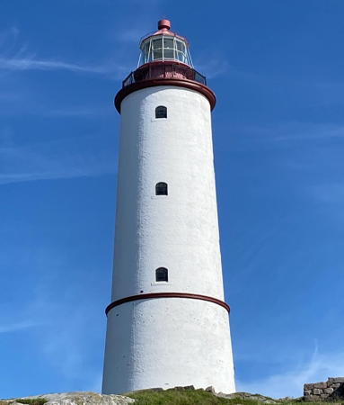
Store Torungen Light, Arendal, August 2021
Instagram photo by konnerudtone

Risør Lighthouses

Grønholmskjær (Grønnholmskjær)) (2)
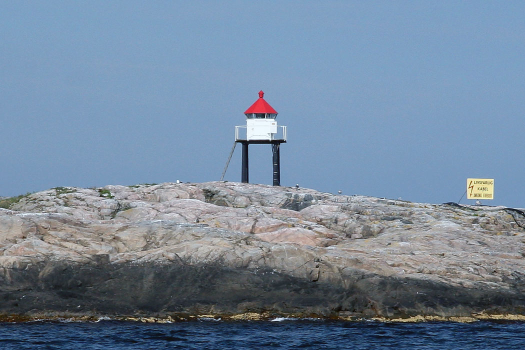
Date unknown (station established 1998). Active; focal plane 7 m (23 ft); white, red or green light depending on direction, 3 s on, 3 s off. 8 m (26 ft) octagonal fiberglass lantern mounted on four straight piles. The lantern is white with a red roof; the piles are black. Trabas has a 2023 photo but Google has only an indistinct satellite view. Bjørn Rehoff Larsen has a 2005 photo of the original lantern. Located on a rocky islet about 6.5 km (4 mi) northeast of Risør. Accessible only by boat. Site open, tower closed. NF-054300; Admiralty B2720; ex-NGA 1056.
** Stangholmen (1)
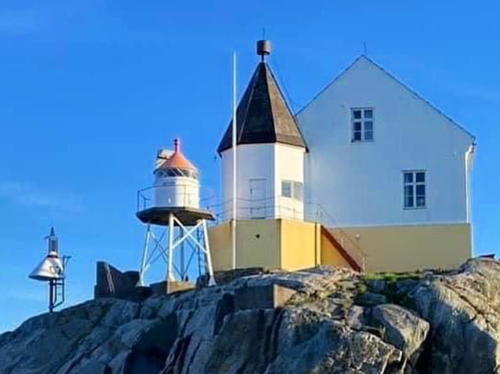
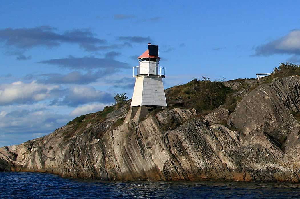
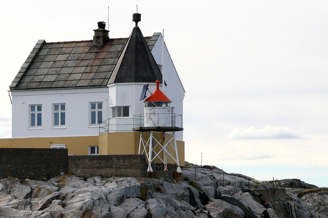
1855. Inactive since 1959. Approx. 8 m (26 ft) square cylindrical tower with lantern and gallery, attached to the front of a 1-1/2 story keeper's house. Building painted white; the tower roof is a dark maroon metallic. Rikard Aker-Svendsen has the 2024 photo at right, the Lighthouse Association has a page for the station, Trabas has a 2006 photo by Wöhrn, Wikimedia has a good 2011 photo, Eivind Lindseth has a photo, Per Arvid Åsen has another good photo, Petter Jørgensen has a street view, and Google has a satellite view. The lighthouse was deactivated in 1959 when its longtime keeper retired. The current light was installed in front of the building. The old lighthouse was transferred to Risør Kommune, which leases it as a restaurant; the leaseholders also operate the Risør Hotel. In addition a music festival is held at the lighthouse in late July. Located on a small island about 1.2 km (3/4 mi) east of Risør. Accessible only by boat. Site open; restaurant open late June through early August (May 1 through September 1 for group reservations). Owner: Risør Kommune. Site manager: Stangholmen Fyr . ARLHS NOR-223.
Stangholmen (2)
1959 (station established 1855). Replaced in 2023. 6 m (20 ft) round cylindrical concrete tower with lantern and gallery, painted white. The lantern roof, formerly painted red, is now white. Fikard Aker-Svendsen has the 2024 photo at right, another photo is available, and Trabas has Wöhrn's photo. In 2023 the lighthouse was replaced with a light on a post (focal plane 8 m (26 ft); red light, 1 s on, 1 s off). Trabas has a 2023 photo and the post light is at the right edge of the original of Rikard Aker-Svendsen's 2024 photo. Located in front of the historic lighthouse. Accessible only by boat. Site open, tower closed. ARLHS NOR-318; ex-NF-054500; ex-NGA 1068. Active light: NF-054506; Admiralty B2722.
Bjørnskjær (2)
Date unknown (station established 1929). Active; focal plane 9 m (30 ft); white, red or green light depending on direction, occulting three times every 10 s. 6 m (20 ft) fiberglass tower colored white with two black horizontal bands. Trabs has a 2023 photo and Google has a satellite view. This light replaced a square pyramidal tower with lantern and gallery. Roger Haug Østvang has a distant 2020 street view from Stangholmen of the former light. Located on a skerry in the entrance to Risør, about 500 m (0.3 mi) west of Stangholmen Fyr. Accessible only by boat. Site open, and anyone can climb to the gallery. NF-055000; Admiralty B2726; ex-NGA 1072.

Stangholmen Lights, Risør, July 2024
Google Maps photo by Rikard Aker-Svendsen

Tvedestrand Lighthouses

#Terneskjær
1920. Removed in 2024. this was a 6 m (20 ft) square tower with lantern mounted on a platform supported by four piles. No photo available but Google has a distant satellite view. of the location. Formerly located on a skerry in the entrance to the Lyngørfjord, about 500 m (0.3 mi) north of Lyngør Fyr. Accessible only by boat. ex-NF-056500; ex-Admiralty B2740; ex-NGA 1092.
Lyngør
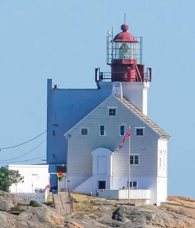
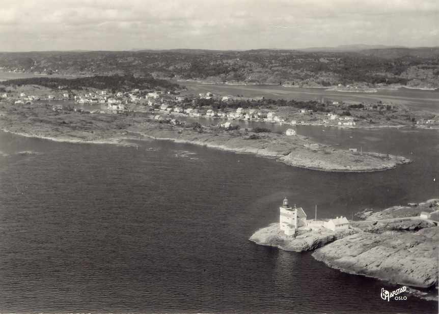
1879 (rebuilt in 1946). Active; focal plane 21 m (69 ft); continuous white light with a brighter flash once every 60 s. 17 m (56 ft) square cylindrical concrete tower with lantern and gallery, attached schoolhouse-style to the front of a 2-1/2 story keeper's house. Original 3rd order Fresnel lens with the original rotating mechanism. Lighthouse painted white, lantern red. The station also includes an engine house, two oilhouses, and a boathouse. An unusually complete and well preserved light station. A 2023 photo by Anne Goril appears at right, June Edvenson has a good photo, Jon Arve Gundersen has a 2021 photo, Trabas has a 2004 photo by Wöhrn, the Arendal Tourist Office has a good 2010 photo, Huelse has an interesting aerial postcard view, and Google has a satellite view. The principal keeper's quarters are a holiday home for Kystverket staff but the assistant keeper's house is available to the public for overnight accommodations. The lighthouse was rebuilt in 1946 to accommodate a fog signal. Located on the southern tip of Kjeholmen, at the entrance to the Lyngørfjord, about 8 km (5 mi) southwest of Risør. Accessible only by boat. Site open, lighthouse and tower open to guests. Owner: Kystverket. Site manager: Kystled Oslofjorden. . ARLHS NOR-292; NF-056600; Admiralty B2738; NGA 1096.
[Sandøy]
1825. Inactive daybeacon. Approx. 15 m (49 ft) octagonal pyramidal wood skeletal tower, all sides covered by horizontal wood slats. Lower half of the tower painted red, upper half white. No photo available but Google has a satellite view. Located on the northeastern point of Sandøy, about 8 km (5 mi) southeast of Tvedestrand. Site open, tower closed. Site manager: unknown.
#Havefjorden
Date unknown (station established 1918). Replaced in 2023 and probably removed. This was a 4 m (13 ft) octagonal lantern, painted white with a red roof and mounted on a stone base. Per Halvard Øveren has a very distant 2020 street view and Google has a satellite view. The light was moved to a post offshore (focal plane 4.5 m (14 ft); green light, 2 s on, 2 s off). Located on the western point of Sandøy, marking the east side of the entrance to the Havefjord. Accessible only by boat. Site and tower closed. ex-NF-057600; ex-Admiralty B2752; ex-NGA 1116. Active light: NF-057341; Admiralty B2751.

Lyngør Light, Tvedestrand, July 2023
Instagram photo by annegoril
#Gråviktangen
Date unknown. Inactive since 2016 and later removed. This was a 4 m (13 ft) hexagonal lantern, white with a red roof, on a stone foundation. No photo available but Google has a satellite view of the former location. The light was moved to a post at the water's edge (focal plane 4.5 m (15 ft); red light, 1 s on, 1 s off). Trabas has a 2023 closeup. Located on a promontory on the east side of the Sandøyfjord, south of Apalen. Site open, tower closed. ex-NF-058500; ex-Admiralty B2767; ex-NGA 1140. Active light: NF-058503; Admiralty B2766.8.

Arendal Lighthouses

Kilsund Area Lighthouses
* Holmesund (Tverdalsøy Ranges Common Front)
Date unknown (station established 1897). Active; focal plane 7 m (23 ft); white, red or green light depending on direction, 3 s on, 3 s off. 6 m (20 ft) hexagonal lantern, white with a red roof, mounted on two concrete piles. Trabas has a closeup 2023 photo, Bernhard Kamp has a 2016 photo and Google has an indistinct satellite view. Located on a promontory at the easternmost point of Tverdalsøy, about 1.5 km (1 mi) east of Kilsund. Site open, tower closed. NF-058200; Admiralty B2760; ex-NGA 1124.
* Kilsund (Tverdalsøy South Range Rear) (3?)
1961 (station established 1882). Inactive since 2022. 7 m (23 ft) lantern with gallery mounted on a stone base. Lantern and gallery painted white; lantern roof is red. Glenn Westberg has a photo and Google has a distant satellite view. This was formerly the rear light of a range with the Holmesund light (previous entry) as the front light. The lighthouse may be removed. Located on a promontory at the southern tip of Tverdalsøy, on the norths ide of the entrance to Kilsund. 834 m (1/2 mi) west southwest of the Holmesund front light. Site open, tower closed. ex-NF-058000; ex-Admiralty B2758; ex-NGA 1120.
Ytre Møkkalasset (Tvedestrand)
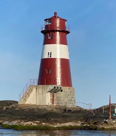
1888. Reactivated (inactive 1986-2021); focal plane 17 m (56 ft); white, red or green light depending on direction, 3 s on, 3 s off. 17 m (56 ft) round cast iron tower with lantern and gallery, mounted on a round stone base. Lighthouse painted red with one narrow white horizontal band. Stian Kjøle's 2021 photo is at right, Trabas has a 2023 photo, Alf Joachim Altenborg has a 2022 photo, Lighthouse Digest has a photo by Wöhrn, Glenn Westberg has a photo, Frode Inge Helland has a good 2006 photo, Grigory Shmerling has a nice view from the sea, and Google has a satellite view. The tower included keeper's quarters but there was also an onshore keeper's house at Brårvikkilen on Flosterøya. The lighthouse was damaged during World War II; repairs after the war included reducing the size of the lantern. The preservation group Møkkalassets Venner worked to maintain and restore the lighthouse with some financial support from the Kystverket. In 2020-21 the Kystverket carried out a more complete restoration and the light was reactivated in September 2021. Located on a skerry off the coast near the entrance to the Sandøyfjord, southeast of Kilsund. Accessible only by boat. Owner/site manager: Kystverket. Site and tower closed. . ARLHS NOR-284; NF-057900; Admiralty B2764.5.

Eastern Tromøy Lighthouses
Bonden (2)
Date unknown (station established 1924). Active; focal plane 14 m (46 ft); flash every 5 s, white, red or green depending on direction. Approx. 9 m (30 ft) octagonal fiberglass lantern, white with a red roof, mounted on a platform supported by four straight black piles. Trabas has a 2023 photo and Google has a distant satellite view. A short rubblestone tower seen in front of this light is a ruined 1845 daybeacon. Located on a rocky islet about 2.5 km (1.5 mi) east of the eastern end of the island of Tromøy. Accessible only by boat. Site open, tower closed. NF-060000; Admiralty B2776; ex-NGA 1138.

Ytre Møkkalasset Light, Arendal, June 2021
Google Maps photo by Stian Kjøle

Skinnfellskjæret
2022 (?). Active; focal plane 10.5 m (34 ft); white, red or green light, depending on direction, occulting once every 4 s. 8,5 m (28 ft) octagonal fiberglass tower colored white with two black horizontal bands; roof is red. Trabas has a 2023 photo but the light is not seen yet in Google's satellite view. Located on a skerry about 275 m (900 ft) east of the former Skinnfelltangen light (next entry). Accessible only by boat. ite open, tower closed. NF-060200; Admiralty B2785.
#Skinnfelltangen
Date unknown (station established 1897). Inactive and since removed. 5 m (16 ft) hexagonal lantern with wood gallery, mounted on a stone foundation. Lantern and gallery painted white; lantern roof is red. Magnus Bakke Archer has a very distant 2017 street view but the lantern is no longer seen in Google's satellite view. The light was replaced by the Skinnfellskjæret light (previous entry). Located on a promontory on the north side of the entrance to Tromøysund, opposite the Gitmertangen lights. The sound entrance is about 500 m (0.3 mi) wide. Site open, tower closed. ex-NF-060700; ex-Admiralty B2786; ex-NGA 1176.
* Gitmertangen Ranges Common Front
Date unknown (station established 1897). Active; focal plane 9 m (30 ft); white light occulting once every 6 s. 9 m (30 ft) hexagonal lantern, white with a red roof, mounted on four straight black piles. Thor Blom-Bakke has the 2024 photo at right, Emilija Sakalauskaitė has a 2022 closeup photo, Trabas has a 2023 closeup, Sven Gunnar Andersen has a 2017 photo and Google has a distant satellite view. Located at the extreme eastern tip of the island of Tromøy, northeast of Arendal. Site open, tower closed. ARLHS NOR-351; NF-060500; Admiralty B2782; ex-NGA 1168.
* Gitmertangen South Range Rear
Date unknown (station established 1897). Active; focal plane 26 m (86 ft); white light, intensified on the range line, occulting twice every 8 s. Approx. 6 m (20 ft) square wood hut with a gable roof; the light is shown through a window. The building is painted white, with the gable painted red and a black vertical stripe on the range line. Trabas has a 2023 closeup, Sondre Andreas Delfin Aas has a photo, and Google has a satellite view. Located near the eastern end of the island of Tromøy, northeast of Arendal. Site open, tower closed. ARLHS NOR-352; NF-060400; Admiralty B2780; ex-NGA 1164.

Gitmertangen Ranges Common Front Light, Tromøy, March 2024
Google Maps photo by Thor Blom-Bakke
* [Gitmertangen North Range Rear]
Date unknown (station established 1897). Active; focal plane 21 m (69 ft); white light occulting once every 6 s. 3 m (10 ft) hexagonal lantern, white with a red roof and a black vertical stripe. Trabas has Wöhrn's closeup 2003 photo and Google has a satellite view. Located about 60 m (200 ft) north of the South Range Rear Light. Site open, tower closed. ARLHS NOR-309; NF-060600; Admiralty B2784; ex-NGA 1172.

Eydehavn Lighthouse
#Frisøy (1)
1894. Apparently removed in 2023. This was a 6 m (20 ft) wood-shingled tower with hexagonal lantern and gallery. Lighthouse painted white, lantern roof red. Wikimedia has a 2010 photo and Bing has a satellite view but Google's satellite view no longer shows the lighthouse. The light was moved to a post (focal plane 7 m (23 ft); red light, 2 s on, 2 s off). Trabas has a 2023 photo. Located on the north (mainland) side of the Tremøysund in Eydehavn, about 7 km (4.5 mi) northeast of Arendal. Site open, tower closed. ex-NF-061200; ex-Admiralty B2792; ex-NGA 1184. Active light: NF-06916; Admiralty B2791.

Arendal Area Lighthouses
* Sandvikodden (Sandvigodden) (1)
1844. Inactive since 1934. 17 m (56 ft) square cylindrical masonry tower with lantern and gallery, joined to the gable end of a 2-1/2 story masonry keeper's house. Lighthouse painted white, lantern dark red. A 2021 photo by Frances Godden is at right, Trabas has a good 2006 photo by Wöhrn, Geir Røsset has a 2008 photo, Grigory Shmerling has 2014 photo, Dag Endresen has a 2003 photo, and Google has a street view and a satellite view. Shipowners contributed the money to build this historic lighthouse. In 1934 the lighthouse was replaced by a second tower built immediately in front of the first; we do not know why this was done. The building is now a private residence; in late 2014 it was listed for sale for 10 million kroner (about $835,000 U.S.). Located on the west side of the entrance to the Galtesund, which leads to Arendal; this is at the eastern corner of the island of Hisøy. Accessible by road. Site and tower closed, although the lighthouse can easily be viewed from nearby. Owner/site manager: private. . ARLHS NOR-317.
* Sandvikodden (Sandvigodden) (2)
1934 (station established 1844). Active; focal plane 17 m (56 ft); white, red or green light, depending on direction, occulting three times every 10 s. 17 m (56 ft) square masonry tower with lantern and gallery. Lighthouse painted white; lantern roof is red. A 2021 photo by Frances Godden is at right and Trabas has a 2006 photo by Wöhrn. This lighthouse stands immediately in front of the former lighthouse. Located on the west side of the entrance to the Galtesund, which leads to Arendal. Site and tower closed, although the lighthouse can easily be viewed from nearby. ARLHS NOR-039; NF-061700; Admiralty B2804; NGA ex-1204.


Sandvikodden Lights, Hisøy, April 2021
Instagram photo by Frances Godden

** Store Torungen (2)
1914 (station established 1844). Active; focal plane 46 m (151 ft); white flash every 20 s. 34.5 m (113 ft) round cast iron tower with lantern and gallery; 2nd order Fresnel lens. Lighthouse painted white with one narrow red horizontal band. A 2021 photo is the top of this page, Alf Joachim Altenborg has a 2023 photo, the Arendal Tourist Office has a good 2012 photo, Jens-Henrik Thrane has a 2021 photo, another closeup is available, Trabas has a 2006 photo by Wöhrn, and Google has a satellite view. Huelse has a postcard view showing this lighthouse as well as the original brick tower, which was a twin of the Lille Torungen lighthouse. This handsome lighthouse serves coastal navigation and also marks the entrance to Arendal. There is a support group, Torungens Venner, for the two historic lighthouses. In 2005 the lighthouse was leased to a foundation, Stiftelsen Torungen fyr. The principal keeper's house and an assistant keeper's house are available for overnight accommodations. The 100th anniversary of the present lighthouse was celebrated in 2014. Located on a small island about 3 km (2 mi) southeast of the mainland and 5 km (3 mi) southwest of Tromøy. Accessible only by boat. Site open, tower open daily during the summer season (boat transportation is available locally). Site manager: Torungenes Venner . ARLHS NOR-040; NF-061400; Admiralty B2798; NGA 1192.
Lille Torungen (1)
1844. Inactive since 1914. 29 m (95 ft) robust round brick tower with lantern and gallery, painted white; lantern painted red. Anne-Liv Bie Torgersen's 2023 photo is at right, Per Arvid Åsen has a good photo, Frode Rodlie has a nice view from the sea, Gunnar Hall Skavoll has a drone view, and Google has a good satellite view. This is Norway's tallest surviving brick lighthouse. Identical lighthouses were built at Lille and Store Torungen. The Store Torungen tower was demolished after it was replaced in 1914, and this lighthouse would also have been torn down if area residents had not intervened. The lighthouse has been restored in recent years through the efforts of the preservation group Torungens Venner. The lighthouse can be leased for special events, and the Canal Street Jazz and Blues Festival is held here in mid July. Located on Lille Torungen island about 1.5 km (1 mi) north of Store Torungen Fyr. Accessible only by boat. Site open, tower closed. Site manager: Torungenes Venner . ARLHS NOR-157.
#Lille Torungen (2)
1914 (station established 1844). Inactive since 2023 and apparently removed. 5 m (17 ft) square skeletal tower with lantern and gallery. Trabas has a photo by Wöhrn but the light is not seen in Google's satellite view. The active light (focal plane 10 m (33 ft); red light, 1 s on, 1 s off) is now on a post (focal plane 11 m (36 ft); red light, 1 s on, 1 s off) at the water's edge. Trabas has a 2023 photo. Located at the southeastern point of the island. Accessible only by boat. Site open, tower closed. ARLHS NOR-314; ex-Admiralty B2800; ex-NGA 1196. Active light: NF-061504; Admiralty B2800.5.

Lille Torungen Light, Arendal, September 2023
Instagram photo by Anne-Liv Bie Torgersen
Halvorsholmene
Date unknown. Active; focal plane 17.5 m (58 ft); white, red or green light, depending on direction, occulting twice every 8 s. 6.5 m (21 ft) octagonal fiberglass tower colored white with two black horizontal bands; roof is red. Trabas has a 2023 photo and Google has a satellite view. Located on a small rocky island about 1.8 km (1.1 mi) west of the Store Torungen lighthouse. Accessible only by boat. Site open, tower closed. NF-062500; Admiralty B2797.5.

Grimstad Lighthouses

Grimstad Area Lighthouses
Spærholmen
Date unknown. Inactive since 2022. 5 m (17 ft) round rubblestone tower with lantern and gallery. Lantern painted white with a red roof. Trabas has a photo by Wöhrn and Google has a satellite view. The light was replaced by a nearby light on a post. The new light is called Spærrumpa (focal plane 7 m (23 ft); green light, 1 s on, 1 s off). Trabas has a 2023 photo. Located on a small island about 1.5 km (1 mi) offshore halfway between Arendal and Grimstad. Accessible only by boat. Site open, tower closed. ex-NF-063000; ex-Admiralty B2816; ex-NGA 1220. Active light: NF-063037; Admiralty B2816.5.
Leiholmsund Østree (2)
Date unknown (station established 1893). Active; focal plane 8 5 m (28 ft); white, red or green light, depending on direction, occulting once every 6 s. 7.5 m (21 ft) octagonal fiberglass tower colored white with two black horizontal bands; roof is red. Trabas has a closeup 2023 photo and Google has a fuzzy satellite view. This light replaced an octagonal lantern and round gallery supported by two steel piles. Trabas has a 2004 photo by Wöhrn. Near the light is a round stone cairn painted with black and white vertical stripes. Located on a skerry about 3 km (1.2 mi) southeast of Grimstad. Accessible only by boat. Site open, tower closed. NF-064100; Admiralty B2834; ex-NGA 1248.
Vessøyhodet (Range Rear)
Date unknown. Inactive since 2022. Approx. 6 m (20 ft) square wood tower with lantern and gallery, painted white; lantern roof painted red. The 2025 photo at right shows that this lighthouse has not been removed, Olav Agnar Frogner has a snowy closeup, Patrick Bosmann has a 2022 photo, Trabas has a photo by Wöhrn, Lars Tinner has a lovely 2005 photo, and Google has a satellite view. The light was moved to a post at water's edge (focal plane 6 m (20 ft); red light, 3 s on, 3 s off). Located on a promonotory at the entrance to Grimstad harbor. Site status unknown. ex-NF-065400; ex-Admiralty B2846.1; ex-NGA 1276. Active light: NF-065108.

Vessøyhodet Light, Grimstad, May 2025
Google Maps photo by GiTa88
Fuglebåen
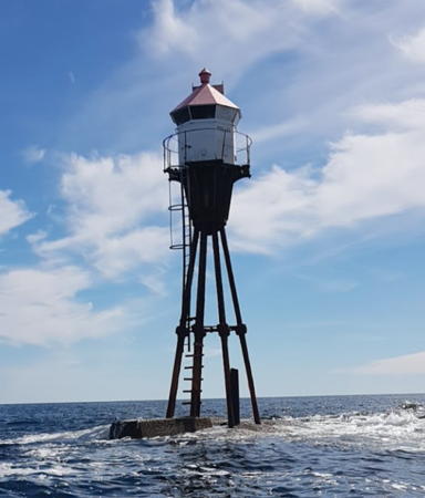
Date unknown. Active; focal plane 9.5 m (31 ft); continuous white, red or green light, depending on direction, 9.5 m (31 ft) octagonal fiberglass tower mounted ona slemder pier; lighthouse colored white with two black horizontal bands; roof is red. Trabas has a closeup 2023 photo and Google has an indistinct satellite view. Located on the approach to Grimstad from the south, about 4 km (2.5 mi) south of the town. Accessible only by boat. Site open, tower closed. NF-065030; Admiralty B2845.8.
Lille Mågeholmen
Date unknown. Active; focal plane 10.5 m (34 ft); white, red or green light, depending on direction, occulting once every 4 s. 6.5 m (21 ft) octagonal fiberglass tower colored white with two black horizontal bands; roof is red. Trabas has a closeup 2023 photo and Google has a satellite view. Located on an island at the start of the approach to Grimstad from the south. Accessible only by boat. Site open, tower closed. NF-065040; Admiralty B2841.5.
Rivingen (1)
1886. Inactive since 1925. Approx. 8 m (26 ft) square cylindrical tower with a sharply pyramidal roof and a spire, attached to the front of a 1-1/2 story keeper's house. Building painted white; the tower roof is a dark maroon metallic. This lighthouse should not be confused with the much better known Ryvingen lighthouse on Norway's south coast (see the Vest-Agder page). The house is now a private summer residence. A 2020 photo is at right, Trabas has a 2023 photo, another 2020 photo is available, Lighthouse Digest has a photo by Wöhrn, and Google has a satellite view. Located on a small island on the approach to Grimstad, about 2.5 km (1.5 mi) south of the town and 1 km (0.6 mi) off the coast of the mainland. Accessible only by boat. Owner/site manager: private. Site and tower closed. . ARLHS NOR-186.
#Rivingen (2)
1925 (station established 1886). Inactive since 2022. 5 m (17 ft) square wood tower with lantern and gallery, painted white; lantern roof painted red. Trabas has a closeup photo by Wöhrn. Located in front of the historic lighthouse. The active light is now on a post (focal plane 7 m (23 ft); green light, 2 s on, 2 s off). Trabas has a 2023 photo. Accessible only by boat. Site and tower closed. ARLHS NOR-315; ex-NF-065100; ex-Admiralty B2842; ex-NGA 1264. Active light: NF-065105; Admiralty B2843.
#Risholmen
Date unknown. Inactive since 2022 and apparently removed. 6 m (20 ft) lantern and gallery mounted on a tripod. Lantern painted white with a red roof. No photo available and the light is not seen in Google's distant satellite view. The light was replaced with a pair of offshore post lights. Located a very short distance west of the Rivingen lighthouse. Accessible only by boat. Site open, tower closed. ex-NF-065200; ex-Admiralty B2844; ex-NGA 1268.

Rivingen lights, Grimstad, August 2020
Instagram photo by iaa.no

Homborsund Area Lighthouses
Homborsund
1879. Active; focal plane 22 m (72 ft); continuous white light with four brighter flashes every 60 s. 20 m (66 ft) square cylindrical concrete tower with lantern and gallery, attached to the gable end of a 1-1/2 story keeper's house. 3rd order Fresnel lens in use. Lighthouse painted white, lantern red. 1-1/2 story duplex assistant keeper's house, boathouse, and other station buildings preserved. Rune Bråten's 2024 photo is at right, Eivind Rinde has a 2023 photo is at right, the Lighthouse Association has a page for the lighthouse, Trabas has a 2023 photo, Knut Glad has a 2020 photo, Arild Martinsen has a 2018 photo, Lars Tinner has a good photo, Wikipedia has a page for the lighthouse with R.D. Carsten's photo, and Google has a satellite view. The light station has been renovated for overnight accommodations. Sibling of the Lyngør lighthouse and built in the same year. Located on Store Gronningen, a small island about 1.5 km (1 mi) southeast of Jortveit. Accessible only by boat. Site open, tower open to guided tours. Owner: Kystverket. Site manager: Homborsund Fyrs Venner . ARLHS NOR-124; NF-066500; Admiralty B2858; NGA 1288.
* Havnespynten (Nellevine)
1897. Active; focal plane 14 m (45 ft); white, red or green light, depending on direction, 3 s on, 3 s off. 8 m (26 ft) square pyramidal wood tower with lantern and gallery. Lighthouse painted white; lantern roof painted red. Trabas has a 2023 photo, Per N. Schwabe has a 2022 closeup photo, Grigory Shmerling has a view from the sea that also shows the Homborsund lighthouse, and Google has a satellite view. The lighthouse is nicknamed Nellevine for the wife of its first keeper. Located at the end of the peninsula sheltering the east side of the harbor of Jortveit. Site open, tower closed. ARLHS NOR-311; NF-066600; Admiralty B2860; NGA 1292.
Sundholmen
Date unknown (station established 1909). Inactive since 2022 and possibly removed. 4 m (13 ft) octagonal lantern . Lantern painted white with a red roof, piles painted black. Per N. Schwabe has a 2020 photo showing the Havnespynten (left), Homborsund (center) and Sundholmen (right) lights. Google has a distant satellite view. The light is now on a post (focal plane 5.5 m (18 ft); green light, 1 s on, 1 s off) just offshore; Trabas has a 2023 photo. Located on an island about 500 m (0.4 mi) northwest of the Havnespynten light. Accessible only by boat. Site open, tower closed. ex-NF-066700; ex-Admiralty B2862; NGA 1296. Active light: NF-066723; Admiralty B2861.

Homborsund Light, Grimstad, June 2024
Instagram photo by Rune Bråten

Lillesand Lighthouses

Lillesand Area Lighthouses
Humlesund (?)
Date unknown (station established 1900). Inactive since 2022 and possibly removed. 8 m (26 ft) lantern mounted on a platform supported by 4 piles. Lantern painted white with a red roof; piles painted black. No photo available but Google has a distant satellite view. Located on the northeaat tip of Bergsøy, on the north side of the entrance to Lillesand. Accessible only by boat. Site open, tower closed. ex-NF-067300; ex-Admiralty B2870; NGA 1308.
Bergsøya
Date unknown. Active; focal plane 9.5 m (31 ft); continuous white, red or green light, depending on direction. 6.5 m (21 ft) octagonal fiberglass tower colored white with two black horizontal bands; roof is red. Trabas has a closeup 2023 photo and Google has a satellite view. Located on the southwest side of Bergsøy, on the north side of the entrance to Lillesand. Accessible only by boat. Site open, tower closed. NF-068200; Admiralty B2872.5.
Saltholmen (1)
1882. Inactive since 1952. 6 m (20 ft) octagonal concrete lantern room with a sharply pyramidal roof, attached at one corner of a 1-1/2 story concrete, slate-roofed keeper's house. Lighthouse painted white; roof is dark gray slate. A 2022 photo is at right, Trabas has a 2023 photo, Nicolay Thygesen has a 2021 photo, Wikimedia has Espen Skibbuvollen's photo, and Google has a satellite view. Previously owned by a sailing association, the light station was tranferred in 2012 to a foundation, Stiftelsen Saltholmen Fyrstasjon. A friends group, Saltholmens Venner, was formed to help maintain the lighthouse, which is now available for overnight stays. Located on a small island in the entrance to Lillesand, about 2 km (1.2 mi) southeast of the town. Accessible only by boat. Site open, lighthouse and tower closed except to members of the friends group. Owner/site manager: Stiftelsen Saltholmen Fyrstasjon. . ARLHS NOR-198.
Saltholmen (2)
1952 (station established 1882). Inactive since 2021. 6 m (20 ft) skeletal tower with lantern and gallery, painted white; lantern roof formerly painted red but now white. A photo is at right and Trabas has a 2023 photo. In 2021 the light (focal plane 10 m (33 ft); red light, 2 s on, 2 s off) was moved to a 3 m (10 ft) post seen in the photo at right and in Nicolay Thygesen's 2021 photo. Located adjacent to the historic lighthouse (previous entry). Accessible only by boat. Site and tower closed. Site manager: private. ARLHS NOR-316; ex-NF-067500. Active light: NF-068102; Admiralty B2876; NGA 1316.

Saltholmen Light, Lillesand, April 2022
Instagram photo by Saltholmen Fyr
Indre Malmegrunnen
Date unknown. Active; focal plane 13.5 m (38 ft); white, red or green light, depending on direction, occulting once every 6 s. 16 m (52 ft) octagonal fiberglass tower mounted atop a robust post. Lighthouse colored white with two black horizontal bands; roof is red. Trabas has a foggy closeup 2023 photo and Google has a satellite view. This light has nine sectors to direct ships approaching Lillesand from any direction. Located at sea about 2 km (1.25 mi) southeast of the Saltholmen lighthouse. Accessible only by boat. Site open, tower closed. NF-068100; Admiralty B2875.

Brekkestø Area Lighthouses
Reierskjær
1908. Active; focal plane 9 m (30 ft); flash every 5 s, white, red or green depending on direction. 10 m (33 ft) lantern supported by six piles. Tower painted red; the lantern is white with a red roof. Jon Haakon Ariansen has the 2020 photo at right, Trabas has a 2023 photo, and Google has a distant satellite view. Located on a rocky reef about 800 m (1/2 mi) offshore from Justøy. Accessible only by boat. Site open, tower closed. ARLHS NOR-360; NF-068400; Admiralty B2888; NGA 1328.
Brekkestø (2)
Date unknown. Active; focal plane 5.5 m (18 ft); white, red or green light, depending on direction, occulting once every 6 s. 5.5 m (18 ft) lantern mounted on a square platform supported by four black piles. Trabas has a 2023 photo, Sven Lunøe Pihl has a 2015 photo, and Google has a distant satellite view. This light replaced a square shingle-covered tower with lantern and gallery. Accessible only by boat. Site open, tower closed. NF-068600; Admiralty B2890; NGA 1332.
#Ågerøya
Date unknown. Inactive since 2022 and since removed. 6 m (20 ft) square shingle-covered tower with lantern and gallery. Lighthouse painted white, lantern roof red. No photo available. Bing has an indistinct satellite view but no light is seen in Google's satellite view. Accessible only by boat. Site open, tower closed. ex-NF-068800; ex-Admiralty B2892; NGA 1336.
[Kvalsholmen (Range Front)]
Date unknown (station established 1897). Inactive. This was a 5 m (16 ft) lantern, white with a red roof, mounted on a stone base. The lantern is missing in Helge Isaksen's 2020 photo although the stone base remains. Google has a satellite view. Located on a tiny island about 600 m (3/8 mi) south of Ramsøy. Accessible only by boat. Site open, tower closed. ex-NF-069300; ex-Admiralty B2899.9; NGA 1344.
Natvigtangen (Range Rear)
Date unknown (station established 1897). Inactive since 2023. 5.5 m (18 ft) octagonal lantern, painted white with a red roof and mounted on a stone base. This was the common rear range light for the southbound Kvalsholmen Range (previous entry) and for the northbound Svervikodden Range (see below). In a distant 2017 view by Sissel Eggen this light is atop the ridge on the left of center; Google has a satellite view. Located on a promontory at the southern entrance to the Isefjærfjorden. Probably accessible only by boat. Site open, tower closed. ex-NF-069700; ex-Admiralty B2900; NGA 1348.

Reierskjær Light, Brekkestø, July 2020
Google Maps photo by Jon Haakon Ariansen
Spaknesskjær
1908. Active; focal plane 6 m (20 ft); white, red or green light, depending on direction, occulting twice every 8 s. 6 m (20 ft) round solid rubblestone tower with lantern and gallery; access to the gallery is by an external ladder. The tower is unpainted gray stone; the lantern is white with a red roof. Trabas has a closeup 2023 photo and Google has a satellite view. In a distant 2017 view by Sissel Eggen this light is in the channel on the right of center. Located on a rock on the south side of the Ramsøysund east of Nattvik. Accessible only by boat. Site open, tower closed. NF-069900; Admiralty B2904; NGA 1356.
#Svervikodden (Range Front)
Date unknown (station established 1897). Inactive since 2023 and possibly removed. This was a 4 m (13 ft) octagonal lantern, painted white with a red roof and a black vertical stripe on the range line. Sissel Eggen has a distant 2017 view (the light is a little to the lower left of center). Bing has a distant satellite view. Located on a promontory about 700 m (0.45 mi) southwest of the Natvigtangen rear light. Site open, tower closed. ex-NF-069800; ex-Admiralty B2900.1; NGA 1352.

Information available on lost lighthouses:

Notable faux lighthouses:

Adjoining pages: East: Telemark | West: Vest-Agder

Return to the Lighthouse Directory index | Ratings key

Posted May 15, 2006. Checked and revised August 12, 2026. Lighthouses: 46. Site copyright 2026 Russ Rowlett and the University of North Carolina at Chapel Hill.