Lighthouses of Norway: Vesterålen

The Kingdom of Norway (Norge in Norwegian) is one of the world's most maritime nations. The country is long and narrow, with drowned valleys called fjords that bring the sea far inland in most regions. The mainland coast is estimated to be 2650 km (1650 mi) long and when all the islands and minor indentations are counted the total coastline approaches an astonishing 60,000 km (37,500 mi), long enough the go around the world one and a half times. With such a lengthy and rocky shore it's not surprising that Norway has a large number of lighthouses.

Norway is divided into counties (fylker) and the counties are divided into townships (kommuner). This page lists lighthouses of the Vesterålen District of Nordland County, located off the northwestern coast of Norway just to the north of the Lofoten Islands. Located entirely north of the Arctic Circle, these mountainous islands have a stunning beauty and attract many visitors. The major islands are connected to each other and to the mainland by bridges. The Vesterålen District includes the five townships of AndøyHadselSortland, and Øksnes.

In Norwegian a lighthouse is a fyrtårn (fire tower) or simply a fyr; a fyrlykt is a beacon and a lyktehus is a lantern. Øy is an island, holmen is an islet, skjær is a skerry (a tiny island or rocky reef), sund is a strait (often between an island and the mainland), bukt is a bay, nes is a headland, and havn is a harbor.

Aids to navigation in Norway are maintained by the Kystverket (Coast Directorate), an agency of the Ministry of Transport and Communications.

ARLHS numbers are from the ARLHS World List of Lights. NF numbers are from the Norsk Fyrliste. Admiralty numbers are from volume L of the Admiralty List of Lights & Fog Signals. U.S. NGA List numbers are from Publication 115.

General Sources
Norsk Fyrhistorisk Forening
News and photos from the Norwegian Lighthouse Association.
Lighthouse Pages from Anke and Jens - Norway
Excellent photos of more than 60 Norwegian lighthouses.
Online List of Lights - Norway - Northwest Coast North Part
Photos by various photographers posted by Alexander Trabas. Most of the photos for this area are by Capt. Peter Mosselberger (Capt. Peter) or by Arno Siering.
Norway's Fjorden and Lighthouses
Photos taken by Charles W. Bash on a 2010 cruise from Bergen to North Cape.
Leuchttürme an der norwegischen Küste
Photos posted by Bernd Claußen.
Lighthouses in Nordland
Photos by various photographers available from Wikimedia.
Norwegische Leuchttürme auf historischen Postkarten
Historic postcard images posted by Klaus Huelse.
Liste over Norske Fyr
From Wikipedia, a handy list of Norwegian light stations with their dates of establishment.
Norsk Fyrliste
The official Norwegian light list can be downloaded as a .pdf document.
GPSNavigationCharts
Navigation chart information for this area.
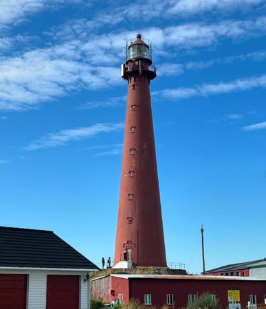

Andenes Light, Andøy, September 2024
Instagram photo by David Spadyx
Hadsel Lighthouses
#Årnøy (1)
Date unknown. Inactive since 2021. This was a 7 m (23 ft) concrete post with lantern and gallery. Lighthouse was white, lantern roof red. No photo available but Bing has a satellite view. The Fyrliste has a new post light at this location (red light, 2 s on, 2 s off) although it lists the focal plane as 85 m -- clearly a typo for 8.5 m (28 ft). Located on the eastern tip of Årnøy, an island just off the northeastern corner of Austvågøy, marking the northern entrance to the Sløverfjord. Site status unknown. ex-NF-785600; ex-Admiralty L3095.4. Current light: NF-785504; Admiralty L3095.7; NGA 12092.
Raftsund
Date unknown. Active; focal plane 11 m (36 ft); white, red or green light depending on direction, occulting once every 6 s. 10 m (33 ft) lantern and gallery mounted on four piles standing on a stone base. Lantern painted white with a red roof. Trabas has Capt. Peter's photo, Bash has a photo, and Google has a distant street view and a distant satellite view. This light marks the narrowest point of the Raftsund, a very narrow passage around the west side of Hinnøya; this is a critical passage in the inside route to Norway's northern coast. (The name Vesterålen comes from the Old Norse name Vestráll ("western strait") for this passage.) Accessible only by boat. Site open, tower closed. NF-741600; Admiralty L2824; NGA 11388.
Ersholmene
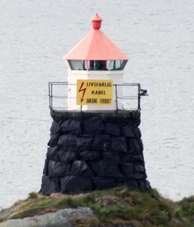
Date unknown. Active; focal plane 10 m (33 ft); white, red or green light depending on direction, occulting twice every 8 s. 6 m (30 ft) round rubblestone tower with lantern and gallery. Lantern painted white with a red roof. is at right, Trabas has Siering's photo (also seen at right), Bash has a 2010 photo, and Google has a satellite view. Located on a skerry off the northeastern tip of Brottøya. Accessible only by boat. Site open, tower closed. NF-789000; Admiralty L3108; NGA 12136.
Lonkanneset
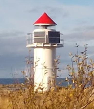
Date unknown. Active; focal plane 11 m (36 ft); white, red or green light depending on direction, 3 s on, 3 s off. 10 m (33 ft) concrete post with lantern and gallery. Lighthouse painted white; lantern roof is red. Trabas has Capt. Peter's photo and Bing has a satellite view. Located on a promontory on the south side of the entrance to the Lonkanfjord from the Hadselfjord. Accessible only by boat. Site open, tower closed. NF-789500; Admiralty L3110; NGA 12156.
Kartnes
Date unknown. Active; focal plane 6.5 m (21 ft); white, red or green light depending on direction, occulting twice every 8 s. 6 m (20 ft) lantern mounted on a platform supported by piles. Trabas has Capt. Peter's photo and Bing has a satellite view. Located on a point of land on the south side of the Sortlandsund west of Kvitnes. Site status unknown. NF-791500; Admiralty L3116; NGA 12160.

Ersholmene Light, Hadsel, June 2015
photo copyright Arno Siering; used by permission
Haugkleppan
Date unknown. Active; focal plane 9 m (30 ft); flash every 5 s, white, red or green depending on direction. 5 m (17 ft) concrete post with lantern and gallery. Lighthouse is white, lantern roof red. Trabas has Capt. Peter's photo and Bing has a satellite view. Located on a skerry off the south coast of Hadseløy, about 3 km (2 mi) southwest of Melbu. Accessible only by boat. Site open, tower closed. NF-786000; Admiralty L3096; NGA 12088.
Børholmen
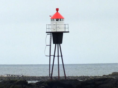
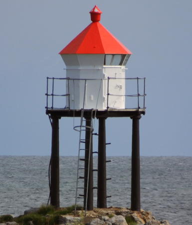
Date unknown. Active; focal plane 9 m (30 ft); flash every 5 s, white, red or green depending on direction. 10 m (33 ft) lantern and gallery mounted on a tripod. Lantern painted white with a red roof. Trabas has Siering's photo (also seen at right) and Bing has an indistinct satellite view. Located on a skerry off the western tip of Hadseløy. Accessible only by boat. Site open, tower closed. NF-795000; Admiralty L3128; NGA 12072.
Dragneset (2?)
Date unknown. Active; focal plane 26 m (85 ft); white, red or green light depending on direction, occulting once every 6 s. 5.5 m (18 ft) round fiberglass lantern and gallery. Trabas has Capt. Peter's photo, Google has a street view, and Bing has a distant satellite view. Located on a promontory at the northwestern tip of Hadseløy. Site status unknown. NF-796000; Admiralty L3130; NGA 12188.

Bø Lighthouses
Seingskjæret
Date unknown. Active; focal plane 7 m (23 ft); white, red or green light depending on direction, 3 s on, 3 s off. 7.5 m (25 ft) concrete post with lantern and gallery. Lighthouse painted white, lantern roof red. Trabas has a Capt. Peter's photo and Google has a distant satellite view. Located on a skerry on the east side of the Jørnfjord, marking the entrance to Haugsnes. Accessible only by boat. Site open, tower closed. NF-799000; Admiralty L3139; NGA 12224.

Børholmen Light, Hadsel, June 2015
photo copyright Arno Siering; used by permission
 
Litløy (Little Island)
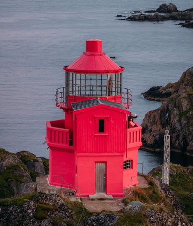
1912. Inactive since 2009. 11 m (36 ft) octagonal stone tower with lantern and gallery, attached to a 2-story equipment building. The lighthouse was formerly painted white, lantern red, but in 2021 or early 2022 it was repainted all red. The former light station buildings now house an important automatic weather station. The active light (focal plane 49 m (160 ft); white flash every 10 s) is on a mast near the lighthouse. A 2022 photo at right shows the new red paint, Lighthouse Association has a page for the lighthouse, Wikimedia has an article, a 2020 photo shows the lighthouse painted the traditional white, and Google has a distant satellite view of the island. The lighthouse marks the entrance to the Eidsfjord, which separates Vesterålen from Lofoten. The Kystverket offered the lighthouse to Bø Kommune in 2005-06 but the municipality declined the offer. The station was then sold to Ellen Marie Hansteensen and she has restored the buildings. The lighthouse is now available for overnight stays. Located at the southwestern tip of Litløy, an island about 5 km (3 mi) west of Bø. Accessible only by boat; transportation from Bø can be arranged. Site open, tower closed. Site manager: Litløy Fyr . ARLHS NOR-435; Active light: NF-800010, Admiralty L3146, NGA 12232.
Skagen
Date unknown. Active; focal plane 5.5 m (18 ft); white, red or green light depending on direction, occulting once every 6 s. 4.5 m (15 ft) lantern and gallery mounted on a stone cairn. Trabas has Capt. Peter's photo and Bing has a satellite view. Located at a landing at the end of the Skagenveien, near the southwest end of Langøy. NF-800400; Admiralty L3150; NGA 12248.
Flatholmen
Date unknown. Active; focal plane 9.5 m (31 ft); two flashes every 5 s, white, red or green depending on direction. 8.5 m (28 ft) lantern mounted on a platform supported by piles. Lantern painted white with a red roof. Trabas has Capt. Peter's photo and Bing has a distant satellite view. Located on a skerry about 6.5 km (4 mi) north of Litløy. Accessible only by boat. Site open, tower closed. NF-800800; Admiralty L3152; NGA 12256.
Skårvågen
Date unknown. Active; focal plane 14 m (46 ft); white, red or green light depending on direction, 3 s on, 3 s off. 9 m (30 ft) lantern and gallery mounted on a stone cairn. Trabas has Capt. Peter's closeup photo and Bing has a satellite view. Located on Flatholmen, an island about 2 km (1.25 mi) northwest of Søberg. Accessible only by boat. Site open, tower closed. NF-801500; Admiralty L3158; NGA 12268.

Litløy Light, Bø, August 2022
Instagram photo by Litløy Fyr
Flaskforet
Date unknown. Active; focal plane 29 m (95 ft); flash every 5 s, white, red or green depending on direction. 6 m (20 ft) square tower with lantern and gallery. Lighthouse painted white, lantern roof red. Trabas has Capt. Peter's closeup photo and Bing has a distant satellite view. Located on a promontory about 5 km (3 mi) northwest of Straume. Site open, tower closed. NF-803500; Admiralty L3166; NGA 12296.
Nykvåg
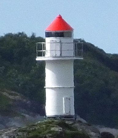
Date unknown. Active; focal plane 17.5 m (57 ft); white, red or green light depending on direction, occulting once every 6 s. 6 m (20 ft) concrete post with lantern and gallery. Siering contributed a 2015 photo, Trabas has Capt. Peter's closeup photo, Wikimedia has a photo, and Google has a street view, but shadows obscure the tower in Google's satellite view of the harbor. Lighthouse painted white, lantern roof red. A photo is at right. Located on a cliff on the west side of Nykvåg harbor. Site open, tower closed. NF-804800; Admiralty L3172; NGA 12312.
* Hovden (2)
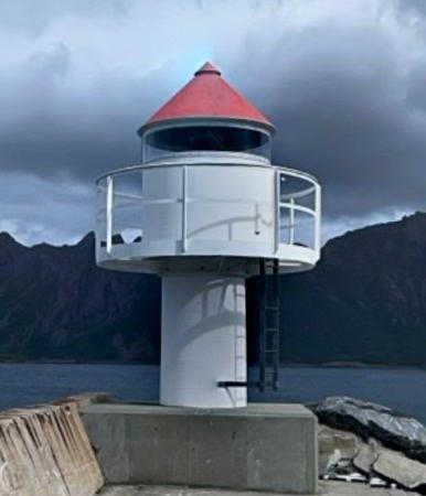
About 2016 (station established 1897). Active; focal plane 8 m (26 ft); white, red or green light depending on direction, occulting once every 6 s. 7 m (23 ft) round tower with a round fiberglass lantern and gallery. Lantern is white with a red roof. Volker Behrendt's 2022 photo is at right, Trabas has Capt. Peter's closeup photo and Google has a satellite view. Located on a mole on the north side of the entrance to Hovden (the original light was on the south side). Site open, tower closed. NF-805100; Admiralty L3178; NGA 12332.
Frugga Sørpynt
Date unknown. Active; focal plane 17.5 m (57 ft); two flashes every 5 s, white, red or green depending on direction. 9 m (30 ft) square skeletal tower with lantern, gallery, and enclosed upper portion. Lighthouse painted white, lantern roof red. Trabas has Capt. Peter's photo, Arve Allertson has a distant view, and Bing has a satellite view. The directional light guides vessels to Hovden harbor. Located on the south point (sørpynt) of the Frugga islands, about 2 km (1.25 mi) northeast of Hovden. Site open, tower closed. NF-806000; Admiralty L3182; NGA 12352.
Frugga (2?)
Date unknown. Active; focal plane 45 m (148 ft); flash every 5 s, white or red depending on direction. 6 m (20 ft) round cylindrical fiberglass tower. Tower is white, lantern roof red. This new light replaced a lantern mounted on a platform supported by piles. Trabas has Capt. Peter's photo and Bing has a distant satellite view. Located on the northern tip of Frugga. Site status unknown. NF-806100; Admiralty L3182.2; NGA 12356.
Møkland (Møkkland)
Date unknown. Active; focal plane 5.5 m (18 ft); white, red or green light depending on direction, occulting once every 6 s. 6.5 m (21 ft) square skeletal tower with lantern and gallery. Tower painted black, lantern white with a red roof. Trabas has Capt. Peter's photo and Bing has a distant satellite view. Located on the west side of the Møksfjord just nort of Kråkberget. Site open, tower closed. NF-807500; Admiralty L3188; NGA 12372.

Hovden Light, Bø, June 2022
Google Maps street view by Volker Behrendt

Sortland Lighthouse
Fiskholmen
Date unknown. Active; focal plane 9 m (30 ft); white, red or green light depending on direction, occulting twice every 8 s. 6 m (20 ft) square tower with lantern and gallery. Lighthouse painted white, lantern roof red. Trabas has Siering's photo, another photo is available, and Google has a satellite view. Located on a skerry in the mouth of the Hognfjord, about 3 km (1.8 mi) northeast of Sortland. Accessible only by boat. Site open, tower closed. NF-794400; Admiralty L3123; NGA 12180.
Stamnes (2?)
Date unknown. Active; focal plane 11.5 m (38 ft); white, red or green light depending on direction, occulting once every 6 s. 6.5 m (21 ft) round fiberglass tower with lantern and gallery. Lighthouse colored white, lantern roof red. Trabas has Capt. Peter's closeup photo and Google has a satellite view. Located on a headland about 8 km (5 mi) north of the Fiskholmen light, marking the northern entrance to the Sortlandsund. Site open, tower closed. NF-794600; Admiralty L3124; NGA 12184.

Øksnes Lighthouses
Breidstrand (Rundskjæret)
Date unknown. Active; focal plane 8 m (26 ft); white, red or green light depending on direction, occulting once every 6 s. 8.5 m (27 ft) lantern and gallery mounted on a tripod. Lantern painted white with a red roof. Robert Bø has a very distant view and Google has a satellite view. Breidstrand is on the south side of Skogsøy, an island off the northwest coast of Langløy. Located on a reef in the entrance to the harbor. Accessible only by boat. Site open, tower closed. NF-809400; Admiralty L3194; NGA 12400.
Våje
Date unknown. Active; focal plane 18 m (59 ft); two flashes every 5 s, white, red or green depending on direction. 10 m (33 ft) lantern mounted on a platform supported by piles. Lantern painted white with a red roof. No photo available but Bing has a distant satellite view. Located on a promontory on the northwest side of Skogsøy. Site status unknown. NF-809000; Admiralty L3192; NGA 12396.
Geitholmen
Date unknown. Active; focal plane 22.5 m (74 ft); flash every 5 s, white, red or green depending on direction. 8 m (26 ft) lantern and gallery mounted on a stone cairn. Lantern painted white with a red roof. Trabas has Capt. Peter's photo and Bing has a satellite view. Located on a skerry about 2 km (1.25 mi) off the north coast of Skogsøy. Accessible only by boat. Site open, tower closed. NF-811000; Admiralty L3208; NGA 12424.
Gjæva (2)
Date unknown. Active; focal plane 7 m (23 ft); white, red or green light depending on direction, occulting once every 6 s. 6 m (20 ft) round cylindrical fiberglass tower with lantern. Tower is white, lantern roof red. Trabas has Capt. Peter's photo (also seen at right) and Google has a satellite view. This light replaced a lantern and gallery mounted on a stone cairn. Located on a small island in the middle of the Prestfjord, on the east side of Skogsøy and off the entrance to the harbor of Myre. Accessible only by boat. Site open, tower closed. NF-810000; Admiralty L3200; NGA 12408.

Gjæva Light, Øksnes
photo copyright Capt. Peter Mosselberger; used by permission
 
Innerøy (2)
Date unknown. Active; focal plane 13 m (43 ft); two flashes every 5 s, white, red or green depending on direction. 6 m (20 ft) round cylindrical fiberglass tower with lantern. Tower is white, lantern roof red. Trabas has Capt. Peter's photo and Google has a satellite view. This light replaced a square tower with lantern and gallery. Lighthouse painted white, lantern roof red. Located on a small island off the west coast of Langøy's northern peninsula. Accessible only by boat. Site open, tower closed. NF-811400; Admiralty L3210; NGA 12432.
* [Nyksund]
Date unknown (station established 1899). Active (reactivated?); focal plane 14.5 m (48 ft); white, red or green light depending on direction, occulting once every 6 s. 3 m (10 ft) octagonal lantern, painted white with a red roof. Trabas has Capt. Peter's photo, another photo is available, Torill Strøm has a distant view, and Google has a satellite view. The fishing village of Nyksund was abandoned in the 1970s but it has recently revived, mostly as a community of summer cottages. Located on a bluff overlooking the entrance to Nyksund harbor on the north coast of Langløy. Accessible by road. Site open, tower closed. NF-811700; Admiralty L3212; NGA 12436.
Kvalbaken
Date unknown. Active; focal plane 9.5 m (31 ft); two flashes every 5 s, white, red or green depending on direction. 11 m (36 ft) lantern and gallery supported by piles. Lantern painted white with a red roof. Erlend Marthinsen has a very distant street view and Bing has a satellite view. Located on a reef between Beinøy and the northwestern side of Langøy's northern peninsula. Accessible only by boat. Site open, tower closed. NF-812200; Admiralty L3218; NGA 12440.
Anda
1932. Active; focal plane 49 m (161 ft); white, red or green light depending on direction, occulting once every 6 s. 16 m (52 ft) robust square cylindrical concrete tower, attached to the gable end of a 1-1/2 story wood keeper's house. Lighthouse painted white, lantern red. The Lighthouse Association has a page for the lighthouse including the photo by Danckert Monrad-Krohn at right, Trabas has Capt. Peter's photo, Wikimedia has a Culture Ministry photo and Julian Albert's view from the sea, and Google has a satellite view. This was the last major light station to be built in Norway, but it was automated from the start. The lighthouse marks a principal entrance to the Vesterålen. Located on a small island off the northern tip of Langøy, about 7 km (4.5 mi) north of Alsvåg. Accessible only by boat. Site and tower closed. ARLHS NOR-304; NF-813500; Admiralty L3222; NGA 12456.

Anda Light, Øksnes, August 2019
Kystverket photo posted by Norwegian Lighthouse Association
Gisløy (Sporholmen Range Rear)
Date unknown (station established 1898). Active; focal plane 12 m (9 ft); white, red or green light depending on direction, 2 s on, 2 s off. 12 m (39 ft) tower: lantern and gallery standing on piles atop a stone base. Lantern painted white with a red roof, piles painted black, stone base unpainted. A 2024 street view is available, Torill Strøm has a distant photo, and Google has an indistinct satellite view. Located at the northeastern point of Gisløy, an island off the northeastern end of Langøy. Site open, tower closed. NF-818000; Admiralty L3250.1; NGA 12520.

Andøy Lighthouses
* Store Sandnes
Date unknown. Active; focal plane 10 m (33 ft); white, red or green light depending on direction, occulting three times every 10 s. 10 m (33 ft) skeletal tower with lantern, gallery, and enclosed upper portion. Upper portion and lantern painted white, skeletal portion painted black. Trabas has Capt. Peter's closeup photo and Google has a street view and a satellite view. Located at the extreme southwestern tip of Andøy. Site open, tower closed. NF-818500; Admiralty L3254; NGA 12528.
* Åknes
Date unknown. Active; focal plane 25 m (82 ft); white, red or green light depending on direction, occulting twice every 8 s. 15 m (49 ft) skeletal tower with lantern and gallery. Lantern painted white with a red roof, skeletal portion painted black. Zoran Babić has a photo, Trabas has Capt. Peter's closeup photo, and Google has a 2022 street view and a satellite view. Located on a promontory on the north side of Åknes, on the southwestern coast of Andøy. Site open, tower closed. NF-818300; Admiralty L3252; NGA 12524.
Børhella (2)
Date unknown. Active; focal plane 20 m (66 ft); flash every 5 s, white, red or green depending on direction. 8 m (26 ft) round cylindrical fiberglass tower with lantern and gallery. Lighthouse colored white with a narrow black horizontal band, lantern roof is red. Oddvar Atle Løken's 2020 street view is at right, Trabas has Capt. Peter's closeup photo, Tomas Kohout contributed a 2013 photo, a 2010 closeup is available, another photo is available, and Google has a satellite view. This light replaced a concrete post with lantern and gallery. Located on the west side of the entrance to Børvågen, on the west coast of Andøy. Site open, tower closed. NF-814200; Admiralty L3227; NGA 12462.


Børhella Light, Andøy, July 2020
Google Maps street view by Oddvar Atle Løken

* Sjåberget (Nordmela) (3?)
2015 (station established 1915). Active; focal plane 11 m (36 ft); white, red or green light depending on direction, occulting three times every 10 s. 7.5 m (25 ft) round cylindrical fiberglass tower with lantern and gallery. Lighthouse colored white, lantern roof is red. Arvydas Kalinauskas has the photo at right, Trabas has Capt. Peter's closeup photo, and Google has a satellite view. This new light replaced a 12 m (39 ft) square skeletal tower with enclosed watch room, lantern, and gallery. Anke and Jens have a page for the earlier tower with photos taken in 2005 and Wikimedia has Kim Joar Bekkelund's 2007 photo. Located in the fishing village of Nordmela on the central north coast of Andøy. Site open, tower closed. ARLHS NOR-441; NF-814500; Admiralty L3228; NGA 12468.
Nattmålskjær
Date unknown. Active; focal plane 7.5 m (25 ft); flash every 5 s, white, red or green depending on direction. 8.5 m (27 ft) concrete post with lantern and gallery. Lighthouse painted white, lantern roof painted red. Trabas has Capt. Peter's closeup photo, a 2008 photo is available, Tony Gulla also has a photo, and Google has a satellite view. Located on a reef about 1.5 km (1 mi) northwest of Bleik. Accessible only by boat. Site open, tower closed. NF-816500; Admiralty L3244; NGA 12500.
Moholmen (2)
Date unknown. Active; focal plane 20 m (66 ft); flash every 5 s, white, red or green depending on direction. 6 m (20 ft) round cylindrical fiberglass tower with lantern and gallery. Tower colored white, lantern roof red. Trabas has Capt. Peter's photo and Google has a satellite view. This lighthouse replaced a square wood tower with lantern and gallery. Located on a small island about 2.5 km (1.5 mi) due west of Andenes harbor. Accessible only by boat. Site open, tower closed. NF-821900; Admiralty L3462; NGA 12948.
**** Andenes
1859. Active; focal plane 40 m (131 ft); continuous white light with a more intense flash every 30 s. 40 m (131 ft) round cast iron, brick-lined tower with lantern and gallery. The original 2nd order Fresnel lens remains in use. Entire lighthouse painted red. The 2-story keeper's house, generator house, and farm buildings have been sold as private residences. David Spady's 2024 photo is at the top of this page, Trabas has Capt. Peter's excellent photo, Anke and Jens have a page with photos, Wikimedia has many photos, Huelse has a historic postcard view, Google has a midnight-sun street view by David Rowley, and Google has a satellite view. The lighthouse is still owned by the Kystverket but the light station is managed by the nearby Andøy Museum, which offers guided tours during the summer season. As a result this is the best known and most visited lighthouse of Norway's Arctic region. Since construction started in 1856 the 150th anniversary of the lighthouse was celebrated in 2006. Located at the northeastern tip of Andøy in Andenes (Andøy). Site open, tower open to guided tours daily from mid June through late August. Site manager: Andøymuseet. . ARLHS NOR-001; NF-822000; Admiralty L3456; NGA 12940.

Sjåberget Light, Andøy, October 2017
Google Maps photo by Arvydas Kalinauskas
* Andeneshamn (Andeneshavn, Andøy Molja)
Date unknown. Active; focal plane 9 m (30 ft); white, red or green light depending on direction, occulting three times every 10 s. 6 m (20 ft) octagonal cast iron tower with lantern and gallery. Lighthouse painted white; lantern roof is red. Trabas has Capt. Peter's closeup photo, another excellent photo is available, and Google has a satellite view. Located at the end of the mole in Andenes (Andøy); accessible by walking the mole. Site open, tower closed. ARLHS NOR-424; NF-821600; Admiralty L3460; NGA 12944.
Andenes Børingan Molja
Date unknown. Active; focal plane 8 m (26 ft); white, red or green light depending on direction, occulting once every 6 s. 6 m (20 ft) concrete post with lantern and gallery. Lighthouse painted white, lantern roof red. Trabas has Capt. Peter's closeup photo, another closeup is available, and Google has a satellite view. Wikipedia has an aerial view of Andenes; the historic lighthouse and the nearby Andeneshamn light appear on the left, and this light is at the end of the mole at top center (click on the photo for higher resolution). Located at the end of the detached Børingan mole, which shelters the modern harbor of Andenes. Site status unknown. NF-821300; Admiralty L3451; NGA 12920.
Haugnes
Date unknown. Active; focal plane 7 m (23 ft); white, red or green light depending on direction, occulting twice every 8 s. 7 m (23 ft) square tower with lantern and gallery, painted white; lantern roof painted red. No photo available but Google has a distant satellite view. Located on a point of land about 5 km (3 mi) southeast of Andenes harbor, at the east end of the Andøy airport. Site status unknown. NF-821200; Admiralty L3448; NGA 12916.
* Skaften
Date unknown. Active; focal plane 7 m (23 ft); white, red or green light depending on direction, occulting three times every 10 s. 6 m (20 ft) lantern on a platform supported by piles. Lantern painted white with a red roof. Trabas has Capt. Peter's closeup photo (seen at right) and Google has a satellite view and a very distant street view. Located on a promontory off highway 82 about 20 km (13 mi) south of Andenes. Site open, tower closed. NF-821000; Admiralty L3446; NGA 12912.
* Dverberg
Date unknown. Active; focal plane 7 m (23 ft); white, red or green light depending on direction, occulting once every 6 s. 6 m (20 ft) concrete post with round fiberglass lantern and gallery. Lighthouse painted white, lantern roof red. Trabas has Capt. Peter's closeup photo, Ørjan Haug's photo also shows the town's historic church, and Google has a satellite view and a distant street view. Located at the end of the breakwater mole at Dverberg, on the east coast of Andøy. Accessible by walking the pier. Site open, tower closed. NF-820400; Admiralty L3442; NGA 12896.
#Lovik
Date unknown. Removed. This was a 6 m (20 ft) square tower with lantern and gallery. Lighthouse painted white, lantern roof red. Michael Boucher contributed a 2011 photo and Trabas has Siering's photo but Google's satellite view confirms the removal of the lighthouse. Formerly located at the tip of a promontory at the northern end of Hinnøy, about 4 km (2.5 mi) east of Risøyhamn. ex-NF-820200; ex-Admiralty L3278; NGA 12560.
Kinnholmen (2)
Date unknown. Active; focal plane 20 m (66 ft); flash every 5 s, white, red or green depending on direction. 6.5 m (21 ft) round cylindrical fiberglass tower with lantern and gallery. Lighthouse is white, lantern roof red. Trabas has Michael Boucher's distant view and Google has a distant satellite view. NGA lists a "framework structure" for this light. Located on the east side of a small island in the Kvæfjord about 15 km (9 mi) east of Risøyhamn. Accessible only by boat. Site open, tower closed. NF-831100; Admiralty L3346; NGA 12688.

Skaften Light, Andøy
photo copyright Capt. Peter Mosselberger; used by permission

Information available on lost lighthouses:

Notable faux lighthouses:

Adjoining pages: North: Southern Troms | South: Narvik Area | West: Inner Lofoten Islands

Return to the Lighthouse Directory index | Ratings key

Posted August 3, 2006. Checked and revised November 25, 2024. Lighthouses: 43. Site copyright 2024 Russ Rowlett and the University of North Carolina at Chapel Hill.