The Republic of the Philippines (Republika ng Pilipinas in Filipino) includes more than 7600 islands stretching over 1750 km (1100 mi) of the western Pacific and separating the Philippine Sea on the east from the West Philippine (South China) Sea on the west. The largest islands are Luzon at the northern end of the country and Mindanao at the southern end. As of 2024 the population of the country was about 114 million.
Spain established a colony at Manila in 1571 and eventually brought nearly all of the archipelago under its control. In 1898 the Spanish-American War brought the islands under U.S. administration. In 1934 the U.S. Congress established a ten-year transition period toward independence, creating the Commonwealth of the Philippines. The transition was interrupted by World War II, as Japan occupied the islands from 1942 to 1945, but the country became independent with the signing of the Treaty of Manila on July 4, 1946.
The country is divided into 18 regions and subdivided into 82 provinces. Luzon, site of the capital city of Manila, dominates the northern half of the Philippines and includes seven of the regions. This page describes lighthouses of the southwestern side of Luzon, including the National Capital Region (Metro Manila) and the southwestern coasts of the Calabarzon and Central Luzon Regions. Lighthouses on the eastern coasts of Calabarzon and Central Luzon Regions are listed on the Northeast Luzon page.
Filipino and English are official languages in the Philippines. In Filipino a lighthouse is called a parola; an island is an isla or pulo. Many English maritime terms have been adopted into Filipino, including cape, bay, and port, and the names of historic lighthouses are often retained in their Spanish forms.
Lighthouses in the Philippines are maintained by the Marine Safety Services Command of the Philippine Coast Guard (PCG). Notices to Mariners are posted by the National Mapping and Resource Information Agency (NAMRIA).
ARLHS numbers are from the ARLHS World List of Lights. PCG numbers are the Philippines Light List numbers, where known. Admiralty numbers are from volume F of the Admiralty List of Lights & Fog Signals. U.S. NGA List numbers are from Publication 112.
- General Sources
- Lighthouses in the Philippines
- Photos and observations in blog entries by Loyd Martinez.
- Lighthouses in the Philippines
- Wikipedia article, with links to articles on several of the individual lighthouses.
- Spanish Lighthouses of the Philippines
- The Directory's own list of the Spanish light stations, with notes on their current status.
- Lighthouses in the Philippines
- Photos by various photographers available from Wikimedia.
- World of Lighthouses - Philippines
- Photos by various photographers available from Lightphotos.net.
- Online List of Lights - Philippines - Luzon and Northeast Internal Seas
- Photos by various photographers posted by Alexander Trabas. Photos for Luzon are by Rainer Arndt.
- NAMRIA- Notices to Mariners
- Monthly notices archived since 2013.
- Leuchttürme Asiens auf historischen Postkarten
- Historic postcard images posted by Klaus Huelse.
- GPSNavigationCharts
- Navigational chart information for the Philippines.
- Google Maps
- Satellite view of southwest Luzon.

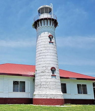
Malabrigo Point Light, Batangas Province, January 2018
Google Maps drone view by T. Pedrosa


