The Independent State of Papua New Guinea includes the eastern half of the island of New Guinea, the Bismarck Archipelago to the northeast, and the island of Bougainville in the Solomon Islands. The colonial history of this area is complex. During the 1880s the southern half of the modern country was colonized by Britain as the Papua colony and the northern half by Germany as German New Guinea. In 1905 Britain transferred the Papua colony to the new Commonwealth of Australia. In 1914, at the start of World War I, Australian and other British Commonwealth troops quickly captured German New Guinea. After the war German New Guinea was assigned to Australia as a League of Nations mandate known as the Territory of New Guinea. In World War II much of the northern territory was occupied by Japan. After World War II the two halves of the country were united under Australian administration as the Territory of Papua and New Guinea. The united territory took the name Papua New Guinea in 1971 and became independent in 1975. Papua New Guinea continues as a Commonwealth Realm recognizing the British monarch as head of state.
Bougainville seeks to become independent. Negotiations are continuing, but it seems likely independence will be coming, probably in 2927.
Papua New Guinea is divided into four regions and subdivided into 20 provinces plus the National Capital District and the Autonomous Region of Bougainville. This page describes lighthouses of the northern half of the country, the former German New Guinea, including the regions of Momase and Islands. There is a separate page for Southern Papua New Guinea.
Aids to navigation in Papua New Guinea are maintained by the National Maritime Safety Authority (NMSA).
Special thanks to the former Nawae Construction Company (disbanded in November 2020) for permission to reproduce several of its lighthouse photos.
ARLHS numbers are from the ARLHS World List of Lights. PNG numbers are from the NMSA light list. Admiralty numbers are from volume K of the Admiralty List of Lights & Fog Signals. U.S. NGA List numbers are from Publication 111 for Bougainville and the Bismarck Archipelago and from Publication 112 for New Guinea.
- General Sources
- National Maritime Safety Authority
- The authority has a map showing the location of the major lights in the country.
- List of Aids to Navigation Lights in Papua New Guinea
- This list was formerly posted in the NMSA web site.
- Online List of Lights - Papua New Guinea
- Photos by various photographers posted by Alexander Trabas.
- World of Lighthouses - Papua New Guinea
- Photos by various photographers available from Lightphotos.net.
- Lighthouses in Papua New Guinea
- Photos by various photographers available from Wikimedia.
- GPSNavigationCharts
- Navigation chart information for Papua New Guinea.
- Google Maps
- Satellite view of Papua New Guinea.

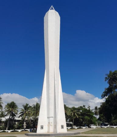
Kalibobo Point Light, Madang, October 2024
Google Maps photo by Achilles Dagwin


