The nation of Gabon, officially the Gabonese Republic (République gabonaise in French), straddles the Equator on the west coast of Africa, with about 800 km (500 mi) of coastline facing on the Atlantic. The country was organized as a French colony around 1885 and from 1910 to 1959 it was part of the consolidated colony known as French Equatorial Africa. Gabon became independent in 1960.
South of Cape Lopez the coast of Gabon faces southwest on the South Atlantic Ocean; north of the cape the coast faces northwest on the Gulf of Guinea. In the north of the country the Gabon Estuary, formed by the Komo and Ebe Rivers, provides a sheltered harbor for the capital, Libreville. Port-Gentil, in the lee of Cape Lopez, is the country's second international port.
Gabon is divided into nine provinces.
French is the official language of Gabon. The French word for a lighthouse is phare, although a smaller light or harbor light is called a feu (literally "fire," but here meaning "light") or a balise (beacon). In French île is an island, cap is a cape, pointe is a promontory or point of land, roche is a rock, récife is a reef, baie is a bay, estuaire is an estuary or inlet, détroit is a strait, rivière is a river, and havre is a harbor.
Aids to navigation in Gabon are maintained by the Service National de la Signalisation Maritime.
ARLHS numbers are from the ARLHS World List of Lights. Admiralty numbers are from volume D of the Admiralty List of Lights & Fog Signals. U.S. NGA List numbers are from Publication 113.
- General Sources
- Online List of Lights - Gabon - Southwest Coast and Northwest Coast
- Photos by various photographers posted by Alexander Trabas.
- Phares d'Afrique
- Photos posted by Alain Guyomard and Robert Carceller as part of their Phares du Monde web site.
- World of Lighthouses - Gabon
- Photos by various photographers available from Lightphotos.net.
- Lighthouses in Gabon
- Photos by various photographers available from Wikimedia.
- Afrikanische Leuchttürme auf historischen Postkarten
- Historic postcard images from the collection of Klaus Huelse.

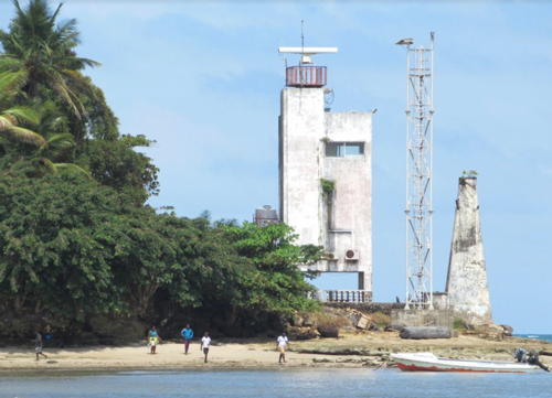
Cap Lopez Light, Port Gentil, May 2020
Google Maps photo by Darlen Nahïlia


