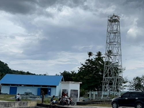
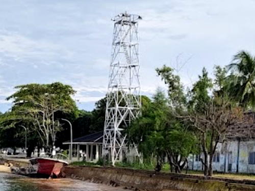
Lighthouses of Indonesia: Western Maluku

The Republic of Indonesia has been independent since 1945 after having been the Dutch East Indies for more than 350 years. It is a huge country, stretching along both sides of the Equator for more than 46 degrees of longitude (roughly 5100 km or 3200 miles). Comprised of some 17,000 islands (more than 6000 inhabited islands), it has hundreds of major aids to navigation.

Indonesia is divided into 38 provinces (provinsi) and the provinces are subdivided into county units called regencies (kabupaten). Maluku Province and North Maluku Province include the islands traditionally known in the West as the Moluccas or the "Spice Islands." The Moluccas lie east of Sulawesi (Celebes), south of the Philippines, and west of New Guinea. The Portuguese established a settlement in the islands at Ambon in 1526. They were replaced in 1609 by the Dutch, who established a second colonial settlement at Ternate. Today Ambon is the capital of Maluku province and Ternate was until recently the capital of North Maluku province.

This page includes lighthouses of islands on the west end of the Moluccas including Buru in Maluku Province and the Sula Islands in North Muluku Province. The Maluku Sea is on the north side of these islands and the Banda Sea is on the south.

More than 700 languages are spoken in Indonesia. The official national language, Indonesian (Bahasa Indonesia), was standardized from a form of Malay that served as a lingua franca across the archipelago. In Indonesian a lighthouse is a mercusuar or a menara suar. Tanjung is a cape, ujung is a headland or point of land, bukit is a hill, sungai is a river, kuala or muara is an estuary or river mouth, pulau is an island, karang is a reef, batu is a rock, laut is a sea, selat is a strait, teluk is a bay, pelabuhan is a harbor, and labuhan is a port. It's also worth knowing that the word for an island is nusa in Balinese and gili in the Sasak language spoken on Lombok and in western Sumbawa.

Aids to navigation in Indonesia are operated and maintained by the Directorate of Marine Navigation within the Directorate General of Sea Transportation

ARLHS numbers are from the ARLHS World List of Lights. Admiralty numbers are from volumes F and Q of the Admiralty List of Lights & Fog Signals. U.S. NGA List numbers are from Publication 112.

General Sources
Online List of Lights - Indonesia - Maluku
Photos by various photographers posted by Alexander Trabas.
World of Lighthouses - Indonesia
Photos by various photographers available from Lightphotos.net.
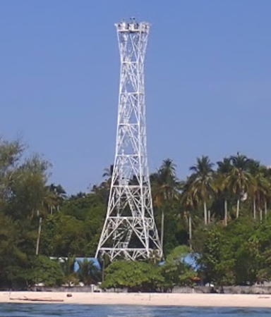
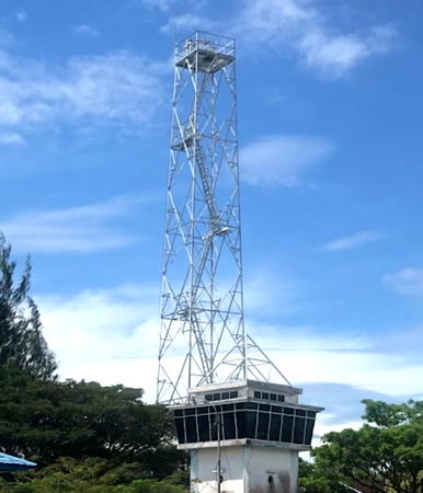
Tanjung Waka Light, Sanana, Sula Islands, October 2020
Google Maps photo by Andreas Muljadi

Maluku Province: Buru Lighthouses

Buru is a large, roughly elliptical island to the west of Seram, from which it is separated by the Manipa Strait. The mountainous island is about 130 km (80 mi) long and 90 km (55 mi) wide. It has a population of about 215,000.

Buru Regency Lighthouses
* Teluk Bara (Bara Bay) (1)
Date unknown. Active (?); focal plane about 15 m (49 ft); white light, pattern unknown. Approx. 13 m (46 ft) skeletal tower, painted white. Iwan Makhwan Hambali has a 2019 photo and Google has a satellite view. Since there is now a new port (next entry), it's not clear if this light remains active. Located at a deepwater port at Bara Bay on the northwest coast of Buru. Site open, tower closed.
* Teluk Bara (Bara Bay) (2)
2017. Active; focal plane 23 m (75 ft); white flash every 3 s. 20 m (66 ft) skeletal tower, painted white. Dede Sulaeman has a 2021 photo, a distant 2022 view is available, and Google has a satellite view. Located at a newer port about 400 m (1/4 mi) south of the original port. Site open, tower closed. Admiralty Q1597.3.
Tanjung Karbau (Kerbau) (2)
Date unknown. Active; focal plane about 30 m (98 ft); white flash every 3 s. Approx. 20 m (66 ft) square white skeletal tower with gallery. No photo available but Google has a satellite view. NGA lists a smaller tower. Located on a promontory about 3 km (2 mi) east of Namlea, a port at the northeastern corner of Buru and capital of Buru Regency. Site status unknown. Admiralty Q1599; NGA 25750.
* Namlea (Old Port) (2)
Date unknown. Active; focal plane about 20 m (66 ft); two white flashes every 10 s. Approx. 16 m (52 ft) short square skeletal tower atop the square tower of the port authority building. The light is at the left edge of Bumi Bupolo's photo, it hides behind an emblem in a closeup photo of the building, Rina Mardiana has a distant view, and Google has a satellite view. In 2007 the main Namlea light was moved to the Pierhead Light (see below). The Admiralty initally gave the Pierhead light the Q1594 number but subsequently moved the number back to this light at the old port. Located on the quay of the original port in downtown Namlea. Site open, tower closed. Admiralty Q1594.
* Namlea-Ambon Ferry Terminal
Date unknown. Active (privately maintained?); focal plane about 16 m (52 ft); flashing white light, period unknown. Approx. 13 m (43 ft) round barbell-shaped white fiberglass tower. Iwan Makhwan Hambali has a closeup photo, Erick Surya Dinata has a 2021 photo, and Google has a satellite view. Located on the Namlea ferry quay. Site open, tower closed. Admiralty Q1594.6.
Namlea Pierhead
2007. Active; focal plane 33 m (108 ft); two white flashes every 10 s. 30 m (98 ft) square skeletal tower, painted white. A 2022 photo is at right, Alfaris Musafir has a 2019 photo, Safirotul Huda has a 2013 photo, a more distant view is available, and Google has an indistinct satellite view. NGA formerly listed a small post light at Namlea; the old light (ex-Admiralty Q1594) was at an older port and may still exist. NGA's application of Q1594 to the new light is incorrect (see Old Port entry above). Located on the waterfront at Namlea, a port at the northeastern corner of Buru. Site status unknown. Admiralty Q1594.5; NGA 25748.
Namlea Approach West
Date unknown. Active; focal plane 18 m (59 ft); red flash every 5 s. Approx. 15 m (49 ft) square red skeletal tower on a square platform supported by piles. No photo available but Google has a satellite view. Located on a shoal about 1.5 km (1 mi) southwest of the Namlea Pier. Site open, tower closed. Accessible only by boat. Admiralty Q1594.15.

Namlea Pierhead Light, Namlea, Buru, August 2022
Google Maps photo by ILHAM
Namlea Entrance
Date unknown. Active; focal plane about 15 m (49 ft); two white flashes every 10 s. Approx. 15 m (49 ft) white tower on a round [ier. No photo available but Google has an indistinct satellite view. Located on a shoal about 1.5 km (1 mi) south of the Namlea Pier. Site open, tower closed. Accessible only by boat. Admiralty Q1594.7.

Southern Buru Regency Lighthouses
* Ulima (Pulau Ambelau)
2015(?). Active; focal plane 22 m (72 ft); white flash every 3 s. 20 m (66 ft) square skeletal tower painted white. Dwikita Ichsana's 2023 photo is at right, Asis Belasa has a 2018 photo, Johannes Hukygah has a 2016 photo and Google has a satellite view. Located on the quay at Ulima, a small port on the north coast of Pulau Ambelau, an island off the southeastern coast of Buru. Site open, tower closed. Admiralty Q1599.3.
Tanjung Bartutui
2003. Active; focal plane 116 m (381 ft); three white flashes every 10 s. 40 m (131 ft) tapered square pyramidal skeletal tower, mounted atop a 1-story building. Several 1-story coast guard buildings. Lighthouse painted white. No photo available but Google has a satellite view. This light marks the southern entrance to the Manipa Strait, the passage between Buru and Seram. Located on the southern tip of Pulau Ambelau. Site status unknown. Admiralty Q1599.5; NGA 25751.
* Namrole
2015(?). Active; focal plane 22 m (72 ft); white flash every 3 s. 20 m (66 ft) square skeletal tower painted white. Budi Power Ono has a 2020 photo, Erwin Bahar has a closeup, Ongki Makatita has a 2017 aerial photo and Bing has a satellite view of the port. Located on the quay at Namrole, a small port on the central south coast of Buru. Site open, tower closed. Admiralty Q1595.

Ulima Light, Ambalau, Buru, July 2023
Google Maps photo by Dwikita Ichsana
Namrole West
Date unknown. Active; focal plane 13.5 m (44 ft); red flash every 5 s. Approx. 12 m (39 ft) square red skeletal tower on a platform supported by piles. No photo available and the light appears as a smudge in Bing's satellite view. Located at the edge of a shoal about 2.5 km (1.5 mi) southwest of Namrole. Site open, tower closed. Accessible only by boat. Admiralty Q1595.2.
#Leksula (1)
Date unknown. Inactive. Approx. 12 m (39 ft) round barbell-shaped white tower. The tower is seen in the left background of a 2017 photo at right and in a distant 2011 view, but it is missing from Google's more recent satellite view. Formerly located next to the passenger terminal at Leksula, a small port on the southwest coast of Buru. Site open, tower closed.
* Leksula (2)
Date unknown. Active; focal plane about 22 m (72 ft); white flash every 3 s. Approx. 20 m (66 ft) square skeletal tower painted white. Muh Yusuf's 2022 photo is at right, Doni Hamdani has a 2021 photo, a 2017 photo is available, and Google has a satellite view. Located on the quay at Leksula. Site open, tower closed. Admiralty Q1596; NGA 25744.
Tanjung Fogi (Pulau Fogi)
Date unknown. Active; focal plane 153 m (502 ft); two white flashes every 15 s. 40 m (131 ft) square skeletal tower with gallery, painted white. The Navigation District has a closeup photo and Google has a satellite view of the station. The Admiralty lists the light as Pulau Fogi. Located on a peninsula (not an island) at the western tip of Buru. Accessible only by boat. Site status unknown. Admiralty Q1597; NGA 25746.
* Pelabuhan Fogi
Date unknown. Active; focal plane about 15 m (49 ft); light characteristic unknown. Approx. 12 m (39 ft) square white skeletal tower. K'ha Anwar has a 2024 view from the harbor and Google has a street view and a satellite view. Located at a small port on the northwest coast of Buru. Not listed by the Admiralty.

Leksula Light, Leksula, Buru, November 2022
Google Maps photo by Muh Yusuf

North Maluku Province: Sula Islands Lighthouses

The Sula Islands are north of Buru and to the west of the Obi islands. Of the three largest islands, Taliabu and Mangole are in a west-east line, while Sulabesi (Sanana) is at right angles south of Mangole. The islands separate the Maluku (Molucca) Sea to the north from the Banda Sea to the south. Taliabu became a separate regency in 2013.

Sula Islands Regency: Pulau Mangole (Mangoli) Lighthouses
Long and narrow, Pulau Mangole (often spelled Mangoli) is lightly populated with about 40,000 residents. Most live near the western tip of the island, which is separated from Pulau Taliabu by the narrow Capalulu Strait.

* Pelabuhan Laut Dofa
Date unknown. Active; focal plane about 23 m (75 ft); flashing white light. Approx. 20 m (66 ft) square skeletal tower painted white. Rengga Purnomo has a 2020 photo and a closeup, a 2022 photo is available, and Google has a satellite view. Located at a new port at Dofa on the west coast of Pulau Mangole. Site open, tower closed. Not listed by the Admiralty.
Tanjung Falabisahaya
Date unknown. Active; focal plane about 16 m (52 ft); green light, pattern unknown. Approx. 16 m (52 ft) square green skeletal tower on a square platform supported by piles. No photo available and the light is only a smudge in Bing's satellite view. Located at the edge of a reef on the west side of the entrance to the bay leading to Falabisahaya. Accessible only by boat. Site open, tower closed. Admiralty Q1601.168.
* Falabisahaya (Pulau Mangole)
Date unknown. Active; focal plane about 23 m (75 ft); flashing white light. Approx. 20 m (66 ft) square skeletal tower painted white. is Gerard Moloney's 2024 photo at right, Ahmad Safar has a 2022 photo, Hidayat Syamsi has a 2018 photo, and Google has a satellite view and a closeup street view. Located at the foot of the pier in Falabisahaya harbor on the central north coast of Pulau Mangole. Site open, tower closed. Admiralty Q1601.165.
Pulau Pastabulu
Date unknown. Active; focal plane about 16 m (52 ft); red light, pattern unknown. Approx. 16 m (52 ft) square red skeletal tower on a square platform supported by piles. No photo available but Bing has a fuzzy satellite view. Pulau Pastabulu is a butterfly-shaped island off the north coast of Pulau Mangole, sheltering the bay leading to Falabisahaya. Located just off the western tip of the island. Accessible only by boat. Site open, tower closed. Admiralty Q1601.169.
Tanjung Dehekalano (Pulau Lifumatola)
Date unknown. Active; focal plane 65 m (213 ft); three white flashes every 20 s. 40 m (131 ft) tapered square skeletal tower, painted white. Several 1-story station buildings. A photo of the lower portion of the tower is available and Google has a satellite view of the station. Located at the eastern tip of Pulau Lifumatola, at the extreme eastern end of the Sula Islands, marking the west side of the southern entrance to the Maluku Sea. Site status unknown. Admiralty Q1592; NGA 25742.

Pelabuhan Falabisahaya Light, Pulau Mangole, July 2024
Google Maps photo by Gerard Moloney

Sula Islands Regency: Pulau Sanana Lighthouses
Another long and narrow island, Pulau Sanana is oriented north-south, at right angles to Pulau Mangole. It has a population of about 65,000.

Tanjung Sakita
Date unknown. Active; focal plane about 15 m (49 ft); white light, pattern unknown. Approx. 12 m (39 ft) square white skeletal tower. Akhim Palulungan has a distant drone view, Dahce Sapasuru has a closeup, and Google has a satellite view. The light was relocated 30 m (100 ft) west in 2022 or 2023. Located at an oil terminal in a sheltered harbor at the northern end of Pulau Sanana. Site status unknown. Admiralty Q1601.5; NGA 25760.
Sanana Entrance North
Date unknown. Active; focal plane 18 m (59 ft); green flash every 5 s. 15 m (49 ft) square skeletal tower painted green and mounted on a square platform supported by piles. The two entrance lights are near the right edge in NurLia Umter's photo, a distant street view from shore is available, and Google has a satellite view. Located on the north side of the entrance to Sanana harbor. Accessible only by boat. Site open, tower closed. Admiralty Q1601.3; NGA 25756.5.
Sanana Entrance South
Date unknown. Active; focal plane 14 m (46 ft); red flash every 3 s. 14 m (46 ft) round red barbell-shaped fiberglass tower mounted on a square platform supported by piles. The two entrance lights are near the right edge in NurLia Umter's photo, a distant street view from shore is available, and Google has a satellite view. Located on the south side of the entrance to Sanana harbor. Accessible only by boat. Site open, tower closed. Admiralty Q1601; NGA 25756.
* Pelabuhan Sanana (1)
Date unknown. Inactive. Approx. 12 m (39 ft) round white barbell-shaped tower. Sambas Junaidi's 2019 photo showing both lighthouses is at right, a 2015 view from the sea is available, and this tower is at the right in another 2019 photo, and Google has a satellite view. Located near the newer and taller tower (next entry). Site open, tower closed.
* Pelabuhan Sanana (2)
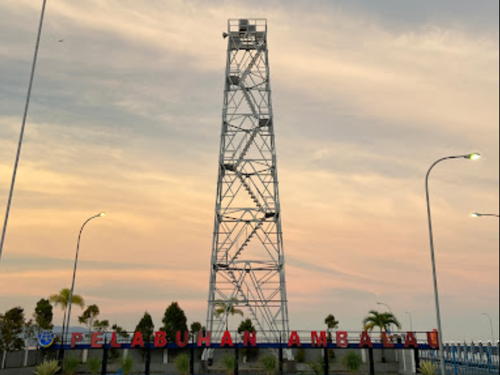
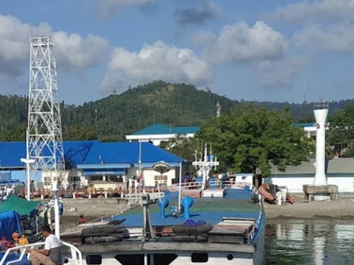
Date unknown. Active; focal plane about 23 m (75 ft); white flash every 5 s. Approx. 20 m (66 ft) square skeletal tower painted white. Sambas Junaidi's 2019 photo showing both lighthouses is at right, Giga Nusantara has an October 2016 photo, a 2019 photo is available, and Google has a satellite view. Located at the foot of the pier in Sanana harbor, near the northeastern corner of the island. Site open, tower closed. Admiralty Q1601.2.

New (left) and old Lights, Pelabuhan Sanana, November 2019
Google Maps photo by Sambas Junaidi
Tanjung Fatkayuan
Date unknown. Active; focal plane 22 m (72 ft); three white flashes every 10 s. Described as a "white beacon," most likely a skeletal tower. No photo available but Google has a fuzzy satellite view. NGA lists this light as Tanjung Fatmok. Located in Fatkayuan, a village in southeastern Sanana, about 6 km (4 mi) northeast of Tanjung Waka. Site status unknown. Admiralty Q1601.1; NGA 25755.
Tanjung Waka
Date unknown. Active; focal plane 50 m (164 ft); three white flashes every 15 s. Approx. 45 m (148 ft) square tapered skeletal tower, painted white. Four 1-story station buildings. Andreas Muljadi's 2020 photo is at the top of this page, a drone view is available, and Google has a satellite view of the station. Located on the southern tip of the narrow island of Sanana, marking the passage between that island and Buru. Site status unknown. Admiralty Q1601.15; NGA 25754.5.
* Pelabuhan Malbufa
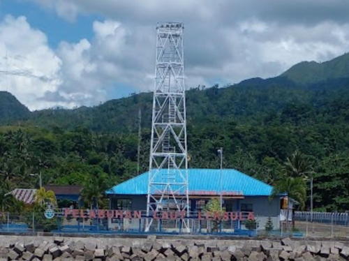
2021. Active; focal plane about 23 m (75 ft); flashing white light. Approx. 20 m (66 ft) square skeletal tower painted white. A 2021 photo is available and Google has a 2022 street view (a portion is seen at right), but the tower is apparently too new to appear in Google's satellite view. Located at the base of the pier at Malbufa on the west coast of Pulau Sanana. Site open, tower closed. Admiralty Q1601.19.
* Malbufa Inner
Date unknown. Active; focal plane 18 m (56 ft); red flash every 5 s. 15 m (49 ft) square skeletal tower painted green and mounted on a square platform supported by piles. This light is on the right in a very distant view and Google has a satellite view. Located on a shoal about 800 m (1/2 mi) off Malbufa, a village on the northwest coast of Pulau Sanana. Accessible only by boat. Site open, tower closed. Admiralty Q1601.16.

Pelabuhan Malbufa Light, Pulau Sanana, April 2022
Google Maps street view by Feihu
* Malbufa Outer
Date unknown. Active; focal plane 18 m (56 ft); green flash every 5 s. 15 m (49 ft) square skeletal tower painted green and mounted on a square platform supported by piles. This light is on the left in a very distant view and Google has a satellite view. Located on a shoal about 1.6 km (1 mi) off Malbufa. Accessible only by boat. Site open, tower closed. Admiralty Q1601.17.

Taliabu Regency Lighthouses
Pulau Sehu (Seku)
Date unknown. Active; focal plane 60 m (197 ft); two white flashes every 15 s. 60 m (197 ft) skeletal tower on a concrete pier. No photo available but Google has an indistinct satellite view. This light and the Pulau Buangbuang Light (see the Eastern Sulawesi page) frame the entrance to the Maluku Sea from the Banda Sea. Located on a promontory on the west side of Pulau Sehu, an island off the southwestern tip of Pulau Taliabu. Accessible only by boat. Site status unknown. Admiralty Q1569.5; NGA 25384.
* Bobong
Active; focal plane about 23 m (75 ft); flashing white light. Approx. 20 m (66 ft) square skeletal tower painted white. A 2024 photo is at right, Rengga Purnomo has a 2020 photo, Eriko Utama has a 2016 beach view, Usman Ramli has a distant street view, and Google has a satellite view. Bobong, at the western end of Pulau Taliabu, is the capital of the Taliabu Regency. Located on the waterfront harbor of Taliabu. Site open, tower closed. Admiralty Q1569.8.
* Tikong (Pelabuhan Bakiki Sahu)
Date unknown. Active; focal plane about 23 m (75 ft); flashing white light. Approx. 20 m (66 ft) square white skeletal tower. A 2020 photo and a more distant view are available and Bing has a satellite view. Located a Tikong, a port on the northwest coast of Pulau Taliabu. Site open, tower closed. Admiralty Q1570.7.

Bobong Light, Pulau Taliabu, December 2024
Google Maps photo by Kamarudin

Information available on lost lighthouses:

Notable faux lighthouses:

Adjoining pages: Northeast: Northern Maluku | East: Central Maluku | West: Southeast Sulawesi

Return to the Lighthouse Directory index | Ratings key

Posted December 31, 2008. Checked and revised January 12, 2025. Lighthouses: 34. Site copyright 2025 Russ Rowlett and the University of North Carolina at Chapel Hill.