Lighthouses of Indonesia: Solor and Alor Islands

The Republic of Indonesia has been independent since 1945, after having been the Dutch East Indies for more than 350 years. It is a huge country, stretching along both sides of the Equator for more than 46 degrees of longitude (roughly 5100 km or 3200 miles). Comprised of some 17,000 islands (more than 6000 inhabited islands), it has hundreds of major aids to navigation.

The island arc that begins in the west with the major islands of Sumatra and Java continues eastward through a chain of smaller islands known in English as the Lesser Sunda Islands and in Indonesian as the Nusa Tenggara ("Southeastern Islands"). From west to east, the major Lesser Sunda Islands are Bali, Lombok, Sumbawa, Sumba, Flores, and Timor.

Indonesia is divided into 38 provinces (provinsi) and the provinces are subdivided into county units called regencies (kabupaten). This page includes lighthouses of the islands of Solor, Adonara, Lembata, Pantar, and Alor in East Nusa Tenggara (Nusa Tenggara Timur) Province.

More than 700 languages are spoken in Indonesia. The official national language, Indonesian (Bahasa Indonesia), was standardized from a form of Malay that served as a lingua franca across the archipelago. In Indonesian a lighthouse is a mercusuar or a menara suar. Tanjung is a cape, ujung is a headland or point of land, bukit is a hill, sungai is a river, kuala or muara is an estuary or river mouth, pulau is an island, karang is a reef, batu is a rock, laut is a sea, selat is a strait, teluk is a bay, pelabuhan is a harbor, and labuhan is a port. It's also worth knowing that the word for an island is nusa in Balinese and gili in the Sasak language spoken on Lombok and in western Sumbawa.

Aids to navigation in Indonesia are operated and maintained by the Directorate of Marine Navigation within the Directorate General of Sea Transportation

ARLHS numbers are from the ARLHS World List of Lights. Admiralty numbers are from volume Q of the Admiralty List of Lights & Fog Signals. U.S. NGA List numbers are from Publication 112.

General Sources
World of Lighthouses - Indonesia
Photos by various photographers available from Lightphotos.net.
Online List of Lights - Indonesia - Lesser Sunda Islands
Photos by various photographers posted by Alexander Trabas.
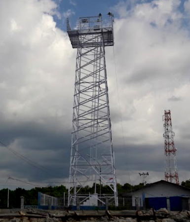
Lewoleba Light, Lembata, July 2017
Google Maps photo by Andy Bona

Solor Islands Lighthouses

The Solor Islands lie to the east of Flores, across the narrow Flores Strait. Solor, Adonara, and Lembata are the largest of the islands.

East Flores Regency: Solor Lighthouses
The East Flores Regency includes the east end of Flores and also the islands of Solor and Adonara. Lighthouses of the regency on Flores are described on the Flores page. Solor, the southernmost of the Solor Islands, is 40 km (25 mi) long and only 6 km (4 mi) wide, with a bend in the middle. It has a population of about 35,000. The Flores Strait begins in the north with a very narrow passage, called the Larantuka Narrows, separating Flores and Adonara. At the southern end a somewhat wider passage separates Flores from Solor.

*
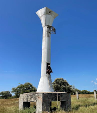
Tanjung Lawawolo (Tanah Lein, Pulau Solor)
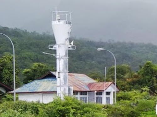
Date unknown. Active; focal plane 23 m (75 ft); quick-flashing white light. Approx. 13 m (43 ft) white barbell-shaped tower mounted on a square base. Andre Toron has the 2022 photo at right, M. Syarifudin has a 2024 photo, and Google has a satellite view. Located on the southwestern tip of Solor, marking the southern entrance to the Flores Strait. Site status unknown. Admiralty Q1339.5; NGA 25643.
* Pelabuhan Menanga
Date unknown. Active; focal plane about 12 m (39 ft); white light, pattern unknown. Approx. 8 m (26 ft) round barbell-shaped fiberglass tower colored blue. Adolina Teryola has a 2021 photo, Faradian Pranilitha has a 2024 view, and Muhammad Iqbal has a more distant view, but a label hides the tower in Google's satellite view. Located on the ferry quay in Menanga, the principal port on the north coast of Solor. Charted by C-Map but not listed by the Admiralty.

East Flores Regency: Adonara Lighthouses
Adonara, the second largest of the Solor Islands, lies between Flores and Lembata, north of Solor. About 40 km (25 mi) long and 25 km (15 mi) wide, the mountainous island has a population of about 135,000.

* Waiwerang (Wai Werang, Pulau Adonara) (2)
Date unknown. Active; focal plane 18 m (59 ft); three white flashes every 15 s. Approx. 14 m (46 ft) square white skeletal tower. Cerita Mama Koe has a 2021 photo, the tower is just to the left of the ship in Frans Kia Ose's photo, Harley Matair has a 2021 drone view and Google has an indistinct satellite view. NGA lists a much smaller tower. Located at the ferry terminal in Waiwerang, on the south coast of Adonara. Site open, tower closed. Admiralty Q1342; NGA 25652.
* Dermaga Sada
Date unknown. Active; focal plane about 16 m (52 ft); white light, pattern unknown. Approx. 14 m (46 ft) square white skeletal tower. The tower is centered in M.G. Naya's photo and is in trees on the right in Simplisius Chandrikia's photo but the tower is not seen in Google's satellite view. Ning Ganteng has a closeup of the top of the tower. Located at a ferry terminal on the east end of Adonara; the ferries cross the Boling Strait to Lembata. Site open, tower closed. Admiralty Q1342.3.

Tanjung Lawawolo Light, Solor, December 2022
Google Maps photo by Andre Toron

Lembata Regency Lighthouses
Lembata is the easternmost and largest of the Solor Islands. The island has a very iregular shape; it is about 80 km (50 mi) long and up to 30 km (19 mi) wide; it has a population of about 135,000.
* Lewoleba (Tanjung Leba-Leba)
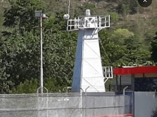
Date unknown. Active; focal plane 35 m (115 ft); nine quick white flashes every 15 s. 25 m (82 ft) square white skeletal tower. Andy Bona has the closeup 2017 photo at the top of this page and Google has a 2016 street view and a satellite view. Lewoleba, the capital of Lembata Regency, is on the northwest coast of Lembata facing Lewoleba Bay. The Admiralty calls it Leba-Leba. Located on the waterfront at Lewoleba. Site open, tower closed. Admiralty Q1342.7.
Karang Lewoleba
Date unknown. Active; focal plane 12 m (39 ft); three red flashes, in a 2+1 pattern, every 15 s. 12 m (39 ft) post on a square platform supportd by piles. Rita Lousiana has a 2022 photo and Google has a satellite view. Located at the west end of large shoal area about 1.6 km (1 mi) north of Lewoleba. Accessible only by boat. Site open, tower closed. Charted by C-Map but not listed by the Admiralty.
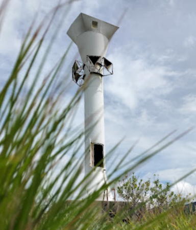
Tanjung Tuak
Date unknown. Active; focal plane 13 m (43 ft); white flash every 4 s. Approx. 11 m (36 ft) round white barbell-shaped metal or fiberglass tower. Yosaphat Aditya has the 2022 photo at right, Hubertus Ola Yan has a closeup photo, and Google has a satellite view. Located on the western tip of Lembata, marking the Boling Strait, the narrow passage between Lembata and Adonara at the northern end of the Lembata Strait. Site status unknown. Admiralty Q1342.5; NGA 25651.7.
Kawula (Tanjung Uhowutun)
Date unknown. Active; focal plane 52 m (171 ft); white flash every 4 s. Approx. 30 m (98 ft) square skeletal tower, painted white. No photo available but Google has a satellite view. Located on a promontory on the north coast of Lembata near Lebewala. Site status unknown. Admiralty Q1343; NGA 25651.
Tanjung Atadei (Dulir)
Date unknown. Active; focal plane 90 m (295 ft); white flash every 7 s. 30 m (98 ft) skeletal tower, painted white. No photo available but Google has a satellite view. Cape Atadei is a prominent cape on the southeast coast of Lembata. The lighthouse is not at the tip of the cape; it is near the village of Dulir about 2.5 km (1.5 mi) northeast of the cape. Site status unknown. Admiralty Q1342.8.

Tanjung Tuak Light, Lembata, April 2022
Google Maps sphoto by Yosaphat Aditya

Pantar and Alor Lighthouses

Alor Regency: Pantar Lighthouses
Alor is a rugged island located north of Timor Leste, from which it is separated by the Ombai Strait. The island has a population of about 170,000. Pantar is a V-shaped island located between Lembata and Alor; it has a population of about 45,000.
Pulau Lapang (Lapan)
Date unknown. Active; focal plane 34 m (111 ft); two white flashes every 15 s. 30 m (98 ft) square pyramidal skeletal tower, painted white. No photo available but Google has a satellite view. Located on an island in the northern entrance to the Alor Strait between Lembata and Pantar. Accessible only by boat. Site status unknown. Admiralty Q1343.5; NGA 25651.5.
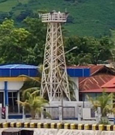
* Blang Merang (Baranusa)
Date unknown. Active; focal plane 14 m (46 ft); white flash every 2 s. 12 m (39 ft) square skeletal tower with gallery, painted white. Yani Moupulo's 2017 photo is at right, a 2014 photo is available, Rid Mayar has a 2021 view from the sea, and Google has a satellite view. Located on the quay at Blang Merang, the seaport associated with Baranusa, the largest settlement on Pantar. Site open, tower closed. Admiralty Q1343.7; NGA 25651.6.
[Tanjung Muna (Tambatan Munasely)]
Date unknown. Active; focal plane 12 m (39 ft); white light, 1 s on, 1 s off. 12 m (39 ft) post centered on a triangular platform supported by piles. Wahidin Abubakar has a very distant view and Google has a satellite view. Located on a shoal off the northeastern tip of Pantar, marking the northern entrance to the Pantar Strait. Accessible only by boat. Site open, tower closed. Admiralty Q1343.8.
* Pelabuhan Bakalang
Date unknown. Active; focal plane about 18 m (59 ft); white light, pattern unknown. Approx. 14 m (46 ft) square white skeletal tower. Jendri Edison has a 2021 photo, Daniel Leatemia has a 2023 view from the sea, Zain Zairo has a 2022 view from the sea, and Google has a satellite view. Located on the waterfront of Bakalang, a port on northern coast of the Pantar Strait. Not listed by the Admiralty.
Pulau Treweg (Tanjung Kelatetek)
2017. Active; focal plane unknown; white light, 1 s on, 1 s off. 20 m (66 ft) square white skeletal tower with gallery. No photo available but Google has a satellite view. In its June 2017 announcement of the light the Admiralty lists the focal plane as 12 m (39 ft), which cannot be correct. Located on the rugged southern tip of Pulau Treweg, an island in the center of the southern entrance to the Pantar Strait. Accessible only by boat. Site status unknown. Admiralty Q1345.5.

Blang Merang Light, Baranusa, March 2021
Google Maps photo byy Rid Mayar

Alor Regency: Alor Lighthouses
Tanjung Margeta
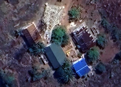
Date unknown. Active; focal plane 55 m (180 ft); white flash every 7.5 s. Approx. 37 m (121 ft) square tapered skeletal tower with lantern and gallery, painted white. Several coast guard buildings. Kolly Christofel has a distant view from the sea and Google has a good satellite view of the station (a portion is seen at right). Located on the southwestern point of Alor, the east side of the entrance to the Pantar Strait. Site status unknown. ARLHS IDO-360; Admiralty Q1346; NGA 25714.
Tanjung Jolono
2008(?). Active; focal plane 35 m (115 ft); white light, 1.5 s on, 5.5 s off. 30 m (98 ft) skeletal tower with gallery, painted white. No photo available but Google has a satellite view. Located on the south side of the entrance to the bay of Kalabahi (see next entry). Site status unknown, probably open. Admiralty Q1345; NGA 25711.7.
* Kalabahi (2?)
About 2006. Active (?); focal plane 23 m (75 ft); three white flashes every 15 s. 20 m (66 ft) square skeletal tower with gallery, painted white. Mujiono Leo posted a 2008 photo, Peter Frans has a night view, and Google has a street view and a satellite view. NGA formerly listed a short post light. Kalabahi, on Alor's northwestern peninsula, is the capital of Alor Regency. The town lies at the head of a long, fjord-like bay. Located in the original port at Kalabahi. Site open, tower closed. Admiralty Q1344; NGA 25712.
* Kalabahi Ferry Terminal
2021. Active; focal plane about 28 m (92 ft); light characteristics unknown. Approx. 25 m (82 ft) square skeletal tower with gallery, painted white. Taus Angga has a 2022 view from the sea and Google has a satellite view. Located at the foot of the ferry pier at the new terminal on the west side of the Kalabahi harbor. Site open, tower closed. Not listed by the Admiralty.

Tanjung Margeta Light, Alor
Google Maps street view
Kalabahi Depot Pertamina
Date unknown. Active; focal plane 16 m (52 ft); white flash every 3 s. Approx. 13 m (43 ft) round white tower. Hidayat Budi Sudarmo has the 2020 photo at right and Google has a satellite view. Located at a Pertamina oil terminal about 3 km (2 mi) southwest of Kalabahi waterfront. Site and tower closed. Admiralty Q1344.5; NGA 25712.5.
Pulau Sika (Sikka) (2)
Date unknown (2019?). Active; focal plane 22 m (72 ft); white flash every 4 s. Approx. 20 m (66 ft) square skeletal tower with gallery, painted white. No photo available but Google has a satellite view. NGA lists 12 m (39 ft) as the focal plane. The Admiralty revised its listing to the higher focal plane in January 2020. Sika is a low island off a prominent cape on the north coast of Alor. Located at the eastern tip of the island. Accessible only by boat. Site open, tower closed. Admiralty Q1348; NGA 25711.5.
Tanjung Babi (1)
Date unknown. Inactive. Approx. 15 m (49 ft) square white skeletal tower. No photo available but Google has a satellite view. Located close to the active light. Site status unknown.
Tanjung Babi (2)
Date unknown. Active; focal plane about 50 m (164 ft); white flash every 5 s. Approx. 40 m (131 ft) square white skeletal tower. No photo available but Google has a satellite view. Located on a prominent cape on the eastern north coast of Alor. Site status unknown. Admiralty Q1347.5; NGA 25711.
Tanjung Manomani
2004. Active; focal plane 80 m (262 ft); white flash every 4.5 s. 30 m (98 ft) square skeletal tower with lantern and gallery, painted white. No photo available but Google has a satellite view. Located on the northeastern tip of Alor. Site status unknown. Admiralty Q1347.3.

Depot Pertamina Light, Kalabahi, November 2020
Google Maps photo by Hidayat Budi Sudarmo
* Pelabuhan Maritaing
Date unknown. Active; focal plane about 13 m (43 ft); white light, characteristic unknown. 10 m (33 ft) round white fiberglass tower with a flared top. Frits Albertus has the 2021 photo at right, Jefree Harsel has a 2017 photo, Muaz Kammis has a view from the sea, and Google has a satellite view. Located on the waterfront of Maritaing, a small port at the east end of Alor. Site open, tower closed. Not listed by the Admiralty; charted as a daybeacon by Navionics.
Tanjung Lisomu (Laisumbu)
Date unknown. Active; focal plane 60 m (97 ft); two white flashes every 28 s. 40 m (131 ft) skeletal tower with lantern and gallery, painted white; lantern painted red. Keeper's house and other station buildings. Milan Nisti has a view from the sea and Google has a good satellite view. This lighthouse guides vessels through the Ombai Strait separating Alor from Timor Leste. Located in Maritaing at the southeastern tip of Alor. Site status unknown. Admiralty Q1347; NGA 25710.
Tanjung Koyiek
2004. Active; focal plane 80 m (262 ft); two white flashes every 16 s. 30 m (98 ft) square pyramidal skeletal tower with lantern and gallery, painted white. Numerous coast guard buildings. Chris Levis has a distant view and Google has a satellite view. Located on a promontory on the central south coast of Alor. Site status unknown. Admiralty Q1346.5.

Information available on lost lighthouses:

Notable faux lighthouses:


Pelabuhan Maritaing Light, Maritaing, January 2021
Google Maps photo by Frits Albertus

Adjoining pages: North: Southern Sulawesi | Northeast: Southern Maluku | Southeast: Timor Leste | South: Rote and West Timor | West: Flores

Return to the Lighthouse Directory index | Ratings key

Posted January 10, 2009. Checked and revised November 19, 2024. Lighthouses: 25. Site copyright 2024 Russ Rowlett and the University of North Carolina at Chapel Hill.