Anguilla is a self-governing British overseas territory located in the Leeward Islands at the extreme northeastern corner of the Caribbean Sea. The population is about 15,000. Founded as a British colony in 1650, Anguilla was governed from 1825 as a dependency of St. Kitts-Nevis. In 1967 Anguillans drove out St. Kitts officials and insisted that the island become a separate British territory; this was confirmed by Parliament's Anguilla Act in 1971. Anguilla continues today as a British Overseas Territory.
The Territory includes the island of Anguilla and a number of smaller islands and cays. The most remote of these is Sombrero, 55 km (34 mi) to the northwest. Though it is a tiny bit of land Sombrero is important to navigators because it lies precisely at the point of entry to the Caribbean for many ships arriving from Europe.
Navigational aids in Anguilla are maintained by the Department of Fisheries and Marine Resources.
ARLHS numbers are from the ARLHS World List of Lights. Admiralty numbers are from volume J of the Admiralty List of Lights & Fog Signals. U.S. NGA List numbers are from Publication 110.
- General Sources
- Online List of Lights - Anguilla
- Photos by various photographers posted by Alexander Trabas.
- Lighthouses in Anguilla
- Photos by various photographers available from Wikimedia.
- World of Lighthouses - Anguilla
- Photos by various photographers available from Lightphotos.net.
- GPSNauticalCharts
- Navigational chart information for Anguilla.

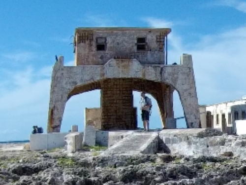
2001 Sombrero Light, Anguilla, May 2020
Google Maps photo by Rogue Travelers
