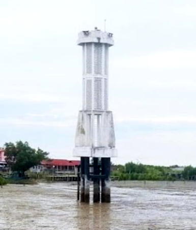
Lighthouses of Indonesia: Northeastern Sumatra

Indonesia is a huge country of Southeast Asia, stretching along both sides of the Equator for more than 46 degrees of longitude (roughly 5100 km or 3200 miles). It occupies 17,504 islands, by official count, including more than 6000 inhabited islands. It is the world's fourth most populous nation with a population currently estinated at about 280 million. More than half of the population lives on the island of Java. Other major islands include Sumatra in the west, Borneo (shared with Malaysia and Brunei) in the northwest, Sulawesi in the northeast, and the eastern half of New Guinea in the far east. Other well known islands include Bali, Lombok, Sumbawa, Flores, and Timor (shared with independent East Timor) along the south side of the country.

The unification of the country was accomplished over many years of struggle by Dutch colonial authorities. The Dutch East India Company was founded in 1602 to establish and extend Dutch administration, and after the company folded the Netherlands established the Dutch East Indies colony and gradually extended its boundaries to reach the present boundaries of Indonesia. During World War II Japan occupied the islands from March 1942 to the end of the war in 1945. The Republic of Indonesia proclaimed its independence immediately after the war ended and following some conflict the Netherlands accepted the country's independnece in 1949.

Sumatra (Sumatera in Indonesian) is the world's sixth largest island and the westernmost of the major islands of Indonesia. It is separated from Malaysia to the north by the Malacca Strait, from Kalimantan (Borneo) to the northeast by the broad Karimata Strait, and from Java to the southeast by the Sunda Strait. Its south coast faces the open Indian Ocean.

Indonesia is divided into 38 provinces (provinsi) and the provinces are subdivided into county units called regencies (kabupaten). Sumatra includes eight of the provinces. This page includes lighthouses of the east (Malacca Strait) coast of North Sumatra Province., which spans the northern part of the island south of Aceh. Lighthouses of the west (Indian Ocean) coast of North Sumatra Province are described on the Northwestern Sumatra page. North Sumatra is the fourth most populous province of Indonesia with a population of about 15 million.

More than 700 languages are spoken in Indonesia. The official national language, Indonesian (Bahasa Indonesia), was standardized from a form of Malay that served as a lingua franca across the archipelago. In Indonesian a lighthouse is a mercusuar or a menara suar. Tanjung is a cape, ujung is a headland or point of land, bukit is a hill, sungai is a river, kuala or muara is an estuary or river mouth, pulau is an island, karang is a reef, batu is a rock, laut is a sea, selat is a strait, teluk is a bay, pelabuhan is a harbor, and labuhan is a port.

Aids to navigation in Indonesia are operated and maintained by the Directorate of Marine Navigation within the Directorate General of Sea Transportation.

ARLHS numbers are from the ARLHS World List of Lights. Admiralty numbers are from volume F of the Admiralty List of Lights & Fog Signals. U.S. NGA List numbers are from Publication 112.

General Sources
Lighthouses in Indonesia
Photos by various photographers available from Wikimedia; most of the photos are historic.
World of Lighthouses - Indonesia
Photos by various photographers available from Lightphotos.net.
Online List of Lights - Indonesia
Photos by various photographers posted by Alexander Trabas.
Navionics Charts
Nautical charts for the Malacca Strait area.

Tanjung Sibungabunga Light, Serdang Bedagai, October 2017
Google Maps photo by Galang Pandu Satria
Deli Serdang Regency (Belawan Area) Lighthouses
Belawan, a city of about 100,000 residents, is the seaport associated with the provincial capital of Medan. With a metropolitan population of more than 4 million, Medan is Indonesia's largest city outside Java. This helps make Belawan Indonesia's second busiest port after Jakarta. Belawan is also the terminal for ferries crossing the Strait of Malacca to Penang, Malaysia.

Nipah Larangan (Nipahlarangang, Kwala Besar) (2)
2014(?) (station establishment date unknown). Active; focal plane 44 m (144 ft); three white flashes every 20 s. 40 m (131 ft) octagonal concrete tower with lantern and galley, painted white, rising from an octagonal building. Several coast guard station buildings. Google has a satellite view. However, the lighthouse is now critically endangered. Maringan Tobing has the August 2017 photo seen at right, showing the tower with a lean of at least 15° (like the Leaning Tower of Pisa). We don't know if this is caused by storm damage or a poor foundation. Nothing has been done to correct this, as we see in Arlong Barabai's 2023 photo. The original lighthouse was a tapered square skeletal tower. Located on a low cape a short distance east of Kuala Besar and about 16 km (10 mi) north of Belawan. Site status unknown. ARLHS IDO-172; Admiralty F1352; NGA 22400.
Belawan Approaches (2?)
2014 (lightship station established 1890). Active; focal plane probably about 20 m (66 ft); green flash every 3 s. Described only as a "beacon," this is almost certainly a green skeletal tower on a platform supported by piles. No photo available and the light is not shown in Bing's satellite view. This light replaced a light formerly listed (ex-Admiralty F1355; ex-NGA 22408) with focal plane 20 m (66 ft) at a location about 2.5 km (1.5 mi) to the north. Located at the east edge of extensive shoals about 8 km (5 mi) offshore and 10 km (6 mi) north of the Belawan entrance. Accessible only by boat. Site open, tower closed. Admiralty F1354.

Nipah Larangan Light, Belawan, August 2017
Google Maps photo by Maringan Tobing
Sungai Nonang
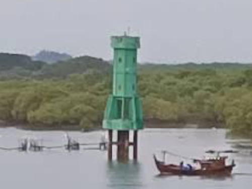
Date unknown. Active; focal plane about 13 m (43 ft); green light, pattern unknown. Approx. 13 m (43 ft) round green concrete tower mounted on piles. Hardian Syah has a view across the river and Google has a satellite view. Located on the inside of a sharp bend in the Nonang (Belawan) River opposite the Bandar Deli docks of Belawan. Accessible only by boat. Site open, tower closed. Admiralty F1373.1.
Belawan Beacon II (Common Rear)
Date unknown. Active; focal plane 17 m (56 ft); white light, 3 s on, 3 s off. 14 m (46 ft) square skeletal tower with gallery, painted with black and white horizontal bands. No photo available and the light is not seen in Google's satellite view. This was the rear light for both inbound and outbound ranges but the outbound range has been discontinued. Located about 2.5 km (1.5 mi) off the harbor entrance at Belawan. Site and tower closed. ARLHS IDO-109; Admiralty F1356; NGA 22416.
Belawan Beacon IV
About 2016. Active; focal plane 12 m (39 ft); two quick white flashes every 4 s. 12 m (39 ft) square skeletal tower mounted on a platform supported by piles. Rika Purnamasari has a photo and Google has a satellite view. Located just off the outermost pier of the harbor. Site open, tower closed. Admiralty F1362; NGA 22424.
#Belawan Beacon V (Entrance Range Rear)
Date unknown. Inactive since 2022. 12 m (39 ft) square skeletal tower with gallery, painted white. Adib Pranata's 2015 view from shore is at right and Hadanata Lim has a 2012 photo of the lighthouse in action. Google's satellite view shows the platform but the tower has been removed. This was the rear light of a harbor approach range. Located on a shoal in Belawan harbor. Site and tower closed. ex-Admiralty F1362.1; NGA 22428.
Pelabuhan Belawan
Date unknown. Active; focal plane 13 m (43 ft); white flash every 4 s. 13 m (43 ft) white skeletal tower. No photo available but the light is centered in Google's satellite view. Nearby buildings must obscure this light in certain directions. Site status unknown. Admiralty F1367; NGA 22430.

Belawan Beacon V Light (since lost), Belawan, January 2015
Google Maps photo by Adib Pranata

Serdang Bedagai Regency Lighthouses
Tanjung Sibungabunga
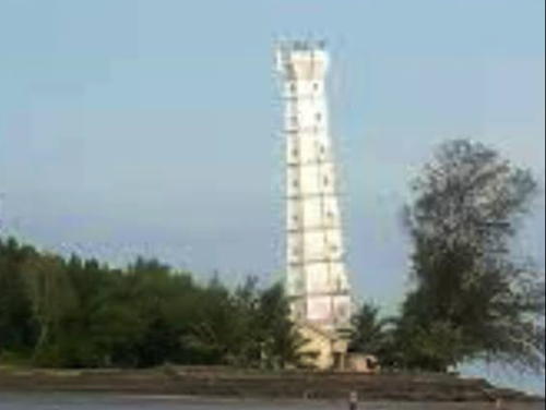
Date unknown. Active; focal plane 21 m (69 ft); white flash every 3 s. 19 m (62 ft) octagonal cylindrical white concrete tower with two galleries. Galang Pandu Satria's photo is at the top of this page and Google has a 2023 street view and a satellite view. Located near the waterfront in Serdang Bedagai northeast of Medan. Site status unknown. Admiralty F1374.5; NGA 22449.
Gosong-Gosong Bunga (Bunga Banks)
Date unknown. Active; focal plane 17 m (56 ft); two white flashes every 5 s. 17 m (56 ft) fiberglass tower, colored black with a red horizontal band and mounted on a platform supported by piles. No photo available and the light is not shown in Google's satellite view. Located on a shoal on the south side of the main channel in the Strait of Malacca 17 km (10.5 mi) northeast of Tanjung Sibungabunga. Accessible only by boat. Site status unknown. Admiralty F1374; NGA 22450.
Pulau Berhala (2)
Date unknown. Active; focal plane 192 m (630 ft); four white flashes every 19 s. Approx. 23 m (75 ft) 2-stage octagonal cylindrical concrete tower with lantern and gallery. A closeup photo is at right, an aerial photo and a distant view (a little over halfway the way down the page) are available and Bing has a distant satellite view. NGA lists a 12 m (39 ft) square skeletal tower. Located on a small, isolated high island about 50 km (30 mi) off the coast in the Strait of Malacca. Probably accessible only by helicopter. Admiralty F1375; NGA 22452.
Kuala Bedagai (2)
Date unknown. Active; focal plane 15 m (49 ft); white flash every 5 s. Described as a 13 m (43 ft) square white skeletal tower but Partogi Hutapea's 2021 distant view and Google's satellite view show a round white concrete tower with lantern and gallery. Located at a beach village at the east end of the regency. Site status unknown. Admiralty F1375.5; NGA 22456.

Pulau Berhala Light, Malacca Strait, July 2017
Google Maps photo by Suhendra S

Batubara Regency Lighthouses
Pankalan Dodek (2)
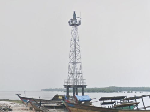
Date unknown (station established 1906). Active; focal plane 18 m (59 ft); white flash every 5 s. 15 m (49 ft) square skeletal tower mounted on a platform supported by piles. Google has a street view (also seen at right) and a fuzzy satellite view. The original lighthouse had a focal plane height of 15 m (49 ft). Located on the Pangkalan River waterfront at Pangkalen Dodek, about 20 km (13 mi) northwest of Tanjungbalai. Site status unknown. Admiralty F1376.5; NGA 22458.
Pankalan Dodek East
Date unknown. Active; focal plane about 18 m (59 ft); white flash every 5 s. Approx. 15 m (49 ft) square skeletal tower mounted on a platform supported by piles. The light is seen at the extreme left edge of J.C. Tobing's panoramic view of the river and Google has a satellite view and a distant street view. Located at a terminal on the east side of the Pangkalan River north of Pangkalen Dodek. Site status unknown. Admiralty F1376.3.
Pankalan Dodek Entrance
Date unknown. Active; focal plane 21 m (69 ft); red flash every 3 s. 21 m (69 ft) square red skeletal tower mounted on a platform supported by piles. No photo available but Bing has a fuzzy satellite view. Located on the est side of the channel entering the Pangkalan River north of Pangkalen Dodek. Accessible only by boat. Site open, tower closed. Admiralty F1376.2.
Kuala Tanjung West
Date unknown. Active; focal plane about 18 m (59 ft); white light, pattern unknown. Approx. 15 m (49 ft) square white skeletal tower. No photo available but Bing has a satellite view. The Port of Kuala Tanjung is under rapid development in recent years. Located at the foot of the western pier at Kuala Tanjung. Site and tower closed. Admiralty F1376.7.
Kuala Tanjung
2018. Active; focal plane 31 m (102 ft); white flash every 4 s. 15 m (49 ft) white post mounted on a port control building. A 2019 photo is available, Aris Syahputra has a 2018 photo, Benedictus Ary Febriarto has a 2022 photo, and Bing has a satellite view. Located at the end of a long pier at Kuala Tanjung. Site and tower closed. Admiralty F1377.5.

Pankalan Dodek Light, Pankalan Dodek, September 2019
Google Maps street view
Pulau Pandang (North Brother Island) (2?)
Date unknown. Active; focal plane 63 m (207 ft); white flash every 5 s. Approx. 18 m (59 ft) 2-stage octagonal white concrete tower with lantern and gallery. Endang Tri Hayati's 2022 closeup photo is at right, Rudi Chandra Sambas has a closeup photo, Amri Hakim has a distant aerial view, a 2018 view is available, and Bing has an indistinct satellite view. NGA lists a 12 m (39 ft) skeletal tower. Located about 15 km (9 mi) northeast of Pulau Salahnama. Accessible only by boat. Site open, tower closed. Admiralty F1378; NGA 22460.
Pulau Salahnama (South Brother Island)
Date unknown. Active; focal plane 121 m (397 ft); white flash every 6 s. 30 m (98 ft) square skeletal tower, painted white. Akbar Suhairi has a fine aerial view, Zul Dalimunthe has a view from the harbor, Kristy Egi Tyo has a distant view from the sea, and Bing has a distant satellite view. This island and its shorter neighbor Pulau Pandang (North Brother) are well-known hazards to navigation along the Sumatran coast. Located on an island in the Strait of Malacca about 20 km (13 mi) off the coast north of Tanjung Balai. Accessible only by boat. Site status unknown. Admiralty F1378.5; NGA 22462.
Tanjung Tiram
Date unknown. Active; focal plane 11 m (36 ft); red flash every 4 s. 11 m (36 ft) tower on a platform supported by piles. No photo available but Google has a satellite view. This light is in line with the range lights (next entries). Located off the entrance to Kuala Batubara. Accessible only by boat. Site open, tower closed. Admiralty F1379; NGA 22468.
Tanjung Tiram Range Front
Date unknown. Active; focal plane 11 m (36 ft); white flash every 3 s. 11 m (36 ft) white concrete tower enclosed by white daymark panels and mounted on a triangular platform supported by piles. Joni Parulian has a 2018 photo of the two range lights and Google has a satellite view. Located just offshore on the east side of the entrance to Kuala Batubara. Accessible only by boat. Site open, tower closed. Admiralty F1378.7; NGA 22463.
Tanjung Tiram Range Rear
Date unknown. Active; focal plane 15 m (49 ft); three white flashes every 10 s. 15 m (49 ft) white concrete tower enclosed by white daymark panels and mounted on a triangular platform supported by piles. Joni Parulian has a 2018 photo of the two range lights and Google has a satellite view. Located at the shoreline 320 m (1050 ft) south of the front light. Accessible only by boat. Site open, tower closed. Admiralty F1378.71; NGA 22463.5.
Tanjung Tambuntulang
Date unknown. Active; focal plane 14 m (46 ft); two white flashes every 4 s. 14 m (46 ft) square pyramidal white concrete tower mounted on a square platform supported by piles. No photo available but Bing has a distant satellite view. Located about 2 km (1.25 mi) off a promontory about 8 km (5 mi) east of the town of Tanjung Tiram. Accessible only by boat. Site open, tower closed. Admiralty F1379.2; NGA 22471.

Pulau Pandang Light, Batubara, February 2022
Google Maps photo by Endang Tri Hayati

Asahan Regency Lighthouses
The Sungai Asahan (Asahan River) is one of the largest rivers of northern Sumatra; its estuary leads to a series of river ports.

Sungai Asahan Outbound Range Rear
Date unknown. Active; focal plane 18 m (59 ft); white light occulting once every 6 s. 18 m (59 ft) square white skeletal tower mounted on a platform supported by piles. No photo available and the light is not shown in Bing's satellite view. Located about 4 km (2.5 mi) north of the mouth of the estuary. Accessible only by boat. Site open, tower closed. Admiralty F1383.1; NGA 22482.1.
Sungai Asahan Outbound Range Front
Date unknown. Active; focal plane 13 m (43 ft); two quick white flashes every 4 s. 13 m (43 ft) square white skeletal tower mounted on a platform supported by piles. No photo available but the shadow of the light is seen in Bing's satellite view. Located 400 m (1/4 mi) south of the rear light. Accessible only by boat. Site open, tower closed. Admiralty F1383; NGA 22482.
Sungai Asahan Outer Bar
Date unknown. Active; focal plane 18 m (59 ft); red flash every 4 s. 15 m (49 ft) red beacon mounted on a platform supported by piles. No photo available but the shadow of the light is seen in Bing's satellite view. Located off the east side of the mouth of the Asahan River, which leads to the port of Tanjungbalai. Accessible only by boat. Site open, tower closed. Admiralty F1382; NGA 22480.
Sungai Asahan Range Front
Date unknown. Active; focal plane 13 m (43 ft); two white flashes every 4 s. 13 m (43 ft) square white skeletal tower mounted on a platform supported by piles. Alexander Pushkov has a distant view and Google has a satellite view. Located in the Asahan River off the port of Perikanen. Accessible only by boat. Site open, tower closed. Admiralty F1379.5; NGA 22481.
Sungai Asahan Range Rear
Date unknown. Active; focal plane 16 m (52 ft); white light, 3 s on, 3 s off. 16 m (52 ft) square white skeletal tower mounted on a platform supported by piles. No photo available but Google has a satellite view. Located in the Asahan River 1.35 km (0.84 mi) south of the front light. Accessible only by boat. Site open, tower closed. Admiralty F1379.51; NGA 22481.1.
Tanjung Siapiapi (Siapi-Api)
Date unknown. Active; focal plane 14 m (46 ft); white flash every 3 s. 14 m (46 ft) square pyramidal white skeletal tower mounted on a square platform supported by piles. No photo available but Bing has a satellite view. Located just off a low cape east of Tanjungbalai. Accessible only by boat. Site open, tower closed. Admiralty F1383.8; NGA 22485.

North Labuhan Batu Regency Lighthouse
Tanjung Ledung (Leidong)
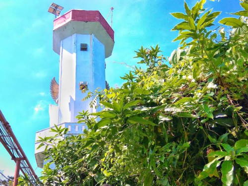
Date unknown. Active; focal plane 15 m (49 ft); two white flashes every 8 s. 15 m (49 ft) 2-stage octagonal white tower mounted on piles. Feri Irawan has the 2022 photo seen at right, Mawar Sari has a photo, and Google has a satellite view. This light has an unusual design. Located just offshore at the Tanjung Leidong port on the west side of the entrance to the Kualuh estuary. Site open, tower closed. Admiralty F1390; NGA 22486.

Tanjung Leidong Light, North Labuhan Batu, December 2020
Google Maps photo by Feri Irawan

Labuhan Batu Regency (Sungai Panai) Lighthouses
Tanjung Datu
Date unknown. Active; focal plane 14 m (46 ft); white flash every 5 s. 14 m (49 ft) white hourglass-shaped fiberglass tower mounted on a square platform supported by piles. No photo available but Bing has an indistinct satellite view. Located on the west side of the entrance to the Sungai Panai, the Panai estuary. Site status unknown. Admiralty F1384.2; NGA 22487.
* Sei Berombang
About 2017. Active; focal plane 18 m (59 ft); white flash every 4 s. 17 m (56 ft) square white skeletal tower mounted on a square platform supported by piles. A photo is at right, Sulhan Iskandar has a 2021 closeup, Akun Vivo has a photo, and Google has a satellite view. Located on the quay at Sei Berombang, a town on the east side of the Panai estuary. Site open, tower closed. Admiralty F1384.6.
Tanjung Lumbalumba
Date unknown. Active; focal plane 24 m (79 ft); white flash every 5 s. 20 m (66 ft) white skeletal tower. No photo available but Google has a satellite view. Located in a right-angle bend of the Panai estuary about 10 km (6 mi) south of Sei Berombang. Site status unknown. Admiralty F1385; NGA 22488.
Pulau Kantan
Date unknown. Active; focal plane 20 m (66 ft); green flash every 4 s. 20 m (66 ft) square pyramidal skeletal tower painted green and mounted on a square platform supported by piles. F. Batubara has a 2023 photo and a second photo and Bing has a satellite view. Located off the northern tip of an island in the Panai estuary. Accessible only by boat. Site status unknown. Admiralty F1385.5; NGA 22489.

Sei Berombang Light, Sei Berombang, March 2018
Google Maps photo by Ahyar Ahyar

Information available on lost lighthouses:

Notable faux lighthouses:

Adjoining pages: North: Eastern Aceh | Northeast: West Malaysia South Coast | South: Eastern Sumatra

Return to the Lighthouse Directory index | Ratings key

Posted April 13, 2006. Checked and revised January 13, 2024. Lighthouses: 33. Site copyright 2024 Russ Rowlett and the University of North Carolina at Chapel Hill.