Lighthouses of Japan: Southern Yamaguchi

The nation of Japan, known in Japanese as Nihon or Nippon (日本), occupies an archipelago off the east coast of Asia. The four main islands are Hokkaidō in the north, Honshū (the largest) in the center, Shikoku in the south, and Kyūshū in the southwest. The country includes thousands of other islands of all sizes; among them the Ryūkyū (Nansei) Islands are a long chain extending to the southwest and including the large island of Okinawa, and the Nanpō Islands are another long chain extending south into the Pacific Ocean. Much of Japan is mountainous but the coastal regions are densely populated and urbanized; the country's population is about 126 million.

Japan is divided into 47 prefectures. Yamaguchi Prefecture is located at the extreme southwestern tip of the main island of Honshū. Yamaguchi has coasts facing south on the Seto Inland Sea (Seto Naikai) and west and northwest on the Sea of Japan. The narrow, twisting Kanmon Strait connects these two seas and barely separates Honshū from Kyūshū. The principal ports in Yamaguchi are Tokuyama on the Inland Sea, Shimonoseki on the Kanmon Strait, and Nagato on the Sea of Japan.

Because of its lengthy coastline, Yamaguchi Prefecture has an unusually large number of lighthouses. This page includes lighthouses of the Suo Bay and Kanmon Strait in the southwestern end of the prefecture. The Eastern Yamaguchi page has the remaining lighthouses of the Seto Inland Sea and the Western Yamaguchi page has the lighthouses of the prefecture's Sea of Japan coast. .

In Japanese the word for a lighthouse is tōdai or toudai (灯台). The words saki and misaki are for capes and headlands, hana ("nose") is a promontory, hantō is a peninsula, shima (also spelled sima or jima) is an island, bae is a reef, iwa or shi is a rocky reef, amase or se is a shoal, wan is a bay, nada is a sound or basin, kaikyō is a strait, kawa is a river, and kō or minato is a harbor.

Lighthouses in Japan are operated and maintained by the Japanese Coast Guard's Maritime Safety Agency. On Honshū there is at least one Coast Guard Section Office in each prefecture, often two or more. The situation in Yamaguchi is more complicated. The lighthouses of the Suo Bay coast are maintained by the Tokuyama Office in the city of Shūnan.while the Kanmon Strait lighthouses are maintained by the Moji Office, located across the strait in Fukuoka Prefecture.

A note on the Sea of Japan/East Sea controversy: The Directory takes no side in any international dispute; it makes use of the terminology, names, and spellings as they currently exist in each area covered. The sea between Japan and Korea is called the Sea of Japan on the pages for Japan and the East Sea on the pages for Korea.

ARLHS numbers are from the ARLHS World List of Lights. JCG numbers are the Japanese Coast Guard's light list numbers. Admiralty numbers are from volume M of the Admiralty List of Lights & Fog Signals. U.S. NGA List numbers are from Publication 112.

General Sources:
Lighthouse-Japan.com - Yamaguchi
Another comprehensive site with photos and notes from visits to many lighthouses.
Lighthouse Visit
Another site with photos of Yamaguchi lighthouses.
Misty's Japanese Lighthouse Tour - Yamaguchi
Photos and a few notes for lighthouses in all parts of the country.
Senzaki Coast Guard Office - Lighthouses
Photos and data for the major lighthouses on the prefecture's northwest coast.
Moji Coast Guard Office - Lighthouses
Photos of lighthouses in the Moji Coast Guard District.
Online List of Lights - Japan - Kanmon Strait and Honshu West Coast
Photos by various photographers posted by Alexander Trabas.
Lighthouses in Yamaguchi Prefecture
Photos by various photographers available from Wikimedia.
Lighthouses in the Meiji Period
Information and photos of lighthouses built during the reign of the Emperor Meiji (1868-1912), posted by the 7th Coast Guard Region.
Japan: Modern Lighthouses
Historic postcard views posted by Michel Forand.
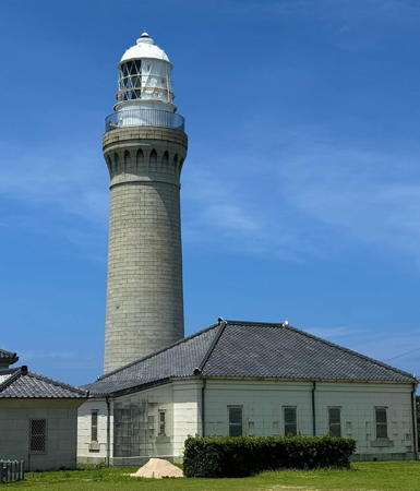

Tsuno Shima Light, Shimonoseki, August 2024
Instagram photo by todai_oshiro


Nagato Kawajiri Misaki Light, Nagato, February 2025
Google Maps photo by Yukako Guesthouse

Suo Nada (Tokuyama Coast Guard District) Lighthouses

Hōfu City Lighthouse
* No Shima (Nojima, No Sima, Suō Noshima)
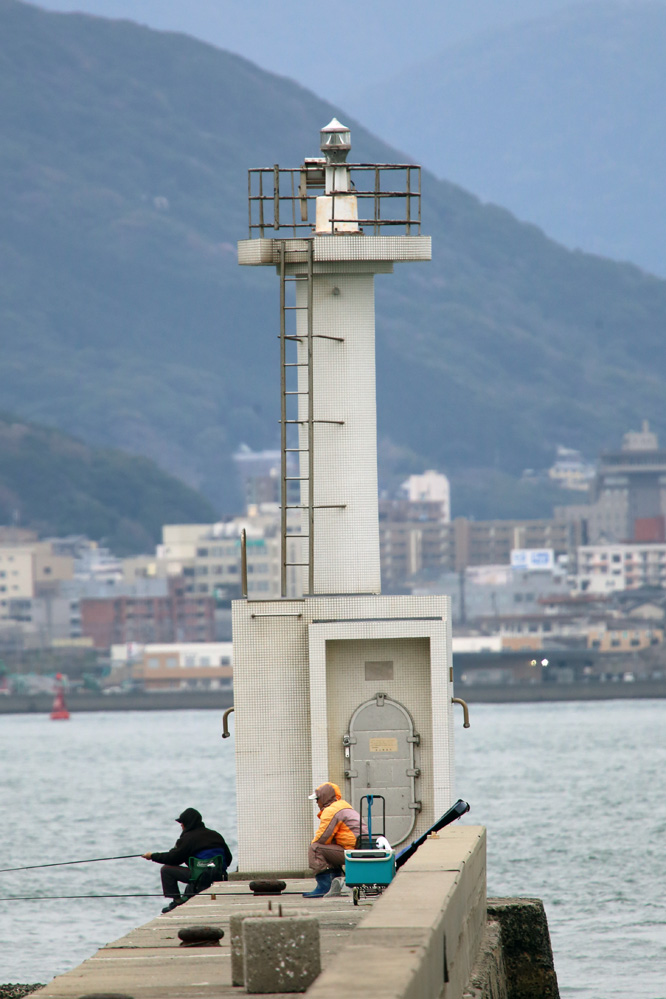
1978. Active; focal plane 87 m (285 ft); white light, 3 s on, 3 s off. 19 m (62 ft) square white concrete tower with lantern and gallery. A boxlike chamber below the gallery contains a powerful spotlight that illuminates the nearby reef of Omo Se. A closeup 2025 photo and a distant 2003 view are available and Google has a satellite view. No Shima is an inhabited island in Suō Bay about 20 km (13 mi) southwest of Kudamatsu and 15 km (9 mi) southeast of Hōfu. Passenger ferry service is available from both cites. Located on a summit near the southern tip of the island. Accessible by a 15-minute walk from the ferry terminal. Site open, tower closed. ARLHS JPN-602; JCG-5140; Admiralty M5398.5; NGA 9512.
* No Shima Kō (West Breakwater)
Date unknown. Active; focal plane 12 m (39 ft); red light, 3 s on, 3 s off. 8.5 m (28 ft) concrete post attached to a square 1-story concrete equipment shelter. Entire lighthouse is red. Shinjirō Hara has a good photo, Kazuya Tanaka has a very distant view, and Google has a satellite view. Located at the end of the west (main) breakwater of the harbor on No Shima. Accessible by walking the pier, and there's a good view from arriving ferries. Site open, tower closed. ARLHS JPN-1646; JCG-5142; Admiralty M5399; NGA 9516.
Mitaziri Nakanoseki Kō
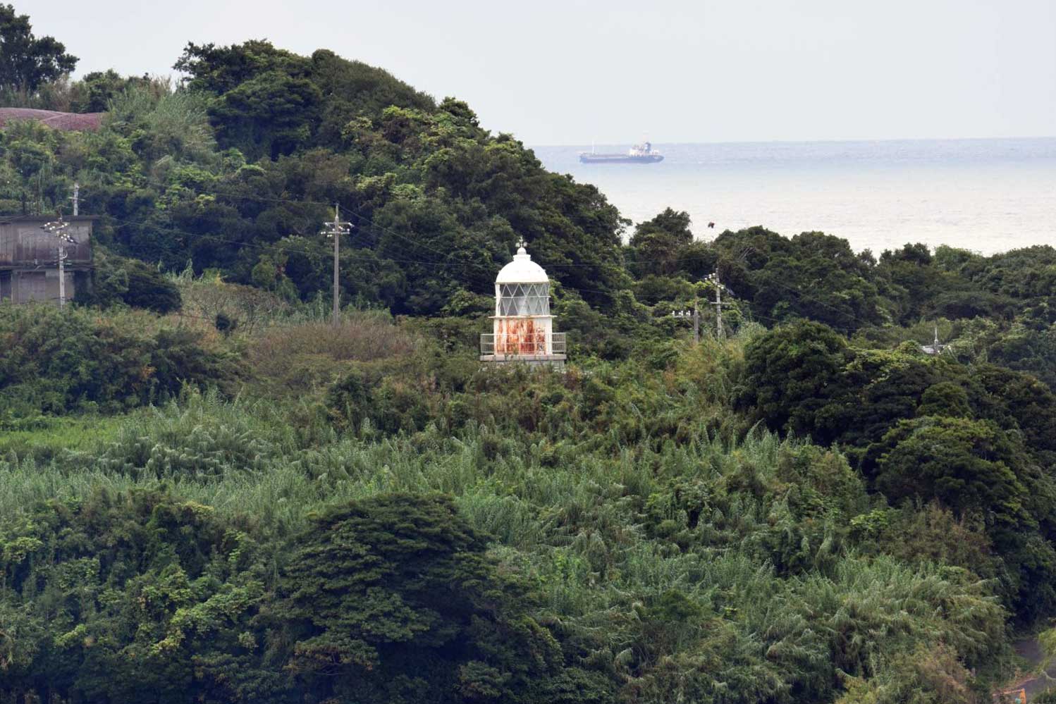
Date unknown. Active; focal plane 14 m (46 ft); red flash every 3 s. 9.5 m (31 ft) round concrete tower with a flared top attached to a small equipment shelter. Entire lighthouse is red. Trabas has a photo and Google has a satellite view. Located on a detached breakwater outside the entrance to Hōfu harbor. Accessible only by boat. Site status unknown. JCG-5181.7; Admiralty M5396; NGA 9577.
* Nakanoseki (Nakano Saki)
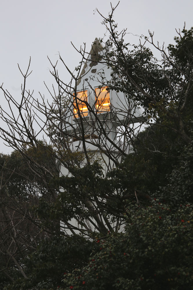
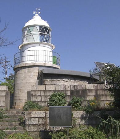
1932. Active; focal plane 66 m (217 ft); white light, 2 s on, 2 s off. 12 m (39 ft) square concrete post attached to a 1-story concrete equipment building. Lighthouse-Japan.com has a page with several photos, a closeup is available, Trabas also has a closeup, and the light pokes through the trees in Google's satellite view. Located on a densely-forested promontory on the west side of the entrance to Hōfu harbor. Accessible by a hiking trail. Site open, tower closed. ARLHS JPN-1643; JCG-5193; Admiralty M5394; NGA 9584.
Saba Shima
Date unknown. Active; focal plane 47 m (154 ft); white flash every 3 s. 13 m (43 ft) square white concrete tower. No closeup photo available. Trabas has a distant view, S. Katsuragi has a distant view from the sea, and Google has a satellite view. Located atop a small island about 7 km (4.5 mi) southwest of Nakano Saki. Accessible only by boat. Site status unknown. ARLHS JPN-1651; JCG-5200; Admiralty M5390.6; NGA 9604.

Yamaguchi City Lighthouses
* Kusayama Saki
1982. Active; focal plane 128 m (420 ft); white light, 3 s on, 3 s off; in addition, a continuous white spotlight (JCG-5202) illuminates a nearby shoal. 12 m (39 ft) round cylindrical concrete tower with gallery. Entire lighthouse is white. S. Katsuragi's 2022 photo is at right, Lighthouse Visit also has a page with photos, Trabas has a closeup, the Coast Guard has a good photo, a 2021 photo is available, and Google has a satellite view. Located in a lovely and popular forest park on a high promontory jutting into Suō Bay about 15 km (9 mi) south of Ogori; a stone column marks the entrance to the park. Site open, tower closed. ARLHS JPN-313; JCG-5201; Admiralty M5390; NGA 9608.
* Aio Kō (South Breakwater)
1976. Active; focal plane 12 m (39 ft); red light, 2 s on, 2 s off. 8.5 m (28 ft) concrete post attached to a square 1-story concrete equipment room. Entire structure is red. Trabas has a closeup photo, Lighthouse Visit has a page with a photo (second lighthouse on the page), there's a photo of the light in action, and Google has a street view and a satellite view. Located at the end of the south (main) breakwater of Aio harbor. Accessible by walking the pier. Site open, tower closed. ARLHS JPN-1605; JCG-5204; Admiralty M5390.45; NGA 9616.

Kusayama Saki Light, Yamaguchi, February 2022
Google Maps photo by S. Katsuragi
Iwayano Hana
Date unknown. Active; focal plane 22 m (72 ft); continuous white spotlight illuminating a nearby reef. 6 m (20 ft) round cylindrical white concrete tower. Trabas has a closeup photo, Katsuhiro Okada has a 2020 photo, and Google has a satellite view. Located at the end of a long, narrow peninsula southwest of Aio. Accessible by a hiking trail; parking is available at the trailhead. Site status unknown. JCG-5206; Admiralty M5389.5; NGA 9620.

Ube City Lighthouses
Suō Tateishi
Date unknown. Active; focal plane 12 m (39 ft); white flash every 4 s. 8 m (26 ft) round cylindrical concrete tower centered on an octagonal concrete pier. Entire lighthouse is white. The Coast Guard has a photo, Trabas has a photo, and Google has a satellite view. NGA garbles the name as "Ta Teisi." Located on a reef in the center of the entrance to Yamaguchi harbor. Accessible only by boat. Site open, tower closed. ARLHS JPN-1664; JCG-5207; Admiralty M5389; NGA 9624.
Tokonami Kō
Date unknown. Active; focal plane 12 m (39 ft); red light, 2 s on, 2 s off. 9 m (30 ft) concrete post attached to a square 1-story concrete equipment room. Entire structure is red. Trabas has a closeup photo and Google has a street view and a satellite view. Located on the south breakwater of Tokonami harbor, a short distance east of Ube Airport. May be accessible by walking the pier. Site open, tower closed. ARLHS JPN-1667; JCG-5209; Admiralty M5387.5; NGA 9632.
Kamega Se
Date unknown. Active; focal plane 12 m (39 ft); white flash every 4 s. 14 m (46 ft) round cylindrical concrete tower with lantern and gallery, mounted on an octagonal concrete pier. A 2020 photo is at right, Trabas has a good photo, and Bing has a fuzzy satellite view. Located on a shoal about 2 km (1.25 mi) south of Ube Airport. Accessible only by boat. Site open, tower closed. JCG-5210; Admiralty M5386; NGA 9636.
#Ubemisaki Kō (1)
Date unknown. Replaced. This was a 8.5 m (28 ft) concrete post attached to a square 1-story concrete equipment room. Entire structure was white. No photo available. Google's satellite view shows that the lighthouse has been replaced by a post light (focal plane 12 m (39 ft); continuous green light with a more intense flash every 5 s). Trabas has a closeup photo of the new light. Located on the east end of a detached breakwater protecting the entrance to Ube's fishing harbor, just west of the airport. Accessible only by boat. Site open, tower closed. ARLHS JPN-1672. Active light: JCG-5211; Admiralty M5382; NGA 9640.

Kamega Se Light, Ube, November 2020
Livedoor blog photo copyright kentmerry
Motoyama
Date unknown. Active; focal plane 15 m (49 ft); white flash every 3 s. 15 m (49 ft) round concrete tower with lantern and gallery, mounted on a square concrete pier. Lighthouse painted white with one black horizontal band. Endangered. Yasushi Kidena's photo at right shows the lighthouse with a troubling lean of at least 10°. Trabas has a similar photo and Kenichiro Asai has a 2024 photo. thelean appears to be stable. The lighthouse is not shown in Google's satellite view. Located in Suō Bay about 5 km (3 mi) offshore south of Ube. Accessible only by boat. Site open, tower closed. ARLHS JPN-1637; JCG-5212; Admiralty M5387; NGA 9648.
Ube Kō South Harbor Range Front
Date unknown. Active; focal plane 13 m (43 ft); continuous red light. 12 m (39 ft) round concrete tower with gallery topped by a triangular concrete daymark. Entire lighthouse is white. Trabas has a photo and Google has a satellite view. Located on the waterfront of the south harbor basin. Site and tower closed. JCG-5224; Admiralty M5380; NGA 9656.
* Ube Kō South Harbor Range Rear
Date unknown. Active; focal plane 19 m (62 ft); continuous red light. 16 m (52 ft) round concrete tower with two galleries topped by a triangular concrete daymark. Entire lighthouse is white. Trabas has a photo and Google has a street view and a satellite view. Located beside a street in the south harbor area, 240 m (0.15 mi) northeast of the front light. Site open, tower closed. JCG-5225; Admiralty M5380.1; NGA 9660.
Ube Kō West Breakwater
Date unknown. Active; focal plane 12 m (39 ft); green light, 3 s on, 3 s off. 9 m (30ft) concrete post attached to a square 1-story concrete equipment room. Entire structure is white. Trabas has a photo, Lighthouse Visit has a photo (last lighthouse on the page) and Google has a satellite view. Located on a short breakwater on the west side of Ube harbor. Site and tower closed (industrial area). ARLHS JPN-1671; JCG-5227; Admiralty M5376; NGA 9664.
 

Motoyama Light, Ube, July 2020
Google Maps photo by Yasushi Kidena

Shimonoseki City (Moji Coast Guard District) Lighthouses

North Side Kanmon Strait Lighthouses
The Kanmon Strait is the narrow passage separating the southwestern tip of Honshū from the northern tip of Kyūshū. The two great islands have been joined since 1958 by the Kanmon Roadway Tunnel and since 1973 by the Kanmonkyō Bridge, which crosses the narrowest point of the strait from Shimonoseki, Honshū, to Kitakyūshū. There are also two railway tunnels under the strait, one of them carrying high-speed trains. The twisting strait has strong tidal currents and is not easy to navigate. Lighthouses on the south side of the strait are described on the Kitakyūshū Area page.

Manzyu (Manju) Shima
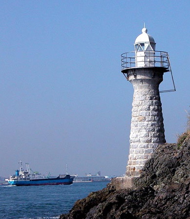
1934. Active; focal plane 16 m (52 ft); white flash every 4 s. 16 m (52 ft) round concrete tower with lantern and gallery. Entire lighthouse is white. Trabas has Jim Smith's view from the sea (also seen at right), additional photos (second lighthouse on the page) are available, Lighthouse Visit also has a page with photos, and Google has a satellite view. Manzyu Shima is a small, wooded island on the north side of the eastern entrance to Kanmon Strait, about 8 km (5 mi) northeast of Shimonoseki. Located on the southern shore of the island. Accessible only by boat. Site open, tower closed. ARLHS JPN-330; JCG-5401; Admiralty M5360; NGA 9762.
Chifumiyazaki (Tyohu, Chofunakahama Kō)
Date unknown. Active; focal plane 12 m (39 ft); green light, 3 s on, 3 s off. 8.5 m (28 ft) concrete post attached to a square 1-story concrete equipment shelter. Entire lighthouse is white. Trabas has a closeup photo, and Google has a street view and a satellite view. Located at the end of detached breakwater off an industrial harbor in northeastern Shimonoseki. Accessible only by boat. Site status unknown. JCG-5416; Admiralty M5358; NGA 9770.
Shimonoseki Range Front
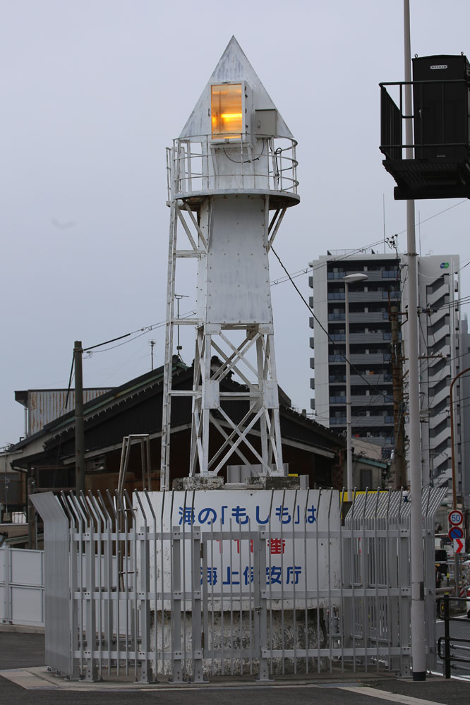
1901. Active; focal plane 13 m (43 ft); continuous yellow light. 12 m (39 ft) cast iron skeletal tower with gallery mounted on a round stone tower; an arrow-shaped daymark surrounds the light. Entire lighthouse is white. Trabas has a closeup photo, Hiroshi Ichikohara has a 2023 closeup, Lighthouse Visit has a page for the two range lights, Michel Forand has a historic postcard view, and Google has a street view and a satellite view. The range guides westbound ships passing Shimonoseki. Located beside the San'yōdō expressway on the waterfront just west of the Kanmonkyō Bridge. Site and tower closed, but the light is a familiar landmark on the south side of the expressway. JCG-5423; Admiralty M5356; NGA 9778.

Manzyu Shima Light, Shimonoseki, September 2016
photo copyright Jim Smith; used by permission
Shimonoseki Range Rear
1901. Active; focal plane 21 m (69 ft); continuous yellow light. 5 m (17 ft) round cast iron tower with gallery; an arrow-shaped daymark surrounds the light. Entire lighthouse is white. Trabas has a closeup photo, Lighthouse Visit has a page for the two range lights, and Google has a street view and a satellite view. Located on a bluff above the north side of the San'yōdō expressway, 163 m (535 ft) west southwest of the front light. The light is not visible from the eastbound lanes of the expressway, being hidden by a concrete retaining wall. Site and tower closed. JCG-5424; Admiralty M5356.1; NGA 9782.
* Sotohama (Kannonzaki) East Breakwater (2?)
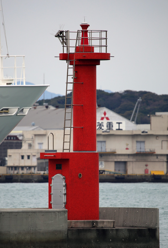
Date unknown (1997? station established 1913). Active; focal plane 8 m (26 ft); red flash every 4 s. 6 m (20 ft) round concrete tower with gallery. Lighthouse covered with red ceramic tiles. The light is in the background of the photo at right, Lighthouse Visit has a page for the two breakwater lights, Trabas has a closeup photo, and Google has a 2024 street view and a satellite view. It's not clear if this is a new structure or a refurbished version of the original lighthouse. Located on the west breakwater of a small craft basin about 1.5 km (1 mi) southwest of the Kanmonkyō Bridge. Accessible by walking the pier; it's an easy walk from the nearby public aquarium. Site open, tower closed. JCG-5425; Admiralty M5353; NGA 9786.
* Sotohama (Kannonzaki) West Breakwater
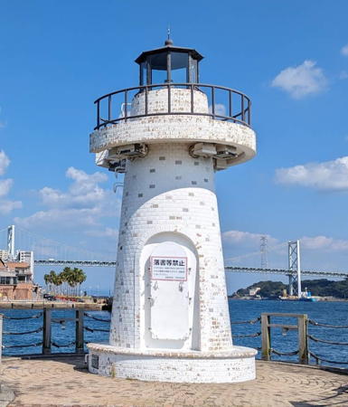
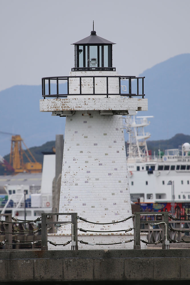
1997. Active; focal plane 8 m (26 ft); green flash every 4 s. 6 m (20 ft) round concrete tower with lantern and gallery. The lighthouse is covered with white and gray ceramic tiles; lantern painted black. A 2023 photo is at right, Lighthouse-Japan.com has a page with several photos, Trabas has a closeup photo, another photo is available, and Google has a street view and a satellite view. Located on the west breakwater of a small craft basin about 1.5 km (1 mi) southwest of the Kanmonkyō Bridge. Accessible by walking the pier; it's only a few steps from the Shimonoseki Marine Science Museum. Site open, tower closed. JCG-5425.1; Admiralty M5352; NGA 9788.
Shimonoseki Kō (Hananocho Breakwater)
2008 (?). Active; focal plane 10 m (33 ft); red flash every 5 s. 8.5 m (28 ft) concrete post attached to a square 1-story concrete equipment room. Entire lighthouse is red. Trabas has a closeup photo, and Google has a satellite view and a distant street view. Located at the end of the breakwater for the Hananocho harbor. JCG-5427; Admiralty M5351; NGA 9794.
Hikoshima Range Front
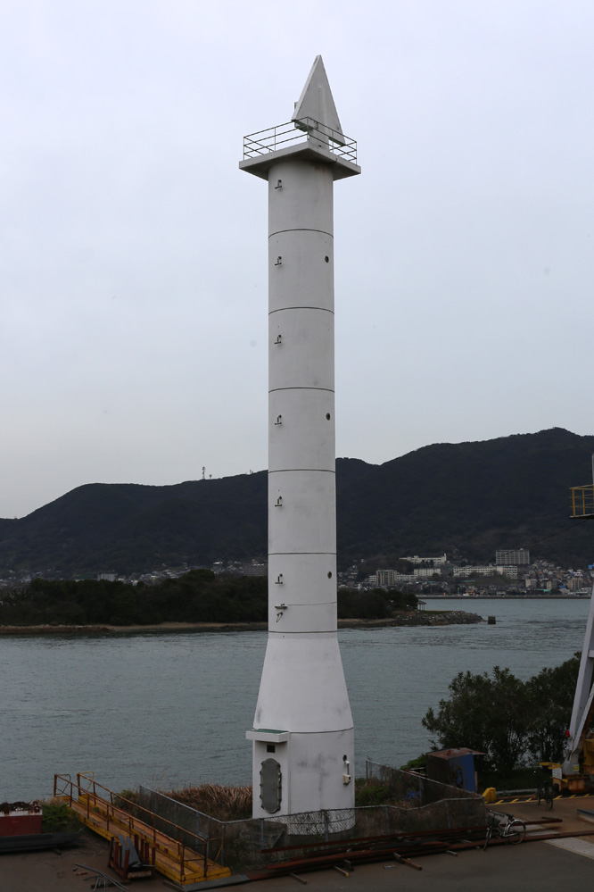
2002. Active; focal plane 27 m (89 ft); continuous yellow light. 26 m (85 ft) round concrete tower with triangular topmark and gallery. Entire lighthouse is white. Trabas has a closeup photo, the Coast Guard has a photo of the two range lighthouses, and Google has a street view and a good satellite view. This range replaced the Ganryu Shima lighthouse (see below). It guides westbound vessels in the reach under the Kanmonkyō Bridge and past the Shimonoseki waterfront. Located on the shore of the strait about 4 km (2.5 mi) southwest of the Kanmonkyō Bridge. Site and tower closed. JCG-5431.1; Admiralty M5349; NGA 9799.

Sotohama West Breakwater Light, Shimonoseki, October 2023
Google Maps photo by Kota
Hikoshima Range Rear
2002. Active; focal plane 35 m (115 ft); continuous yellow light. 13 m (46 ft) concrete tower with lantern and gallery. Entire lighthouse is white. Trabas has a photo, the Coast Guard has a photo of the two range lighthouses, and Google has a satellite view. Located on a wooded bluff 90 m (300 ft) southwest of the front light. Site status unknown. JCG-5431.2; Admiralty M5349.1; NGA 9799.5.
#Ganryu Shima
Date unknown. Demolished in 2003. This was a 17 m (56 ft) round tower with lantern and gallery, painted with red and white horizontal bands. Wikimapia has a photo of the small square concrete platform on which the lighthouse stood and Google has a satellite view. The lighthouse became redundant with the activation of the Hikoshima range lights (previous entries), so it was demolished in January 2003. Located at the tip of a headland a short distance south of the Hikishima lighthouses. Site status unknown. ex-JCG-5431; ex-Admiralty F5350.
#Yamasokono Hana
1918. Demolished, probably in 2003. This 14 m (46 ft) structure consisted of a 5 m (17 ft) round stone tower extended by a square skeletal tower. Google's satellite view shows no trace of the lighthouse. The light was replaced by a green buoy. Located on the north edge of the strait about 2 km (1.25 mi) east of the Kanenotsuru lighthouse (next entry). Site open. ex-JCG-5435.
Kanenotsuru (Kanenoturu) Misaki (Cape Kinnogen)
1871 (relocated here in 1920). Inactive since 2000. 8.5 m (28 ft) round stone tower with lantern and gallery. The tower is unpainted; lantern painted white. Kenichiro Asai's 2020 view from the strait is at right, a 2016 photo and a 2008 photo are available, and Google has a satellite view. This small lighthouse stands on the extreme southwestern tip of Honshū, on the inside of a right-angle bend in the Kanmon Strait. Ships rounding this point are guided now by buoys and by range lights on the south (Kyūshū) side of the strait, making this light obsolete. Of the four historic lighthouses that guided ships around this bend, this is the only one not demolished. Accessible only by boat. Site and tower closed. ARLHS JPN-805; ex-JCG-5441; ex-Admiralty F5342.
#Ōyamano Hana
1901. Demolished, probably in 2003. This was a 12.5 m (41 ft) concrete tower from which the lantern had been removed. Google has a street view and a satellite view of a small concrete pier on which the lighthouse stood. Located about 400 m (1/4 mi) northwest of the Kanenotsuru lighthouse (previous entry). Site open. ex-JCG-5460.

Kanenotsuru Misaki Light, Shimonoseki, April 2020
Google Maps photo by Kenichiro Asai
Fukuura Breakwater (Simonoseki Basin Breakwater)
1965. Active; focal plane 10 m (33 ft); two green flashes every 8 s. 8.5 m (28 ft) concrete post attached to a square 1-story concrete equipment shelter. Entire lighthouse is white. Trabas has a closeup photo, Lighthouse Visit has a page with a photo, and Google has a 2024 street view and a satellite view. Located at the end of the breakwater of the Fukuura harbor on the west side of Hikoshima. This pier seems too narrow to be walked safely. Site open, tower closed. ARLHS JPN-816; JCG-5461; Admiralty M5339; NGA 9860.
#Daiba (Daiga) Hana
1900. Inactive since 2009 and demolished, probably in 2010. This was an 11 m (36 ft) round brick tower with lantern and gallery, painted white. Lighthouse-Japan.com has a page with excellent photos taken in 2008 and Misty's Tour has a 2003 photo. Google's satellite view confirms that the lighthouse was removed, an unfortunate loss of a historic structure. This lighthouse marked the north side of the entrance to the Kanmon Strait from the Sea of Japan. It stood on an island, separated from the mainland by a narrow channel but accessible by bridge. ARLHS JPN-1607; ex-JCG-5530; ex-Admiralty M5335.6; ex-NGA 9920.
* Mutsure (Muture) Shima
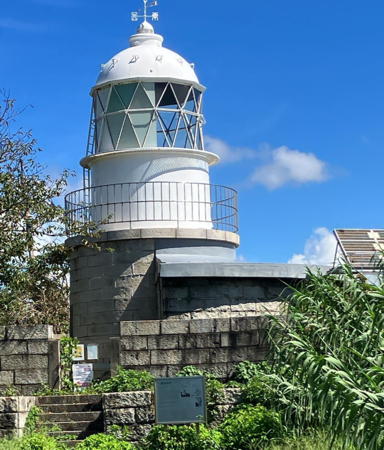
1871 (Richard Henry Brunton). Active; focal plane 28 m (92 ft); white flash every 10 s. 11 m (36 ft) round stone tower with lantern and gallery, attached to a semicircular keeper's cottage. The lighthouse is unpainted granite; lantern painted white. A 2023 closeup is at right, the Coast Guard has a page for the lighthouse, Lighthouse Visit has a page with photos, Misty's Tour has a photo, Trabas has Jim Smith's distant view, a 2020 photo and a 2018 closeup are available, the Moji Coast Guard Office has a photo, Ryokuya Midori has a fine 2019 street view, and Google has a satellite view. This historic light is one of the oldest active Japanese lighthouses, inaugurated on 21 November 1871. The emperor Meiji visited the lighthouse on 12 June 1872. In 2020 it was the first active lighthouse to be designated a National Important Cultural Property. The lighthouse marks the approach to Kanmon Strait, which is from the north and not from the west. Located at the northeastern point of Mutsure Shima about 3 km (2 mi) north of Daiba Hana. The island is accessible by passenger ferry, and the lighthouse is only a short walk from the harbor. Site status unknown. . ARLHS JPN-384; JCG-5537; Admiralty M5334; NGA 9944.

Mutsure Shima Light, Shimonoseki, August 2023
Instagram photo by itsuchiyan9523

Information available on lost lighthouses:

Notable faux lighthouses:

Adjoining pages: North: Western Yamaguchi | East: Eastern Yamaguchi | South: Kitakyūshū Area

Return to the Lighthouse Directory index | Ratings key

Posted January 25, 2007. Checked and revised April 10, 2025. Lighthouses: 32. Site copyright 2025 Russ Rowlett and the University of North Carolina at Chapel Hill.