Lighthouses of South Korea: Northern Wando Islands

For most of its history Korea was an independent kingdom, or at least an autonomous kingdom under Chinese influence. This came to an end in 1910 when Japan annexed all of Korea. At the end of World War II in 1945 the 38° parallel was established as the dividing line between U.S. and Soviet zones of occupation, and in 1948 separate civil administrations were established in the two halves of the country. The Korean War (1950-53) ended in a draw with the armistice line falling close to the prewar 38° line. The Republic of Korea (ROK; 대한민국, Daehan Minguk in Korean), commonly called South Korea, occupies the Korean peninsula south of the armistice line.

South Korea is divided into nine provinces and eight province-level cities; the provinces are subdivided into counties and cities. This page covers lighthouses of the northern section of the island county of Wando located off South Korea's southwest coast. Wando is a county of Jeollanam Province in the region of southwestern Korea formerly known known as Jeolla or Cholla. There is another page for the southern islands of the county. Also included on this page are several lighthouses of Jangheung County and Gangjin County, counties on the mainland facing Wando.

In 2000 South Korea adopted a Revised Romanization System to replace systems formerly used in the West. In the Revised System, the word for a lighthouse is deungdae (등대); dan (formerly tan) is a cape, seom (som) or do (to) is an island, am or amseog is a rock, man is a bay, and hang is a harbor. Some place names may be more familiar to Westerners in the spellings of older systems.

Navigational aids in the ROK are regulated by the Ministry of Oceans and Fisheries (MOF). Most of the lights on this page are maintained by the Mokpo Regional Office of Oceans and Fisheries, but several of the lights in the southeastern part of the Wando archipelago are maintained by the Yeosu Regional Office of Oceans and Fisheries.

ARLHS numbers are from the ARLHS World List of Lights. KR numbers, where available, are from the Korean light list. Admiralty numbers are from volume M of the Admiralty List of Lights & Fog Signals. U.S. NGA List numbers are from Publication 112.

General Sources
Port of Mokpo - Lighthouses
Photos and information in English for the major lighthouses of the area.
World of Lighthouses - South Korea
Photos by various photographers available from Lightphotos.net.
Online List of Lights - Korea
Photos by various photographers posted by Alexander Trabas.
Navionics Charts
Navigation chart for Wando.


Wando Hang Light, Wando, August 2019
Google Maps photo by Banny

Northeastern Wando County Lighthouses

Geumdang Township Lighthouses
Geumdangdo, the easternmost island of Wando County, is a smaller island about 5 km (3 mi) west of Geogeumdo in Goheung County.
Geumdangdo Hang
Date unknown. Active; focal plane 11 m (36 ft); green flash every 4 s. 16 m (52 ft) concrete tower, painted green. A photo and a closeup photo (3/4 the way down the page) are available, and Google has a distant satellite view. Located in the entrance to a harbor between Geumdangdo and Bigyeondo at the southeastern end of Geumdangdo. Accessible only by boat. Site status unknown. KR-2570.6; Admiralty M4297.55; NGA 17301.55.
Bigyeondo
Date unknown. Active; focal plane about 15 m (49 ft); six white flashes followed by a long white flash. Approx. 12 m (39 ft) round concrete tower, upper half yellow and lower half black. No photo available but Google has a satellite view. Bigyeondo is a smaller island off the southeastern side of Geumdangdo. Located on a reef southeast of Bigyeondo. Accessible only by boat. Site open, tower closed. KR-2557.3; Admiralty M4297.53.
Gilmado
Date unknown. Active; focal plane 10 m (33 ft); green flash every 4 s. 10 m (33 ft) round cylindrical green concrete tower. No photo available but Google has an indistinct satellite view. Located on a reef about 1.6 km (1 mi) southwest of the northwestern point of Geumdangdo. Accessible only by boat. Site open, tower closed. KR-2570.1; Admiralty M4281.69.
Geumdangdo (Kumdang Do)
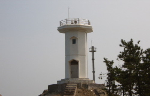
Date unknown. Active; focal plane 50 m (164 ft); white flash every 6 s. 10 m (33 ft) round white concrete tower. A photo is at right, a view from the sea is available, and Google has a satellite view. Located at the northwestern point of Geumdangdo. Site status unknown. KR-2570; Admiralty M4281.7; NGA 17301.
Geumdangdo Light
Geumdangdo Light, Geumdang District
ex-Daum.net Creative Commons photo by 고기잡는어부

Geumil Town Lighthouses
Geumil includes Pyeongdildo, an irregularly shaped island in the southeastern corner of the Wando archipelago about 25 km (15 mi) south southwest of the Goheung Peninsula.

Daebyeongpungdo (Taebyongp'ungdo)
1997. Active; focal plane 12 m (39 ft); white flash every 6 s. 9 m (30 ft) round cylindrical white concrete tower. A closeup photo (fourth photo on the page) is available and Google has a satellite view. Located on the northern point of an island about 8 km (5 mi) southeast of Pyeongdildo. Accessible only by boat. Site status unknown. KR-2545; Admiralty M4296.7; NGA 17292.5.
Hwangjedo
Date unknown. Active; focal plane 50 m (164 ft); white flash every 5 s. 10 m (33 ft) octagonal cylindrical white concrete tower with gallery. Salamat Maksetbaevich has a distant view and Google has a distant satellite view. Located on the eastern tip of Hwangjedo, a small island in the Korea Strait about 15 km (9 mi) due south of Pyeongdildo. Accessible only by boat. Site open, tower closed. Admiralty M4295.5; NGA 17290.
Hwangjedo West
Date unknown. Active; focal plane 27 m (89 ft); two white flashes every 6 s. 8 m (26 ft) hexagonal cylindrical skeletal tower with gallery mounted on a robust round concrete base. Entire lighthouse is white. No photo available but Google has a distant satellite view. Located at the west end of Hwangjedo. Accessible only by boat. Site status unknown. Admiralty M4295.7; NGA 17291.
Seopdo (Sopto)
1957. Active; focal plane 55 m (180 ft); white flash every 10 s. 8 m (26 ft) octagonal cylindrical white concrete tower with gallery. A Yeosu Port Administration photo is at right, a page describing the island has a photo, and Google has a satellite view. Located on the southeastern tip of Seopdo, a small island about 4 km (2.5 mi) southeast of Pyeongdildo. Accessible only by boat. Site open, tower closed. KR-2544; Admiralty M4296; NGA 17292.
Dongsongni (Pyeongildo Northward)
Date unknown. Active; focal plane 14 m (46 ft); two white flashes every 5 s. 12 m (39 ft) round concete tower painted with red and black horizontal bands and mounted on a round concrete pier. No photo available but Google has a satellite view. Located on a reef in the strait on the north side of Pyeongdildo. Accessible only by boat. Site open, tower closed. KR-2557.1; Admiralty M4296.6.
Darangdo
2012. Active; focal plane 18 m (56 ft); two white flashes every 10 s. 17 m (56 ft) round concrete tower, painted black with a red horizontal band. No photo available but Google has an indistinct satellite view. Located on an isolated rock about 5 km (3 mi) south of Sadong Hang. Accessible only by boat. Site open, tower closed. KR-2557.2; Admiralty M4295.72.
* Sadong Hang South Breakwater (?)
2001. Active; focal plane 10 m (33 ft); two red flashes every 6 s. 8 m (26 ft) octagonal concrete tower, painted red. No photo available. Bing has a satellite view, but the breakwater has recently been extended and the tower is not seen in Google's satellite view. Sadong is a small boat harbor at the southeastern end of Pyeongdildo. Located at the end of the breakwater at the south end of Sadong harbor. Accessible by walking the pier. Site open, tower closed. KR-2557; Admiralty M4295.8; NGA 17291.3.
Seopdo Light
Seopdo Light, Geomildo District
Yeosu Regional Port Administration photo (no longer online)
* Sadong Hang North Breakwater
2001. Active; focal plane 10 m (33 ft); green flash every 5 s. 8 M (26 ft) octagonal white concrete tower. Google has a satellite view and a 2023 street view showing both breakwater lighthouses. Located at the end of the north breakwater. Accessible by walking the pier. Site open, tower closed. KR-2558; Admiralty M4295.82; NGA 17291.35.
* Sadong Hang West Breakwater
2001. Active; focal plane 10 m (33 ft); red flash every 5 s. 8 M (26 ft) octagonal concrete tower, painted red. Google has a satellite view and a 2023 street view showing both breakwater lighthouses. Located at the end of the west breakwater. Accessible by walking the pier. Site open, tower closed. KR-2559; Admiralty M4296.5; NGA 17293.
* Dojang Hang South Breakwater
Date unknown. Active; focal plane 16 m (52 ft); red flash every 4 s. 10 m (33 ft) square concrete tower. Entire lighthouse is red. Hunseok Shin's photo is at right, several photos are available, Jichan Seo has a distant street view, and Google has a distant satellite view. Dojang is a small boat harbor at the northwestern end of Pyeongdildo. Located at the end of the south breakwater of Dojang harbor. Accessible by walking the pier. Site open, tower closed. KR-2555.4; Admiralty M4296.67.
Dojang Hang Detached Breakwater South Head
Date unknown. Active; focal plane 16 m (52 ft); green flash every 4 s. 10 m (33 ft) square concrete tower. Entire lighthouse is white. Hunseok Shin's photo is at right, several additional photos are available, Jichan Seo has a distant street view, and Google has a distant satellite view. Located at the south end of the detached breakwater of Dojang harbor. Accessible only boat but easily seen from shore. Site open, tower closed. KR-2555.3; Admiralty M4296.66.
Dojang Hang Detached Breakwater North Head
Date unknown. Active; focal plane 17 m (56 ft); red flash every 4 s. 10 m (33 ft) square concrete tower. Entire lighthouse is red. Several photos are available, Jichan Seo has a distant street view, and Google has a distant satellite view. Located at the north end of the detached breakwater of Dojang harbor. Accessible only boat but easily seen from shore. Site open, tower closed. KR-2555.2; Admiralty M4296.65.
Cheokdo
Date unknown. Active; focal plane 11 m (36 ft); quick-flashing white light. 15 m (49 ft) round concrete tower, upper half black and lower half yellow. No photo available but Google has a satellite view. The light guides vessels in the narrow passage between Pyeongdildo and Sindo. Located off the north coast of Cheokdo, a small island off the northern tip of Pyeongdildo. Accessible only by boat. Site open, tower closed. KR-2546; Admiralty M4296.63.

Detached Breakwater South (left) and South Breakwater Lights, Dojang Hang, October 2018
Google Maps photo by Hunseok Shin

Saengil Township Lighthouses
Saengildo is a mountainous, lightly populated island a short distance southwest of Pyeongildo.

Deogudo (Dogudo, Togudo)
Date unknown. Active; focal plane 23 m (75 ft); white flash every 5 s. 8 m (26 ft) octagonal white concrete tower. No photo available but Google has a satellite view. Deogudo is a small, inhabited island about 8 km (5 mi) south of Saengildo. Located on a hill above the harbor of Deogudo. Accessible by a short walk from the village. Site open, tower closed. Admiralty M4283.7; NGA 17309.
Sodeogudo (Sodogu Do)
Date unknown. Active; focal plane 32 m (105 ft); white flash every 6 s. 5 m (16 ft) round cylindrical white concrete tower. No photo available but Google has a satellite view. Located on the north end of a small uninhabited island halfway between Deogudo and Saengildo. Accessible only by boat. Site status unknown. KR-2565; Admiralty M4281.4; NGA 17308.
Nangdo (Saengildo)
Date unknown. Active; focal plane 43 m (141 ft); white flash every 6 s. 9 m (30 ft) round white concrete tower. Several closeup photos are available and Google has a satellite view. Located on Nangdo, an islet off the east end of Saengildo. Accessible only by boat. Site open, tower closed. KR-2561.3; Admiralty M4281.55; NGA 17302.5.
Doryongnangdo (Toryongnangdo)
Date unknown. Active; focal plane 20 m (66 ft); white flash every 4 s. 8 m (26 ft) octagonal white concrete tower. No photo available but Google has a satellite view. Located on a small island just off the south coast of Saengildo. Accessible only by boat. Site open, tower closed. Admiralty M4281.5; NGA 17310.

Jangheung County Lighthouses

Hoejin Township Lighthouses
Hoejin Hang Breakwater East End
2007. Active; focal plane 11 m (36 ft); four yellow flashes every 8 s. 10 m (33 ft) round cylindrical concrete tower. Entire lighthouse is yellow. No photo available but Google has a satellite view. Hoejin is a mainland port opposite the Wando islands. Located at the northeast end of the detached breakwater of Hoejin harbor. Accessible only by boat. Site open, tower closed. KR-2570.11; Admiralty M4281.78; NGA 17303.2.
Hoejin Hang Breakwater West End
2007. Active; focal plane 11 m (36 ft); red flash every 4 s. 10 m (33 ft) round cylindrical concrete tower. Entire lighthouse is red. No photo available but Google has a satellite view. Located at the southwest end of the detached breakwater of Hoejin harbor. Accessible only by boat. Site open, tower closed. KR-2570.12; Admiralty M4281.79; ; NGA 17303.3..

Gangjin County Lighthouses

Maryang Township Lighthouses
The Maryang Township is on the mainland separated by a narrow channel from Gogeumdo, the second largest of the Wando Islands. The Gogeum Bridge at Maryang crosses the strait.

Sinma Hang Detached Breakwater East Head
Date unknown. Active; focal plane about 14 m (46 ft); yellow light, pattern unknown. Approx. 12 m (39 ft) round cylindrical concrete tower. Entire lighthouse is yellow. Byung Gook Choi has a distant photo and Google has a satellite view. Located at the east end of the breakwater off Sinma harbor, east of the Gogeum Bridge. Accessible only by boat. Site open, tower closed. KR-2578.3; Admiralty M4281.863.
Sinma Hang Detached Breakwater West Head
Date unknown. Active; focal plane about 14 m (46 ft); red light, pattern unknown. Approx. 12 m (39 ft) round cylindrical concrete tower. Entire lighthouse is red. Byung Gook Choi has a distant photo and Google has a satellite view. Located at the west end of the breakwater off Sinma harbor, east of the Gogeum Bridge. Accessible only by boat. Site open, tower closed. KR-2578.2; Admiralty M4281.862.
* Sinma Hang Breakwater
Date unknown. Active; focal plane about 14 m (46 ft); green light, pattern unknown. Approx. 12 m (39 ft) round cylindrical concrete tower. Entire lighthouse is white. Byung Gook Choi has a photo of the light in action and Google has a satellite view. The Admiralty calls this the East Breakwater but it is at the west end of Sinma harbor. Accessible by walking the pier. Site open, tower closed. KR-2578.1; Admiralty M4281.861.
* Maryang Hang East Breakwater
Date unknown. Active; focal plane 11 m (36 ft); red flash every 4 s. 8.5 m (28 ft) round cylindrical concrete tower. Entire lighthouse is red. No closeup photo available but Google has a satellite view. Bae Gwang-bae has a very distant view (this light is near the left edge). Maryang is a mainland port opposite the Wando islands and west of the Gogeum Bridge. Located on the east breakwater of Maryang harbor. Accessible by walking the pier. Site open, tower closed. KR-2577; Admiralty M4281.9; NGA 17307.
* Maryang Hang West Breakwater (2?)
Date unknown. Active; focal plane 11 m (36 ft); green flash every 4 s. 8.5 m (28 ft) round (?) cylindrical concrete tower. Entire lighthouse is white. Hyunyong Kim's 2020 photo is at right, Bae Gwang-bae has a distant view, and Google has a satellite view. Byung Gook Choi has a distant view of an earlier tower. NGA lists a round tower and describes this location as the "center breakwater." Located on the west breakwater of Maryang harbor. Accessible by walking the pier. Site open, tower closed. KR-2578; Admiralty M4281.93; NGA 17307.5.
Gamakseom (Gamagsom, Kkamakseom)
Date unknown. Active; focal plane 11 m (36 ft); six quick white flashes followed by one long white flash. 11 m (36 ft) round concrete tower, upper half painted yellow and lower half black. A photo is available and Google has a satellite view. NGA lists the light as Kkamaksom. Located on a shoal about 800 m (1/2 mi) west of the Maryang West Breakwater Light. Accessible only by boat. Site open, tower closed. KR-2575; Admiralty M4281.8; NGA 17306.
 

West Breakwater Light, Maryang Hang, May 2020
Google Maps photo by Hyunyong Kim
 

Northwestern Wando County Lighthouses

Yaksan Township Lighthouses
The Yaksan Township includes the large island of Joyakdo located east of Gogeumdo. A bridge connects the two islands across a very narrow strait.

Doeoduji (Tooduji
)
Date unknown. Active; focal plane 35 m (115 ft); white flash every 4 s. 10 m (33 ft) round cylindrical white concrete tower. A photo is available and Google has a satellite view. Located on a small island off the northeastern tip of Joyakdo, an island northwest of Geumildo. Accessible only by boat. Site open, tower closed. Admiralty M4281.65; NGA 17303.
Gongdaejisan
Date unknown. Active; focal plane 28 m (92 ft); white flash every 6 s. 11 m (36 ft) round white concrete tower. No photo available but Google has a satellite view. Located on the southeastern tip of Joyakdo. Site status unknown. Admiralty M4281.6; NGA 17302.
Deugam (Deukam) Hang East Breakwater
2006. Active; focal plane 14 m (46 ft); red flash every 4 s. 8 m (26 ft) octagonal cylindrical concrete tower. Entire lighthouse is red. Jo JongSu has a street view (a portion is at right), a photo (fourth photo in first row) and a second photo (second photo on the page) are available, and Google has a satellite view. Located at the end of the east breakwater of Deugam, on the south coast of Joyakdo. Accessible by walking the pier. Accessible only by boat. Site open, tower closed. KR-2566.5; Admiralty M4281.56.

Sinji (Sinchi) Township Lighthouses
Sinjido is an island about 15 km (9 mi) long east to west and varying in width from 2 km (1.2 mi) to 5 km (3 mi). The island has a population of about 3900 and is accessible by bridge from Gogeumdo.

Hyeoldo
Date unknown. Active; focal plane 43 m (141 ft); white flash every 6 s. 9 m (30 ft) round white concrete tower with gallery. No photo available but Google has a satellite view. Located on a small island off the eastern tip of Sinjido. Accessible only by boat. Site status unknown. KR-2567.2; Admiralty M4281.58; NGA 17302.1.
Mohwangdo
Date unknown. Active; focal plane 50 m (164 ft); two white flashes every 6 s. 5 m (16 ft) round white concrete tower. No photo available but Google has a satellite view. Located on the southern tip of Mohwangdo, a small island about 3 km (2 mi) off the southeastern tip of Sinjido. Accessible only by boat. Site status unknown. KR-2567; Admiralty M4281.2; NGA 17312.
Sinjido
Date unknown. Active; focal plane 22 m (72 ft); white flash every 4 s. 11 m (36 ft) round white concrete tower with gallery. A distant 2023 sea view is available but Google has a satellite view. Located on a high promontory on the southwestern coast of Sinjido. Site status unknown. Admiralty M4281; NGA 17304.
Gogeumdo Southwest
Date unknown. Active; focal plane 12 m (39 ft); six quick white flashes followed by one long white flash every 15 s. 13 m (43 ft) round cylindrical concrete tower, upper half painted yellow and lower half black. No closeup photo available but Google has a satellite view and a distant street view. Located about 2 km (1.25 mi) northeast of the Gogeumdo-Sinjido Bridge. Accessible only by boat. Site open, tower closed. KR-2574; Admiralty M4280.73.

Deugam Light, Yaksan, September 2021
Google Maps street view by Jo JongSu
Chido
Date unknown. Active; focal plane 12 m (39 ft); white flash every 6 s. 10 m (33 ft) round white metal (?) tower. No photo available and shadow hides the light in Bing's satellite view. Located on the north side of Chido, a small island off the northwestern coast of Sinjido. Site status unknown. KR-2573.5; Admiralty M4280.95.
* Donggo Hang (East Breakwater)
Date unknown. Active; focal plane about 10 m (33 ft); green light, pattern unknown. Approx. 8 m (26 ft) round white concrete tower. No photo available but Google has a satellite view. Located on the east (main) breakwater of Donggo village on the northeast coast of Sinjido. Accessible by walking the pier. Site open, tower closed. Admiralty M4281.57.

Wando Town Lighthouses
Wando Town includes the southeastern 2/3 of Wando, the largest island of the group. The island is accessible by bridges from the mainland and from Sinjido.
* Wando Hang (West Breakwater)
Date unknown. Active; focal plane 19 m (62 ft); two red flashes every 6 s. 15 m (49 ft) round cylindrical concrete tower wrapped in square panels creating a heliacal effect. Entire lighthouse is red. A 2019 photo is at the top of this page, another photo is available, a blog has many photos, and Google has a satellite view. In the evenings the lighthouse is illuminated and plays music while the panels rotate around the tower. These unusual enhancements were apparently added in 2009 as photos from 2008 and earlier (no longer online) do not show them. Located at the end of the north (main) breakwater of Wando harbor. Accessible by walking the pier. Site open, tower closed. KR-2576; Admiralty M4280.8; NGA 17305.
Wando Hang East Breakwater (2)
2006. Active; focal plane 18 m (59 ft); two green flashes every 6 s. 10 m (33 ft) round cylindrical concrete tower with lantern and gallery. Entire lighthouse is white. A portion of Sungpil Kang's 2016 photo is at right, a 2023 sea view and a 2009 photo are available, and Google has a satellite view. In 2006 the original east breakwater was removed and replaced by a new detached breakwater. Located at the north end of the Wando breakwater. Accessible only by boat. Site open, tower closed. KR-2574.2; Admiralty M4280.9; NGA 17304.5.
* Wando West Jetty (Quay Head)
Date unknown. Active; focal plane 18 m (59 ft); red flash every 4 s. Approx. 12 m (39 ft) round cylindrical concrete tower with lantern and gallery. Entire lighthouse is red. The two jetty lights are at the right edge of Sungpil Kang's photo of the East Breakwater Light and Google has a satellite view. Located on the east breakwater of a small boat harbor on the east side of Wando harbor. Accessible by walking the pier. Site open, tower closed. KR-2574.3; Admiralty M4280.87.
* Wando East Jetty
Date unknown. Active; focal plane 18 m (59 ft); green flash every 4 s. Approx. 12 m (39 ft) round cylindrical concrete tower with lantern and gallery. Entire lighthouse is white. The two jetty lights are at the right edge of Sungpil Kang's photo of the East Breakwater Light and Google has a satellite view. Located on the west breakwater of a small boat harbor on the east side of Wando harbor. Accessible by walking the pier. Site open, tower closed. KR-2574.4; Admiralty M4280.88.
Waemollyeo (Meeruam) (2)
2013 (?). Active; focal plane 13 m (43 ft); two white flashes every 5 s. 13 m (43 ft) round concrete tower with lantern and gallery painted black with one red horizontal band. No photo available but Bing has a satellite view. The original light was replaced temporarily by a buoy in 2012. Located on a shoal about 5 km (3 mi) south of Wando. Accessible only by boat. Site open. KR-2572; Admiralty M4280.5; NGA 17328.

East Breakwater Light, Wando, August 2016
Google Maps photo by Sungpil Kang

Gunoe Township Lighthouses
The Gunoe Township includes the northwestern 1/3 of Wando as well as a number of small islands to the west.

Sahudo
Date unknown. Active; focal plane 10 m (33 ft); six quick white flashes and one long white flash every 15 s. 10 m (33 ft) round concrete tower, upper half yellow and lower half black. No photo available but Google has a satellite view. Located off the harbor of Sahudo, a small island between Wando and Gogeumdo. Accessible only by boat. Site open, tower closed. Admiralty M4280.726; NGA 17305.5.
Daldo
Date unknown. Active; focal plane 8 m (26 ft); red flash every 6 s. 11 m (36 ft) round cylindrical concrete tower. Entire lighthouse is red. The light is at the right edge of Ha Jang-soo's photo and Google has a satellite view. This light guides ships in the narrow strait separating the northwestern end of Wando from the mainland. Located about 800 m (1/2 mi) southwest of the Wando Bridge. Accessible only by boat, although easily seen from shore. Site open, tower closed. KR-2584; Admiralty M4280.71.
Heugildo (Hugildo, Hugil-to)
Date unknown. Active; focal plane 14 m (43 ft); white flash every 5 s. 9 m (30 ft) round white concrete tower. No photo available but Google has a satellite view. Located at the southwestern tip of Hugildo, an island about 13 km (8 mi) southwest of Wando. Site status unknown. Admiralty M4279.37; NGA 17531.5.

Information available on lost lighthouses:

Notable faux lighthouses:

Adjoining pages: West: Jindo | East: Goheung Area | South: Southern Wando Islands

Return to the Lighthouse Directory index | Ratings key

Posted January 9, 2008. Lighthouses: 46. Checked and revised April 10, 2024. Site copyright 2024 Russ Rowlett and the University of North Carolina at Chapel Hill.