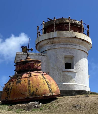
Saint Lucia is an island nation located south of Martinique and north of St. Vincent in the Windward Islands of the West Indies. The mountainous island is about 40 km (25 mi) long and up to 20 km (13 mi) wide. First colonized by France in the 1660s, it was considered a valuable colonial prize and was captured repeatedly by Britain in its various wars with France over the next 150 years. Britain finally took control for good during the Napoleonic Wars and it was confirmed as a British colony in 1814. Saint Lucia became independent in 1979 and has remained a Commonwealth Realm recognizing the British monarch as head of state. The capital of the country is Castries on the northwest coast of the island and the population is about 185,000.
Saint Lucia has become a very popular tourist destination with many resorts, although it may not be quite as well known as its neighbors Martinique and Barbados.
English is the official language of Saint Lucia but as a result of its long French connection a French-based Creole language is commonly spoken and most of the place names are French.
Aids to navigation in Saint Lucia are owned and operated by the St. Lucia Air and Sea Ports Authority (SLASPA). For many years SLASPA allowed the island's two historic lighthouses to deteriorate. In recent years the Authority formed a partnership with the Saint Lucia Archaeological and Historical Society and the Saint Lucia National Trust to maintain the Vigie lighthouse, but the Moule à Chique lighthouse has continued to be ignored.
ARLHS numbers are from the ARLHS World List of Lights. Admiralty numbers are from volume J of the Admiralty List of Lights & Fog Signals. U.S. NGA numbers are from Publication 110.
- General Sources
- Online List of Lights - Saint Lucia
- Photos by various photographers posted by Alexander Trabas. Currently the St. Lucia photos are by Arno Siering and Rainer Arndt.
- SLASPA - Light Houses
- A page on the two historic lighthouses posted by SLASPA.
- World of Lighthouses - Saint Lucia
- Photos by various photographers available from Lightphotos.net.
- Saint Lucia Lighthouses
- Aerial photos posted by Marinas.com.
- Lighthouses in Saint Lucia
- Photos by various photographers available from Wikimedia.
- Leuchttürme Mittelamerikas und der Karibik auf historischen Postkarten
- Historic postcard images posted by Klaus Huelse.
- GPSNauticalCharts
- Navigational chart information for Saint Lucia.

