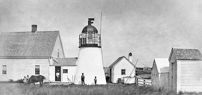
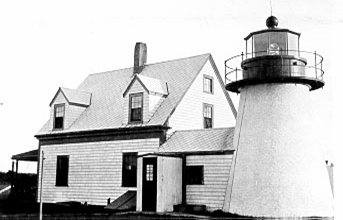
Lighthouses of the United States: Cape Cod, Massachusetts

The United States of America is a federal union of 50 states and a capital district. The state of Massachusetts, officially the Commonwealth of Massachusetts, is the most populous of the New England states in the northeast of the country. Its capital city of Boston, founded in 1630, is the leading port of the region.

A small state with a long coastline and many harbors, Massachusetts has a large number of lighthouses. This page lists the lighthouses of Cape Cod. More than a cape, Cape Cod is a hook-shaped peninsula, actually a large barrier spit 105 km (65 mi) long and averaging 10-20 km (6-13 mi) wide. It extends east and then (at a 90° angle) north, appearing on maps like an arm bent at the elbow and ending with a clenched fist. The peninsula encloses Cape Cod Bay; the open Atlantic Ocean is to the east; and to the south Nantucket Sound separates the Cape from the islands of Nantucket and Martha's Vineyard. The beaches and shoals of Cape Cod have been grave hazards to navigation ever since the European discovery of this coast. The lights that warn of these dangers include some of the best known and best loved U.S. lighthouses.

Massachusetts is divided into fourteen counties. Most of the county governments have been abolished or greatly reduced in function but Barnstaple County, which includes all of Cape Cod, continues to have a functioning government. . The county is subdivided into fifteen towns for local government.

Jeremy D'Entremont's book, The Lighthouses of Massachusetts (Beverly, Mass.: Commonwealth Editions, 2007) is an indispensible resource for information on these lighthouses.

Navigational aids in Massachusetts are operated by the U.S. Coast Guard Sector Southeastern New England based in Woods Hole on Cape Cod, but ownership (and sometimes operation) of historic lighthouses has been transferred to local authorities and preservation organizations in many cases.

ARLHS numbers are from the ARLHS World List of Lights. Admiralty numbers are from volume J of the Admiralty List of Lights & Fog Signals. USCG numbers are from Vol. I of the USCG Light List.

General Sources
New England Lighthouses: A Virtual Guide - Massachusetts
Data and photos for all of the lighthouses; an outstanding resource created by Jeremy D'Entremont.
Lighthouses of Massachusetts
Photos, travel directions, and historical accounts from Kraig Anderson's Lighthouse Friends site.
Online List of Lights - Massachusetts
Photos by various photographers posted by Alexander Trabas.
Lighthouses in Massachusetts
Photos by various photographers available from Wikimedia.
Massachusetts Lights
From Bill Britten's Lighthouse Getaway site: fine photos of many of the state's better-known lighthouses.
Lighthouses of Massachusetts
Photos and accounts by Gary Richardson and Anna Klein; part of their Cyberlights site.
Lighthouses in Massachusetts, United States
Aerial photos posted by Marinas.com.
Leuchttürme USA auf historischen Postkarten
Historic postcard images of U.S. lighthouses posted by Klaus Huelse.
U.S. Coast Guard Navigation Center: Light Lists
The USCG Light List can be downloaded in pdf format.
GPSNautocal Charts
Navigation chart for Massachusetts.
Google Maps
Satellite view of Cape Cod.


Highland Light, Truro, May 2024
Instagram photo by malformica
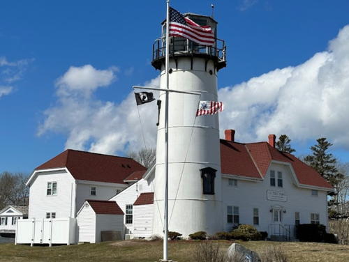

Chatham Light, Chatham, March 2023
Google Maps photo by Jason Grant

Cape Cod Bayside Lighthouses

Bourne Bayside Lighthouses
* Cape Cod Canal Breakwater
Date unknown. Active; focal plane 43 ft (13 m); red flash every 5 s. 43 ft (13 m) round dumbbell-shaped red fiberglass tower. Radio-activated fog horn (blast every 15 s). Trabas has a 2009 photo, a 2020 photo is available, Isaiah Suchman has a 2019 street view along the breakwater, and Google has a 2015 sea view and a satellite view. The Cape Cod Canal, completed in 1916, is a 7 mile (11.3 km) long sea-level cut across the neck of Cape Cod, connecting Cape Cod Bay to the northeast and Buzzards Bay to the southwest. Located at the end of the north breakwater at the eastern entrance to the canal. Accessible by walking the pier. Site open, tower closed. ARLHS USA-1436; Admiralty J0372; USCG 1-13050.
Cape Cod Canal Entrance Range Rear
Date unknown. Active; focal plane 56 ft (17 m); continuous green light. 52 ft (16 m) square skeletal tower with a small metal equipment shelter in the base. The tower carries a rectangular daymark painted red with a white vertical stripe. Trabas has a 2009 photo and Google has a 2022 street view and a satellite view. The front light is on a shorter, triangular skeletal tower. The light stands on the grounds of the Canal Generating Plant, an oil and natural gas-powered electric generating station. Located on the south side of the canal about 1 mile (1.6 km) southeast of the entrance. Site and tower closed, but the light can be seen from nearby. Site manager: Ironclad Energy Partners. Admiralty J0374.1; USCG 1-13085.

Barnstaple Lighthouse
Sandy Neck (2)
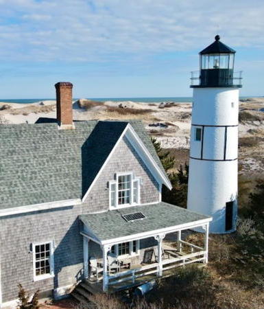
1857 (station established 1826). Reactivated (inactive 1931-2007, now privately maintained); focal plane 49 ft (15 m); white flash every 6 s. 52 ft (16 m) round brick tower with lantern and gallery, strengthened (in 1887) with cast iron bands. Tower painted white, gallery black. The 1-1/2 story wood keeper's house (1880) is a private residence. Gregg Squeglia's 2021 photo is at right, Anderson's page has photos, James Govoni has a 2022 photo, Stefaan Lambrecht has a 2012 photo, Trabas has a 2009 photo, Steve Arena has the view from the bay, Lighthouse Digest has Bram Eisenthal's September 2003 article on the light station, and Google has a satellite view. The lighthouse was replaced in 1931 by a light on a skeletal tower. In 1933 the lantern was removed and the lighthouse was sold. The Coast Guard leased the station in 1942-44 to house a beach patrol unit. In 1950 the Hinckley family acquired the lighthouse and members of that family have continued to occupy and manage it. The light on the skeletal tower was discontinued in 1952. In 2003 the Sandy Neck Lighthouse Restoration Committee was organized to raise funds to build and install a replica of the original lantern. The project was carried out in 2007 and on October 20 the lighthouse was relit for the first time in 76 years. The oil house (1905) was restored in 2008 and in 2010 the light was upgraded with a modern LED lens. Located on the Sandy Neck Dunes on the north side of the entrance to Barnstaple Harbor from Cape Cod Bay. Best seen by boat: it's a difficult 6-mile (10 km) hike on the beach to reach the site. Site and tower closed. Owner/site manager: private. . ARLHS USA-732; Admiralty J0375.5; USCG 1-13117.

Sandy Neck Light, Barnstable, April 2021
Google Maps drone view by Gregg Squeglia

Wellfleet Light Station
* [Mayo's Beach (2)]
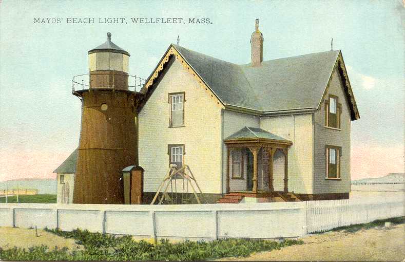
1881 (station established 1838). Inactive since 1922. In late 2007 astonished researchers discovered that the 35 ft (11 m) cast iron light tower of Mayo's Beach, long thought to have been demolished, was actually dismantled and shipped to California. In 1928 it was installed at Point Montara, near San Francisco, and it stands there today. The 2-story wood keepers' house (1881) and brick oil house (1907) remain in excellent condition at their original locations. Anderson's page has recent photos, Huelse has a historic postcard view, and Google has a street view and a satellite view. The house is a private residence. Located next to a beach parking area at 115 Kendrick Avenue in Wellfleet. Site closed but the house is easily seen from the street or parking area. Owner/site manager: private. ARLHS USA-486.

Provincetown Lighthouses
Provincetown is a very popular resort town at the end of the Cape Cod Peninsula. The town's permanent population is about 3700 but the population may increase to 50,000 or more during the summer.

Long Point (2)
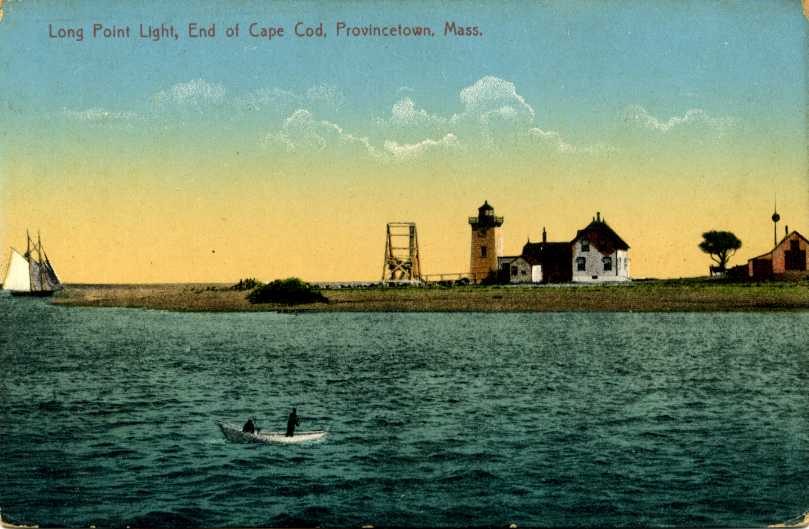
1875 (station established 1826). Active; focal plane 36 ft (11 m); green light occulting every 4 s. 38 ft (11.5 m) square pyramidal brick tower with lantern and gallery; solar-powered 300 mm lens. Tower painted white, lantern black. Radio-activated fog horn (blast every 15 s). Sibling of Wood End. The keeper's house and fog signal building have been demolished but the oil house (1904) survives. A 2024 photo is at right, Anderson has a page with good photos, Trabas has Michael Boucher's 2008 photo, Marinas.com has aerial photos, Huelse has a historic postcard view, Jacob Sconyers has a beach view, and Google has a satellite view. In 1998 the American Lighthouse Foundation secured a license from the Coast Guard for restoration and maintenance of the light. In December 2009 preservationists proposed to rebuild the keeper's house as a bed and breakfast similar to the operation at Race Point (see below). So far there's been no progress on this idea. In 2012 ALF volunteers painted all three Provincetown lighthouses. Located in the Cape Cod National Seashore near the end of the sand spit protecting Provincetown Harbor. Accessible by boat or by a hike of 2-1/2 miles (4 km); Flyer's Boat Yard operates a boat shuttle from Provincetown's West End from mid June through early September (group trips can be arranged in the off season). Site open, tower closed. Owner: U.S. Coast Guard. Site manager: American Lighthouse Foundation (Cape Cod Chapter). . ARLHS USA-450; Admiralty J0382; USCG 1-13275.

Long Point Light, Provincetown,May 2024
Google Maps photo by H
* Wood End
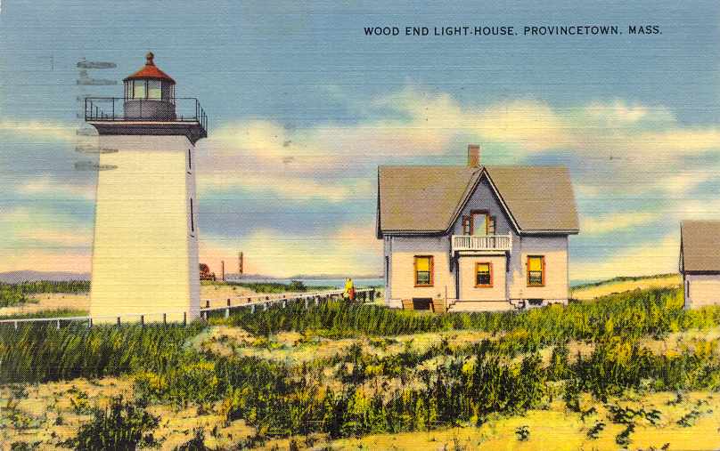
1872. Active; focal plane 45 ft (13.5 m); red flash every 10 s. 39 ft (12 m) square pyramidal brick tower with lantern and gallery, solar-powered VRB-25 aerobeacon. Tower painted white, lantern black. Radio-activated fog horn (blast every 30 s). The keeper's house and other light station buildings were demolished in 1961; the oil house (1896) survives. Maksim Mercuri has a 2023 photo, Anderson has a page with excellent photos, Trabas has a 2009 photo, Kyle Walton has a good 2007 photo, Marinas.com has aerial photos, Huelse has a historic postcard view, Patrick O'Leary has a beach view, and Google has a satellite view. The American Lighthouse Foundation is responsible for restoration and maintenance of the light. In 2000 ALF volunteers painted the tower and oil house, and in 2012 they painted all three Provincetown lighthouses. Located in the Cape Cod National Seashore on the southwestern face of Long Point. Accessible by a hike of about 1-1/4 miles (2 km). Site open, tower closed. Owner: U.S. Coast Guard. Site manager: American Lighthouse Foundation (Cape Cod Chapter). . ARLHS USA-904; Admiralty J0383; USCG 1-13270.
** Race Point (2)
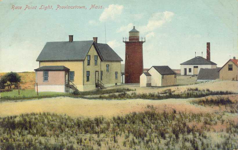
1876 (station established 1816). Active; focal plane 67 ft (20 m); white flash every 10 s. 45 ft (13.5 m) round cast iron tower (brick lined) with lantern and gallery; solar-powered VRB-25 aerobeacon. Tower painted white, lantern black. Fog horn (2 blasts every 60 s). The original 1-1/2 story wood keeper's house, restored by the Cape Cod Chapter of the American Lighthouse Foundation in 1995, is available for overnight rental, and in 2007 the 1-story brick whistle house (1870s) was also opened for overnight rental. The original brick fog signal building was restored in 1999 as a field station of the Center for Coastal Studies. Harvey Hensley's 2023 photo is at right, Anderson has a fine page with several photos, Trabas has Michael Boucher's 2007 photo, Steve Arena has a fine 2019 photo, Huelse has a historic postcard view, Scott Hummel has a 2020 street view, and Google has a satellite view. This tower replaced an 1816 tower similar to the Scituate Light (see Northern Massachusetts). The gallery railing was replaced in 2001 and restoration of the tower was completed in 2002. In 2006-07 the station's whistle house was renovated to provide an additional accommodation and a wind turbine was installed to provide additional power. A movie, The Lightkeepers, was filmed at this lighthouse in 2009. In 2012 ALF volunteers painted all three Provincetown lighthouses. Accessible by a hike of about 1.5 miles (2.5 km) from Race Point Beach. Located in the Cape Cod National Seashore on the extreme tip of Cape Cod, west of Provincetown. Accessible by hiking or by 4WD (permit required). Site open, tower open for guided tours on Sundays, July through October. Owner: U.S. Coast Guard (leased to the American Lighthouse Foundation). Site manager: Race Point Light Station . ARLHS USA-680; Admiralty J0386; USCG 1-0485.


Race Point Light, Provincetown, August 2023
Google Maps photo by Harvey Hensley

Cape Cod Oceanside Lighthouses

Truro Lighthouse
**** Highland (Cape Cod) (3)
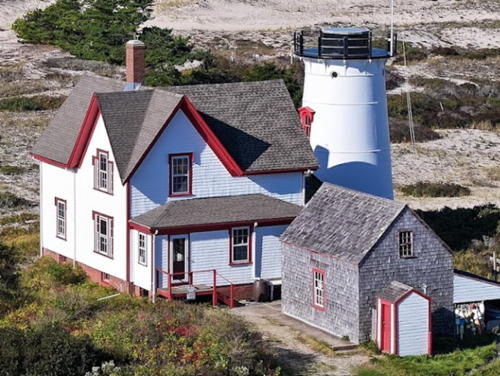
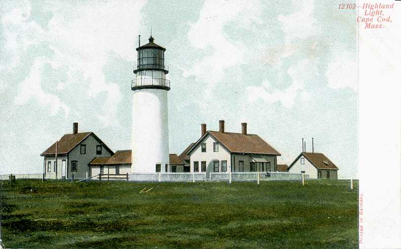
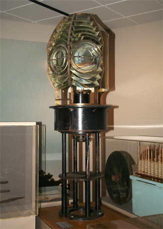
1857 (station established 1797). Active; focal plane 183 ft (56 m); white flash every 5 s, day and night. 66 ft (20 m) round brick tower with lantern and gallery; LED beacon. Tower painted white, lantern black. The 1st order Fresnel lens was largely destroyed in 1998 during a botched attempt to remove it; some pieces of it are on display at the museum on site. The original 1-1/2 story Queen Anne wood keeper's house includes the museum and gift shop. A 2024 photo is at the top of this page, Anderson has a good page for the lighthouse with many photos, Trabas has a 2009 photo, a 2023 photo is available, , Marinas.com has aerial photos, Huelse has a historic postcard view, and Google has a street view and good satellite view as well as Lenny Kagan's street view taken inside the lantern. This historic and famous lighthouse is almost always called Highland Light although officially it was renamed Cape Cod Light in 1976. The light station was relocated 450 feet (137 m) west in 1996 to escape erosion of the bluff. In 2001 Campbell Construction repainted the lighthouse, renovated iron work, and restored the interior of the lantern. At the end of 2013 the Park Service allowed its 20-year management agreement with the preservation group Highland Museum and Lighthouse to expire without renewal; the lighthouse is now managed by Eastern National, a National Park Service concession operator. In January 2015 the Park Service announced that the tower was in need of major restoration to repair moisture damage to the masonry. Emergency repairs were scheduled allowing the tower to open for the 2015 season. A $1.2 million rehabilitation project began in late summer or early fall 2019 and the lighthouse was closed during 2020. The LED beacon was installed in 2017, replacing a Vega rotating beacon. The Truro Historical Society operates the Highland House Museum June 1 through September 30 in a historic hotel adjoining the lighthouse. Located in the Highlands area of Cape Cod National Seashore atop a high cliff at the end of Highland Road, off US 6 in North Truro. Site open, museum open daily except Tuesdays and Wednesdays mid April through early May and then every day May through mid October; tower open daily May through late October. Owner: U.S. National Park Service (Cape Cod National Seashore). Site manager: Highland Lighthouse . ARLHS USA-110; Admiralty J0390; USCG 1-0500.

Eastham Lighthouses
** Nauset (2) (Three Sisters)
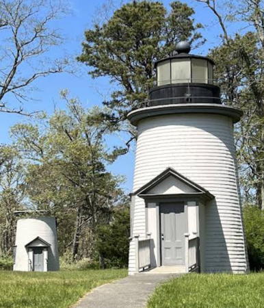
1892 (station established 1838). Northern and southern towers inactive since 1911; center tower inactive since 1923. Triple 29 ft (9 m) round conical wood towers; only the northern tower retains its lantern and gallery. The 4th order Fresnel lens from the center tower (1873, transferred from an older tower) was transferred to Nauset Light in 1923 and is now on display at the national seashore's Salt Pond Visitor Center in Eastham. Lighthouses painted white, lanterns black. A 2022 photo is at right, Roxie Zwicker has a closeup 2007 photo of the north lighthouse, a closeup of one of the others is available, Anderson's page has photos of all three, and Google has a satellite view. Only a few triple-tower light stations were built in the U.S. and this is the only surviving example. The towers were privately owned for many years; the National Park Service purchased two of them in 1965 and the third in 1975. In 1989 the park service renovated the three towers and placed them in their original configuration about 1800 ft (550 m) west of the Nauset Light. Lighthouse Digest has Don Sparrow's January 2002 feature story on the light station and a historic photo of the three towers in service. Located near the Nauset Light Beach parking area in Eastham. Site open; towers open to guided tours in season. Owner: U.S. National Park Service. Site manager: Cape Cod National Seashore. ARLHS USA-975 (north), 528 (middle), and 976 (south).
*** Nauset (3) (Nauset Beach)
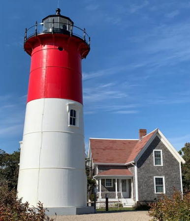
1877 (originally Chatham Light North Tower, relocated to Nauset in 1923). Active (privately maintained since 1997); focal plane 102 ft (31 m); flash every 5 s, alternating red and white, day and night. 47 ft (14 m) round cast iron tower (brick lined) with lantern and gallery; DCB-224 aerobeacon (1981). Tower painted white with a broad red band at the top; lantern and gallery painted black. The original 4th order Fresnel lens is on display at the national seashore's Salt Pond Visitor Center in Eastham. The 1-1/2 story wood keeper's house (1875) is a private residence. Brick oil house (1892). A 2022 photo is at right, Anderson has a good page for the light station, Trabas has a 2009 photo, Dirk Varelmann has a 2021 closeup, and Google has a street view and a good satellite view. This lighthouse is a familiar symbol of Cape Cod. International Chimney Corporation relocated the lighthouse 300 ft (90 m) west in 1996 to escape erosion of the bluff; the keeper's house was relocated similarly in 1998. In 2005 the exterior of the lighthouse was refurbished and restored. In 2013 the lighthouse was repainted thanks to a grant from Snyder's-Lance, the owner of Cape Cod Potato Chips (which has the lighthouse as a logo). In 2021 ICC Commonwealth (the successor to International Chimney) removed rust and repainted the lighthouse. Probably endangered: the lighthouse is less than 100 m (330 ft) from the bluff and may need to be moved again soon. In 2024 the 1875 keeper's house (built for the original Three Sisters Lights) was transferred tp Park Service ownership and opened for weekly vacation rentals. Located in Cape Cod National Seashore at Nauset Beach off US 6 in Eastham. Site open; tower open generally in the late afternoon and early evening on Sundays and Wednesdays July through September and on Sundays in May and October. Owner: U.S. National Park Service (Cape Cod National Seashore). Site manager: Nauset Light Preservation Society . ARLHS USA-529; Admiralty J0392; USCG 1-0510.1.
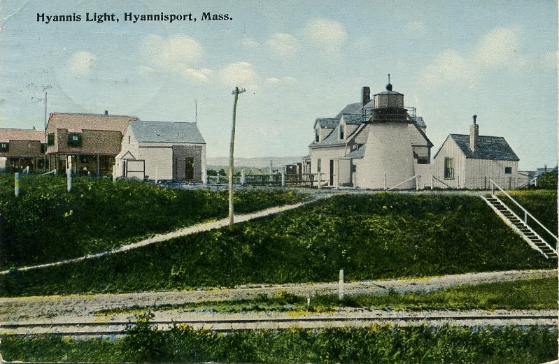

Center (right) and North Three Sisiters Lights, Eastham, Auguts 2022
Google Maps photo by JOdile Eloy-Tran Van Chuoï


Nauset Light, Eastham, October 2022
Google Maps photo by John X.


Chatham Oceanside Lighthouses
** Chatham (3)
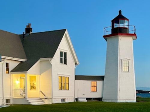
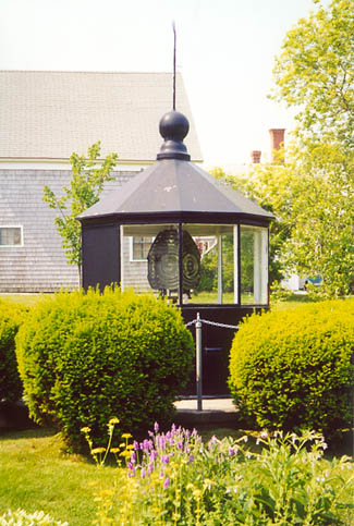
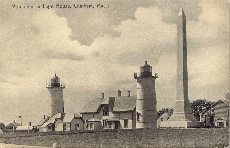
1877 (station established 1808). Active; focal plane 80 ft (24 m); 2 white flashes every 10 s, day and night. 48 ft (14.5 m) round cast iron tower (brick lined) with lantern and gallery. The lantern is modern, installed in 1969. Tower painted white with black trim; lantern is gray. A steel post near the tower carries a light (yellow flash every 2.5 s, USCG 1-13305) that operates only when breaking seas make entering the harbor dangerous. The original 1-1/2 story wood keeper's house remains in use as Coast Guard housing. The original lantern and 4th order Fresnel lens are on display adjacent to the Atwood House Museum in Chatham; the lens is lit whenever the museum is open. Jaspn Grant's 2023 photo appears at the top of this page, Anderson has a good page with many photos, Linda Cichocky has a 2021 photo, Trabas has a 2009 photo, Marinas.com has aerial photos, and Google has a street view and a satellite view. Originally the station had twin towers but the north tower was moved to Nauset Beach in 1923 (see previous entry). Huelse has a historic postcard view of the twin-tower station. In July 2026 the rotating DCB-224 aerobeacon (1993) was replaced with a rotating LED lens. Located at the Coast Guard Base Cape Cod just off Main Street in downtown Chatham. Site open; museum open Tuesday through Saturday afternoons, Memorial Day weekend (late May) through mid October and on Fridays and Saturdays in late October and in December; grounds open for tours led by the Coast Guard Auxiliary Flotilla 11-1 generally on Wednesday afternoons during the summer. The tower is normally open during the tours but it is sometimes closed for maintenance. Owner/site manager: U.S. Coast Guard. . ARLHS USA-158; Admiralty J0394; USCG 1-0525.
Monomoy Point (2)
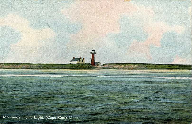
1849 (station established 1823). Inactive since 1923; charted as a landmark. 47 ft (14 m) round cylindrical cast iron tower with lantern and gallery, painted red; lantern and gallery painted black. The original 2-story wood keeper's house is used as a guest house. Brick oil house (1894) and generator building. A 2023 photo by Bob McGovern is at right, Anderson's page has photos and a report from a recent visit, Jan Crocker has a 2018 photo, Stephen Furlong has a 2019 closeup, Lighthouse Digest has D'Entremont's December 2006 article on the history of the station, Huelse has a historic postcard view, and Google has a satellite view. This early cast iron tower has a unique design. The Massachusetts Audubon Society purchased the station from private owners in 1964 and sold it to the federal government in 1977. The light station was restored twice through efforts of the Audubon Society (1960s) and Lighthouse Preservation Society (1988). The Friends of Monomoy National Wildlife Refuge support continued preservation of the lighthouse. The beach has built up in the area so that the lighthouse, built at the dune line, is now 1/2 mile (800 m) from the ocean. In October 2009 $1.5 million in federal recovery act funding was allocated to restoration of the lighthouse; this was enough to restore the lighthouse and the exterior of the keeper's house and add solar and wind generators to provide power for the buildings. The restoration was carried out by Campbell Construction in 2010-11. Interior restoration of the keeper's house continued and was completed in 2016. Supplies for the restoration were brought to the island by Coast Guard helicopters. Located near the south end of South Monomoy Island (the island was cut in two by the Blizzard of 1978). Accessible only by boat; the Friends of Monomoy organization offers tours in season. Site open, tower closed. Owner/site manager: U.S. Fish and Wildlife Service (Monomoy National Wildlife Refuge). . ARLHS USA-510.

Monomoy Point Light, Chatham, July 2023
Google Maps photo by Bob McGovern

Cape Cod Southside Lighthouses

Chatham Southside Lighthouses
* [Stage Harbor (Hardings Beach) (3?)]
Date unknown. Active; focal plane 28 ft (8.5 m); white flash every 6 s. 6 m (20 ft) square skeletal tower. Patrick O'Leary has a 2017 street view, Rachel Doddridge-Spring's 2022 Instagram photo shows the light in the distance, Trabas has a distant 2009 photo, and Google has a satellite view. Located on the beach in front of the historic lighthouse (next entry). Site open, tower closed. Admiralty J0422; USCG 1-13860.
* Stage Harbor (Hardings Beach) (1)
1880. Inactive since 1933; charted as a landmark. 36 ft (11 m) round cast iron tower with gallery, lantern removed, attached to a 1-1/2 story wood keeper's house. Buildings painted white with red trim; lighthouse gallery painted black. Barry Mullin's 2023 drone view is at right, Russell Hubbard has a 2024 photo, Melanie McCue has a 2009 photo, Anderson's page has closeup photos, David Walsh has a 2019 closeup, Marinas.com has aerial photos, Patrick O'Leary has a beach view, and Google has a satellite view. The building is a private summer residence owned since 1936 by members of the Hoyt family. The lighthouse was repainted in September 2019.Located on the west side of the Stage Harbor entrance in Chatham. Accessible by 1 mile (1.6 km) hike on the beach from the end of Harding's Beach Road; there is a distant view across the harbor from the town landing at the end of Sears Road. Site and tower closed. Owner/site manager: private. . ARLHS USA-806.

Dennis Lighthouse
** West Dennis (Bass River, Lighthouse Inn)
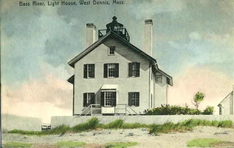
1855. Reactivated (inactive 1880-1881 and 1914-1989, now privately maintained; shown May through October); focal plane 44 ft (13.5 m); white flash every 6 s. Lantern mounted on the roof of what was once a 2-1/2 story wood keeper's house. 300 mm lens. Building painted white with green trim, lantern red. Bill Girolamo has a closeup 2025 photo, Anderson has a good page with several photos, Trabas has a closeup 2009 photo, and Google has a street view and a satellite view. This light station was operated as an inn by the Stone family from 1938. to 2026. The building has been expanded several times and is now much larger than the original lighthouse as seen in Huelse's historic postcard view. The light was relit on 7 August 1989, the 200th anniversary of the U.S. Lighthouse Service. In 2002 the lantern room was restored by Campbell Construction. In 2026 the Stone family sold the inn for $16.5 million. Located just off Lighthouse Road in West Dennis. Site open; inn and restaurant open Memorial Day (late May) through Columbus Day (mid October); tower closed. Owner/site manager: The Lighthouse Inn . ARLHS USA-042; Admiralty J0425.7; USCG 1-14175.

Stage Harbor Light, Chatham, October 2023
Flickr Creative Commons photo by Barry Mullin

Hyannis Lighthouses
Bishop and Clerks (3)
1998(?) (station established 1858). Active; focal plane 45 ft (14 m); white flash every 6 s. 30 ft (9 m) round cylindrical metal tower, painted white with a red band (very similar to the "D9" towers so common on the Great Lakes). Anderson has a photo of the current light on his page for the lighthouse, Trabas has Micheal Boucher's closeup 2016 photo, and Bing has a satellite view. This modern beacon stands on the foundation of the historic 1858 lighthouse, a 65 ft (20 m) classic wave-swept masonry tower seen in Huelse's historic postcard view. The lighthouse became dilapidated and began to lean dangerously, so the Coast Guard demolished it in 1952. An unlighted daybeacon stood on the foundation until the present light was installed. Located on a dangerous group of rocks about 2.5 miles (4 km) south southeast of Point Gammon. Accessible only by boat. Site and tower closed. Owner/site manager: U.S. Coast Guard. ARLHS USA-058; Admiralty J0426.68; USCG 1-14490.
Point Gammon
1816. Inactive since 1858; charted as a landmark. 20 ft (6 m) round conical fieldstone tower topped by a wood observation room. The keeper's house was dismantled in 1935. Emily Wasserbauer has the 2022 photo seen at right, Anderson has a good page with several photos, a 2018 photo is available, Marinas.com has aerial photos, and Google has a satellite view. The original iron lantern was removed after the light was deactivated. A round observation room with a conical roof was added by ornithologist Charles Cory, who bought the entire "island" on which the lighthouse stands in 1882. However, the current observation room was built much more recently (1970s?). Located on Great Island (actually a peninsula) at the eastern entrance to Hyannis Harbor. Site and tower closed (private property, no public access). Visible (distantly) from Keyes Beach in Hyannis and from the Hyannis-Nantucket ferries, and Google has a very distant street view from Keyes Beach. Owner/site manager: private. ARLHS USA-622.
Lewis Bay (Channel Point)
Date unknown. Active (privately maintained and unofficial); focal plane 26 ft (8 m); flashing green light. 26 ft (8 m) round tower with lantern and gallery, attached to a small workshed. Tower painted white; lantern and gallery painted black. Andrew Bell has a 2026 photo, Lightphotos.net has Charlie Kellogg's photo, a 2025 photo is available, Adrian Hobson has a 2025 closeup, Marinas.com has aerial photos (misidentified as Hyannis Harbor Light), and Google has a 2024 street view and a satellite view. The lighthouse is a close replica of the Brant Point (8) Light on Nantucket (see below). In 2023 the property was for sale for $3.995 million. Located on private property at the end of Channel Point Road on the inner harbor of Hyannis, opposite the Nantucket ferry terminal. Site and tower closed (private property) but there's a view from the Hyannis Harbour Park at the end of Pleasant Street. Owner/site manager: private.

Point Gammon Light, Hyannis, April 2022
Google Maps photo by Emily Wasserbauer
Hyannis Harbor (Range Rear)
1849. Inactive since 1929. 19 ft (6 m) round old-style brick tower attached to 1-1/2 story wood keeper's house. The lantern, removed in 1929, has been replaced by an octagonal sunroom (1989). Tower painted white with three narrow red bands under the sunroom; the roof is black. Brick oil house (1902). Anderson's page also has closeup photos, Wanda Acosta has a 2020 closeup, Lighthouse Digest featured the lighthouse in January 2002, and Google has a street view and a satellite view. The Coast Guard has a historic photo showing the original "birdcage" lantern; a second Coast Guard photo and Huelse's historic postcard view show the later form of the light station. The lighthouse was the rear light of a range beginning in 1885. The keeper's house, expanded at least twice, is a private residence owned by two antiques dealers. The red bands were added when the tower was repainted in 2012. Located at the end of Harbor Road on Hyannis Harbor. Site and tower closed (private property); there are views from the street and from Keyes Beach nearby. Owner/site manager: Hyland Granby Antiques. ARLHS USA-397.

Falmouth Lighthouses
** Nobska Point (Woods Hole) (2)
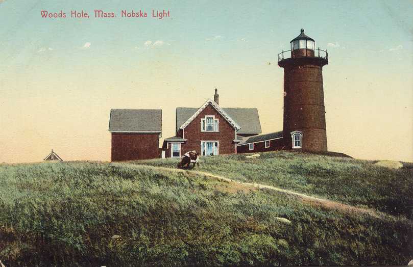
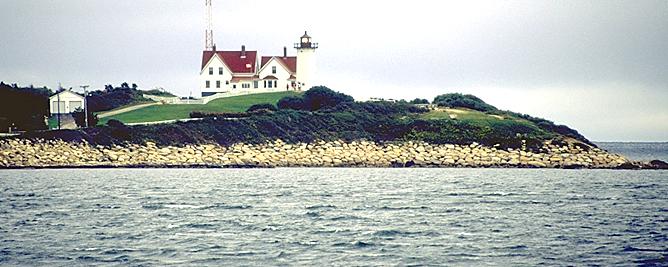
1876 (station established 1828). Active; focal plane 87 ft (26.5 m); white flash every 6 s, day and night; red sector covers dangerous shoals. 40 ft (12 m) "Race Point" round cylindrical cast iron tower (brick lined) with lantern and gallery, attached to 1-1/2 story wood keeper's house. The buildings are floodlit at night. Fog horn (2 blasts every 30 s). 4th order Fresnel lens (1888) in use. Buildings painted white, roofs red, lantern black. Oil house and utility buildings also preserved. John Toomey's 2022 photo is at right, Anderson has an excellent page for the lighthouse with good photos, Trabas has a 2009 photo, Lynda Morales has a 2021 photo, Jessica Langlois has a good 2009 photo, Marinas.com has aerial photos, Huelse has a historic postcard view, and Google has a street view and a satellite view. The keeper's house was for many years the residence of the commander of Coast Guard Sector Southeastern New England. In November 2013, however, the Coast Guard announced that the house needed $550,000 in repairs. It offered to lease or sell the building to any organization that would restore it. In December 2014 a new nonprofit organization, the Friends of Nobska Light, formed to work for preservation of the lighthouse. In March 2016 the Town of Falmouth accepted a management license from the Coast Guard and in April management was transferred to the town. The Friends planned to restore the lighthouse and open it to the public with a museum in the keeper's house. A drive began to raise $4 million for the restoration. Exterior restoration of the tower began in September 2017. In March 2021 the contractor DellbrookJKS completed its work restoring the interior. In 2023 the lighthouse became available for transfer under the National Historic Lighthouse Preservation Act (NHLPA) and in May 2025 the Friends group was selected to be the new owner. The deed was transferred in July.. Located on Nobska Road, at the eastern entrance to Woods Hole Harbor. Visible from the Woods Hole-Martha's Vineyard ferries. Site open daily, tower open for tours on Tuesday, Wednesday, and Thursday early June through early October (ticket purchase required). Owner/site manager: Friends of Nobska Light . ARLHS USA-550; Admiralty J0456; USCG 1-15560.

Nobska Point Light, Falmouth, October 2022
Google Maps photo by John Toomey
Cleveland Ledge
1943. Active; focal plane 74 ft (22.5 m); white flash every 10 s, day and night. 70 ft (21 m) round cylindrical reinforced concrete tower with lantern and gallery, atop a 2-story octagonal reinforced concrete keeper's quarters, all mounted on a concrete caisson. 190 mm lens (1978). Fog horn (blast every 15 s) on demand. Building painted white, lantern black, caisson red. Anderson's page has excellent closeup photos, Trabas has Michael Boucher's closeup 2016 photo, James Johnson has a 2019 photo, CapeCod.com has an article on the history of the station, and Google has a satellite view. This Art Moderne building is one of the last more-or-less traditional lighthouses built in the U.S. It was renovated by the Coast Guard in 1990. In 2007 the lighthouse became available for transfer under NHLPA. No suitable recipients came forward and in December 2010 the lighthouse was sold at auction for $190,000 to Sandy D. Boyd of Emeryville, California, the owner of a chain of coffeehouses. Boyd is researching the history of the station and plans to restore the lighthouse as a vacation residence. Located on a reef on the east side of the main Buzzard's Bay channel, off West Falmouth. Accessible only by boat. Site and tower closed. Owner/site manager: private. . ARLHS USA-179; Admiralty J0502; USCG 1-16080.

Bourne Southside Lighthouse
Wings Neck (2)
1889 (station established 1848). Inactive since 1945; charted as a landmark. 32 ft (10 m) hexagonal wood tower with lantern and gallery, attached to a 1-1/2 story wood keeper's house. Lighthouse painted white, lantern black with red trim. The assistant keeper's house (1888) was relocated from Ned's Point Light (see below) in 1923. A 2021 photo by Amanda Hays is at right, Anderson's page also has good photos, HaoCheng Tsai has a closeup drone view, Jack Sullivan has a 2021 closeup photo, and Google has a satellite view. After many years as a private residence the house was renovated in 2003 for weekly vacation rental. The tower was repaired and repainted in 2014. Currently the house can be booked through Airbnb.com. The owner also made the light station available for weddings and other special events. This led to protests from neighbors and in September 2016 the local zoning board ruled that these uses are not allowed. The owner sued but in late 2018 a court upheld the zoning ruling and the state appeals court agreed in June 2020. Located on Wing's Neck in Pocasset, on the east side of the southern approach to the Cape Cod Canal. Site open to guests but otherwise closed; tower closed. There is a distant view from the edge of the property at the end of Wings Neck Road. Owner/site manager: Wings Neck Lighthouse . ARLHS USA-899.

Wings Neck Light, Pocasset, November 2021
Google Maps photo by Amanda Hays

Information available on lost lighthouses:

Notable faux lighthouses:

Adjoining pages: North: Northern Massachusetts | South: Southern Massachusetts

Return to the Lighthouse Directory index | Ratings key

Original Massachusetts page posted December 2002. Checked and revised August 3, 2026. Lighthouses: 22. Site copyright 2026 Russ Rowlett and the University of North Carolina at Chapel Hill.