Lighthouses of the United States: Southern Massachusetts

The United States of America is a federal union of 50 states and a capital district. The state of Massachusetts, officially the Commonwealth of Massachusetts, is the most populous of the New England states in the northeast of the country. Its capital city of Boston, founded in 1630, is the leading port of the region.

A small state with a long coastline and many harbors, Massachusetts has a large number of lighthouses. This page lists the lighthouses of the southern part of the state, including the islands of Nantucket and Martha's Vineyard and the mainland coast in the New Bedford area. The former whaling center of New Bedford is the only important port in this region. However, the beaches and shoals of the islands have been grave hazards to navigation ever since the European discovery of this coast. The lights that warn of these dangers include some of the best known and best loved U.S. lighthouses.

Massachusetts is divided into fourteen counties, although most of the county governments have been abolished or greatly reduced in function. The counties are subdivided into towns and cities for local government.

Jeremy D'Entremont's book, The Lighthouses of Massachusetts (Beverly, Mass.: Commonwealth Editions, 2007) is an indispensible resource for information on these lighthouses.

Navigational aids in Massachusetts are operated by the U.S. Coast Guard Sector Southeastern New England in Woods Hole on Cape Cod, but ownership (and sometimes operation) of historic lighthouses has been transferred to local authorities and preservation organizations in many cases.

ARLHS numbers are from the ARLHS World List of Lights. Admiralty numbers are from volume J of the Admiralty List of Lights & Fog Signals. USCG numbers are from Vol. I of the USCG Light List.

General Sources
New England Lighthouses: A Virtual Guide - Massachusetts
Data and photos for all of the lighthouses; an outstanding resource created by Jeremy D'Entremont.
Lighthouses of Massachusetts
Photos, travel directions, and historical accounts from Kraig Anderson's Lighthouse Friends site.
Online List of Lights - Massachusetts
Photos by various photographers posted by Alexander Trabas.
Illuminating Lighthouses
The history of the lighthouses of Martha's Vineyard, from Martha's Vineyard magazine.
Lighthouses in Massachusetts
Photos by various photographers available from Wikimedia.
Massachusetts Lights
From Bill Britten's Lighthouse Getaway site: fine photos of many of the state's better-known lighthouses.
Lighthouses of Massachusetts
Photos and accounts by Gary Richardson and Anna Klein; part of their Cyberlights site.
Lighthouses in Massachusetts, United States
Aerial photos posted by Marinas.com.
Leuchttürme USA auf historischen Postkarten
Historic postcard images of U.S. lighthouses posted by Klaus Huelse.
U.S. Coast Guard Navigation Center: Light Lists
The USCG Light List can be downloaded in pdf format.
GPSNautocal Charts
Navigation chart for Massachusetts.


West Chop Light, Vineyard Haven, July 2022
Instagram photo by Colleen Spelman

Nantucket County Lighthouses

 
Nantucket is an island located 30 miles (48 km) south of the right-angle bend of Cape Cod. The island has a permanent population of about 10,000, but that number is greatly increased during the summer season. Nantucket is accessible by ferries from Hyannis.

Nantucket Harbor Lighthouses
* Nantucket Cliff Range (Brant Point Range) Lights (2)
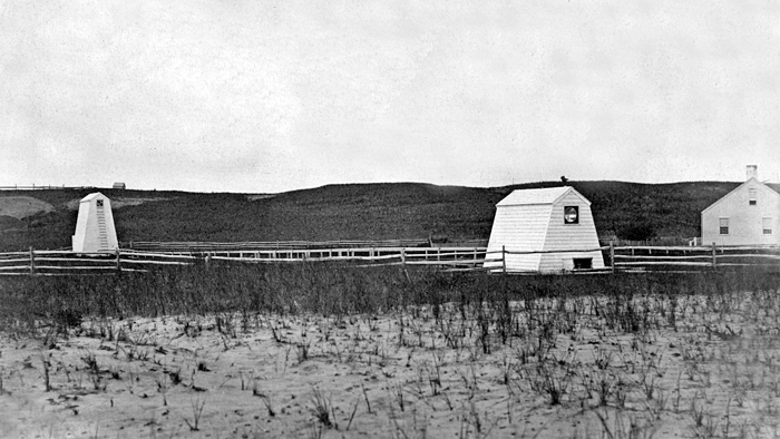
1903 (station established 1838). Inactive since 1912. Two wooden towers, painted white, topped by conical shingled roofs. The lights were displayed through windows. These lights have been relocated to the grounds of a private residence. Jackie Reynolds has 2019 photos of the front and rear light towers and Google has a satellite view. The Coast Guard has a historic photo of the original range lights. Located on opposite sides of a house on Pawguvet Lane at Hulbert Avenue, about 3/4 mi (1.2 km) northwest of Brant Point. Site and towers closed but the lighthouses can be seen from the street. Owner/site manager: private. ARLHS USA-078 (front) and 521 (rear).
* Brant Point (8)
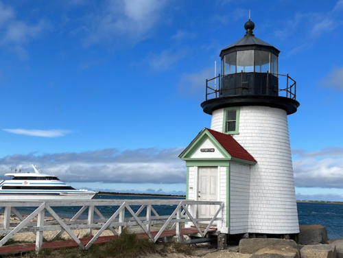
1901 (station established 1746). Active; focal plane 26 ft (8 m); red light occulting every 4 s. 26 ft (8 m) round shingle-clad wood tower with lantern and gallery; 250 mm lens. The lighthouse is connected to shore by a walkway. Fog horn (blast every 10 s). Lighthouse painted white, lantern and gallery black. A 2023 photo is at right, Anderson also has a good page for this station, Guy Cipriani has a good photo, Trabas has a closeup 2016 photo by Michael Boucher, Michael Femia has a good photo, and Google has a street view and a satellite view. This small but prototypical lighthouse has been the model for dozens of faux lighthouses all over the U.S. The walkway was heavily damaged by a storm in 1991 and was rebuilt in 1992. The Coast Guard and Campbell Construction carried out an extensive renovation of the light tower in 2000. Brant Point is the third oldest light station in the U.S., established in 1746; a series of at least five lighthouses stood here prior to 1790. Located at the water's edge east of the 1856 light station. Ferries to Nantucket round Brant Point just before arrival. Site open, tower closed. Owner/site manager: U.S. Coast Guard. . ARLHS USA-1095; Admiralty J0414; USCG 1-15205.

Brant Point Light, Nantucket, June 2023
Google Maps photo by Luvsforgod
* Brant Point (7)
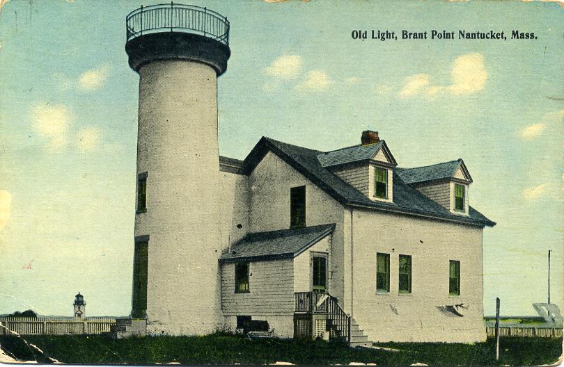
1856 (station established 1746). Inactive since 1900. 47 ft (14 m) round brick tower, painted white with black trim, attached to a 2-story brick keeper's house; lantern removed. A 2022 photo by Barbara Perez is at right, Anderson has a separate page for this lighthouse with good photos, Paul Hildebrandt has an excellent 2007 photo, Huelse has a historic postcard view, and Google has a street view and a satellite view. The building continued in use as the keeper's house for the station; it is now used as a Coast Guard communications station. Located at the Nantucket Coast Guard Station, at the end of Easton Street. Ferries to Nantucket round Brant Point just before arrival. Site open, tower closed. Owner/site manager: U.S. Coast Guard Station Brant Point . ARLHS USA-1094.
* Nantucket Harbor Range Front
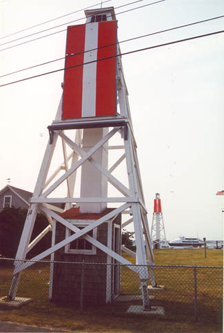
1908. Active; focal plane 35 ft (10.5 m); quick-flashing white light, brighter on the range line. 9 m (30 ft) square pyramidal wood skeletal tower, painted white, with a small open lantern at the top and a small wood equipment shelter in the base; the tower also carries a rectangular wood daymark painted red with a white vertical stripe. Tower painted white; the daymark is red with a white vertical stripe on the range line. Anderson has a photo, Trabas has a 2010 closeup by Michael Boucher, and Google has a street view and a satellite view. These old wood towers are very rare survivors from the early 1900s. Located a few feet northeast of the old Brant Point Light (previous entry). Site open, tower closed. Owner/site manager: U.S. Coast Guard. Admiralty J0416; USCG 1-15160.
* Nantucket Harbor Range Rear
1908. Active; focal plane 51 ft (15.5 m); continuous white light, brighter on the range line. 14 m (46 ft) square pyramidal wood skeletal tower, painted white, with a small open lantern at the top and a small wood eqipment shelter in the base; the tower also carries a rectangular wood daymark painted red with a white vertical stripe. Tower painted white; the daymark is red with a white vertical stripe on the range line. Anderson has a photo, Trabas has a 2016 photo by Michael Boucher, Roland Cody has a fine photo of this light behind the old Brant Point Lighthouse, and Google has a street view and a satellite view. Located at the water's edge south of the old Brant Point Light and 89 yd (81 m) south southeast of the front light. Site open, tower closed. Owner/site manager: U.S. Coast Guard. Admiralty J0416.1; USCG 1-15165.
 

1856 Brant Point Light, Nantucket, August 2022
Google Maps photo by Barbara Perez

Nantucket Oceanside Lighthouses
Great Point (3)
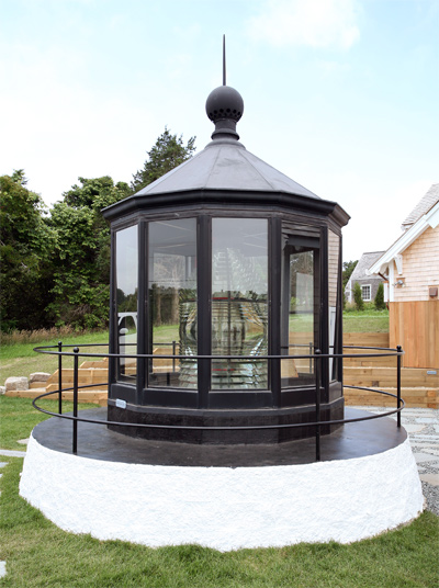
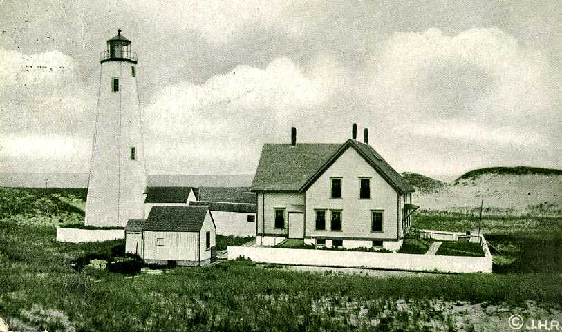
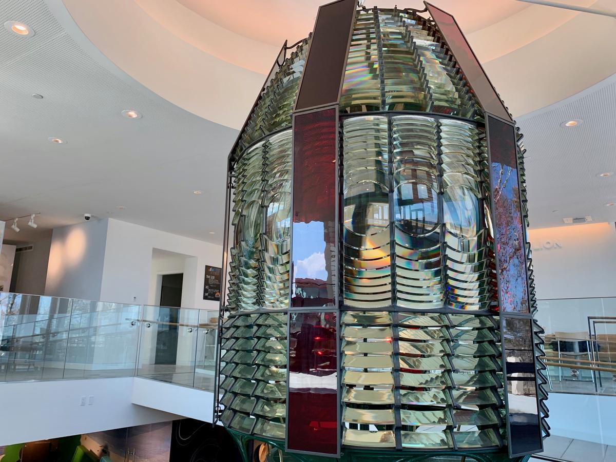
1986 reproduction of 1818 lighthouse (station established 1784). Active; focal plane 70 ft (21 m); white flash every 5 s (red sector covers dangerous shoals). 66 ft (20 m) round rubblestone-faced concrete tower with lantern and gallery, painted white; lantern and gallery painted black. Solar-powered VRB-25 aerobeacon. A 3rd order Fresnel lens from this station (1857, removed in 1971) is displayed in a replica lantern outside the Egan Maritime Shipwreck and Lifesaving Museum. The keeper's house burned in 1966. A 2021 photo is at right, Anderson also has a good page for the lighthouse, Trabas has a closeup 2010 photo by Michael Boucher, Cole Rabe has a 2022 closeup, Marinas.com has aerial photos, Huelse has a historic postcard view, and Google has a satellite view. The original lighthouse, a wood tower, burned under somewhat suspicious circumstances in 1816. The 1818 lighthouse was destroyed by a powerful nor'easter in March 1984; it was rebuilt at a cost of more than $2 million appropriated by Congress. The late Senator Edward Kennedy raised the flag at the dedication of the new lighthouse in September 1986. Stone from the original lighthouse was used in the facing for the new tower. Located on the end of the long sand spit at the northeast corner of Nantucket about 900 ft (275 m) west of the site of the 1818 tower. The area may be closed during bird nesting season; otherwise it is open to hikers (free) or 4-wheel drive vehicles (for a stiff fee). Site open, tower open only for an annual tour date in late August. Owner: U.S. Coast Guard. Site manager: Trustees of Reservations (Coskata-Coatue Wildlife Refuge). . ARLHS USA-348; Admiralty J0404; USCG 1-0545.

Great Point Light, Nantucket, March 2021
Google Maps photo by Vin D Sr.
* Sankaty Head
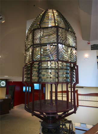
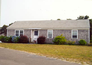
1850. Active; focal plane 158 ft (48 m); white flash every 7.5 s. 70 ft (21 m) round brick and granite tower with lantern and gallery; original lantern removed (1970) but replaced by an aluminum replica. Rotating LED lamp. The original 2nd order Fresnel lens (one of the oldest Fresnel lenses in the U.S.) has been on display at the Nantucket Whaling Museum since 1938. Tower painted white with a broad red horizontal band; lantern, gallery, and watch room black. The historic keeper's house was demolished in 1939. The replacement keeper's house has been relocated to Nantucket and rented as low-income housing. Original oil house (1887). A 2023 photo is at right, Anderson has a page for the lighthouse with good photos, Trabas has Michael Boucher's closeup 2016 photo, Huelse has a historic postcard view, and Marinas.com has aerial photos. This was the first U.S. lighthouse built with a Fresnel lens as its original optic. Endangered by erosion of the cliff, the lighthouse was added to the Lighthouse Digest Doomsday List. In 2000 neighboring landowners got permission to install 8-foot high plastic tubes to retard the beach erosion, but this plan was dropped under protests from environmentalists. In July 2006 the 'Sconset Trust announced plans to lease the light station from the Coast Guard and relocate it 400 ft (122 m) northwest. The $4 million relocation project was carried out in 2007 with the lighthouse reaching its destination in early October. An August 2008 photo, Timothy Valentine's 2011 photo, Okan Aykar's 2022 photo, and Google's satellite view show the lighthouse in its new location and a 2010 photo shows the lighthouse freshly repainted. The lighthouse was closed for restoration in 2022. In December 2023 the Coast Guard installed a rotating LED lamp. Located off the end of Baxter Road adjacent to the fifth hole of the Sankaty Head Golf Club, north of Siasconset ('Sconset) at the eastern end of Nantucket. Site open, tower closed except for occasional guided tours. Owner: U.S. Coast Guard. Site manager: 'Sconset Trust (Sankaty Head Lighthouse ). ARLHS USA-735; Admiralty J0406; USCG 1-0555.

Sankaty Head Light, Nantucket, November 2023
Instagram photo by mb.vogue

Dukes County Lighthouses

Martha's Vineyard Lighthouses
Martha's Vineyard is an island about 4 miles (7.5 km) south of the southwestern end of Cape Cod. The name is commonly extended to include the smaller Chappaquiddick Island, which is separated from the main island by a narrow channel. The island is triangular in shape, with its south coast facing the Atlantic Ocean, the northwest side facing Vineyard Sound, and the northeast side facing Nantucket Sound. "The Vineyard," as it is often called, has a permanent population of about 15,000 and a much larger summer population. The island is accessible by scheduled air service and by ferries from Wood's Hole, Hyannis, and several other locations.

****
Gay Head (Aquinnah) (2)
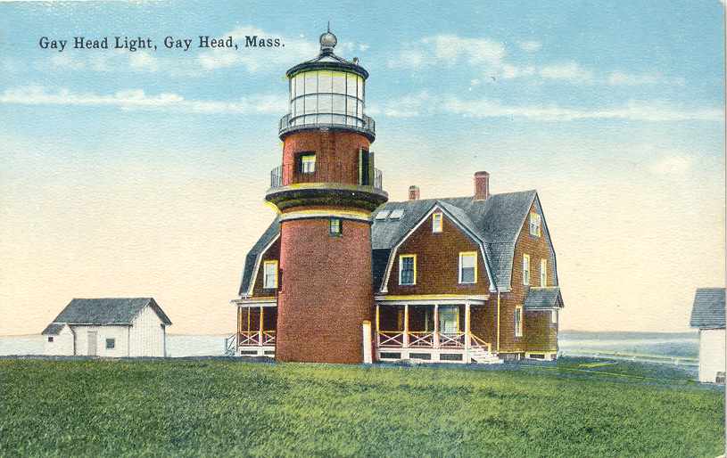
1856 (station established 1799). Active; focal plane 170 ft (52 m); flash every 7.5 s, alternating red and white, day and night. 51 ft (15.5 m) unpainted round red brick tower with lantern and gallery; DCB-224 aerobeacon (1953). Lantern is painted black. The original 1st order Fresnel lens, removed in 1952, is on display in the Martha's Vineyard Museum in Vineyard Haven. The keeper's house and other light station buildings were all demolished in 1956. Anton Lezhankin's 2021 photo is at right, Tracy Lee Carroll has a good photo, Anderson's page has fine photos, Trabas has Michael Boucher's 2016 photo, Britten has a fine photo, Marinas.com has aerial photos, Huelse has a historic postcard view, Teri Carilli has a street view, and Google has a satellite view. This is a famous and familiar lighthouse. The lighthouse was prominent in the news in July 1999 when John F. Kennedy, Jr., was killed in a plane crash just offshore. In August 2009 President Barack Obama and his family visited the lighthouse during a Vineyard vacation. The lighthouse was long endangered by erosion of the bluff on which it stands, and in May 2011 town officials learned that the need to move the tower would be coming soon. In November 2012 the Aquinnah Board of Selectmen announced formation of an advisory committee to plan for ownership, relocation, and restoration of the lighthouse. The committee established a web site for the restoration effort. In the meanwhile the lighthouse went on the Lighthouse Digest Doomsday List. In February 2013 a town meeting approved acquisition of the lighthouse for the purpose of relocation and preservation. In April the Coast Guard announced plans to replace the failing DCB-224 with a modern LED light. Following protests a replacement DCB was found in storage in Virginia. In June the National Trust for Historic Preservation placed the lighthouse on its 2013 Most Endangered Historic Places list and supporters launched a "Keep on Shining" campaign to save the lighthouse. The move would cost about $3 million and energetic fundraising secured that amount. In October 2013 researchers discovered the stone foundations of the 1799 lighthouse. In April 2014 International Chimney Corporation was selected to relocate the lighthouse, and in July a new site was identified 190 ft (58 m) inland. Ownership of the lighthouse was transferred to the town of Aquinnah in February 2015. After weeks of preparation the move was carried out in 48 hours on May 28-30, 2015. A circle of foundation stones marks the original location. In February 2016 International Chimney Corp. was hired to study restoration needed at the lighthouse; in September their report called for needed repairs estimated to cost $1.3 million. Work has continued with restoration of the dome and repointing the brickwork, but as of June 2019 another $500,000 was needed to complete the restoration of the building. In July 2021 Richard Skidmore retired after 31 years as keeper. Located at the end of Lighthouse Road at the extreme western tip of Martha's Vineyard. In November 2024 the light was extinguished for a 6-month, $1.4 million restoration by ICC Commonwealth. A new LED lens will display the historic light pattern, three white flashes followed by one red flash. Site open, tower open Friday through Monday Memorial Day weekend (late May) through June and daily July 1 through Labor Day weekend (early September). Parking near the lighthouse is limited. Owner: Town of Aquinnah. Site manager: Gay Head Lighthouse . ARLHS USA-319; Admiralty J0476; USCG 1-0620.

Relocated Gay Head Light, Aquinnah, November 2021
Instagrams photo by Anton Lezhankin
* West Chop (3)
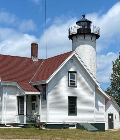
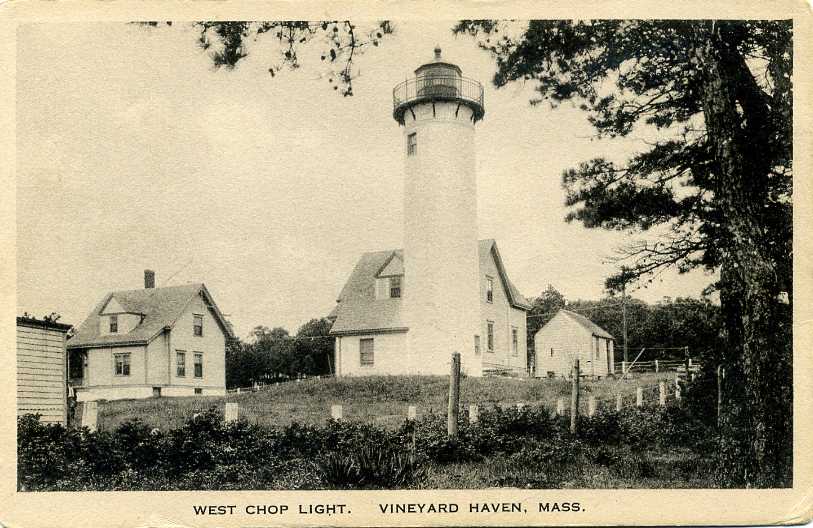
1891 (station established 1817). Active; focal plane 84 ft (25.5 m); white light occulting every 4 s; red sector covers dangerous shoals. 52 ft (16 m) round cylindrical brick tower with lantern and gallery; original 4th order Fresnel lens. The 1-1/2 story wood keeper's house (1847, remodeled 1881) has been used as a Coast Guard residence; the assistant keeper's house is a vacation cottage for military personnel. Lighthouse painted white, lantern and gallery black. Colleen Spelman's 2022 photo is at the top of this page, Anderson's page has excellent photos, Trabas has a 2009 photo by Michael Boucher, Marinas.com has aerial photos, Huelse has a historic postcard view, and Google has a street view and a satellite view. A well preserved light station, including the wood fog signal building (1881) and oil house (1895).The house was used for Coast Guard housing until 2018, when high lead levels were detected in surrounding soil. After mny delays work to remove the contaminted soil began in December 2025. Located on West Chop Road (now Main Street) at the western entrance to Vineyard Haven Harbor in Vineyard Haven, a village at the northern apex of Martha's Vineyard. Site closed, but visitors can park nearby; tower closed. Owner/site manager: U.S. Coast Guard. . ARLHS USA-877; Admiralty J0450; USCG 1-13775.
** East Chop (Telegraph Hill, Oak Bluffs)
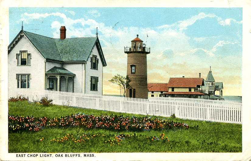
1877. Active; focal plane 79 ft (24 m); green light, 3 s on, 3 s off. 40 ft (12 m) round cast iron tower with lantern and gallery; 300 mm lens. Lighthouse painted white, lantern black. The keeper's house was demolished in 1934. Paul Hu's 2022 photo is at right, Anderson's page has good photos, another closeup photo is available, Marinas.com has aerial photos, Huelse has a historic postcard view, and Google has a street view and a satellite view. In 1957 the Town of Oak Bluffs bought the land around the lighthouse as a public park, and in 1994 the Coast Guard licensed the Martha's Vineyard Historical Society to manage the lighthouse. In 2007 the lighthouse was repaired, restored and repainted in a $140,000 project. The lantern was restored in 2019. In 2020-21 the Coast Guard was removing lead contamination from the surroundings while ICC Commonwealth carried out additional restoration of the tower including repair of the brackets supporting the gallery. The Coast Guard plans to transfer ownership to the Town of Oak Bluffs once the site is clean. Located on Highland Drive at the eastern entrance to Vineyard Haven Harbor in Oak Bluffs. Site open (town park, but parking is limited), tower open on Sunday evenings late June through early September (entry fee). The lighthouse can also be rented for weddings or other special events. Owner: U.S. Coast Guard. Site manager: Martha's Vineyard Historical Society (East Chop Lighthouse ). ARLHS USA-259; Admiralty J0446; USCG 1-13745.

West Chop Light, Vineyard Haven, May 2022
Google Maps photo by Paul Hu
*** Edgartown Harbor (2)
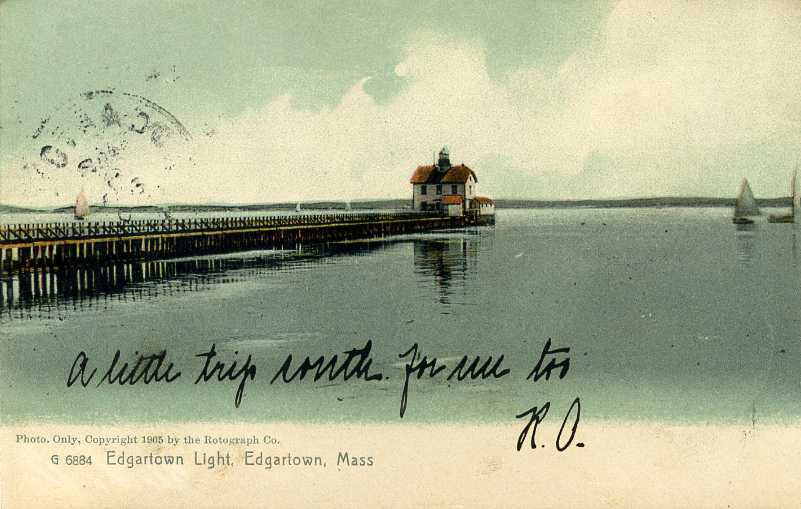
1881 (originally the Ipswich Range Rear Light, relocated here in 1939; station established 1828). Active; focal plane 45 ft (13.5 m); red flash every 6 s. 45 ft (13.5 m) round cast iron tower with lantern and gallery; 250 mm lens (1988). Lighthouse painted white, lantern and gallery black. Tin Nguyen's 2022 photo is at right, Anderson has a good page with several photos, Brian Holzhausen has a 2021 photo, Marinas.com has aerial photos, and Google has a beach view and a good satellite view. The town of Edgartown is near the eastern end of Martha's Vineyard, facing Chappaquiddick Island across the narrow sound of Katama Bay. The original lighthouse was built offshore, as seen in Huelse's historic postcard view. It was nearly destroyed by the 1938 hurricane and was demolished in 1939. The hurricane converted the shoal into a sandy island, which then developed into a spit, which the Coast Guard then stabilized by building a stone jetty. The present tower was renovated in 1985. In 1994 the Martha's Vineyard Historical Society secured a 30-year lease on the building. In 2001 the foundation was restored and the lighthouse was rededicated as the Children's Lighthouse Memorial. In 2007 the lighthouse was restored inside and out; boarded-up windows were replaced with glass and a new spiral stairway was installed. This allowed opening the lighthouse to visitors for the first time in 2008. In 2012 the lighthouse became available for transfer under NHLPA, and in January 2013 the town decided to seek ownership, an effort approved by voters at a town meeting in April. In January 2014 the town was awarded ownership. A $643,000 project in 2026 restored the exterior and repaired windows. Located on a spit at the entrance to Edgartown Harbor. Accessible by a short walk from the downtown area. The Falmouth-Edgartown ferry rounds the spit just before arriving. Site open, tower open daily late June through Labor Day (early September) and on weekends late May to mid June and September through early October. The lighthouse can also be rented for weddings or other special events. Parking is limited. Owner: Town of Edgartown. Site manager: Martha's Vineyard Historical Society. . ARLHS USA-265; Admiralty J0440; USCG 1-15420.
Cape Poge (Cape Pogue) (4)
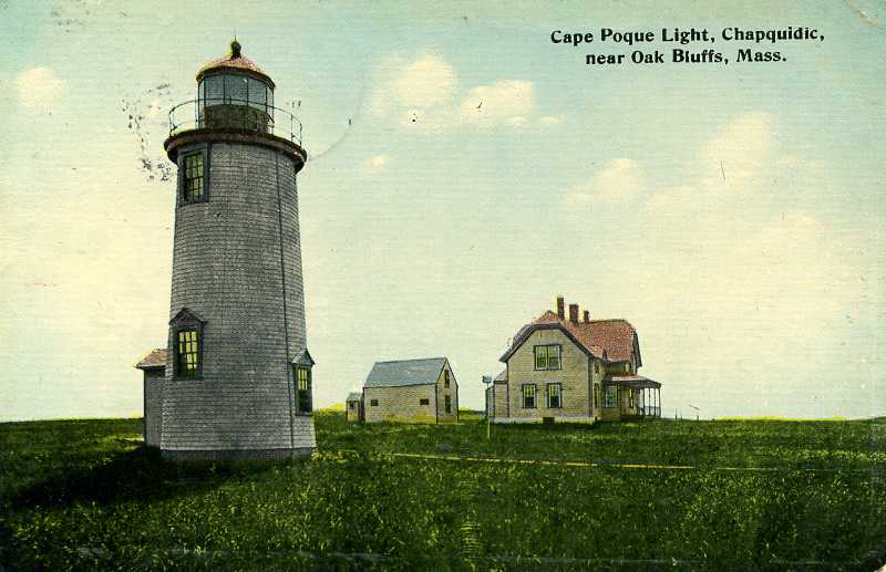
1893 (station established 1801). Active; focal plane 65 ft (20 m); white flash every 6 s. 35 ft (11 m) round shingle-clad wood tower with lantern and gallery; solar-powered 300 mm lens. The original 4th order Fresnel lens is on display at the Martha's Vineyard Museum in Vineyard Haven. Lighthouse painted white, lantern and gallery black. The keeper's house was demolished in 1954. Anderson has a fine page with closeup photos, Trabas has Michael Boucher's 2009 photo, Khadijah Osbourne has a 2024 photo, Teri Carilli has a street view from the gallery, Huelse has a historic postcard view, and Google has a satellite view. The configuration of Cape Poge changes very rapidly and the present tower has been relocated away from the water's edge four times: in 1907, 1922, 1960 and 1987. The last relocation was 500 ft (150 m) by helicopter. The lantern was restored in 1997. Located at the extreme northeastern tip of Martha's Vineyard on Chappaquiddick Island. Accessible by boat, by a 5-mile (8 km) hike (free), or by 4-wheel drive (expensive license required) north from Tom's Neck. Site open, tower open to guided tours (admission fee, reservations required) in the summer. Owner: U.S. Coast Guard. Site manager: Trustees of Reservations (Cape Poge Wildlife Refuge). . ARLHS USA-132; Admiralty J0438; USCG 1-13715.

Edgartown Harbor Light, Edgartown, August 2022
Google Maps photo by Tin Nguyen

Elizabeth Islands Lighthouses

The Elizabeth Islands are a chain of small islands extending southwestward from the Wood's Hole area, separating Vineyard Sound on the southeast from Buzzards Bay on the northwest. Most of the islands are privately owned. The only village is Cuttyhunk, located at the southwestern end of the archipelago.

Buzzards Bay Entrance (2)
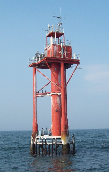
1997 (station established 1961). Active; focal plane 67 ft (20 m); white flash every 2.5 s. Beacon mounted on a platform supported by three legs and a larger central column, all painted red. Fog horn (2 blasts every 30 s). NOAA has a photo; it maintains a C-MAN automatic weather station on the platform. Bing has a satellite view. This light tower replaced a Texas tower lighthouse seen on Wikipedia's page and in several photos (almost halfway down the page) by Brian Tague. The new tower is similar to the 1999 Ambrose Light formerly off New York Harbor. The lighthouses replaced the Vineyard lightship, which sank in a hurricane in September 1944. Located at the mouth of Buzzards Bay about 5 mi (8 km) west southwest of Cuttyhunk. Accessible only by boat. Site and tower closed. Owner/site manager: U.S. Coast Guard. ARLHS USA-100; Admiralty J0480; USCG 1-0630.
#Cuttyhunk (3)
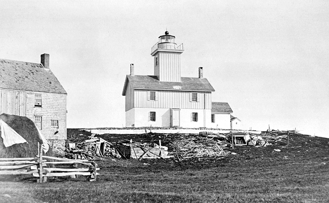
1947 (station established 1823). Inactive since 2005 and later removed. This was a 60 ft (18 m) skeletal tower with a small enclosed workroom at the base. Anderson's page has a photo, the tower is near the right edge of another photo, and Google has an indistinct satellite view of the location. The 1891 lighthouse, a 45 ft (14 m) brick tower attached to a 1-1/2 story wood keeper's house, was demolished when it was deactivated in 1947. The Coast Guard has a historic photo of the original lighthouse; the ruined stone oil house and foundations of the keeper's house remain. Nearby is a round stone tower that looks very much like a lighthouse; it is a monument to the English explorer Batholomew Gosnold, who settled a short-lived colony on the island in 1602. Located at the southwestern end of Cuttyhunk Island. The island is accessible by ferry from New Bedford. Site open. Owner/site manager: U.S. Coast Guard. ARLHS USA-215; ex-USCG 1-15615.
Tarpaulin Cove (2)
1891 (station established 1817). Active; focal plane 78 ft (24 m); white flash every 6 s. 28 ft (8.5 m) round cylindrical brick tower with lantern and gallery, attached to a brick workroom; 300 mm lens. Tower painted white, lantern and gallery black. The keeper's house was demolished in 1962. John Allen's 2023 photo is at right, Anderson has a page with photos taken from the water, Lighthouse Digest has an article on the history of the station, Trabas has Michael Boucher's 2016 photo, Jennifer Webber has a 2007 photo, D'Entremont has a photo, and Google has a satellite view. Tavern keepers maintained a private light at this site from 1759 to 1817. In late 2001 the light station was leased from the Coast Guard by the Cuttyhunk Historical Society, which has a web page for the lighthouse. In 2024 the lighthouse became available under NHLPA and the Society was considering whether to seek ownership. Located on the eastern side of Naushon Island, one of the Elizabeth Islands southwest of Wood's Hole. Accessible only by boat. Site and tower closed except for an annual open house; the island is privately owned. Owner: U.S. Coast Guard. Site manager: Cuttyhunk Historical Society. . ARLHS USA-835; Admiralty J0470; USCG 1-15580.

Tarpaulin Cove Light, Gosnold, October 2023
Google Maps photo by John Allen

Southern Plymouth County Lighthouses

Marion and Mattapoisett Lighthouses
These lighthouses are on the mainland shore of Buzzards Bay east of New Bedford. Lighthouses of the town of Plymouth, on the county's east coast, are described on the Northern Massachusetts page.

Bird Island
1819. Reactivated (inactive 1938-1997, now privately maintained); focal plane 37 ft (11 m); white flash every 6 s. 31 ft (9.5 m) round rubblestone tower with lantern and gallery; ML-300 lens (1997). Lighthouse painted white, lantern and gallery black. The keeper's house and all other structures except the tower were destroyed by the hurricane of 1938. Anderson has a good page for the lighthouse, Trabas has Michael Boucher's 2016 photo, Paul Cantrell has a 2023 photo, Marinas.com has aerial photos, and Google has a good satellite view. The tower was sold in 1940 and remianed in private hands until the island was purchased by the Town of Marion in 1966. The lighthouse was restored by the town and the Sippican Historical Society in 1976. In 1994 the Bird Island Preservation Society was formed to further restore the tower and it was relit in 1997 with a solar-poweted light. There was concern when longtime Bird Island Preservation Society chairman Charles Bradley Jr. retired in early 2008, but the society and the Marion harbormaster cooperated to repaint and refurbish the lighthouse in 2009. In 2016 the Army Corps of Engineers carried out a $3.1 million project to protect the island from rising sea levels with stone revetments. By 2023 the lighthouse was much in need of repainting. In 2024 Marion voters at a Town Meeting approved an appropriation of $28,925 from Historic Preservation Reserves to plaan a complete restoration of the lighthouse. Located on a small island in Buzzard's Bay off Butler Point, Marion. Accessible only by boat. Site and tower closed (nature reserve). Owner/operator/site manager: Town of Marion . ARLHS USA-057; Admiralty J0511.1; USCG 1-17105.
** Ned's Point
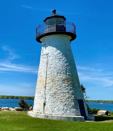
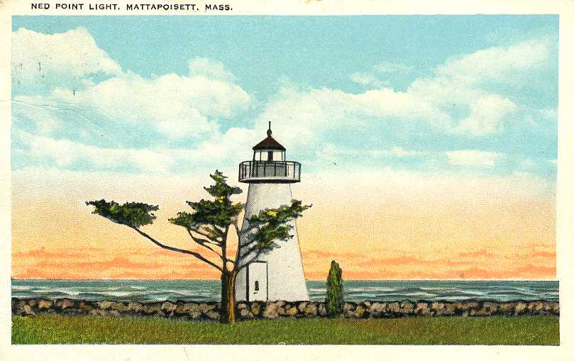
1838 (Leonard Hammond). Reactivated (inactive 1952-1961); focal plane 41 ft (12.5 m); white light, 3 s on, 3 s off. 39 ft (12 m) round rubblestone tower with lantern and gallery. 250 mm lens (1996). Lighthouse painted white, lantern and gallery black. The keeper's house was relocated to Wing's Neck Light in 1923 (see above). Joe Peloquin's 2024 photo is at right, a 2007 photo is available, Anderson's page has good photos, Trabas has a 2009 photo, Daniel Chavarria has a 2020 photo, Marinas.com has aerial photos, Huelse has a historic postcard view, and Google has a street view and a good satellite view. The Coast Guard sold the land surrounding the lighthouse to the Town of Mattapoisett in 1958. The lighthouse was restored through local efforts in 1993-98 and is maintained with the help of the Coast Guard Auxiliary Flotilla 6-3. Auxiliary members worked on renovations to the lighthouse in 2011. In 2019 lead contamination was discovered in the lantern and the lighthouse was closed. It reopened in October 2021 after lead was removed and the lantern restored. In 2022 a campaign launched to raise $270,000 for a through restoration of the tower, and the town's Select Board expressed interest in taking ownership of the lighthouse. Restoration work was underway in 2024 with completion expected in 2025. Located in Veterans Memorial Park at the end of Ned's Point Road on the east side of the harbor entrance in Mattapoisett. Site open, tower open for tours on a variable schedule, generally on Saturdays in July and August. Owner: Coast Guard Auxiliary Flotilla 6-3 (tower only). Site manager: Town of Mattapoisett and Friends of Ned's Point Lighthouse. . ARLHS USA-533; Admiralty J0504; USCG 1-17095.

Ned's Point Light, Mattapoisett, May 2024
Instagram photo by Joe Peloquin

Bristol County (New Bedford and Fall River) Lighthouses

New Bedford is a city of about 100,000 residents facing lower Buzzards Bay. A historic seaport, it was the center of U.S. whaling in the Nineteenth Century and it remains a major fishing port.

New Bedford Harbor Lightships
* Lightship WLV-613 Nantucket II
1952. The last lightship on station in the U.S., relieved 20 December 1983. 39 m (128 ft) steel lightship; lantern and gallery atop a tripod light tower amidships. Hull painted red, superstructure white, light tower and lantern gold. The ship served initially on the Ambrose station off New York, and later at Nantucket Shoals. Uma Tyan has a closeup 2007 photo. After decommissioning, the ship was donated to a nonprofit and served as a museum in Boston. In 1996 it was placed on sale and purchased by a small group that moved the ship to Quincy but was not able to care for it. In 1998, when it looked like the ship would be scrapped, it was bought by Jack Baker, who spent more than $1 million to restore the vessel. The ship sailed to New Bedford and back in September 1999. In 2000 the ship sailed to New York to participate in OpSail 2000. In 2002 the ship was docked at Wareham, where it remained for more than a decade; Google has distant 2012 street view of the ship at anchor there. In November 2014 the ship was purchased by Bill Golden, the owner of Nantucket I, and at the end of the month it was towed to a shipyard in New Bedford for restoration. The restoration was expected to last only a few months. As of July 2017 the ship was berthed at Fairhaven, across the Acushnet River from New Bedford; Lightphotos.net has Andreas Köhler's September 2017 photo seen at right. According to an October 2018 article in Boat International, both Nantucket I and Nantucket II were "berthed in New Bedford, Massachusetts, side by side." The ship is moored near the Seatrade International pier on the east side of the Acushnet; Benjamin Llenas has a 2021 photo, a 2022 photo is available, and Google has a June 2023 street view of the ship and a satellite view. Owner: private. ARLHS USA-524.
 

Lightship WLV-613 Nantucket II, New Bedford, September 2017
Lightphotos.net photo by Andreas Köhler; used by permission
* Lightship WLV-612 Nantucket I
1950. Decommissioned 1985. 2-masted, 617-ton steel lightship, length 128 ft (39 m), beam 30 ft (9 m). The ship served most of its career off San Francisco, but it was also stationed off Portland, Maine, and from 1975-1983 on the Nantucket Shoals station, where it alternated on station with Nantucket II and was one of the last two U.S. lightships in service. Wikimedia has Jim Henderson's February 2009 photo (also seen at right) of the ship moored at lower Manhattan, and Jef Nickerson has a November 2006 photo of the lightship at Boston. In 1987 the vessel was purchased for $1500 by the Metropolitan District Commission of Boston with the intention that it would be refurbished as a museum. These plans were never carried out and in the end the state allowed the ship to deteriorate at a berth in Quincy. In 1999 the State of Massachusetts declared the ship surplus property, and on March 15, 2000, the state put the ship up for auction on eBay. It was sold to Bill and Kristin Golden, who renovated the vessel and put it back into operation. The ship arrived in Boston under its own power in October 2002 and was moored off season at Rowe's Wharf on the Boston waterfront. In late 2004 the Goldens announced plans to berth the ship at Nantucket during the summer and sell shares in the vessel to would-be summer residents. However, nothing came of these plans. In January 2006 the Goldens put the lightship up for sale with an asking price of $7.6 million, but the ship found no buyers. In 2008 the Goldens sailed the ship to New York, where it was based at Battery Park City in lower Manhattan. In 2009 they sailed the ship to Hyannis, Massachusetts, flashing its light as a memorial to Senator Edward Kennedy. In late summer 2009 the ship was anchored at Vineyard Haven, Martha's Vineyard. In the summer of 2013 it was at Jamestown, Rhode Island, and it was scheduled to move to New York in the fall. In 2015 it was berthed at Pier 25 in Hudson River Park; a photo is available. For the 2016 season it moved to the new One°15 Brooklyn Marina at Pier 5, south of the Brooklyn Bridge. According to an October 2018 article in Boat International, both Nantucket I and Nantucket II were "berthed in New Bedford, Massachusetts, side by side." In January 2019 the Goldens had Nantucket I listed for sale for $5.2 million and in April 2020 the listed price was $4.95 million. In January 2020 the ship was at the Boston Yacht Haven in downtown Boston; a YouTube video is available. By the summer of 2022 it was back in New Bedford, moored at the State Pier, but Google's satellite view and June 2023 street view do not show it there. Its current loction is unknown. Owner/site manager: private. ARLHS USA-523.

Lightship WLV-612 Nantucket at Pier 25, New York, February 2009
Wikimedia public domain photo by Jim Henderson
 

New Bedford Harbor Lighthouses
New Bedford West Barrier
1960s. Active; focal plane 48 ft (15 m); quick-flashing green light. Lights mounted atop a 2-story concrete control tower. Fog horn (blast every 10 s) on demand. Trabas has a 2009 photo and Google has a satellite view. The New Bedford Hurricane Barrier was built to prevent storm surge from entering the funnel-shaped harbor, as happened with devastating results during the great hurricane of 1938. The barrier's narrow opening for ships can be closed by gates when necessary to protect the city. The East Barrier Light (Admiralty J0500.2; USCG 1-16896) marks the other side of the opening. Located on the west side of the harbor entrance. Site and tower closed to the public. Admiralty J0500; USCG 1-16897.
* Palmer (Palmers) Island
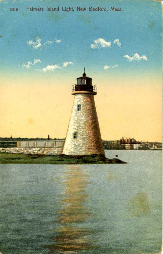
1849. Reactivated (inactive 1962-1999, now maintained by the city of New Bedford); focal plane 42 ft (13 m); white flash every 4 s. 24 ft (7 m) round rubblestone tower with lantern and gallery; solar-powered 250 mm acrylic lens. The lantern is a fiberglass repica. Lighthouse painted white, lantern and gallery black. Josh Hanna's 2020 photo is at right, Robert English has a photo, Anderson has a good page with several photos, Trabas has a 2009 photo, David Long has a 2024 sunset photo, Marinas.com has aerial photos, Huelse has a historic postcard view, and Google has a satellite view. One of the last "old style" stone towers built. The keeper's house was destroyed by the 1938 hurricane. Though protected now by the city's hurricane dike, the tower was gutted by fire in 1966 and repeatedly vandalized thereafter. Acquired by the city in 1978, it was restored and relit in 1999. Lighthouse Digest has Jeremy D'Entremont's feature on keeper Arthur Small. Located on a pier off the north end of the island, in New Bedford Harbor. Accessible at low water from the hurricane barrier. Visible from the New Bedford Whaling Museum, from the Cuttyhunk ferry, and from harbor tours in season. Site open, tower closed. Owner/operator/site manager: City of New Bedford. . ARLHS USA-578; Admiralty J0501; USCG 1-16898.

Palmer Island Light, New Bedford, October 2020
Google Maps photo by Josh Hanna
Butler Flats
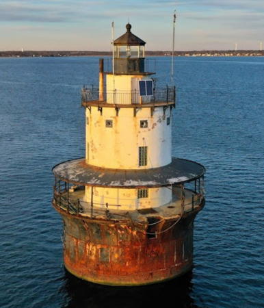
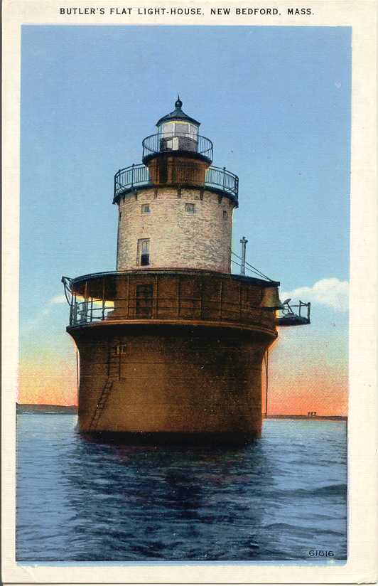
1898 (F. Hopkinson Smith). Inactive since 2014. 53 ft (16 m) round cylindrical brick tower incorporating 3-story keeper's quarters, with double upper gallery and a lower gallery, mounted on a concrete and cast iron caisson. The original 5th order Fresnel lens is on display at the Maine Lighthouse Museum. Unusual design: a sparkplug tower in brick rather than cast iron. Lighthouse painted white; lantern, galleries, and caisson painted black. Dave Peloquin's 2021 drone view is at right, Anderson's page has good photos, Christopher Fredericks has a 2017 photo, Huelse has a historic postcard view, and Google has a satellite view and a distant street view. The lighthouse was maintained by the city for many years beginning in 1978; volunteers and county jail inmates worked to keep it in order. It was one of the first lighthouses in the country to be converted to solar power. In 2012 the lighthouse became available for transfer under NHLPA but the city declined to apply for it and no other group came forward. The lighthouse was offered for sale by auction in August 2013. Nick Korstad, the owner of the similar Borden Falls lighthouse (see below), declined to bid; he estimates the lighthouse needs $1 million just to restore the foundation. That auction was cancelled but in September 2015 the lighthouse was again offered for auction, and in November the lighthouse sold for $80,000. The buyers formed a nonprofit organization called Mass Light to maintain the lighthouse. In May 2019 the city council approved a $250,000 grant for the stabilization and repair of the base of the lighthouse and the concrete deck. We need to learn if there is progress on this restoration project. Located in New Bedford Harbor east of Clark's Point. Accessible only by boat. Good views from the Martha's Vineyard ferry mid-May to early October. Site and tower closed. Owner/site manager: Mass Light. . ARLHS USA-099; ex-Admiralty J0498; ex-USCG 1-16853.
* Clark's Point (2)
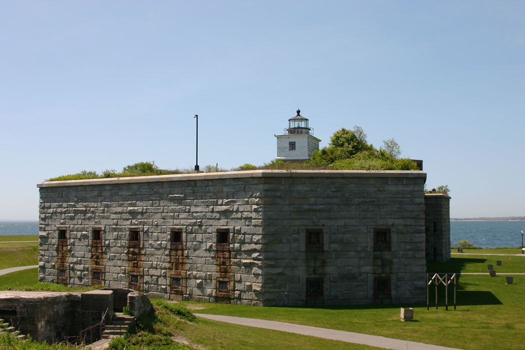
1869 (station established 1804). Inactive 1898-2001 and since 2016. 2-story rectangular keeper's house, lower story stone and upper story wood, with cylindrical lantern and gallery, mounted atop the walls of Fort Taber (1840). Lantern black; upper story of keeper's house painted white, lower story unpainted stone. Anderson has a good page for the lighthouse, Mike Carey has a closeup 2007 photo, Trabas has a photo, Connor McLeish has a photo, and Google has a street view and a satellite view. This lighthouse was previously endangered by neglect, but the city has since restored the tower. The light was relit in celebrations in June 2001. Lighthouse Digest has Jeremy D'Entremont's story on this effort and the history of the light station. Located off South Rodney Boulevard on the west shore of New Bedford Harbor. Site open, parking provided, tower closed. Owner/site manager: City of New Bedford (Fort Taber Park ). ARLHS USA-174; ex-Admiralty J0497; ex-USCG 1-16795.

Butler Flats Light, New Bedford, January 2021
Google Maps photo
by Dave Peloquin
Dumpling Rocks (4?)
Date unknown (station established 1828). Active; focal plane 52 ft (16 m); green flash every 6 s. 46 ft (14 m) square cylindrical skeletal tower mounted on a square concrete base and carrying a square daymark painted green. 1-story concrete equipment shelter. Anderson has a page for this light station, Trabas has a distant 2009 view and Google has a satellite view. The original lighthouse was a 2-story keeper's house with the lantern on the roof. This was replaced in 1890 by a square wood tower attached to a 2-story keeper's house. The light station was largely destroyed by the great hurricane of 1938; in 1940, the remains were demolished and a skeletal tower was installed. The present skeletal tower has a more modern design. Located off Round Hill Point about 8 km (5 mi) southwest of Clarks Point. Accessible only by boat; there should be a good view from the end of Club House Road in Dartmouth. ARLHS USA-247; Admiralty J0492; USCG 1-16040(=16731).

Fall River Lighthouse
The city of Fall River is on the east side of Mount Hope Bay, an arm of Rhode Island's Narragansett Bay. The city has a population of about 90,000.

Borden Flats
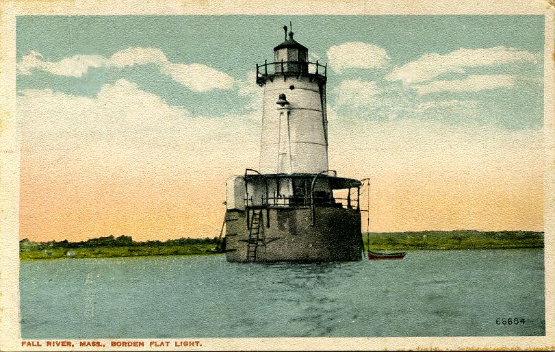
1881. Active; focal plane 47 ft (14.5 m); white flash every 2.5 s. 50 ft (15 m) round cast iron sparkplug tower with lantern and upper and lower galleries, incorporating 2-story keeper's quarters and mounted on a circular concrete and cast iron caisson. 250 mm lens (1977). Fog horn (1 s blast every 10 s). Lighthouse painted white with one red horizontal band, lantern and gallery painted black, lantern roof red. The caisson was expanded after the hurricane of 1938 damaged the original foundation. Juergen Roth's 2023 photo is at right, Anderson's page has good photos, Robert Magina has a 2012 photo, Trabas has a 2009 photo, Ewan McBride has a 2019 drone view, C.M. Hanchey has a good 2013 photo, Marinas.com has aerial photos, Huelse has a historic postcard view, and Google has a satellite view and a distant 2023 street view. In 2006 the lighthouse became available for transfer under NHLPA but no interested parties came forward to accept it. In December 2008 it was sold for $55,000 to Michael Gabriel, a Nevada attorney and lighthouse fan who had also purchased the Fourteen Foot Bank lighthouse in Delaware Bay and the Bloody Point Bar lighthouse in Chesapeake Bay. In August 2009 Gabriel announced plans to finance maintenance of his lighthouses by operating microbreweries in them. However, it seems that Gabriel had overreached, because he defaulted on the closing for Borden Flats. The lighthouse went back on the auction block and in August the high bid of $56,569 was submitted by Nick Korstad. Gabriel sued to have this sale stopped but the General Services Administration confirmed Korstead's title. In 2011 Korstad had the lighthouse repainted, adding the red horizontal band. He opened the lighthouse for overnight rental. In 2017 the revolving Vega beacon was replaced by a modern LED light. In November 2017 Korstad placed the lighthouse for sale for $389,900. In 2018 the lighthouse was purchased by new owners Kevin and Carole Ferias, who promised to continue and expand the existing programs. In 2023 they placed the lighthouse for sale for $1.2 million, but still as an active B&B. Located in the middle of Fall River just downstream from the Braga Bridge (I-195). Accessible only by boat. There are good views from the Borden Light Marina at 251 Bank Street. Site open; tower open for overnight stays and private tours can be arranged by contacting the owner. Owner/site manager: Borden Flats Lighthouse . ARLHS USA-072; Admiralty J0576; USCG 1-18925.

Borden Flats Light, Fall River, November 2023
Instagram photo
by Juergen Roth

Information available on lost lighthouses:

Notable faux lighthouses:

Adjoining pages: North: Northern Massachusetts | Northeast: Cape Cod | West: Rhode Island

Return to the Lighthouse Directory index | Ratings key

Checked and revised July 1, 2025. Lighthouses: 23. Lightships:2. Site copyright 2025 Russ Rowlett and the University of North Carolina at Chapel Hill.