Lighthouses of Canada: Northwestern Ontario

The nation of Canada was created by the British North America Act in 1867 with Ontario, Québec, New Brunswick, and Nova Scotia as the four original provinces. The area of Ontario was part of New France, the former French empire in North America, from tthe founding of Québec city in 1608 until France was forced to cede its Canadian territories to Britain at the end of the Seven Years War in 1763. Today Canada is a federation of ten provinces and three large federal territories in the far north of the country.

In 1798 the southern portions of modern Ontario were separated from Québec as Upper Canada, known after 1841 as Canada West and taking the name Ontario in 1867. Its territory was expanded northward several times and the province reached it present boundaries in 1912.

The province of Ontario has a tremendous width east to west, including the entire Canadian side of the Great Lakes. Across this vast area there were once about 250 lighthouses. More than 130 remain, a large percentage of them active. This page includes lighthouses in the western part of the province, guiding vessels on the St. Marys River, Lake Superior, the Rainy River, and the Lake of the Woods.

Southern Ontario is divided into counties and municipalities but these more sparsely populated areas to the north are divided into districts having mostly unincorporated areas. This page covers theThunder Bay and Rainy River Districts in the northwestern part of the province.

Aids to navigation in Canada are maintained by the Canadian Coast Guard. In 2008 Parliament passed the Heritage Lighthouse Protection Act to designate and protect historic lighthouses. Fortunately, Canadian Lighthouses of Lake Superior has been organized to support and restore the lighthouses of that region.

This page has been greatly improved by the comments and corrections of Michel Forand. I'd also like to thank Ron Walker of the Canadian Coast Guard for answering a number of questions.

ARLHS numbers are from the ARLHS World List of Lights. CCG numbers are from the Inland Waters volume of the List of Lights, Buoys, and Fog Signals of Fisheries and Oceans Canada. For lights near the international border, USCG numbers are from volume 7 of the U.S. Coast Guard Light List.

General Sources
Lighthouses of Lake Superior
Photos posted by C.W. Bash.
Ontario Canada Lighthouses
Excellent photos plus historical and visitor information from Kraig Anderson's LighthouseFriends.com web site.
Canadian Lighthouses of Lake Superior (CLLS)
This organization works to restore the lighthouses of the north shore of the lake. The Lighthouses page links to pages for many of them.
Lighthouses in Ontario
Photos by various photographers available from Wikimedia.
World of Lighthouses - Canadian part of Great Lakes
Photos by various photographers available from Lightphotos.net.
Ontario, Canada Lighthouses
Aerial photos posted by Marinas.com.
List of Lights, Buoys, and Fog Signals
Official Canadian light lists are available in both pdf and html formats.
U.S. Coast Guard Navigation Center: Light Lists
The USCG Light List can be downloaded in pdf format.
GPSNavigationCharts
Navigation chart information for Lake Superior.
Google Maps
Satellite view of northern Lake Superior.


Caribou Island Light, Lake Superior, posted July 2025
Google Maps photo by Garrett Griffin

Thunder Bay District Lighthouses

Northeastern Lake Superior Lighthouses
Caribou Island (2)
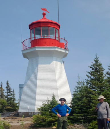
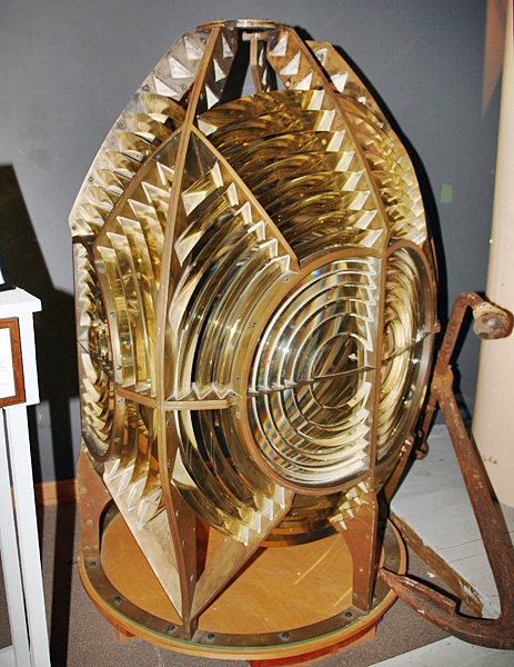
1912 (station established 1886). Active; focal plane 30 m (99 ft); white flash every 15 s. 31.5 m (104 ft) hexagonal concrete tower with six flying buttresses, lantern and gallery. Lighthouse painted white; lantern, gallery, and watch room are red. The original 2nd order Fresnel lens is displayed at the Coast Guard Base in Parry Sound. A drone view is at the top of this page, Laurie Mackie has a 2011 closeup, Marinas.com has aerial photos, and Google has a satellite view. Lighthouse Digest has a historic view of the station from the lake. Caribou Island is about 55 km (35 mi) off Agawa Bay on the east shore of the lake. The island is owned as a nature reserve by the Melon Conservancy Trust. The lighthouse is located on a small island southwest of Caribou Island itself and about 5 km (3 mi) north of the international border. Accessible only by boat. Site open, tower closed. Owner/site manager: Canadian Coast Guard. ARLHS CAN-631; USCG 7-16845; CCG I-1096.
Michipicoten Island East End
1912. Active; focal plane 25.5 m (84 ft); white flash every 10 s. 21.5 m (71 ft) hexagonal concrete tower with six flying buttresses, lantern and gallery. Lighthouse painted white; lantern, gallery, and watch room are red. The original 3rd order Fresnel lens is displayed at the Coast Guard Base in Parry Sound. Richard Bentoski's 2006 aerial photo is at right, J. Rowe Heritage Consulting has a page with a photo and the history of the station, David Johnston has a photo of the station from the lake, a 2017 photo is available, Lighthouse Digest has a photo by Ken Szijarto, Marinas.com has aerial photos, and Google has a satellite view. Michipicoten Island is a large (500 km2 or 200 sq. mi.) wilderness island 15 km (10 mi) south of the north shore of the lake and 65 km (40 mi) southwest of Wawa. The entire island is a provincial park. Lighthouse located at the eastern end of the island. Accessible only by boat. Site open, tower closed. Owner: Canadian Coast Guard. Site manager: Michipicoten Island Provincial Park. ARLHS CAN-1319; CCG I-1097.
Davieaux Island (2)
1911 (station established 1872). Active; focal plane 39 m (129 ft); white flash every 20 s. 13 m (44 ft) octagonal concrete tower with lantern and gallery, painted white with red trim; lantern is red. User-activated fog horn (two 3 s blasts every 60 s). Lighthouse Digest has a photo by Ken Szijarto, Marinas.com has aerial photos, and Google has an anonymous closeup photo and a distant satellite view. Located on the summit of a small island, part of a reef sheltering Québec Harbour on the south side of Michipicoten Island. Accessible only by boat. Site open, tower closed. Owner: Canadian Coast Guard. Site manager: Michipicoten Island Provincial Park. ARLHS CAN-559; CCG I-1098.

Michipicoten Island East End Light, Lake Superior, July 2006
Google Maps photo by Richard Bentoski
[Québec Harbour Range Front (3?)]
Date unknown (station established 1918). Active; focal plane 6.5 m (21 ft); continuous red light. 5 m (17 ft) square skeletal mast carrying a daymark colored white with an orange vertical stripe. No photo available but Google has a satellite view. Anderson discusses these range lights on his Davieaux Island page. The original lighthouse, a 10 m (32 ft) square tower, was built on Agate Island in 1872 and relocated as the front range light in 1917. Located on the north side of the harbor, the only sheltered harbor on Michipicoten Island. Accessible only by boat. Site open, tower closed. Owner: Canadian Coast Guard. Site manager: Michipicoten Island Provincial Park. ARLHS CAN-853; CCG I-1099.
[Québec Harbour Range Rear (3?)]
Date unknown (station established 1918). Active; focal plane 20 m (66 ft); continuous red light. 5 m (17 ft) square skeletal mast carrying a daymark colored white with an orange vertical stripe. No photo available but Google has a satellite view. Anderson discusses these range lights on his Davieaux Island page; he has a photo of the original lighthouse under construction. Located 214 m (702 ft) north of the front light. Accessible only by boat. Site open, tower closed. Owner: Canadian Coast Guard. Site manager: Michipicoten Island Provincial Park. ARLHS CAN-854; CCG I-1100.
Otter Island
1903. Active; focal plane 29.5 m (97 ft); white flash every 8 s. 6.5 m (21 ft) octagonal pyramidal concrete tower with lantern and gallery, painted white; lantern is red. A 2025 photo by Thomas Wiese is at right, the North of Superior Tourism Association posted a 2020 photo, Lighthouse Digest has a photo by Wende Cameron Botham, Marinas.com has aerial photos, and Google has a satellite view. Located on a small island off the most remote section of the lakeshore. Accessible only by boat; tours by sea kayak available. Site open, tower closed. Owner: Canadian Coast Guard. Site manager: Pukaskwa National Park. ARLHS CAN-582; CCG I-1102.

Otter Island Light, Pukaskwa National Park, May 2025
Google Maps photo by Thomas Wiese

Northern Lake Superior Lighthouses
Hawkins Island (Peninsula Harbour) (3?)
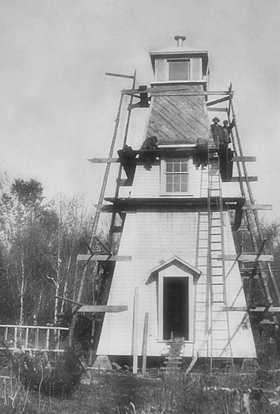
1975 (station established 1891). Active; focal plane 27 m (89 ft); white flash every 4 s. 13 m (43 ft) square steel skeletal tower. No photo of the current light available but Google has an indistinct satellite view of the station. The original lighthouse was replaced in 1929 by the lighthouse shown in the photo contributed to Lighthouse Digest by Michel Forand. The 1929 lighthouse was destroyed after being deactivated in 1957. The island is named for an early keeper, David Hawkins. Located at the southwestern tip of the island, at the entrance to Peninsula Harbour at Marathon. Accessible only by boat. Site open, tower closed. Owner/site manager: Canadian Coast Guard. ARLHS CAN-1081; CCG I-1106.
Slate Islands
1902. Active; focal plane 68 m (224 ft); white light, 10 s on, 5 s off. 7 m (22 ft) octagonal wood tower with lantern and gallery, painted white; lantern and gallery painted red. Two 2-story keeper's houses and other light station buildings located on the shore below the lighthouse. Part of David Johnston's 2021 street view is at right, a 2020 photo is available, Lighthouse Digest has Aaron White's photo, Marinas.com has aerial photos, and Google has a satellite view. Bluebird Charters has a photo and offers transportation to the island. The Slate Islands, located about 11 km (7 mi) southeast of Terrace Bay, are included in a provincial park. Lighthouse located on a high ridge on the south side of Patterson Island. Accessible only by boat; transportation from Terrace Bay or Rossport can be arranged and tours by sea kayak are available. Site open, tower closed. Owner: Canadian Coast Guard. Site manager: Slate Islands Provincial Park. ARLHS CAN-589; USCG 7-16865; CCG I-1111.
Battle Island (2)
1911 (station established 1877). Active; focal plane 36 m (118 ft); three white flashes, separated by 4 s, every 24 s. 13 m (43 ft) octagonal concrete tower with lantern and gallery, painted white; lantern and gallery painted red. 2-story keeper's house occupied by a resident caretaker, who is the former keeper. Marshall Eriksen has a closeup 2024 photo, Roger King has a 2013 photo, Lake Superior Magazine has a feature article on the lighthouse, Lighthouse Digest has a Coast Guard aerial photo, Marinas.com has aerial photos, and Google has a sea view and a satellite view of the station. For more than a deacde the Friends of Battle Island Lighthouse FOBIL) worked to restore and maintain the light station and open it to visitors. In July 2025 Fisheries and Oceans suspended the group's license and closed the island to visitors followin a First Nations land claim. The group will negotiate with the Pays Plat First Nation to resolve the issues. Located at the western end of the island, south of Rossport. Accessible only by boat. Site open, tower closed. Owner/site manager: Canadian Coast Guard. ARLHS CAN-547; USCG 7-16870; CCG I-1117.

Slate Islands Light, Lake Superior, July 2021
Google Maps photo by David Johnston
Lamb Island (2)
1961 (station established 1877). Active; focal plane 30 m (99 ft); white flash every 5 s. 12 m (40 ft) square pyramidal steel skeletal tower. The 2-story wood keeper's house and several other buildings remain of the original light station. Anderson has a Coast Guard aerial photo, Jon Stephens has a 2025 photo of the keeper's house, and Google has a satellite view. The lighthouse received Heritage designation in May 2015. Located on a small island off the western entrance to Nipigon Bay. Accessible only by boat. Site open, tower closed. Owner/site manager: Canadian Coast Guard. ARLHS CAN-757; CCG I-1126.

Northwestern Lake Superior Lighthouses
Shaganash Island ("Island Number 10")
1910. Active; focal plane 11 m (36 ft); white flash every 4 s. 7.5 m (24 ft) square pyramidal wood tower with lantern and gallery, painted white with red trim; lantern and gallery are red. Kurt Riplinger has a 2023 photo, a Flickr.com portfolio of photos is available, Roger King has a view from the lake, and Google has a satellite view. In 2014 Canadian Lighthouses of Lake Superior (a new group at that time) assumed management and restored the lighthouse; they repainted the lighthouse in 2014 and there are plans to make it available for overnight accommodations for boaters and kayakers. In 2023 the lighthouse received designation as a Heritage Lighthouse and ownership was transferred to CLLS. Located on a small island east of Edward Island and about 25 km (15 mi) northeast of the village of Silver Islet. Accessible only by boat. Site open, tower closed. Owner/site manager: Canadian Lighthouses of Lake Superior. ARLHS CAN-587; CCG I-1127.
Porphyry Point (2)
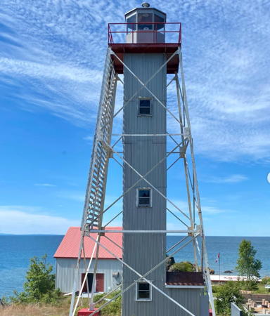
1960 (station established 1873). Active; focal plane 25 m (82 ft); white flash every 10 s. 14.5 m (48 ft) square pyramidal skeletal tower with square central cylinder, lantern and gallery, painted white. 2-story keeper's quarters and other light station buildings. Jen Smith's 2022 photo is at right, another 2022 photo is available, Bash has a photo, Marinas.com has aerial photos, and Google has a satellite view of the station. In 2014 Canadian Lighthouses of Lake Superior assumed management and restored the lighthouse; they repainted the lighthouse in 2014 and have made it available for overnight accommodations for boaters and kayakers. In 2016 CLLS was seeking college students to take residence at the light station for the summer.The 150th anniversary of the station was celebrated in 2023. Porphyry Island is a provincial nature reserve and a popular destination for sea kayakers. Located at the southwestern tip of the island guarding the entrance into Black Bay, about 8 km (5 mi) east of Silver Islet. Accessible only by boat. Site open, tower closed. Owner: Canadian Coast Guard. Site manager: Canadian Lighthouses of Lake Superior and Porphyry Island Provincial Park. . ARLHS CAN-584; USCG 7-16885; CCG I-1128.
Trowbridge Island
1924. Active; focal plane 35 m (114 ft); white flash every 5 s. 7 m (23 ft) octagonal concrete tower with lantern and gallery, painted white with red trim; lantern and gallery painted red. 3rd order Fresnel lens. 2-story keeper's quarters and other light station buildings. Stan Peet has a 2024 photo, Bash has a 2006 photo, CLLS has a closeup of the lantern, Marinas.com has aerial photos, and Google has a satellite view. The Friends of Trowbridge Island Lighthouse was formed to work for the preservation of the light station, but the station is now leased by Canadian Lighthouses of Lake Superior. In 2018 CLLS received a $25,000 grant for a general cleanup of the light station. Located atop a small island east of Thunder Cape on the approach to Thunder Bay. Accessible only by boat. Site open, tower closed. Owner: Canadian Coast Guard. Site manager: Canadian Lighthouses of Lake Superior. ARLHS CAN-596; USCG 7-16890; CCG I-1129.

Porphyry Point Light, Black Bay, August 2022
Instagram photo by Jen Smith
[Thunder Cape (3?)]
Date unknown (station established 1874). Active; focal plane 10.5 m (35 ft); white flash every 4 s. 6.5 m (21 ft) mast carrying a rectangular red and white daymark. Brian Kresack has a photo, Wolfgang Küfner has a view of the station, and Google has a satellite view. Several station buildings survive; they are now occupied by the Thunder Cape Bird Observatory. Lighthouse Digest has a historic distant view of the station. The original lighthouse was demolished in the 1920s after being replaced by a post light. Located on the tip of a long, narrow peninsula sheltering the east side of Thunder Bay. Site open, tower closed. Owner: Canadian Coast Guard. Site manager: Sleeping Giant Provincial Park. ARLHS CAN-1086; USCG 7-16905; CCG I-1131.

Thunder Bay City Lighthouses
Thunder Bay City, the seat of Thunder Bay District, is a city of about 110,000 residents facing the large embayment of Thunder Bay. The bay is about 50 km (30 mi) long and 22 km (14 mi) wide.

Thunder Bay North Entrance
Date unknown. Active; focal plane 9.5 m (31 ft); green flash every 4 s. 6 m (20 ft) post mounted on a 1-story equipment building, painted white. No photo available but Google has a satellite view. Located at the end of the breakwater on the south side of the north entrance to Thunder Bay Harbour. Accessible only by boat. Site and tower closed. Owner/site manager: Canadian Coast Guard. CCG I-1156.
Thunder Bay Main
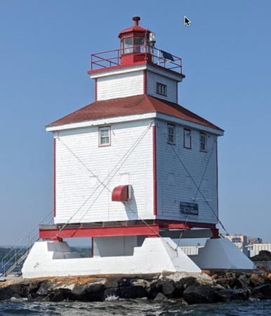
1937. Active; focal plane 15 m (49 ft); red flash every 5 s. 9.5 m (31 ft) square cylindrical wood light tower with lantern and gallery, centered on the roof of a 2-story wood keeper's house. Lighthouse painted white with red trim, lantern red. User-activated fog horn (three 2 s blasts every 60 s). Tom Cullen's 2023 photo is at right, Brian Kresack has a photo, Kaiya Ham has a 2021 photo, Marinas.com has aerial photos, and Google has a satellite view. In 2021 Canadian Lighthouses of Lake Superior was negotiating for a lease of the lighthouse. As the photo at the right shows, the lighthouse was at least partially restored and repainted in 2022-23. Located at the end of the north breakwater sheltering the city's main harbor. Accessibility and site status unknown, but the lighthouse can be seen easily from the downtown waterfront. Tower closed. Owner/site manager: Canadian Coast Guard. . ARLHS CAN-595; USCG 7-16915; CCG I-1152.
Thunder Bay South Entrance
Date unknown. Active; focal plane 8 m (26 ft); green flash every 5 s. 6 m (20 ft) post mounted on a 1-story equipment building, painted white. Brian Kresack has a photo and Google has a satellite view. Located at the end of the breakwater on the south side of the south entrance to Thunder Bay Harbour. Accessible only by boat. Site and tower closed. Owner/site manager: Canadian Coast Guard. CCG I-1150.3.
Kaministiquia (Kamistikia) River Entrance
Date unknown. Active; focal plane 6.5 m (22 ft); red flash every 10 s. 5 m (17 ft) post mounted on a 1-story equipment building, painted white. No photo available but Google has a satellite view. This light is probably similar to the Mission Channel Entrance Light (see below). Located at the south end of the Thundar Bay breakwaters, marking the entrance to the river. Accessible only by boat. Site and tower closed. Owner/site manager: Canadian Coast Guard. CCG I-1144.
Welcome Island (2)
1959 (station established 1906). Active; focal plane unknown; white flash every 10 s. Approx. 20 m (66 ft) square skeletal tower, painted red. 1-story modern keeper's house (1959) and other station buildings. Google has a satellite view. Located on the northeastern point of the island, about 8 km (5 mi) southeast of the Thunder Bay waterfront. Accessible only by boat. Site status unknown. ARLHS CAN-521; CCG I-1133.

Thunder Bay Main Light, Thunder Bay, June 2023
Google Maps photo by Tom Cullen
Mission Channel Entrance
1917. Active; focal plane 13.5 m (44 ft); green flash every 2 s. 7.5 m (25 ft) square 1-story workroom topped by a square skeletal tower. Skeletal tower is green; workroom painted white with red trim and red gallery on the roof. Google has a satellite view. Located at an elbow of the breakwater at the entrance to Mission River, on the south side of Thunder Bay. Accessible only by boat. Site and tower closed. Owner/site manager: Canadian Coast Guard. ARLHS CAN-1016; CCG I-1136.

Western Lake Superior Lighthouses
Angus Island (2)
Date unknown (station established 1927). Active; focal plane 24.5 m (81 ft); white flash every 20 s. Approx. 21 m (70 ft) square pyramidal steel skeletal tower. The 1-1/2 story keeper's house and several other buildings remain of the original light station. ARLHS has Bash's photo, a page for the lighthouse has photos, and Google has a satellite view of the station. The Trowbridge Island and Angus Island lights frame the entrance to Thunder Bay. Located on a small island off the east end of Pie Island on the south side of the entrance. Accessible only by boat. Site open, tower closed. Owner/site manager: Canadian Coast Guard. ARLHS CAN-1026; USCG 7-16895; CCG I-1130.
Pie Island (2)
1904 (station established 1895). Inactive since 1953. Approx. 9 m (30 ft) square pyramidal wood tower with lantern, painted white with red trim. Part of a distant 2025 view from the lake is at right but trees conceal the lighthouse in Google's satellite view. Formerly endangered. In 2010 the Coast Guard announced its intention to demolish the lighthouse, but following protests it reversed course and restored the exterior; Anderson has a photo. There are proposals to relocate the lighthouse. The original (1895) lighthouse was sold and dismantled for its lumber. The current light (focal plane 10 m (33 ft); white flash every 4 s) is on a 5 m (17 ft) skeletal tower. Pie Island is an island about 12 km (7.5 mi) long, located about 10 km (6 mi) south of Thunder Bay and 25 km (15 mi) north of Isle Royale, Michigan. Located at the west end of the island. Accessible only by boat. Site open, tower closed. Site manager: Fort William First Nation. ARLHS CAN-792; CCG I-1158.
Victoria Island (2)
1980s (station established 1887). Active; focal plane 18 m (59 ft); white flash every 4 s. Approx. 12 m (39 ft) square pyramidal skeletal tower carrying two rectangular red and white daymarks. No photo available but Google has a satellite view. The original lighthouse was a square pyramidal wood tower. Located on the western tip of the island, about 16 km (10 mi) northeast of the U.S. border. Accessible only by boat. Owner/site manager: Canadian Coast Guard. ARLHS CAN-859; CCG I-1161.
 

Pie Island Light, Thunder Bay, August 2025
Google Maps photo by JJM
 

Rainy River District Lighthouses

Chapple Township (Rainy River) Lighthouse
* Barwick
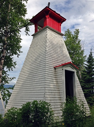
2003. Active (privately maintained and unofficial); focal plane about 12 m (39 ft); continuous white light. Approx. 9 m (30 ft) square pyramidal wood tower with lantern and gallery. Lighthouse covered with wood shingles, painted white. Charlie Webb has a 2020 photo, the township has a page for the lighthouse, a 2016 photo and a 2004 photo are available, Wikipedia has a 2012 photo, and Google has a 2025 street view and a satellite view. Built as a civic project by volunteers, guided by plans supplied by the Coast Guard. The Rainy River drains westward into the Lake of the Woods, forming part of the boundary between Canada and the U.S. Located on the bank of the Rainy River off ON 11 in Barwick, about 80 km (50 mi) west of Fort Frances. Site open, tower closed. Owner/site manager: Chapple Township.

Lake of the Woods Township Lighthouses
The Lake of the Woods is a large lake, roughly 110 km (70 mi) in diameter, mostly in Ontario but partly in Manitoba and the U.S. state of Minnesota. The lake drains by the Winnipeg River to Lake Winnipeg in Manitoba.

**
Tomahawk Island
1901. Inactive since 1963. 10 m (33 ft) square pyramidal wood tower with lantern and gallery, painted white with red trim; lantern roof is red. C.J. Bahan's 2025 photo is at right, Google has a distant satellite view. Originally located on a small island southeast of Bigsby Island in the Lake of the Woods, this lighthouse was sold to private owners in 1963. The lighthouse was relocated to Morson, on the northeastern extension of the lake off ON 11, where it houses a collection of artifacts of early travel on the lake. The lighthouse was replaced at its original location by a post light (focal plane 10 m (33 ft); green flash every 4 s; CCG I-1500). Bing has a satellite view of the original location. Located at the end of Lighthouse Road just south of Morson. Site, museum and tower open by appointment only (call ahead). Owner/site manager: private. ARLHS CAN-1087.

Tomahawk Island Light, Morson, August 2025
Google Maps photo by C.J. Bahan
[Ferris Island (2)]
Date unknown. Active; focal plane 14 m (46 ft); white flash every 4 s. 6.5 m (21 ft) post carrying a red and white daymark. No photo available but Bing has an indistinct satellite view of the location. The original lighthouse, a square wood tower, was removed around 1960. Located on a small island off the western tip of Bigsby Island in the Lake of the Woods. Accessible only by boat. Site status unknown. ARLHS CAN-1062; CCG I-1499.

Information available on lost lighthouses:

Notable faux lighthouses:

Adjoining pages: East: Northern Ontario | Southwest: USA: Minnesota | West: Manitoba

Return to the Lighthouse Directory index | Ratings key

Posted December 16, 2003. Checked and revised September 28, 2025. Lighthouses: 22. Site copyright 2025 Russ Rowlett and the University of North Carolina at Chapel Hill.