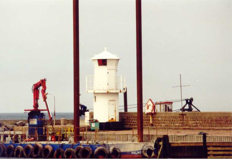
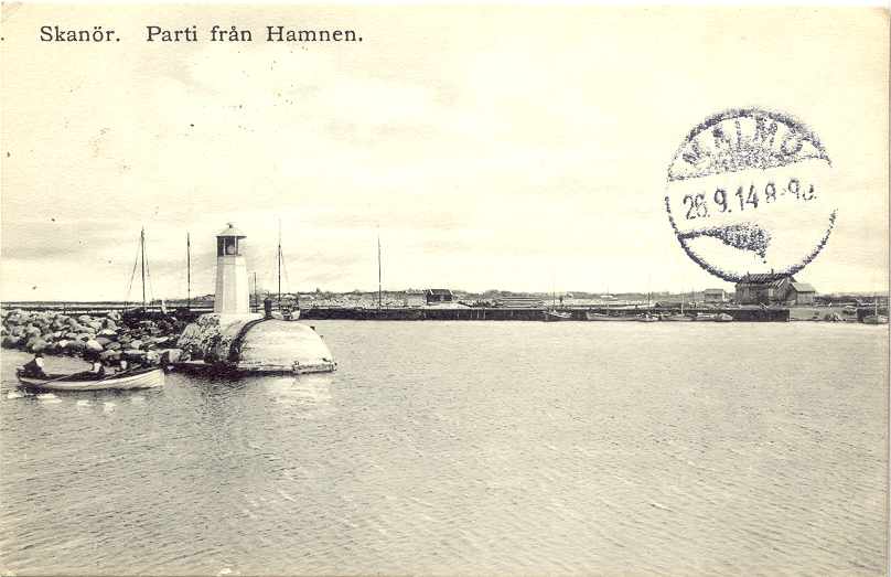
Lighthouses of Sweden: Eastern and Southern Skåne (Scania)

The Kingdom of Sweden (Sverige in Swedish) is the largest country of northern Europe, occupying the entire west coast of the Baltic Sea. Along with its lengthy coast Sweden has a distinguished lighthouse history and a good record of preserving its historic lights. The Swedish Lighthouse Society (Svenska Fyrsällskapet) works actively for the preservation of the lighthouses.

Sweden is divided into 21 counties (län) and the counties are subdivided into townships and municipalities (kommuner). This page covers lighthouses of the eastern an southern coasts of the Swedish county of Scania (Skåne Län), the southernmost county of Sweden. These coasts fhe southernmost basin of the Baltic Sea.

The Swedish word for a lighthouse is fyr. The front light of a range is the nedrefyr (lower light) and the rear light is the övrefyr (upper light). Ö is an island, holme is an islet, skär is a skerry (a tiny island or rocky reef), sund is a strait (often between an island and the mainland), vik is a bay, hav is a sea, udde is a headland, and hamn is a harbor.

Aids to navigation in Sweden are maintained by the Swedish Maritime Administration (Sjöfartsverket).

ARLHS numbers are from the ARLHS World List of Lights. SV numbers are from the Sjöfarsverket light list (Svenska Fyrlista) as reported by the Swedish Lighthouse Society. Admiralty numbers are from volume C of the Admiralty List of Lights & Fog Signals. U.S. NGA List numbers are from Publication 116.

General Sources
Swedish Lighthouse Society (Svenska Fyrsällskapet, SFA)
The Society is active in promoting the preservation of Swedish lighthouses.
Svenskt Fyrväsende
From the SFA web site, data and photos for many of the lighthouses.
Online List of Lights - Skåne - East Coast, South Coast, Falsterbo Canal, Falsterbo, Skanör, and West Coast
Photos by various photographers posted by Alexander Trabas.
Lighthouses in Sweden
Aerial photos posted by Marinas.com.
Lighthouse Pages from Anke and Jens - Sweden
Photos and brief accounts (in English) by two German lighthouse fans.
Leuchttürme und Leuchtfeuer in Schweden - Svenska Fyrar
A large collection of photos and data posted by Erich Hartmann; text in German.
Lighthouses in Sweden
Photos by various photographers available from Wikimedia.
World of Lighthouses - Sweden
Photos by various photographers available from Lightphotos.net.
Schwedische Leuchttürme auf historischen Postkarten
Historic postcard views posted by Klaus Huelse.
GPSNauticalCharts
Navigational chart information for Scania.
Google Maps
Satellite view of Skåne.


Sandhammaren Light, Ystad, July 2024
Google Maps photo by Sandra Hil

East and South Coasts (Baltic Sea) Lighthouses

Kristianstad Lighthouses
Lägerholmen
1908. Active; focal plane 17 m (56 ft); flash every 5 s, white, red or green depending on direction. 17 m (56 ft) round cylindrical concrete tower with lantern and gallery. Lantern painted white; the concrete tower is unpainted. SFA has a page for the lighthouse, Trabas has a 2008 photo, Ola Holst has a photo, and Google has a good satellite view. Located on a small island about 3 km (2 mi) offshore and about 6 km (4 mi) southwest of Tredenborg; the island is a nature reserve. Accessible only by boat. Site status unknown. Site manager: Naturreservatet Lägerholmen. ARLHS SWE-229; SV-6421; Admiralty C7564; NGA 7240.
Åhus Nedre (2)
1963 (station established 1897). Active; focal plane 35 m (115 ft); quick-flashing red light. Approx. 38 m (125 ft) square skeletal tower, also carrying a red triangular daymark. SFA has a page for the lighthouse, Trabas has a 2008 photo, and Google has a satellite view. The rear light is mounted on a grain silo. This is the entrance range for Åhus, the port of Kristianstad. SFA has photos of the original lighthouses. Located on the north side of the harbor entrance. Site and tower closed. SV-6495; Admiralty C7572.3; NGA 7222.

Simrishamn Lighthouses
Stenshuvud
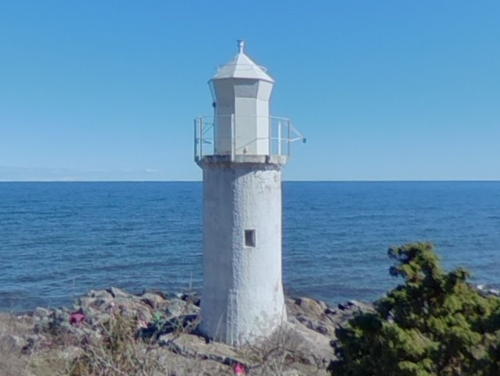
1916. Inactive since 2010. 9.5 m (31 ft) round cylindrical concrete tower with octagonal lantern and gallery. Entire lighthouse painted white. Part of Alex Karpsson's 2021 street view is at right, SFA has a page for the lighthouse, Frank Haamann has a 2008 photo, a 2021 photo is available, Hartmann's page has a photo, and Google has a satellite view. Located on a cape about 8 km (5 mi) northwest of Simrishamn. Accessible by a hiking trail described as "very rocky in places and not recommended for people who have weak ankles or knees." Site open, tower closed. Site manager: Stenshuvuds Nationalpark. . ARLHS SWE-369; ex-SV-6513; ex-Admiralty C7576; ex-NGA 7172.
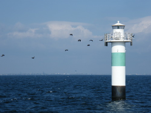
Stenshuvud Light, Simrishamn, April 2021
Google Maps street view by Alex Karpsson
* Simrishamn (2)
1959 (station established 1883). Active; focal plane 16 m (52 ft); white, red or green light depending on direction, 3 s on, 3 s off. 16 m (52 ft) round cylindrical concrete tower with lantern and gallery. Entire lighthouse painted white. Trabas has a 2008 photo, SFA has a page for the lighthouse, Hartmann's page has a photo, and Google has a satellite view and a distant street view. Huelse has a historic postcard view of the original lighthouse; it appears from this view that the present lantern may be the original. Located on the south quay of Simrishamn. Site open, tower closed. ARLHS SWE-341; SV-6523; Admiralty C7582; NGA 7152.

Ystad Lighthouses
Ystad is a town of about 18,000 residents; it is the terminal for ferries to the Danish island of Bornholm and to Swinoujscie, Poland.

*
Sandhammaren
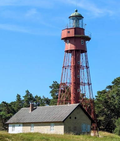
1862 (Gustav von Heidenstam). Active; focal plane 31 m (102 ft); white flash every 5 s. 29.5 m (96 ft) 12-sided cast iron skeletal tower with lantern, gallery, enclosed watch room, and central cylinder. The original 2nd order Fresnel lens remains in use. Entire lighthouse painted red. Sandra Hil's 2024 photo is at the top of this page, Robert Tigge has a 2022 photo, Trabas has a closeup 2008 photo, SFA has a page for the lighthouse, Anke and Jens also have a page, Ulla Lundgren has a good photo showing the full height of the tower, Hartmann's page has a photo, Marinas.com has aerial photos, and Google has a street view and a satellite view. Von Heidenstam built twin towers for this station, but the north tower was deactivated in 1891 and relocated in 1905 to Pite-Rönnskär in Western Bothnia. Sandhammaren is an extensive area of dunes and maritime forest at the southeastern corner of Scania. Located in the forest about 200 m (220 yd) from the point of the cape, about 8 km (5 mi) south of Borrby. Accessible by a short walk from the nearby road, Sandhammarvägen; limited roadside parking is available. Site open, tower closed. . ARLHS SWE-055; SV-6545; Admiralty C2460; NGA 5648.
* Ystad (West Mole Range Rear) (2)
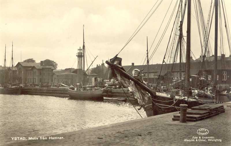
1866 (Gustav von Heidenstam) (station established 1847). Inactive since 1975. 16 m (52 ft) tapered octagonal cast iron tower with lantern and gallery. Lower half of lighthouse painted a dark red; upper half and lantern painted white with dark red trim; lantern dome is greenish metallic. SFA has a page for the lighthouse, a 2008 photo is available, Hartmann's page has a good photo, Andreas Fennhagen has a good closeup of the lantern, Wikimedia has several photos, Huelse has a historic postcard view, and Google has the 2022 street view at right and a satellite view. The lighthouse is located on the traditional waterfront near the ferry terminal. Site open, tower closed. . ARLHS SWE-077; ex-Admiralty C2452.

West Mole Light, Ystad, September 2022
Google Maps street view

Trelleborg Lighthouses
The southernmost town in Sweden, Trelleborg has about 45,000 residents. It is a major ferry port with departures for locations in Germany, Poland, and Lithuania.

* Smygehuk
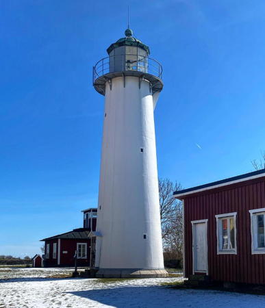
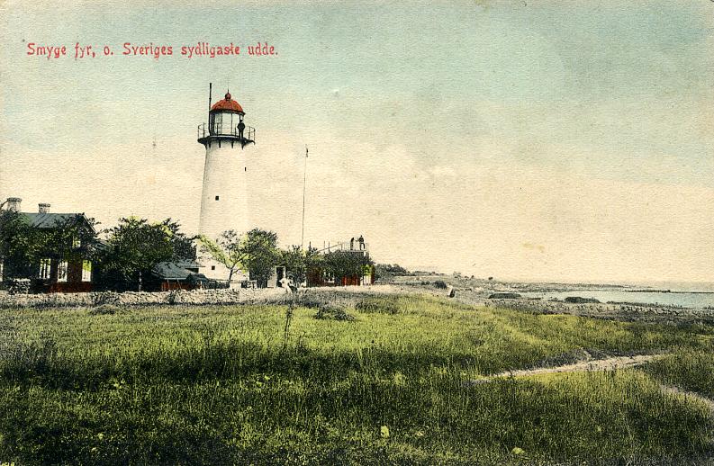
1883. Reactivated (inactive 1975-2001); focal plane 19 m (62 ft); three white flashes, in a 1+2 pattern, every 20 s. 17 m (56 ft) round cast iron tower with lantern and gallery. Lighthouse painted white; lantern dome is greenish metallic. 4th order Fresnel lens in use. A 2022 photo is at right, Larry Myhre has a photo, Trabas has a closeup 2008 photo, Hartmann's page has a photo, SFA also has a page for the lighthouse, Marinas.com has aerial photos, Huelse has a historic postcard view, and Google has a 2025 street view and a satellite view. This lighthouse marks the southernmost tip of Sweden and of the Scandinavian Peninsula. It was deactivated in 1975 in favor of the offshore Kullagrundet lighthouse. In 2001 the abandoned light station was restored with assistance from the Sjöfartsverket and Trelleborg Municipality; the light was reactivated and the keeper's house was renovated as a youth hostel. Located on the coastal highway about 1.5 km (1 mi) west of Smygehamn. Site open, tower closed. Site manager: Smygehuk Hostel . ARLHS SWE-355; SV-6576; Admiralty C2439; NGA 5606.
Kullagrundet
1975. Active; focal plane 18 m (59 ft); white, red or green light depending on direction, 2 s on, 2 s off. 19 m (62 ft) round cylindrical concrete tower with lantern, two galleries, mounted on a round cylindrical concrete caisson. Tower painted red with one black horizontal band, lantern painted white, caisson unpainted. A helipad formerly on top has been removed. SFA has a page with closeup photos, Jette and Olle have a closeup photo, and Trabas has a very distant view, but the lighthouse is not shown in Google's satellite view. This is the southernmost Swedish lighthouse. Located in the Baltic about 3 km (1.8 mi) offshore from Smygehuk and 12 km (7.5 mi) southeast of Trelleborg. Accessible only by boat. Site open, tower closed. ARLHS SWE-036; SV-6580; Admiralty C2445; NGA 5604.
* Trelleborg Ostmole
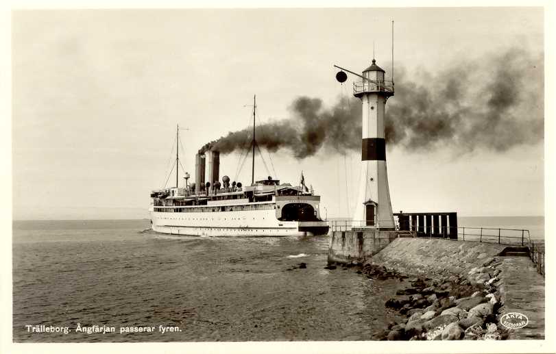
1897. Inactive since 1958. 15.5 m (51 ft) tapered octagonal cast iron tower with lantern and gallery. Lighthouse painted white with one narrow black horizontal band; lantern dome is greenish metallic. SFA has a page for the lighthouse. Lights were displayed on the Trelleborg waterfront as early as 1863. Huelse's historic postcard view shows how this light once stood at the harbor entrance. It became obsolete after World War II when new breakwaters extended the harbor considerably. The lighthouse was removed in October 2007 and placed in storage. The local maritime museum (Trelleborgs Sjöfartsmuseum) sought to acquire the lighthouse and display it outside the museum. However, in July 2010 the lighthouse was moved back to the waterfront at the end of a pier on the east side of the harbor, a location comparable to its original position. A 2012 photo is available and Google has a satellite view. Located at the end of the main ferry pier. Site open, tower closed. ex-SV-6621; ex-Admiralty C2428.

Smygehuk Light, Smygehamn, March 2022
Instagram photo by smygehukfyr Smygehuk Lighthouse
Trelleborg
1930. Inactive since 2013. 14 m (46 ft) round cylindrical cast iron tower with lantern and gallery, mounted atop a round tapered granite caisson. Lighthouse painted with black and white horizontal bands; the caisson is unpainted gray stone. SFA has a page for the lighthouse, Trabas has a closeup, Christer Granquist has a 2011 closeup, and Google has a satellite view. This the oldest of many caisson lighthouses built to replace lightship stations on Sweden's coast. NGA lists the lighthouse as a racon (interactive radar) station. Located about 1.6 km (1 mi) south of the entrance to Trelleborg harbor. Accessible only by boat, but the lighthouse can be viewed from ferries that cross the Baltic from Trelleborg to Rostock, Saßnitz, and Travemünde, Germany. Site open, tower closed. . ARLHS SWE-069; ex-SV-6588; ex-Admiralty C2424; NGA 5572.

West Coast (Öresund) Lighthouses

Vellinge (Falsterbo Peninsula) Lighthouses
The former island of Skanör has become attached to the southwestern tip of Sweden by an isthmus, forming the anvil-shaped Falsterbo peninsula.

*
Falsterbo Kanal No. 1 (South Entrance East Pier)
Date unknown. Active; focal plane 7 m (23 ft); white, red or green light, depending on direction, 8 s on, 2 s off. 5 m (17 ft) round concrete tower with lantern and gallery, painted white. Peter Book has a 2025 photo, Trabas has a 2008 photo, John Timo has a closeup street view, and Google has a satellite view. Built during World War II, the Falsterbo Canal is a short canal across the isthmus joining Skanör to the mainland; it allows small craft to avoid the trip around the end of the peninsula. SFA has a page on the canal and its lights. Located at the end of the east breakwater at the south entrance to the canal. Accessible by walking the pier. Admiralty C2412.8; NGA 5536.
* Falsterbo Kanal No. 3 (2)
2009. Active; focal plane 24 m (79 ft); white light, 1 s on, 1 s off, visible only along the line of the canal. 21 m (69 ft) triangular skeletal tower. The tower also carries a diamond-shaped daymark painted red with a green vertical stripe. Trabas has Hartmann's 2013 photo and Google has a street view and a satellite view. Located at the east end of a sluice gate that is closed when the tidal difference between the ends of the canal creates a dangerous current. Site open, tower closed. Admiralty C2412.4; NGA 5530.
* Falsterbo Kanal No. 4 (2)
2009. Active; focal plane 24 m (79 ft); white light, 1 s on, 1 s off, visible only along the line of the canal. 21 m (69 ft) triangular skeletal tower. The tower also carries a diamond-shaped daymark painted red with a green vertical stripe. Trabas has Hartmann's 2013 photo and Google has a street view and a satellite view. Located at the west end of a sluice gate that is closed when the tidal difference between the ends of the canal creates a dangerous current. Site open, tower closed. Admiralty C2412.6; NGA 5528.
** Falsterbo (Falsterbo Udde)
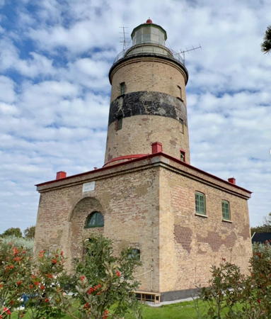
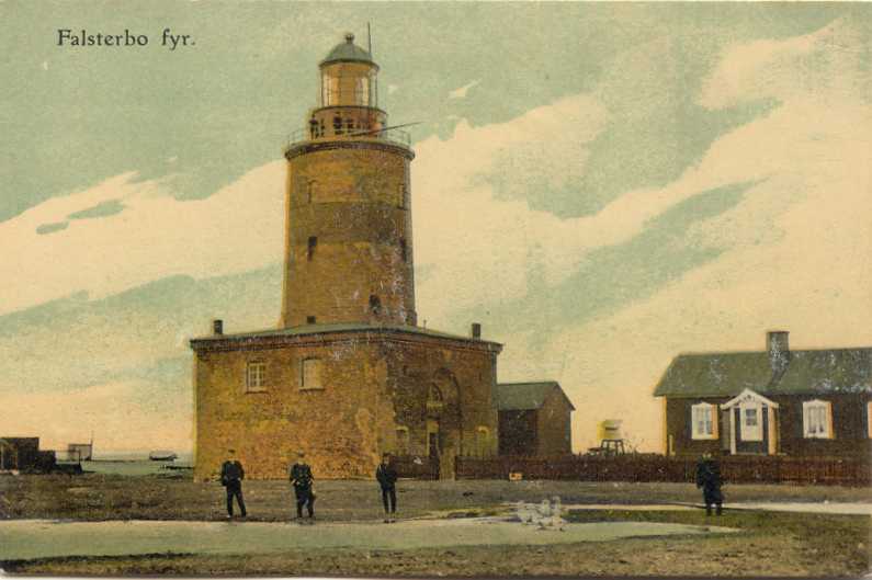
1796 (Olof Tempelman). Reactivated (inactive 1990-1993, now maintained by Vellinge City); focal plane 24 m (79 ft); white light occulting once every 5 s. 25 m (82 ft) round brick tower with lantern and gallery, centered on a 2-story brick keeper's house. 2nd order Henry Lepaute Fresnel lens (1842) in use. The lighthouse is unpainted brick with one black horizontal band; the lantern dome is painted red. A 2023 photo is at right, SFA has a page for the lighthouse, Trabas has a closeup 2008 photo, Anke and Jens have a page for the lighthouse, Hartmann's page has a photo, Hans Adam Sønderby has a 2023 photo, Marinas.com has aerial photos, Huelse has a historic postcard view, and Google has a satellite view. This historic lighthouse marks the extreme southwestern corner of Scania and Sweden and the southern entrance to the Öresund. Lights have been displayed here in various ways since at least the 1220s, and a vippfyr (basket light) was maintained starting in 1635. Since 1973 the offshore Falsterborev lighthouse has been the key light for vessels rounding the southern tip of Sweden, so the lighthouse was deactivated in 1990. It was restored in 1993 by the Vellinge City Council after many requests from the public. Since 1909 the surrounding area has been the Falsterbo Golfklubb, one of the best known golf courses in Sweden, with the lighthouse standing beside the 15th tee. Located at the southwestern tip of the Falsterbo peninsula. Site open; tower open to guided tours by prior arrangement with the attendent. . ARLHS SWE-008; SV-6648; Admiralty C2416; NGA 5556.

Falsterbo Light, September 2023
Instagram photo by inglano
Falsterborev (Falsterbo Reef)
1972 (lightship station established 1884). Active; focal plane 29 m (95 ft); white, red or green light depending on direction, 4 s on, 4 s off. 30.5 m (100 ft) round cylindrical concrete tower with four galleries and a helipad on top. Lighthouse painted with red and black horizontal bands. Juergen Baack's 2023 photo at right, Trabas has a 2021 photo, and Huelse has a photo, but the lighthouse is not shown in Google's satellite view. This is Sweden's tallest lighthouse, marking the turn from the Öresund into the Baltic Sea. It replaced Lightship 28 Falsterborev, which had a long second career as a restaurant in Belgium but sank in 2007 at Le Havre, France. This was Sweden's last active lightship station. Including the caisson, the tower has a total height of 48.5 m (159 ft). At last report it still had its helipad. Located in the middle of the southern entrance to the Öresund, about 12 km (7.5 mi) southwest of Falsterbo and the same distance east of Stevns Klint, Denmark. Accessible only by boat. Site open, tower closed. SV-6656; Admiralty C2417; NGA 5560.
* Fyrskepp 8 Svinbådan (lantern)
1870. Decommissioned 1972. Lantern and the upper portion of the mast, painted red. A 2026 photo is available, Hartmann has a photo and historical notes (bottom of the page), Benoît Derrier has a photo, and Google has a 2024 street view and a satellite view. Built as a two-masted schooner, this lightship was converted to a powered vessal in 1885. It served at Svinbådan, then at Falsterborev, and from 1931 to 1972 it was a reserve lightship for the Malmö station. After it was decommissioned as a lightship it served several years as a pilot vessel for Malmö before being scrapped in 1976. The lantern and part of the mast, removed in 1972, have stood ever since on the waterfront of the yacht harbor in Skanör. Site open, tower closed.
* Skanör (2)
1947 (station established 1881). Active; focal plane 7 m (23 ft); red or green light depending on direction, 2 s on, 2 s off, 2 s on, 4 s off. 6 m (20 ft) round cylindrical concrete tower with lantern and gallery, painted white. Trabas has a closeup 2008 photo, Andreas Köhler has a fine 2017 closeup, Hartmann has a page for the lighthouse, Huelse has both a photo and a historic postcard view of the original lighthouse, and Google has a street view and a satellite view. Located on the north breakwater of Skanör, about 2.5 km (1.5 mi) north of Falsterbo. Site open, tower closed. ARLHS SWE-345; SV-6733; Admiralty C2414; NGA 5540.
Höllviken
1964. Active; focal plane 9 m (30 ft); two flashes every 6 s, white, red or green depending on direction. 10 m (33 ft) round cylindrical concrete tower with lantern and gallery. Lantern and upper half of the tower painted white, lower half green. Hartmann has a page for the lighthouse, and Trabas also has a photo, but the lighthouse is not shown in Google's satellite view. Located in the Öresund about 3 km (2 mi) west of Höllviken, an artificial harbor south of Malmö. Accessible only by boat. Site open, tower closed. ARLHS SWE-197; SV-6710; Admiralty C2408; NGA 5496.

Falsterborev Light, Baltic Sea, May 2023
MarineTraffic.com photo by Juergen Baack

Flintrännan (Flint Channel) Lighthouses

The Flint Channel is a dredged channel through the narrow passage of the Öresund between Malmö and the Danish island of Saltholm. Historically this important channel (the main entrance to the Baltic Sea) was marked by lightships. Wikimedia has a historic photo of one of them, the Kalkgrundet. During the 1960s the lightships were replaced by four caisson lighthouses: Kalkgrundet, Oscarsgrundet Nordost, Flinten Sydväst, and Oscarsgrundet Sydväst. However, the construction of the Öresund Bridge-Tunnel in 1995-99 required that a new channel be dredged. The new channel is marked by a series of cylindrical lighthouses, including the original caisson towers at new locations, plus about a dozen buoys and lightfloats. SFA has a page on the channel's history and Hartmann has a page with photos of the lighthouses.

Flintrännan Sydväst (Flinten Sydväst, relocated)
1966. Active; focal plane 12 m (39 ft); white, red or green light, depending on direction, occulting twice every 8 s. 13 m (43 ft) round cylindrical concrete tower with lantern and gallery, painted white with one red (formerly green) horizontal band. An SFA photo is at right and Trabas has a photo but the lighthouse is not seen in Google's satellite view. This is the original Flinten Sydväst lighthouse; in 1999 it was relocated about 7.5 km (4 mi) south southeast to mark the southwestern entrance to the Flintrännan. Located about 6 km (3.5 mi) southwest of the Öresund Bridge Tunnel. Accessible only by boat. Site and tower closed. SV-6739.05 (ex-6797); Admiralty C2349.5; NGA 5494.
Flintrännan No. 19
1999. Active; focal plane 12 m (39 ft); green light, 2 s on, 2 s off. 13 m (43 ft) round cylindrical concrete tower with lantern and gallery, painted white with one green horizontal band. Trabas has a photo and Hartmann has a photo (fourth lighthouse on the page) but the light is not seen in Bing's satellite view. Located about 2.5 km (1.5 mi) south of the Öresund Bridge Tunnel. Accessible only by boat. Site and tower closed. Admiralty C2349.29.
Flintrännan No. 18
1999. Active; focal plane 12 m (39 ft); red light occulting every 8 s. 13 m (43 ft) round cylindrical concrete tower with lantern and gallery, painted white with one red horizontal band. Trabas has a photo and Hartmann has a photo (third lighthouse on the page), but the light is not seen in Bing's satellite view. Located about 400 m (1/4 mi) southeast of the No.19 light. Accessible only by boat. Site and tower closed. Admiralty C2349.28; NGA 5486.

Flintrännan Sydväst Light, Öresund, December 2016
SFA Creative Commons photo by CL
Flintrännan No. 17
1999. Active; focal plane 12 m (39 ft); green light, 2 s on, 2 s off. 13 m (43 ft) round cylindrical concrete tower with lantern and gallery, painted white with one green horizontal band. A photo is at right, Trabas has a photo, Hartmann has a photo (second lighthouse on the page), and Google has a distant street view from the bridge, but the light is not seen in Bing's satellite view. Located about 1.5 km (1 mi) south of the Öresund Bridge Tunnel. Accessible only by boat. Site and tower closed. Admiralty C2349.27.
Flintrännan No. 16
1999. Active; focal plane 12 m (39 ft); red light occulting every 8 s. 13 m (43 ft) round cylindrical concrete tower with lantern and gallery, painted white with one red horizontal band. Trabas has a photo, Google has a distant street view from the bridge and Bing has a satellite view. Located about 400 m (1/4 mi) southeast of the No.17 light Accessible only by boat. Site and tower closed. Admiralty C2349.26; NGA 5485.
Flintrännan No. 7
1999. Active; focal plane 12 m (39 ft); green light, 2 s on, 2 s off. 13 m (43 ft) round cylindrical concrete tower with lantern and gallery, painted white with one green horizontal band. Trabas has a photo and Google has a very distant street view from the bridge, but the lighthouse is not shown in Google's satellite view. Located about 1.6 km (1 mi) north of the Öresund Bridge Tunnel. Accessible only by boat. Site and tower closed. SV-6739.5; Admiralty C2349.17; NGA 5492.
Flintrännan No. 6
1999. Active; focal plane 12 m (39 ft); red light occulting once every 8 s. 13 m (43 ft) round cylindrical concrete tower with lantern and gallery, painted white with one green horizontal band. Trabas has a photo and Google has a very distant street view from the bridge, but the lighthouse is not shown in Google's satellite view. This is apparently the original Oskarsgrundet Sudväst lighthouse. Located about 400 m (1/4 mi) southeast of the No.7 light . Accessible only by boat. Site and tower closed. Admiralty C2350.5; NGA 5493.
Flintrännens Fyr 17
Flintrännan Light 17, Öresund, August 2009
ex-Panoramio photo copyright gpermant; used by permission
Flintrännan No. 5
1999. Active; focal plane 12 m (39 ft); green light, 2 s on, 2 s off. 13 m (43 ft) round cylindrical concrete tower with lantern and gallery, painted white with one green horizontal band. Trabas has a photo but the lighthouse is not shown in Google's satellite view. Located about 4 km (2.5 mi) north of the Öresund Bridge Tunnel. Accessible only by boat. Site and tower closed. Admiralty C2349.15.
Flintrännan No. 4
1999. Active; focal plane 12 m (39 ft); red light occulting once every 8 s. 13 m (43 ft) round cylindrical concrete tower with lantern and gallery, painted white with one red horizontal band. Trabas has a photo but the lighthouse is not shown in Google's satellite view. Located about 400 m (1/4 mi) southeast of the No. 5 light. Accessible only by boat. Site and tower closed. Current location: Admiralty C2351.5; NGA 5491.
Flintrännan No. 1 (Flintrännan Nordost, ex-Oskarsgrundet)
1962. Active; focal plane 13 m (43 ft); white, red or green light, depending on direction, occulting twice every 8 s. 13 m (43 ft) round cylindrical concrete tower with lantern and gallery, painted white with one red horizontal band. A photo is at right, Trabas has a photo, and Bing has a satellite view. This is apparently the original Oskarsgrundet Nordost lighthouse; it marks the northeastern entrance to the Flintrännan. Located about 2.5 km (1.5 mi) off Limhamn, on the west side of Malmö, and about 4.5 km (2.8 mi) north of the Öresund Bridge Tunnel. Accessible only by boat. Site and tower closed. SV-6739; Admiralty C2352.5; NGA 5480.

Flintrännan Nordost Light, Öresund, February 2015
SFA Creative Commons photo by Leif Elsby
 

Information available on lost lighthouses:

Notable faux lighthouses:

Adjoining pages: North: Halland | East: Blekinge | South: Denmark: Bornholm | West: Denmark: Copenhagen Area

Return to the Lighthouse Directory index | Ratings key

Posted April 9, 2007. Checked and revised March 30, 2025. Lighthouses: 28; lightships: 1. Site copyright 2025 Russ Rowlett and the University of North Carolina at Chapel Hill.