Lighthouses of Sweden: Western Skåne (Scania)

The Kingdom of Sweden (Sverige in Swedish) is the largest country of northern Europe, occupying the entire west coast of the Baltic Sea. Along with its lengthy coast Sweden has a distinguished lighthouse history and a good record of preserving its historic lights. The Swedish Lighthouse Society (Svenska Fyrsällskapet) works actively for the preservation of the lighthouses.

Sweden is divided into 21 counties (län) and the counties are subdivided into townships and municipalities (kommuner). This page covers lighthouses of the west coast Swedish county of Scania (Skåne Län), the southernmost county of Sweden, from Malmö northward. This coast faces west on the Kattegat and the Öresund, which separate Sweden and Denmark. It includes the two major port cities of Helsingborg and Malmö.

The Swedish word for a lighthouse is fyr. The front light of a range is the nedrefyr (lower light) and the rear light is the övrefyr (upper light). Ö is an island, holme is an islet, skär is a skerry (a tiny island or rocky reef), sund is a strait (often between an island and the mainland), vik is a bay, hav is a sea, udde is a headland, and hamn is a harbor.

Aids to navigation in Sweden are maintained by the Swedish Maritime Administration (Sjöfartsverket).

ARLHS numbers are from the ARLHS World List of Lights. SV numbers are from the Sjöfarsverket light list (Svenska Fyrlista) as reported by the Swedish Lighthouse Society. Admiralty numbers are from volume C of the Admiralty List of Lights & Fog Signals. U.S. NGA List numbers are from Publication 116.

General Sources
Swedish Lighthouse Society (Svenska Fyrsällskapet, SFA)
The Society is active in promoting the preservation of Swedish lighthouses.
Svenskt Fyrväsende
From the SFA web site, data and photos for many of the lighthouses.
Online List of Lights - Sweden
Photos by various photographers posted by Alexander Trabas.
Lighthouses in Sweden
Aerial photos posted by Marinas.com.
Lighthouse Pages from Anke and Jens - Sweden
Photos and brief accounts (in English) by two German lighthouse fans.
Leuchttürme und Leuchtfeuer in Schweden - Svenska Fyrar
A large collection of photos and data posted by Erich Hartmann; text in German.
Lighthouses in Sweden
Photos by various photographers available from Wikimedia.
World of Lighthouses - Sweden
Photos by various photographers available from Lightphotos.net.
Schwedische Leuchttürme auf historischen Postkarten
Historic postcard views posted by Klaus Huelse.
GPSNauticalCharts
Navigational chart information for Scania.


Kullen Light, Höganäs, May 2021
Instagram photo by Handelsplats Höganäs

Malmö Lighthouses
Malmö is the third largest city of Sweden with an urban population of about 365,000 and a metropolitan population of more than 700,000. A traditional center for shipbuilding, it continues to be an important port.

Klagshamn Övre
Date unknown. Active; focal plane 14 m (46 ft); continuous green light. Approx. 12 m (39 ft) square pyramidal steel skeletal tower carrying an orange triangular daymark, point down. Trabas has Hartmann's photo, SFA has a page for the range lights, and Google has a satellite view. The front light is on a similar, shorter tower. Located in a forest behind the waterfront of Klagshamn, a small harbor on the southwest side of Malmö. Site status unknown. SV-6722.01; Admiralty C2403.1; NGA 5508.
* Lernacken
1952. Inactive since 1999. 6 m (20 ft) round cylindrical concrete tower with lantern and gallery, painted white. Ole A 2024 photo is at right, SFA has a page for the lighthouse, Carl Fredrik has a photo, Petter Duvander has a good closeup, and Google has a street view and a satellite view. This lighthouse is located a short distance north of the eastern end of the Öresund Bridge-Tunnel (E-20); it became obsolete after that crossing was completed in 1999. Site open, tower closed. ARLHS SWE-474; ex-SV-6738; ex-Admiralty C2401.
#Limhamn Övre
Date unknown. Inactive since 2017 and removed around 2020. Approx. 15 m (49 ft) triangular skeletal tower carrying an orange triangular daymark, point down. Trabas has a photo and Google has a 2019 street view. The front light was on a post. Google's 2022 street view and satellite view confirm the removal. Located on the waterfront of Limhamn, a small boat harbor on the south side of Malmö. Site open, tower closed. ex-SV-6740.01; ex-Admiralty C2398.1; ex-NGA 5464.

Lernacken Light, Malmö, June 2024
Instagram photo by cronansfoto
 
Malmö Vågbrytarbank (Outer Breakwater)
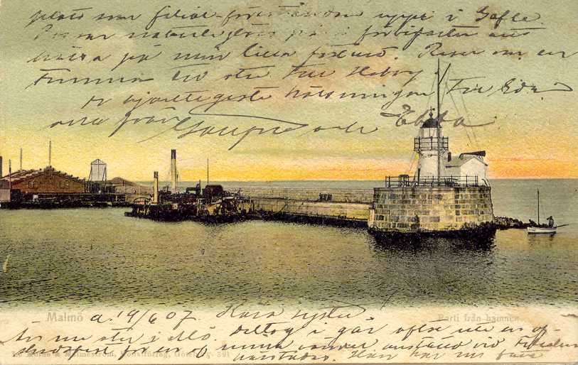
Date unknown. Active; focal plane 11 m (36 ft); white, red or green light, depending on direction, 5 s on, 5 s off. 12 m (39 ft) round cylindrical concrete tower with gallery, mounted on a round stone base. Lighthouse painted white. Trabas has a photo, Olof Adell has another photo, a closeup is available, and Google has a satellite view and a distant street view from shore. The original lantern has been replaced fairly recently by a modern structure. Located on a notorious rocky shoal just off the entrance to Malmö harbor, about 300 m (330 yd) west of the north breakwater; a submerged "breakwater" of dredge spoil connects the shoal to shore. Accessible only by boat, but the lighthouse can be viewed easily from the waterfront or from vessels entering or leaving the harbor. Site and tower closed. ARLHS SWE-272; SV-6823; Admiralty C2358; NGA 5376.
* Malmö Hamn (Range Front)
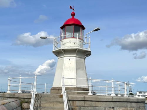
1925. Inactive since 1983. 8 m (26 ft) octagonal cast iron tower with lantern and gallery. Lighthouse painted white, lantern dome red; the end of the pier is painted white with a green horizontal band. Anders Gustavson's 2021 photo is at right, SFA has a page for the two range lighthouses, Predrag Markovic has a 2021 photo, Hartmann's page has a closeup photo, Steffanie Müller has a 2008 photo, and Google has a street view and a satellite view. This was formerly the front light of a range with the the Malmö lighthouse (next entry) as the rear light; the range was discontinued because the line of approach to the harbor changed. Huelse has a historic postcard view showing that this pier was originally at the entrance to the harbor. Today the harbor has been extended seaward about 800 m (1/2 mi), and the pier now projects into a basin known as the Frihamn (Free Harbor). Located on a short pier at the end of Hjälmarekajen quay. Site open, tower closed. ARLHS SWE-481; ex-Admiralty C2359.

Malmö Hamn Light, Malmö, August 2021
Google Maps photo
by A Predrag Markovic
* Malmö (Inre Hamn) (Range Rear) (2)
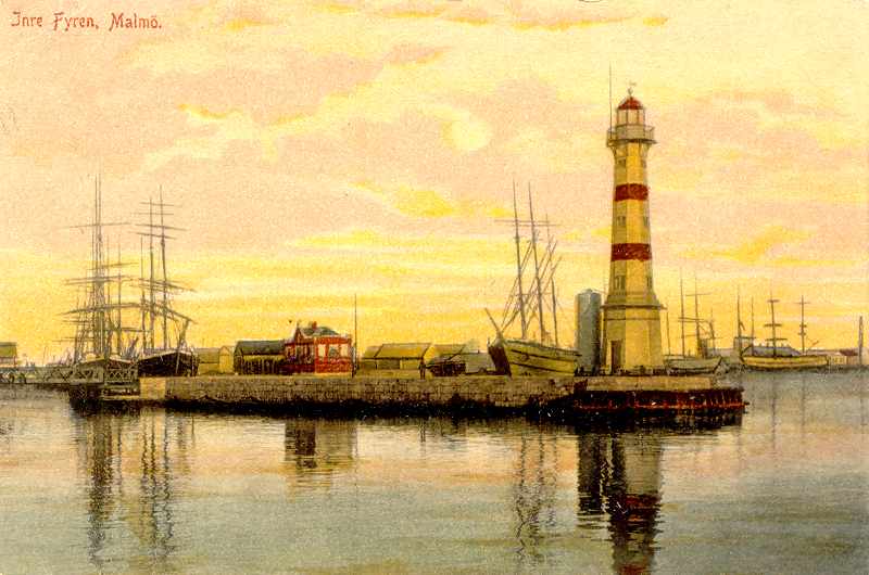
1878 (station established 1822). Inactive since 1983 (a decorative light is displayed; charted as a landmatk). 20 m (66 ft) octagonal cast iron tower with lantern and gallery, mounted on an octagonal stone base. Tower painted white with two narrow red horizontal bands; the lantern dome is also red. Daniel Böhm's 2022 photo is at right, SFA has a page for the two range lighthouses, Kevin Hoogheem has a view from the south, a 2008 photo is available, Hartmann's page has a photo, a dawn photo shows the decorative light, Google has a street view and a satellite view, and Huelse has a historic postcard view showing the light when it stood on a pierhead projecting into the harbor. The light is now located on the Stora Varvsgaten at the intersection of the Hjälmarekajen quay. Site open, tower closed. . ARLHS SWE-045; ex-SV-6810; ex-Admiralty C2359.1.
* [Malmö Range Front]
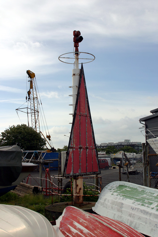
Date unknown. Active; focal plane 13 m (43 ft); white light occulting once every 5 s. 10 m (33 ft) triangular skeletal tower carrying a red triangular daymark, point up. Trabas has a photo and Google has a street view and a satellite view. This is the modern entrance range for Malmö. Located in the Harbor Park (Hamnparken) at the end of the Grimsbygaten on the east side of the harbor. Site open, tower closed. Admiralty C2360; NGA 5360.
* Malmö Range Rear
Date unknown. Active; focal plane 20 m (66 ft); quick-flashing white light. 15 m (49 ft) triangular skeletal tower carrying a red triangular daymark, point down. Trabas has a photo and Google has a street view and a satellite view. Located in the Kristianiagaten in the harbor area. Site open, tower closed. Admiralty C2360.1; NGA 5364.
* Frihamn Range Rear
Date unknown. Active; focal plane 32 m (105 ft); quick-flashing white light. 30 m (98 ft) square steel skeletal tower carrying an orange diamond-shaped daymark. Trabas has a photo and Google has a street view and a satellite view. The front light is mounted on the roof of a warehouse. Located in the harbor area on the Grimsbygaten. Site open, tower closed. Admiralty C2374.1; NGA 5400.
Industrihamn Range Rear
Date unknown. Active; focal plane 20 m (66 ft); white light occulting once every 3 s. 20 m (66 ft) triangular steel skeletal tower carrying an orange diamond-shaped daymark. Trabas has a photo and Google has a satellite view and a street view across the harbor. The front light is on a similar, shorter tower. Located on the waterfront at the end of the Blidögaten. Site status unknown. Admiralty C2378.1; NGA 5416.

Malmö Light, Malmö, July 2022
Google Maps photo
by Daniel Böhm

Kävlinge Municipality Lighthouse
Pinhätten
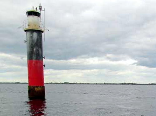
1960. Active; focal plane 12.5 m (41 ft); white, red or green light, depending on direction, 2 s on, 8 s off. 13 m (43 ft) round cylindrical concrete tower with lantern and gallery. The tower is painted black with one red horizontal band; lantern painted white. Niels Stumman's photo at right is from SFA's page for the lighthouse, Trabas has a distant view, and Bing has a satellite view. The white sectors of this light guide coastwise traffic. Located in the Öresund about 2.5 km (1.5 mi) west of Barsebäckshamn. Accessible only by boat. Site open, tower closed. ARLHS SWE-314; SV-6951; Admiralty C2336; NGA 5320.

Landskrona Lighthouses
* Landskrona South Range Rear
Date unknown. Active; focal plane 14 m (46 ft); green light, occulting once every 4 s, synchronized with the front light. 12 m (39 ft) square skeletal tower. The tower also carries a large diamond-shaped daymark, painted green. Trabas has a photo and Google has a street view and an indistinct satellite view. The front light is a small beacon suspended from a post. SFA has a page with a drawing of a small lighthouse built at Landskrona in 1872. The range marks the south side of the entrance channel. Located in a parking lot on the Landskrona waterfront. Site open, tower closed. SV-6976.01; Admiralty C2328.1; NGA 5308.
* Landskrona North Range Rear
Date unknown. Active; focal plane 14 m (46 ft); red light, occulting once every 4 s, synchronized with the front light. The light and a large diamond-shaped daymark, painted red, are mounted on the west end of a 4-story waterfront building. Trabas has a photo, Erik Wahlstrom has a photo, and Google has a street view and a satellite view. The range marks the north side of the entrance channel. The front light is on a short post. Located at the corner of Hamngaten and Lilla Strandgaten on the Landskrona waterfront. Site open, tower closed. SV-6980.01; Admiralty C2332.1; NGA 5316.

Pinhätten Light, Barsebäckshamn, February 2015
SFA Creative Commons photo
by Niels Stumman

Ven (Hven) Lighthouses
Ven (Hven in the Danish spelling) is an island in the Öresund, roughly 3 km (2 mi) long and 2 km (1.25 mi) wide, lying about 4 km (2.5 mi) off the Swedish coast. Though formerly a part of Denmark, the island has been Swedish since 1660. It is devoted mostly to farming and has a population of less than 400. Ferry service to the island is available from Landskrona, and the island is administered as part of Landskrona municipality.

*
Haken Nedre (Range Front) (2)
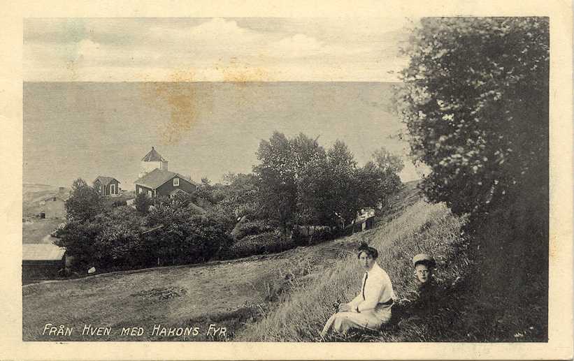
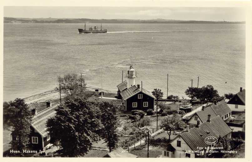
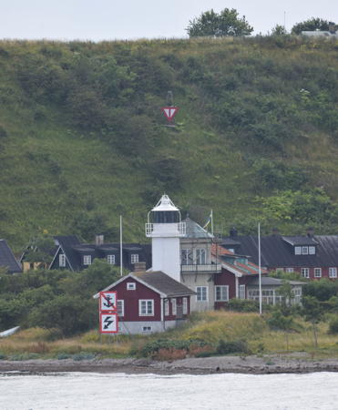
1939 (station established 1890). Active; focal plane 15 m (49 ft); white, red or green light, depending on direction, 4 s on, 4 s off. 12.5 m (41 ft) round cylindrical concrete tower with lantern and gallery, attached by a covered passage to the original 1-1/2 story wood keeper's house. Lighthouse painted white, house red. A 2022 photo is at right, Trabas has a photo by Karl-Heinz Wellm, Hartmann has a page for the lighthouse, Martin Hansen has another photo, Huelse has historic postcard views of the original and present lighthouses, and Google has a satellite view of the station. The rear light of the range is a small lantern 90 m (100 yd) southwest; Google has a satellite view and Jim Smith contributed his photo showing both lights. Located near the northeastern tip of the island, about 800 m (1/2 mi) north of the ferry terminal at Bäckviken. Site open, tower closed; the buildings are probably privately owned. ARLHS SWE-168; SV-7002; Admiralty C1936; NGA 5272.
* Ven Södra Udde (2)
1967 (station established 1941). Active; focal plane 35 m (115 ft); white, red or green light, depending on direction, occulting three times every 30 s. 8.5 m (28 ft) round cylindrical tower with lantern and gallery, painted white with one red horizontal band. SFA has a page for the lighthouse, Trabas has a closeup by Karl-Heinz Wellm, a 2005 photo is available, Marinas.com has aerial photos, and Google has a satellite view. Located in an open field near the southeastern end of the island, about 1 km (0.6 mi) southwest of Bäckviken. Site open, although probably privately owned, tower closed. ARLHS SWE-334; SV-6996; Admiralty C1932; NGA 5280.
* Kyrkbacken
Date unknown. Active; focal plane 7 m (23 ft); white, red or green light, depending on direction, 2 s on, 2 s off. 6 m (20 ft) round cylindrical tower with lantern and gallery, painted white. A 2018 photo is available, Hartmann has a page for the lighthouse, Aiham Azmeh has a street view, Rune Jensen has a closeup 2023 street view, and Google has a satellite view. Located at the end of the south breakwater at Kyrkbacken, on the west side of the island facing Denmark. Accessible by walking the mole. Site open, tower closed. SV-6992; Admiralty C1930; NGA 5288.
Ven (1)
1871. Inactive. Approx. 11 m (36 ft) octagonal cylindrical wood tower with lantern and gallery rising from a 1-1/2 story wood keeper's house. Tower painted white, house red with a white vertical stripe continuing the white of the light tower. Rune Jensen has a closeup 2023 street view and Google has a satellite view. Located at the end of the Fyrvägen near the northwestern tip of the island about 600 m (0.4 mi) northwest of Kyrkbacken. Site status unknown, probably private. ARLHS SWE-034.

Haken Nedre Light, Ven, May 2022
Google Maps photo by E Kno
Ven (2)
Date unknown (1967?). Active; focal plane 24 m (79 ft); white, red or green light, depending on direction, 2 s on, 8 s off. 8.5 m (28 ft) round cylindrical tower with lantern and gallery, painted white with one red horizontal band. Christine Linden has a 2022 photo, SFA has a page for the lighthouse, Trabas has a closeup photo by Karl-Heinz Wellm, Marinas.com has aerial photos, and Google has a satellite view. Located in a field off the Mossvägen at the extreme northwestern tip of the island, about 400 m (1/4 mi) north of the original lighthouse. Site status unknown, probably open. SV-6987; Admiralty C1928; NGA 5284.

Helsingborg Lighthouses
Helsingborg is a city of about 115,000 residents located at the narrowest point of the Öresund strait; the Danish town of Helsingør is only 4 km (2.5 mi) away. As a result Helsingborg is an important ferry port with more than 70 departures daily.

*
Råå Pierhead
1872. Active; focal plane 7 m (23 ft); quick-flashing light, white, red or green, depending on direction. 6 m (20 ft) octagonal cast iron skeletal tower with lantern and gallery, painted white. Erik Forsberg has a photo, Trabas has a good photo, Jacek Lesniowski has a closeup, Hartmann has a page for the lighthouse, and Google has a satellite view. Located at the end of the breakwater of what is now a popular small boat harbor at Råå, on the south side of Helsingborg. Probably accessible in good weather by walking the mole. Site open, tower closed. SV-7018; Admiralty C2316; NGA 5264.
Sydhamn Range Front
Date unknown. Active; focal plane 22 m (72 ft); white light, 1.5 s on, 1.5 s off. Approx. 19 m (62 ft) square skeletal tower painted white and carrying an orange triangular daymark, point up. Trabas has a photo and Google has a satellite view. Located on a quay in the south harbor of Helsingborg. Site and tower closed. Admiralty C2306; NGA 5216.
Sydhamn Range Rear
Date unknown. Active; focal plane 28 m (92 ft); white light, 1.5 s on, 1.5 s off. Approx. 26 m (85 ft) square skeletal tower painted white and carrying an orange triangular daymark, point down. Trabas has a photo and Google has a satellite view. Located 254 m (275 yd) north of the front light. Site and tower closed. Admiralty C2306.1; NGA 5220.
* Helsingborg
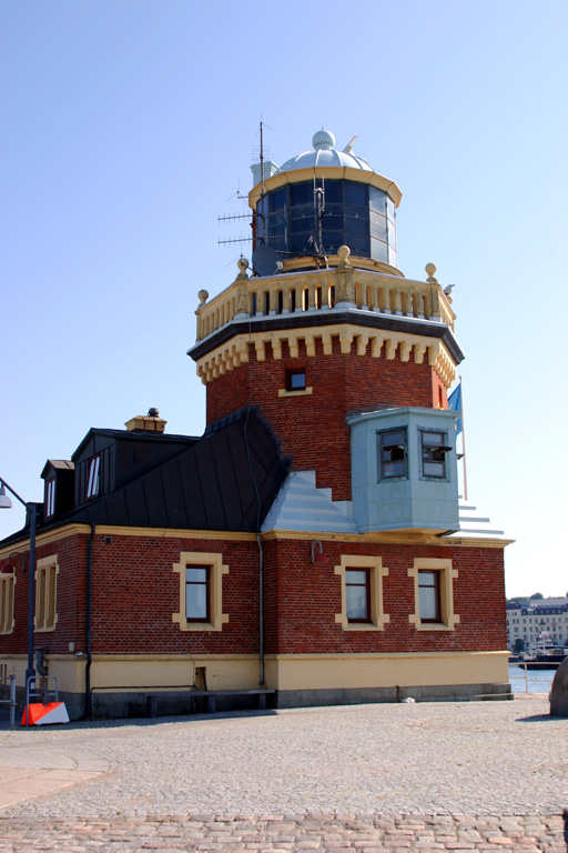
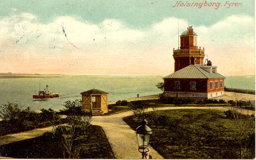
1889 (John Höijer). Active; focal plane 17 m (56 ft); white or green light, depending on direction, occulting once every 15 s. 19 m (62 ft) octagonal cylindrical brick tower rising from a 1-1/2 story brick pilot station. The lighthouse is red brick with trim in the Swedish colors, blue and gold; the lantern dome is blue. George Charleston's 2's 2020 photo is at right, Morten Perriard has a nice closeup photo, Trabas has a closeup, Larry Myhre has a 2007 closeup, Hartmann's page has a photo, SFA has a page for the lighthouse, Marinas.com has aerial photos, Huelse has a historic postcard view, and Google has a street view and a satellite view. This lovely and historic lighthouse welcomes travelers arriving in Helsingborg on Scandlines ferries from Helsingør, Denmark. The lighthouse was designed by John Hoijer as part of the development of Helsingborg's North Harbor; it also served as the pilot station. The Swedish edition of Wikipedia has an article on the lighthouse. Located at the south end of the main north mole at Helsingborg. Owner: Statens Fastighetsverk (National Property Board). Site manager: City of Helsingborg. Site open, tower closed. . ARLHS SWE-029; SV-7039; Admiralty C2288; NGA 5184.

Helsingborg Light, Helsingborg, August 2020
Google Maps photo by George Charleston
Helsingborg North Entrance
Date unknown. Active; focal plane 8.5 m (27 ft); quick-flashing red light. 6 m (20 ft) square pyramidal skeletal tower mounted on a square 1-story metal equipment shelter. Enire structure painted red. The tower is floodlit at night. Trabas has Hartmann's photo, a view from the sea is available, Stefan Hansson has a distant street view along the pier, and Google has a satellite view. Located at the end of the breakwater extending from the historic lighthouse. Accessible by walking the pier although it's a long, highly exposed walk. Site open, tower closed. Admiralty C2291; NGA 5200.

Höganäs Lighthouses
Svinbådan
1961 (lightship station established 1866). Active; focal plane 24 m (79 ft); white, red or green light, depending on direction, 4 s on, 4 s off. 25 m (82 ft) round cylindrical concrete tower with upper and lower galleries and a helipad on top; the light has been moved to a round lantern perched atop the helipad. Lighthouse painted black with one red horizontal band; lantern painted red with a white roof; the tower is also floodlit. SFA has a page for the lighthouse, Trabas has Andreas Köhler's photo, Martin Hansen has another good photo, Marinas.com has aerial photos, Google has a very distant street view from shore, and Bing has a fuzzy satellite view. This light guides vessels entering the Öresund from the Kattegat. In 1994 a new lantern was placed on top of the helipad, which is no longer usable. A sibling of the Tylögrund lighthouse, this tower is located on a shoal in the Öresund about 1.5 km (1 mi) off the coast at Viken. Accessible only by boat. Site open, tower closed. . ARLHS SWE-067; SV-7121; Admiralty C2274; NGA 5124.
Höganäs (2)
1951 (station established 1887). Active; focal plane 12.5 m (41 ft); white, red or green light, depending on direction, occulting twice every 8 s; the tower is also floodlit. 10 m (33 ft) round cylindrical tower with a small lantern and gallery. Lighthouse painted white with one red horizontal band. Andreas Köhler's 2017 photo is at right, Trabas has a photo, C.L. Lindmark has a sunset photo, and Google has a satellite view. SFA has a photo of the original lighthouse, an octagonal brick tower. Located at the end of the breakwater mole at Höganäs. Site and tower closed. ARLHS SWE-193; SV-7130; Admiralty C2268; NGA 5108.

Höganäs Light, Höganäs, June 2017
ex-Google Plus photo by Andreas Köhler; used by permission
**** Kullen (9?)
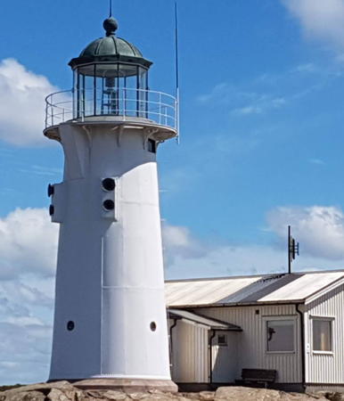
1900 (Magnus Dahlander) (station established 1561). Active; focal plane 78.5 m (258 ft); white flash every 5 s. 15 m (49 ft) round granite tower with lantern and gallery, attached to a 2-story service building. The Barbier and Benard 1st order clamshell Fresnel lens (1900) remains in use. The lighthouse is unpainted gray stone; the lantern is painted white with a black dome. Two keeper's houses nearby; although the light is automated the station continues to be staffed. One of the station buildings is a café. A 2021 photo is at the top of this page, SFA has a page for the lighthouse, Philip Grönqvist has a 2021 photo, Johanna Hernandez has a photo, Anke and Jens have a good page for the lighthouse, Trabas has a closeup photo, Marinas.com has aerial photos, Huelse has a historic postcard view, Swedish-language Wikipedia has an article and photo, and Google has a street view and a satellite view. Kullens Fyr, at the end of the long Kullaberg Peninsula, marks the east side of the entrance to the Öresund and the Baltic Sea. Fires were lit here in Viking times, and there have been at least half a dozen lighthouses built: a basket fire in 1561, the first stone tower in 1563, new towers in 1585, 1624, 1749, 1792, 1817, and 1843 before the present tower was built in 1898-1900. The famous Danish astronomer Tycho Brahe was the lightkeeper at Kullen between 1577 and 1588 (when the area was under Danish rule). SFA has a historic photo of the 1843 lighthouse. The present tower is the most powerful Scandinavian lighthouse, with a range of 50 km (30 mi); it is also the highest Swedish lighthouse. Ulla Lundgren has an August 2007 photo showing exterior renovations to the lighthouse underway. The lens was rotated on a mercury bed until 2016, when the hazardous mercury was removed and a mechanical rotation system installed. Renovation was underway in 2023-24 but the lighthouse was expected to reopen in May 2024. The surrounding area is a nature reserve, the Kullabergs Naturreservat. Located at land's end about 10 km (6 mi) northwest of Höganäs. Site open, observation room open daily, tower open to guided tours. Site manager: Kullens Fyr . ARLHS SWE-037; SV-7146; Admiralty C2260; NGA 5084.
* [Kullen Västra]
Date unknown (station established 1898). Active; focal plane 12 m (39 ft); white or green light, depending on direction, occulting three times every 20 s. 4 m (13 ft) round lantern mounted on a concrete base. Lantern painted white. SFA has a page for the lighthouse, Hartmann also has a page, Trabas has a photo, Vladimír Černý has a 2023 photo, Kaur Aare Saar has a street view, and Google has a satellite view. This is a passing light, located on the extreme tip of the Kullen cape, 70 m (230 ft) below the historic lighthouse. Site open, tower closed. SV-7149; Admiralty C2262; NGA 5088.

Hallands Väderö (Båstad) Lighthouse
*
Hallands Väderö
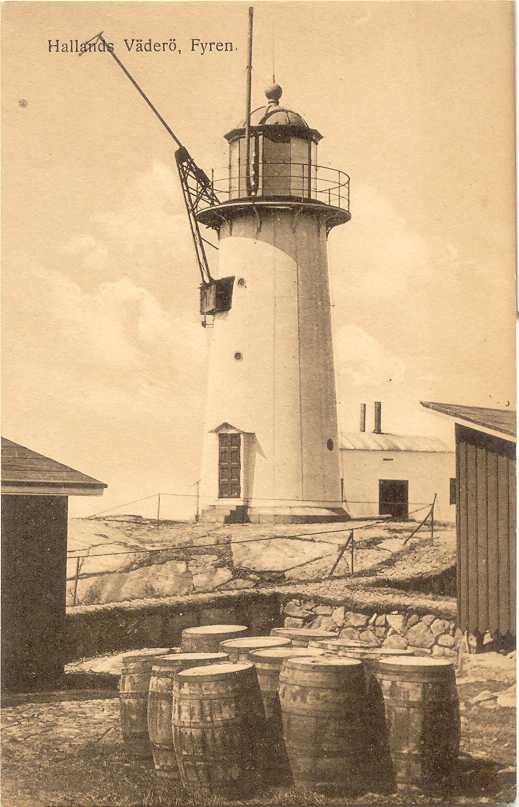
1884. Active; focal plane 21 m (69 ft); white light, 4 s on, 4 s off. 13 m (43 ft) round cast iron tower attached by a covered passageway to a 1-story keeper's house. Lighthouse painted white; lantern dome is greenish metallic. Mårten Fridberg's 2020 photo is at right, SFA has a page for the lighthouse, Trabas has a closeup photo by Karl-Heinz Wellm, Henry Law has a 2008 photo, Hartmann's page has a photo, Huelse has a historic postcard view, and Google has a satellite view. Hallands Väderö is an island in the Kattegat about 2.5 km (1.5 mi) in length and about 2.5 km (1.5 mi) off the end of the Bjare Peninsula. There are no permanent inhabitants, but there are summer cottages on the island. Despite its name this island is in the Båstad municipality in the county of Scania and not in the adjoining county of Halland. The island was set aside as a nature reserve in 1958. Passenger ferry transportation is available from Torekov. Located at the western tip of the island; accessible by easy hiking trails. Site open, tower closed. . ARLHS SWE-170; SV-7173; Admiralty C2242; NGA 1452.

Information available on lost lighthouses:

Notable faux lighthouses:


Hallands Väderö Light, Båstad, July 2020
Google Maps photo by Mårten Fridberg

Adjoining pages: North: Halland | South: Eastern and Southern Skåne | West: Denmark: Copenhagen Area

Return to the Lighthouse Directory index | Ratings key

Posted April 9, 2007. Checked and revised March 30, 2025. Lighthouses: 26; lightships: 1. Site copyright 2025 Russ Rowlett and the University of North Carolina at Chapel Hill.